 |
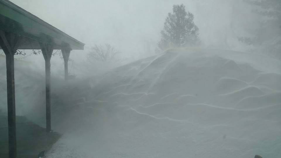 |
| Drifting snow, estimated to 8-10 feet, in Friona, Texas, on 27 December 2015. The picture is courtesy of News Channel 10 in Amarillo. |
| |
| A very large and intense upper level storm system approaching West Texas combined with cold air and amazing amounts of moisture for late December to bring widespread high-impact winter weather to the region over the Christmas Holiday Weekend. After a mild and dry Christmas day, a strong cold front moved through early on the 26th. Northerly increased throughout the day carrying in much colder air, with temperatures gradually falling to and below the freezing mark through late Saturday afternoon and evening. By the evening hours, wind gusts of 55 to 65 mph were common, making conditions quite unpleasant as wind chill readings dipped into the single digits and teens. |
| |
 |
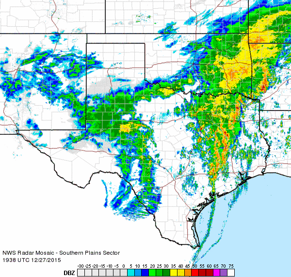
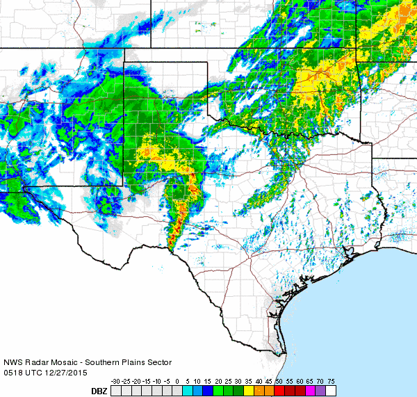
| Regional radar animation valid from 8:28 pm to 9:38 pm on Saturday, 26 December 2015. An additional radar animation valid from 11:18 pm on the 26th to 12:28 am on the 27th can be FOUND HERE. |
| |
| In addition to the cold and wind, precipitation blossoming in eastern New Mexico quickly spread into the South Plains (see the above radar animation) Saturday evening. There was enough instability for lightning and thunder to also mix in as freezing rain and sleet gradually changed to snow from west-to-east across much of the Caprock through the evening and overnight hours. The thunder sleet and snow made for an impressive weather display, but it made for challenging driving conditions. In fact, where the precipitation changed over to snow, blizzard conditions with near zero visibility quickly developed as the snow was tossed about by the strong winds. The strong winds and snow also conspired to build large snow drifts, particularly downwind of large open fetches. Further east in the Rolling Plains, freezing rain and sleet were the primary mode, though some snow did eventually fall too. |
| |
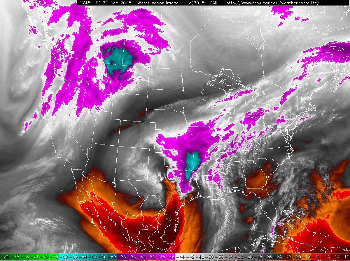 |
| Water vapor satellite image captured at 11:45 am on 27 December 2015. |
| |
| On the warm side of the storm parts of North Texas (near Dallas) experienced killer tornadoes Saturday evening. Thankfully, West Texas didn't see any tornadoes, but the strong winds and freezing rain and sleet and snow did make travel very difficult to impossible, and it did cause its own share of damage. After a brief lull in the wintry precipitation early Sunday (noted by the relative minimum in moisture and tall, cold clouds in the above and below satellite images), another wave of sleet and snow pivoted around the north side of the upper level storm system and over the South Plains region. |
| |
 |
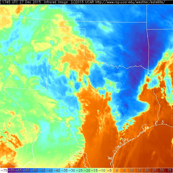 |
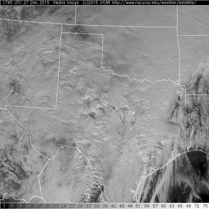
| Visible (left) and infrared (right) satellite images captured at 11:45 am on 27 December 2015. Click on the images for larger views. |
| |
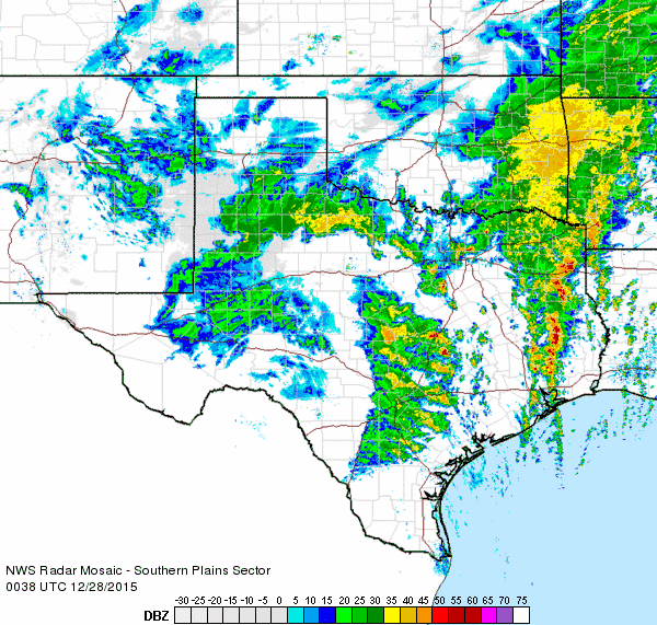
| This next round of sleet and snow came in heavy bursts late Sunday afternoon and evening, and accounted for a good chunk of the sleet and snow for the South Plains into the Rolling Plains, whereas the bulk of the heavy snow around Friona and Muleshoe fell late Saturday night into early Sunday. Conditions further deteriorated as the falling and blowing and drifting snow really piled up. Many roads became impassable as winds refused to let up and drifts continued to grow. |
| |
 |
| Regional radar animation valid from 1:38 to 2:48 pm on Sunday, 27 December 2015. An additional radar animation valid from 6:38 to 7:48 pm on the 27th can be FOUND HERE. |
| |
| The powerful winter storm finally moved off to the east early Monday (28 December) and gave way to lighter winds and a return to sunshine. This allowed people to assess the damage, both literally and figuratively, and begin the digging out process. The below satellite image shows the massive scale of wintry output from the Christmas Weekend Blizzard of 2015. |
| |
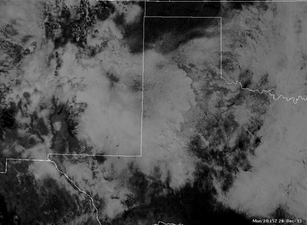 |
| Visible satellite image captured after the storm, at 2:15 pm on Monday, 28 December 2015. Aside from on the right portion of the image, most of the white is sleet and snow on the ground. Click on the image for a larger view. |
| |
| A preliminary tally of the sleet and snow totals for the South Plains region can be viewed below. Keep in mind that exact measurements were nearly impossible given the extensive blowing and drifting, so these should be viewed as best estimates. Regardless, the amounts were certainly impressive. A listing of the snowfall storm totals can also be VIEWED HERE. |
| |
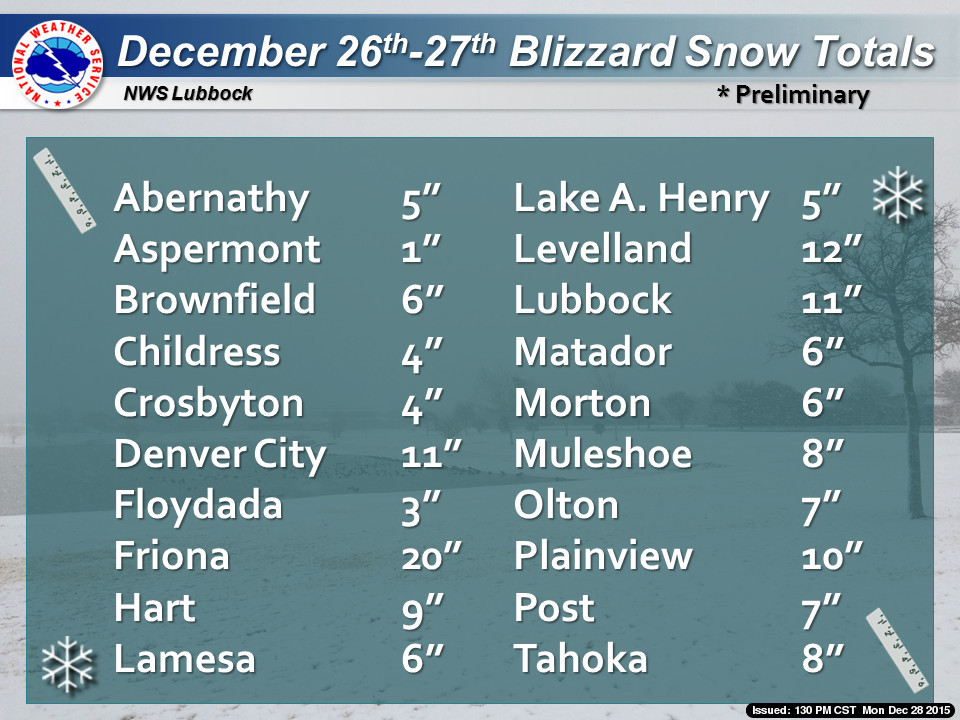 |
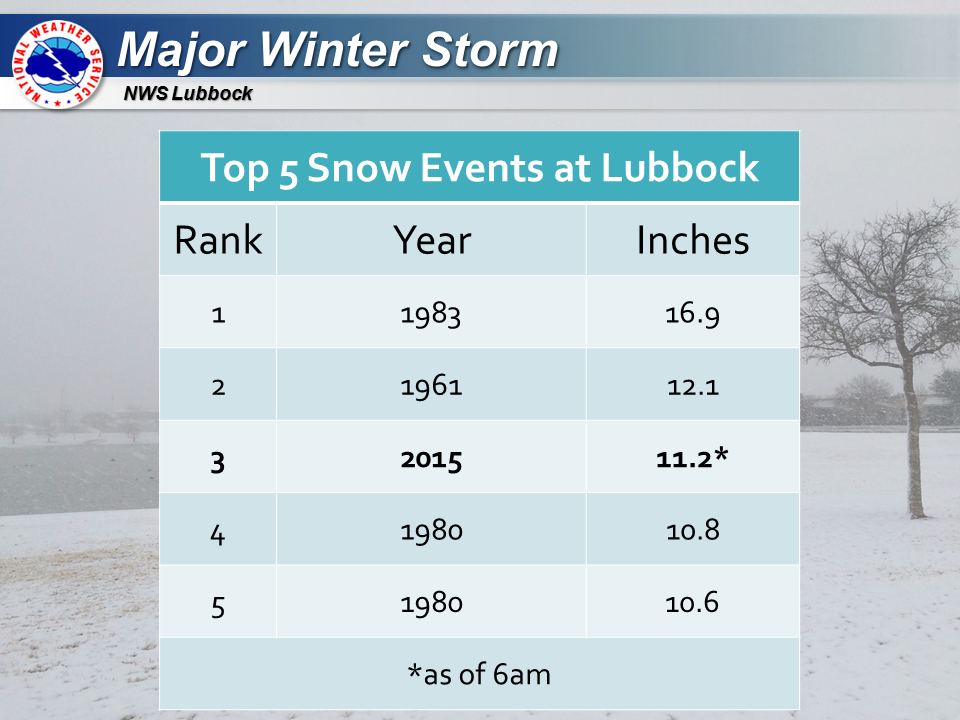
| Preliminary snow and sleet totals for the Christmas Weekend Blizzard. |
| |
| In fact, Lubbock International Airport officially measured 11.2 inches of sleet and snow over the duration of the winter storm from December 26th through the 27th. This impressive tally ranked as the third highest snow event at the airport, and was the highest since the all-time record of 16.9 inches in 1983. Not surprising, this amount of snow took many days for Lubbock to shovel out from, with travel disruptions lasting well into the following week. |
| |
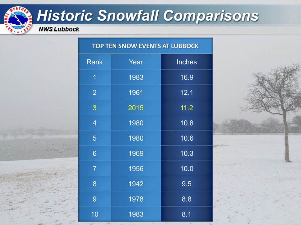 |
| Top ten snow events at Lubbock. |
| |
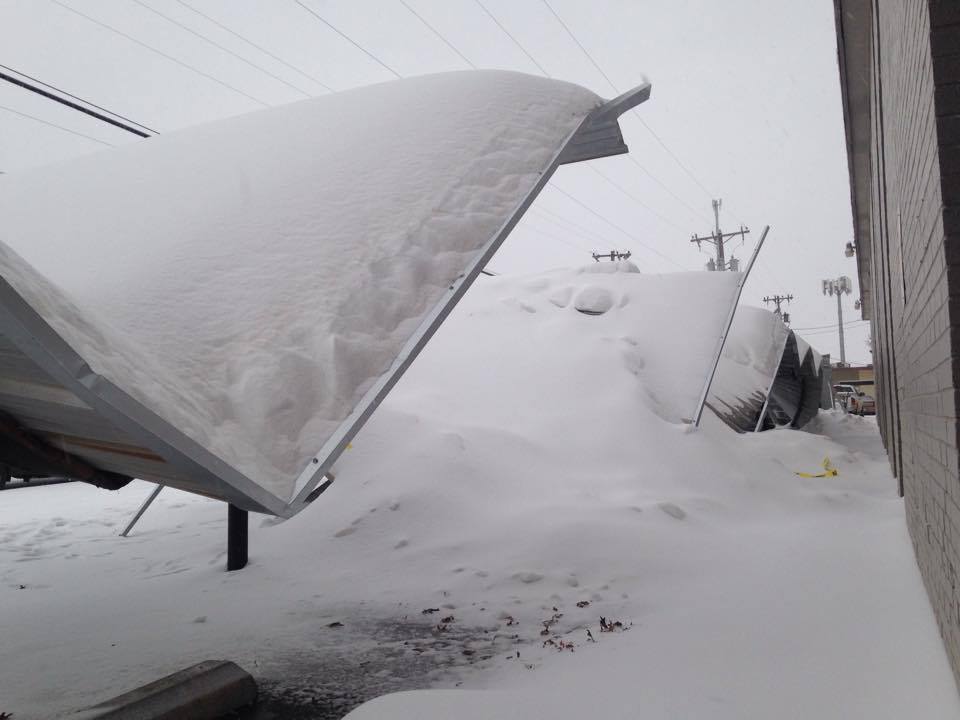
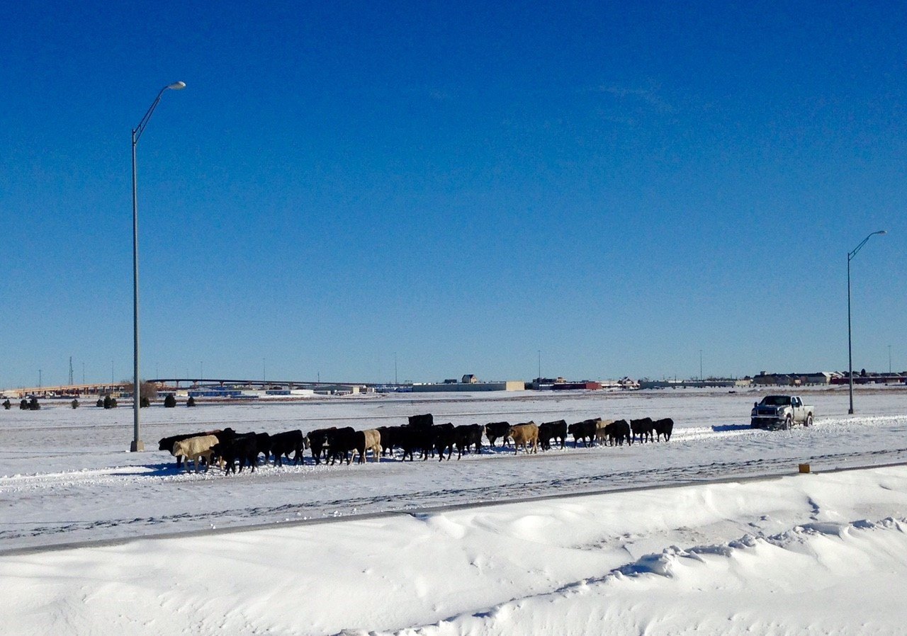
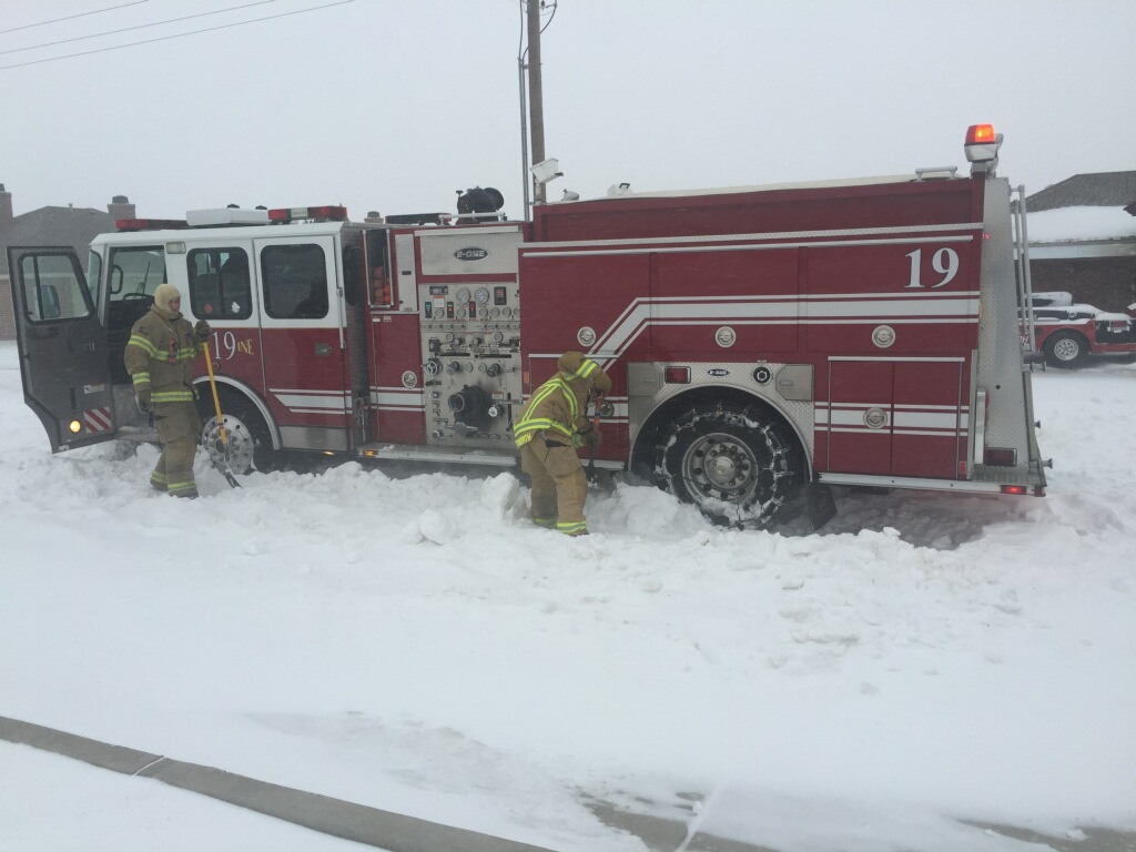
| Amazingly, the 11.2 inches of snow for the event (and the month) at Lubbock also set a record for the snowiest December on record. Below are some interesting pictures captured during and after the Christmas Weekend Blizzard. The heavy snow damaged carports, allowed cattle to escape their enclosures and crippled travel for even some big rigs. |
| |
|
|
| (ul) Damage from the heavy snow near 51st Street and Avenue W in Lubbock. The picture is courtesy of KCBD. (ur) View of the snowy conditions in Brownfield, courtesy of KCBD. (ll) Cattle on Spur 327 and Milwaukee Avenue, courtesy of Chris Winn. (lr) Fire truck being dug out on the Lubbock streets. Image is courtesy of the Lubbock Fire Department. |
| |
| When the sun returned and the winds died off, the resulting wintry scene did create some beautiful views, though with limited snow removal equipment, roads were slow to improve. |
| |
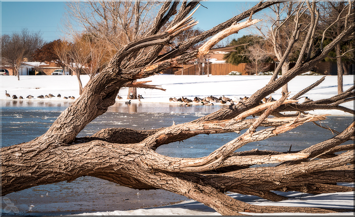
|
|
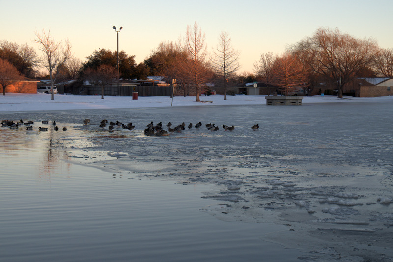
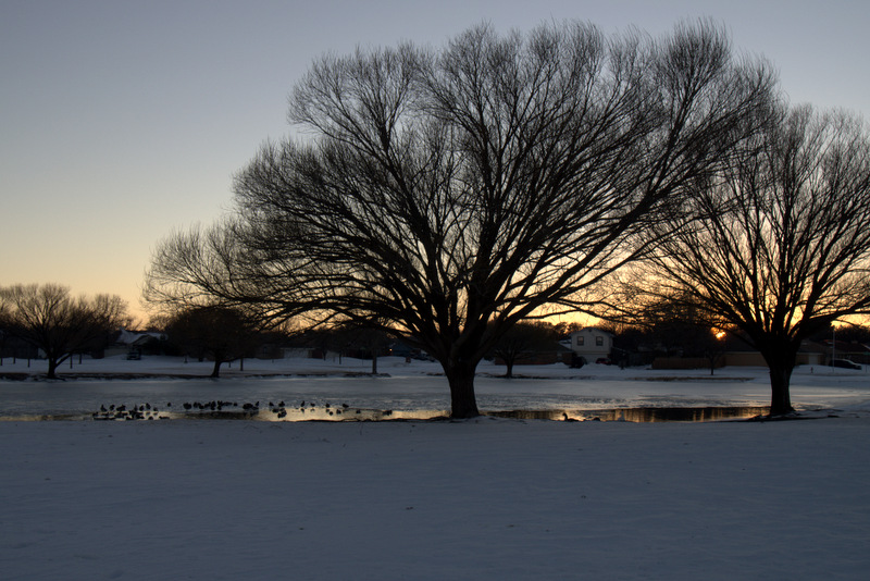
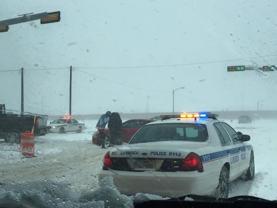
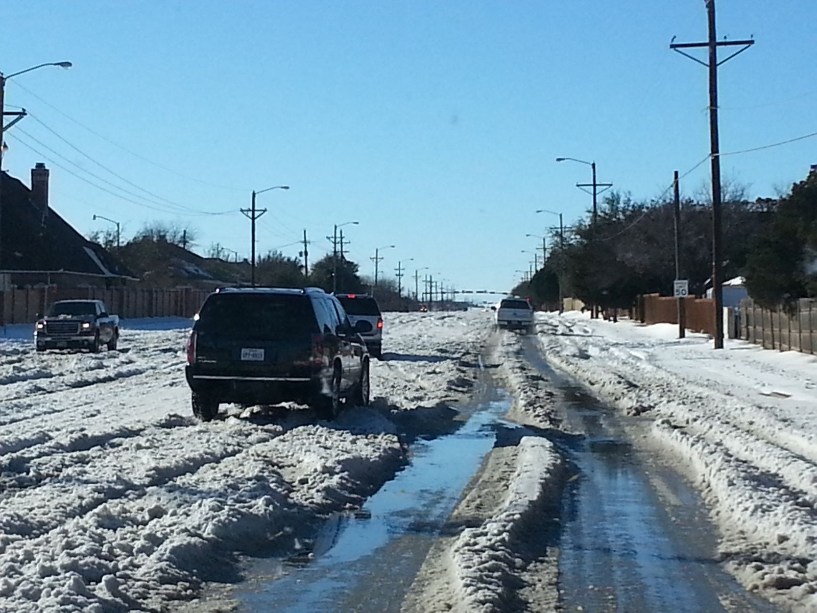
| (ul & ur) Ducks making the best of the winter weather in Lubbock. (ll) The heavy snow and drifting made travel difficult to impossible. Picture courtesy of KAMC. (lr) Even when the winds diminished and the sun came out after the storm, travel remained difficult for several days. |
| |
| Additional scenes from Lubbock during and after the blizzard can be found below. |
| |
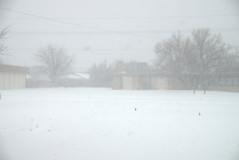
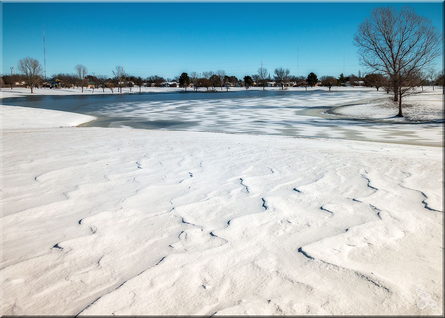
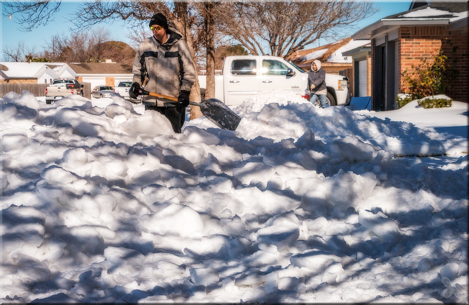
|
|
| (ul) Heavy snow falling in south Lubbock on 27 December 2015. (ur & ll) The results of the wind and snow at a south Lubbock park on 28 December 2015 (courtesy of Erin Shaw). (lr) The dig out begins on the 28th (courtesy of Erin Shaw). |
| |
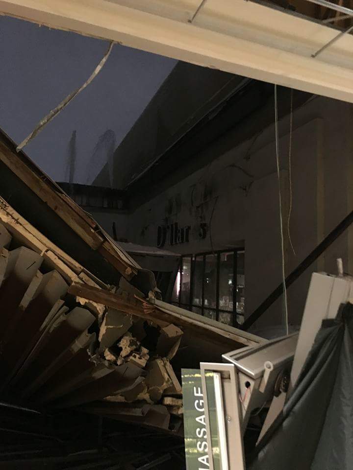
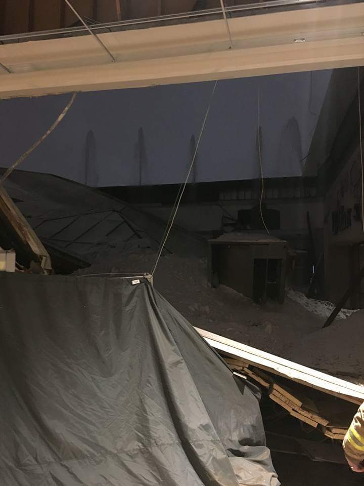
| As already discussed, the storm generated huge drifts. The weight of all the snow brought down a portion of the roof at the Lubbock South Plains Mall, and damaged several other builds around town and the region. |
| |
|
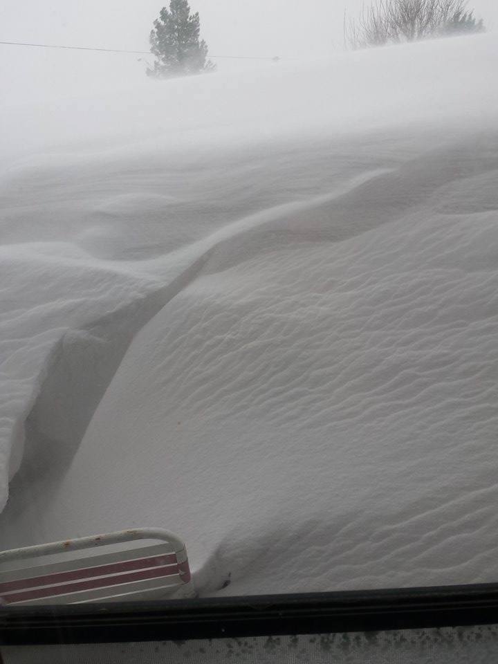
|
| (l) Large drift photographed in Abernathy on the 27th of December. (c & r) Roof collapse at the South Plains Mall (courtesy of FOX 34). |
| |
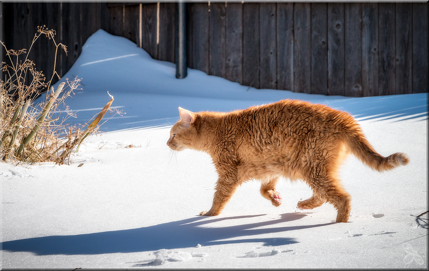
| Some people, and creatures (including cats), did take the blizzard in stride. |
| |
|
|
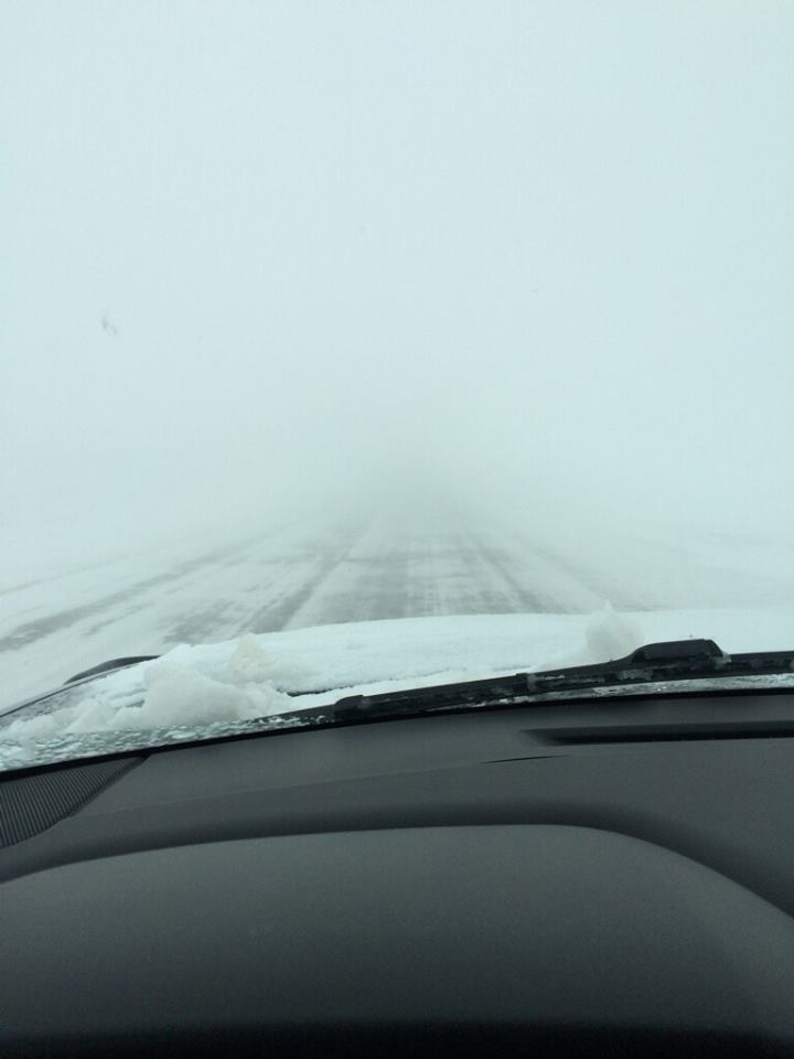
| (l) An old cat enjoying a brief romp in the snow (courtesy of Erin Shaw). (r) Blizzard conditions west of Smyer on Highway 114 on the 27th of December (courtesy of KCBD). |
| |


