
Numerous severe thunderstorms are expected across a broad region from the Ohio Valley to the Mid-Atlantic and Northeast States today into tonight. Swaths of damaging wind gusts are expected and some tornadoes are possible. Bertha is expected to bring tropical storm conditions to portions of the Gulf Coast from the Florida Panhandle westward to southeastern Louisiana later today and Wednesday. Read More >
|
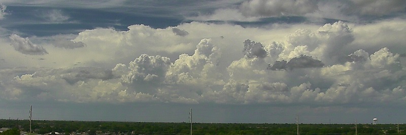
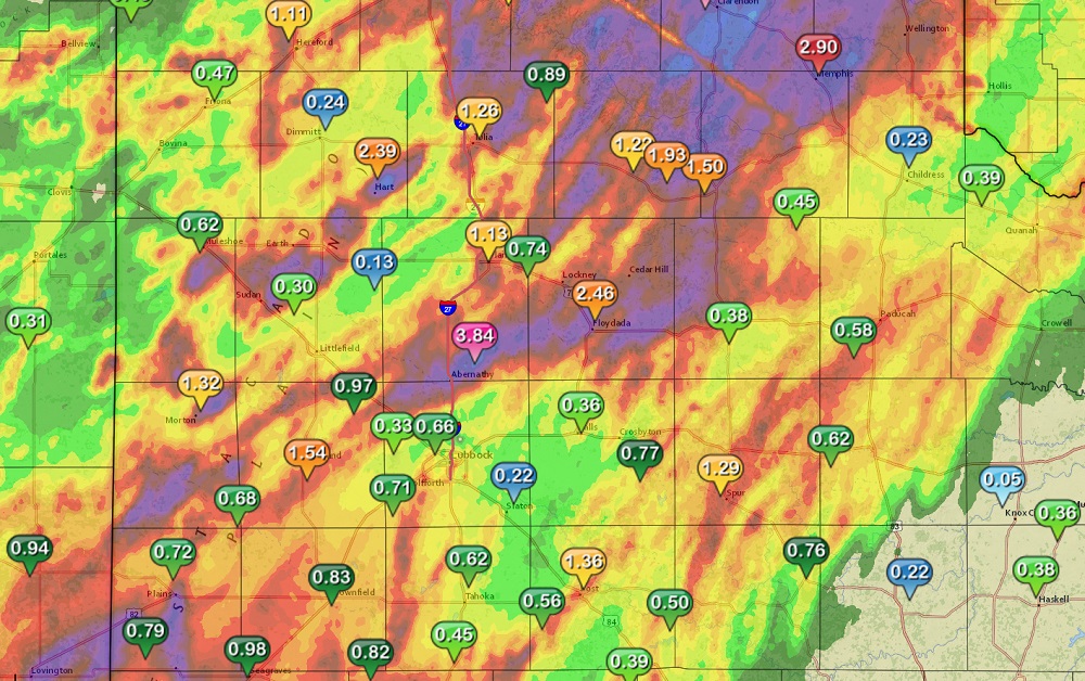
The combination of deep moisture moving in from the south, and a slow-moving storm system coming in from the west, brought a period of stormy weather to the region. Most of the area saw at least a quarter inch of rain through the period. In general, the storms moved pretty slowly, and the activity tended to track in a southwest to northeast pattern, bringing repeated rounds of rain to some locations. Narrow swaths across the area saw more generous rainfall, from about 2 to 5 inches in some locations. As can be seen in the map below, heavier rain was more widespread across much of Floyd, Briscoe and Hall Counties. |
|
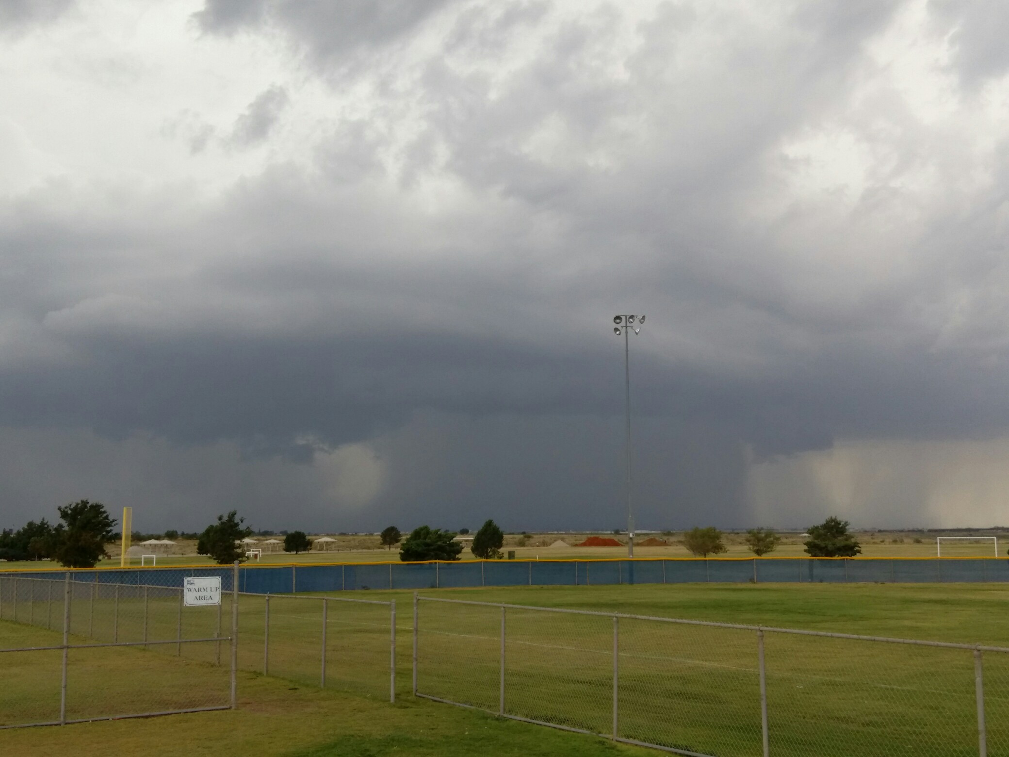
Some severe weather was reported as well. On Tuesday the 23rd, several wet microbursts produced severe wind gusts near Abernathy, Levelland and Paducah, causing some minor damage. The storm near Abernathy was part of a line of storms that movesd slowly across northwest Lubbock and southern Hale Counties. One of the storm cells dropped very heavy rain in Shallowater, which caused some street flooding as can be seen in the photograph below. |

|
The image below shows the heavy thunderstorm cell near Shallowater on the evening of August 23rd. |
|
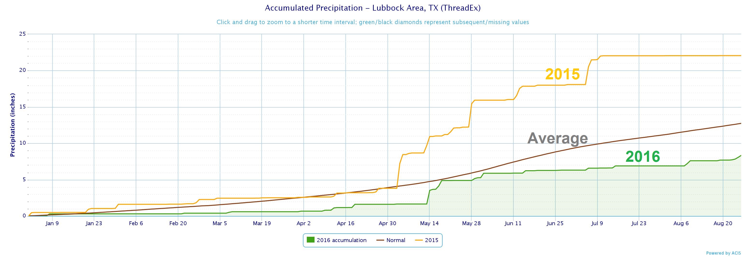
As of 8 pm CDT on August 26th, Lubbock has received 8.23 inches of precipitation, which is about 4.5 inches less than the amount that usually falls through this time of year. The graph below shows how except for a wet period in May, rain has been pretty scarce this year. Of course, this is measured at the Lubbock airport, and areas across the South Plains (including right around the city of Lubbock) have received significantly higher amounts. |
|

