
Scattered thunderstorms with severe gusts, hail and a tornado risk are possible near a cold front from the Ohio Valley to the Mid-Atlantic tonight. Tropical Storm Bertha is expected to bring tropical storm conditions to portions of the Gulf Coast from the panhandle of Florida into Louisiana through Wednesday. Read More >
| Welcome widespread rainfall (15-20 August 2018) |
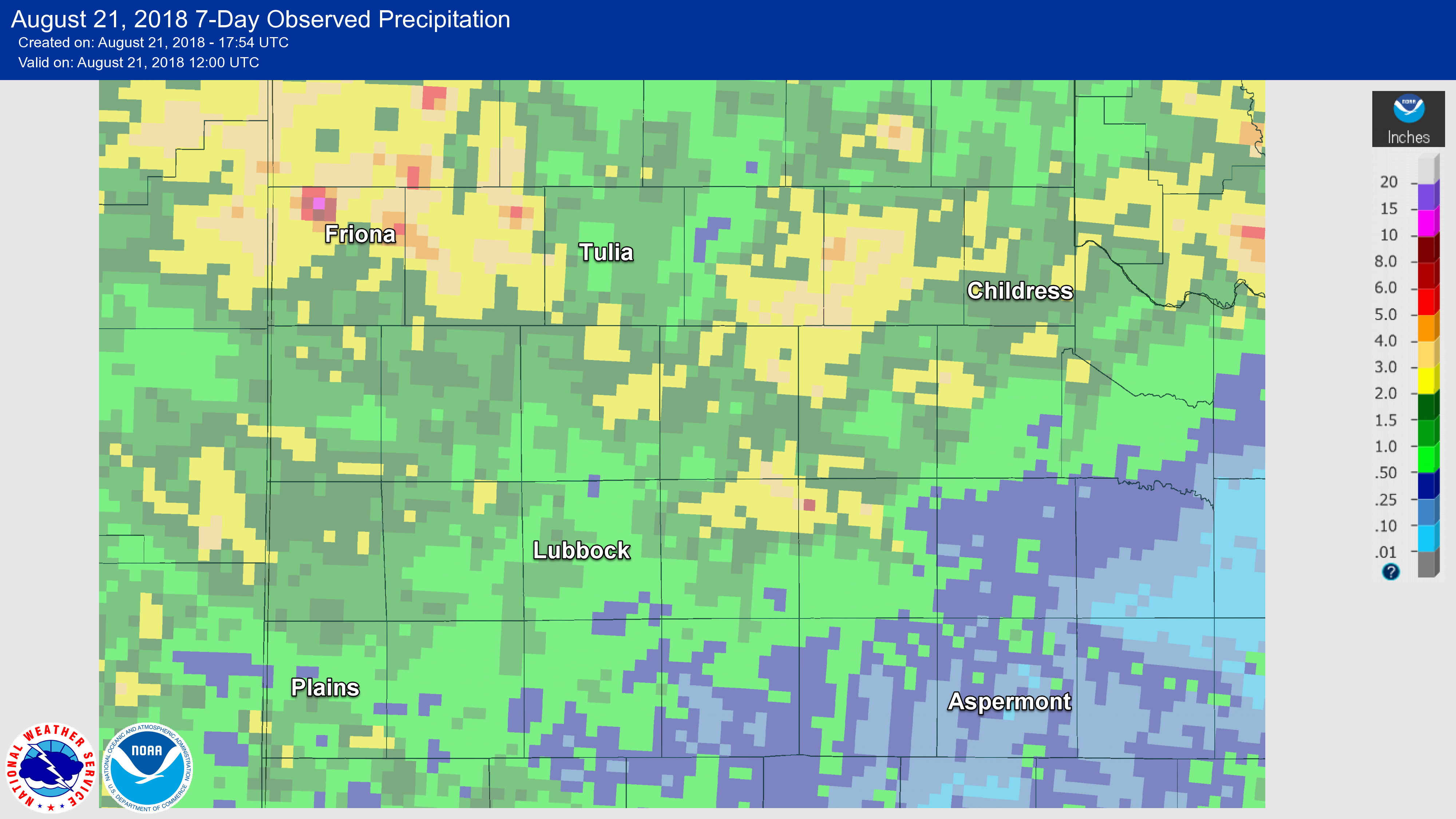 |
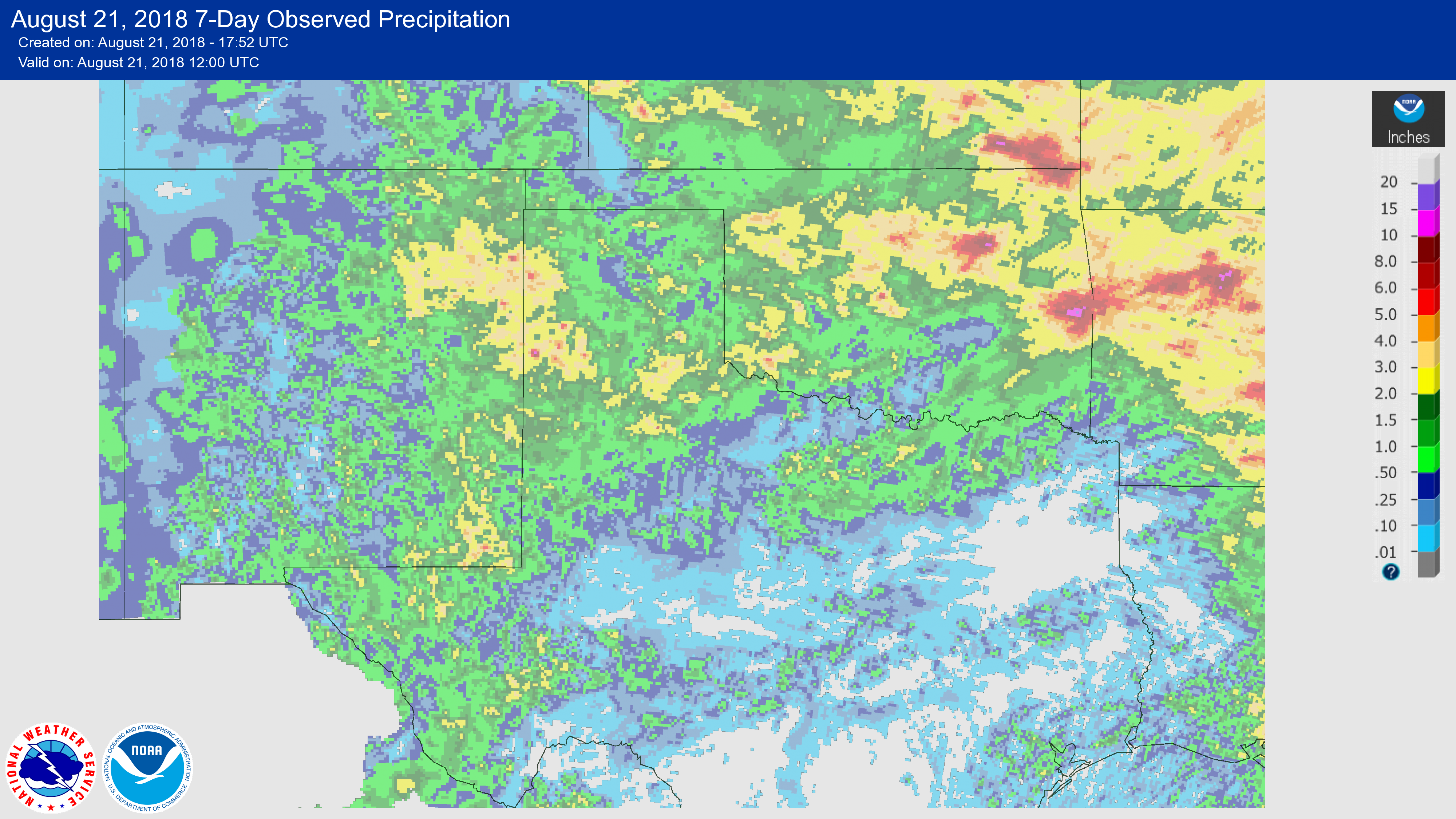
| Radar-estimated and bias-corrected 7-day rainfall ending at 7 am on Tuesday, 21 August 2018. A regional view of the same information can be FOUND HERE. |
| Several rounds of showers and thunderstorms provided widespread welcome rainfall for West Texas in mid-August. The rainfall was isolated to scattered through much of the work week (August 13th-17th), but increased in coverage and intensity late Friday into the weekend. After all was said and done, most of the South Plains region recorded rain totals near and above an inch, with the heaviest amounts favoring the southern Texas Panhandle. |
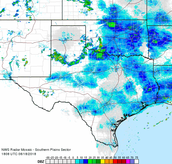 |
| Regional radar animation valid from 1:08 pm to 2:18 pm on Saturday, 18 August 2018. |
|
The southwest Texas Panhandle, from Friona through Dimmitt and Tulia, did experience heavy rainfall and even a couple of severe storms Wednesday evening into early Thursday morning. Specifically, half dollar size hail fell in Summerfield, a wind gust to 69 mph was recorded near Tulia and a wind gust of 74 mph was measured near Friona Wednesday evening. In addition, these strong to severe storms dumped locally heavy rainfall of 1 to 2+ inches. Late Friday into Saturday morning (17-18 August), a decaying complex of showers and thunderstorms then provided additional light to moderate rainfall over parts of the southern Texas Panhandle into the northern and central South Plains. |
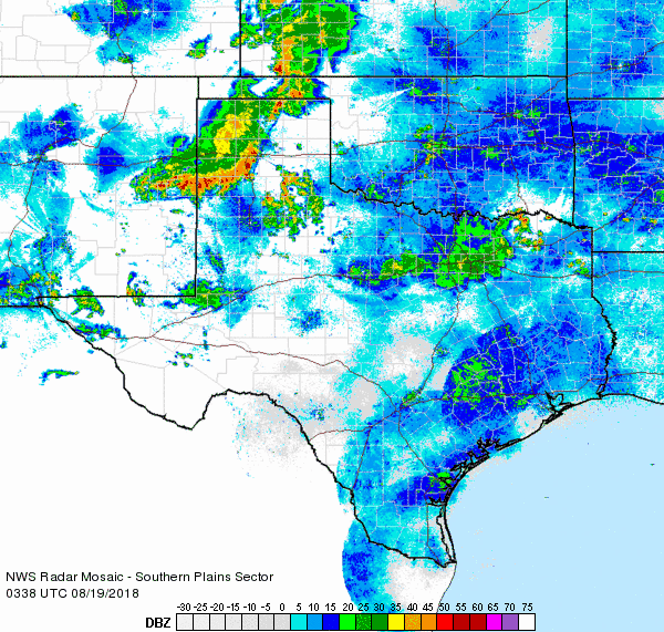 |
| Regional radar animation valid from 10:38 pm to 11:48 pm on Saturday, 18 August 2018. |
|
More widespread rainfall accompanied a complex of thunderstorms that raced southeastward out of Colorado and northeast New Mexico late Saturday evening/night. As the above radar imagery shows, the heaviest rainfall with this complex of thunderstorms favored the Texas Panhandle and northern South Plains. Finally, another batch of showers and thunderstorms developed across the southern South Plains and Rolling Plains early Monday morning (20 August), bringing this region some much-needed precipitation. |
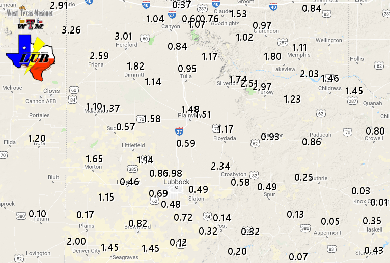 |
| Measured 6-day rain totals (inches) ending at 4 pm on Monday, 20 August 2018. The data are courtesy of the West Texas Mesonet. |
| As the above plot shows, over the course of several days everyone saw at least a little rain, with many locations recording an inch or more. The luckiest spots, including Denver City, Ralls, Friona, Hereford, Turkey, Estelline and Caprock Canyons State Park measured over 2 inches of rainfall. Officially, Lubbock recorded 0.86" between August 15th and 20th and Childress measured 1.82". This rainfall helped cut into the yearly precipitation deficits, though several more inches are still required to end the longer-term drought. |

