
Scattered thunderstorms with severe gusts, hail and a tornado risk are possible near a cold front from the Ohio Valley to the Mid-Atlantic tonight. Tropical Storm Bertha is expected to bring tropical storm conditions to portions of the Gulf Coast from the panhandle of Florida into Louisiana through Wednesday. Read More >
| End of Year Thunderstorms and Welcome Rainfall 27-28 December 2019 |
||
 |
||
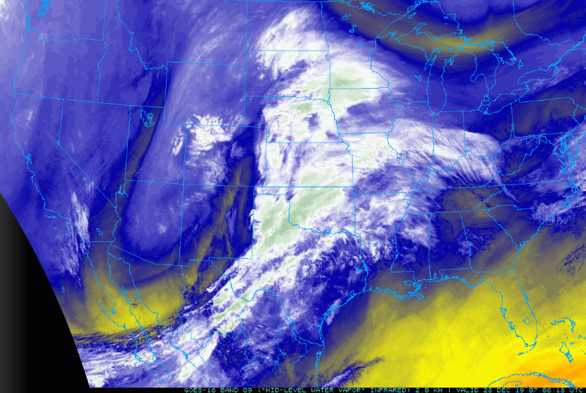
| Mid-level water vapor satellite image captured at 1:06 am on Saturday, 28 December 2019. | ||
| A powerful winter storm emerging from the Rockies (and visible in the above imagery) drew rich moisture into West Texas in late December 2019. Well in advance of the system, as low-level moisture increased and a weak front dipped into the region, widespread dense fog and a few light showers overspread the South Plains region on Friday, December 27th. Unfortunately, the thick fog did contribute to several significant vehicle accidents along Highway 84 near Slaton. This included a dramatic accident when a tractor trailer plowed into several vehicles which were responding to and recovering from earlier accidents. The chain reaction accidents resulted in two injuries. | ||
 |
 |
 |
 |
 |
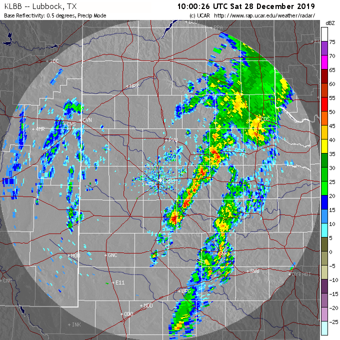 |
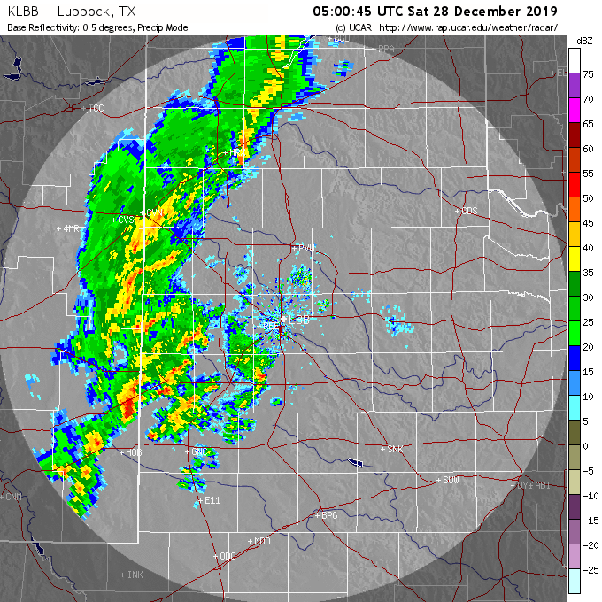
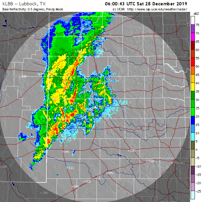
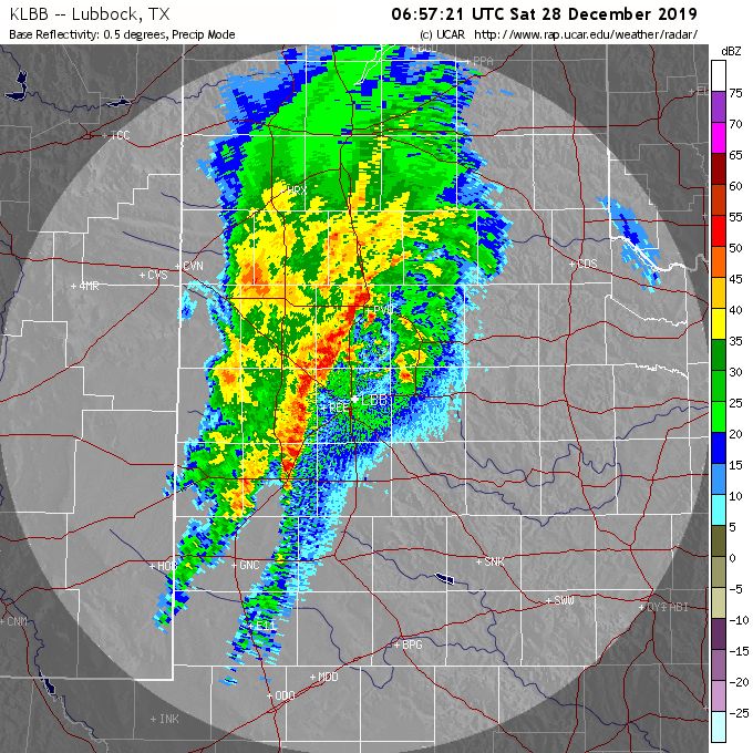
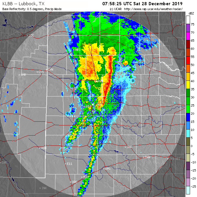
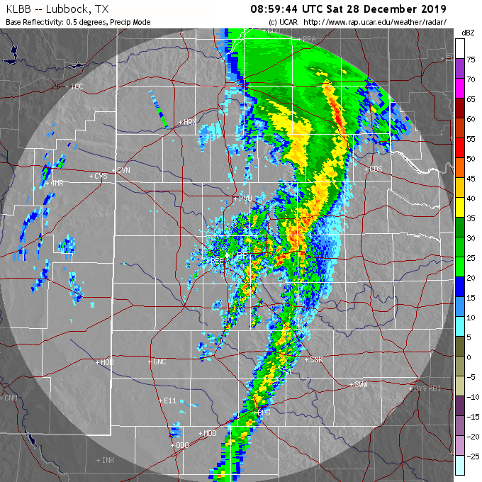
| Lubbock WSR-88D base reflectivity images captured at: 11 pm on Friday, 27 Dec (upper left); 12 am on Saturday, 28 Dec (upper center); 1 am on Saturday, 28 Dec (upper right); 2 am on Saturday, 28 Dec (lower left); 3 am on Saturday, 28 Dec (lower center); and 4 am on Saturday, 28 Dec (lower right). | ||
| Much later in the day, as the upper level storm system approached, showers and thunderstorms blossomed in eastern New Mexico Friday evening. This activity raced eastward across the South Plains region through early Saturday morning, as the above radar images illustrate. A few of the embedded storms were on the strong side and dropped brief heavy rainfall. | ||
 |
||
| View from Lake Alan Henry at 11:22 am on Saturday, 28 December 2019. The picture is courtesy of KAMC. | ||
| Scattered showers and a few rumbles of thunder lingered through about midday Saturday before shifting east of the area. These final showers made for dramatic skies (see above), but didn't produce much additional rainfall. | ||
 |
||
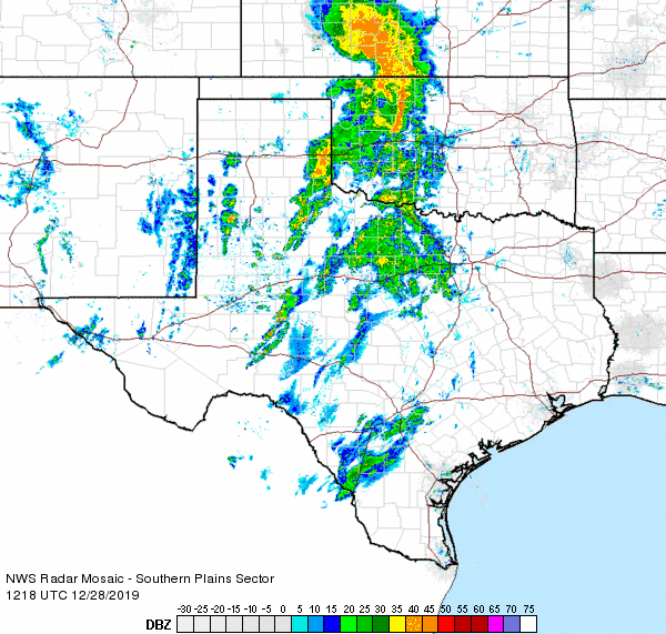
| Regional radar animation valid from 6:18 am to 7:28 am on 28 December 2019. | ||
| The rounds of showers and thunderstorms did provide widespread rainfall for the region, the first in around a month. Rain totals of a quarter to three quarters of an inch were common. A few swaths of heavier rainfall, in excess of an inch, did affect the central and eastern South Plains into the south-central Texas Panhandle. | ||
 |
||
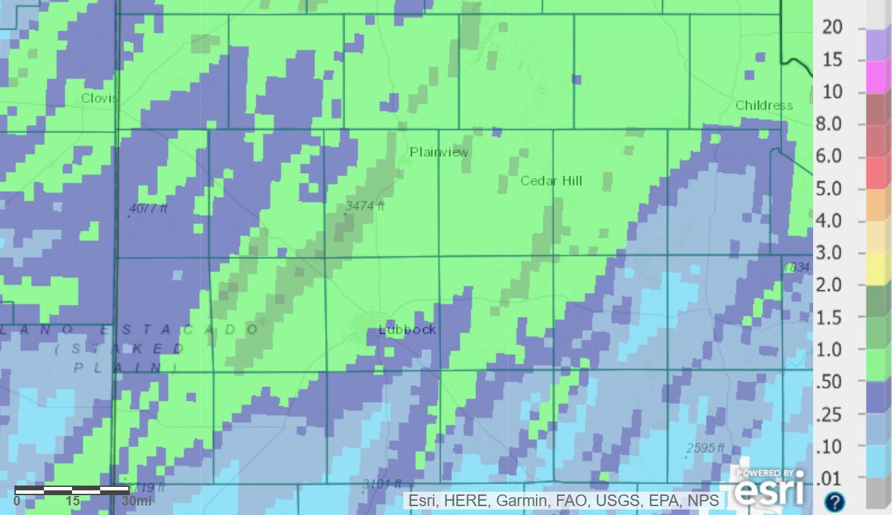
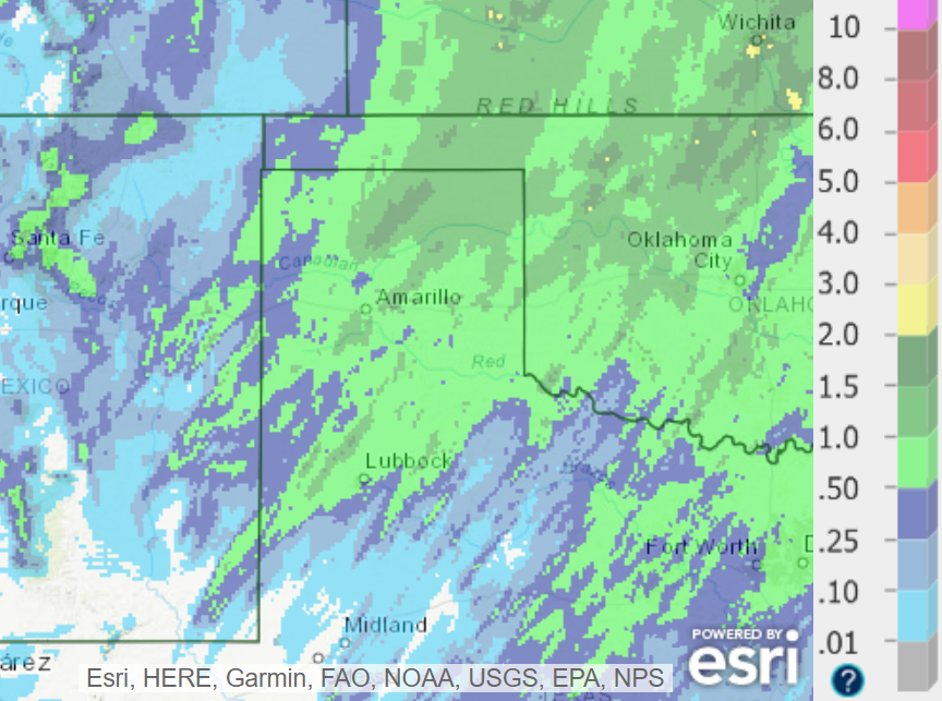
| Radar-estimated and bias-correct 7-day rainfall totals ending at 6 am on Thursday, 2 January 2020. A regional view can be FOUND HERE. | ||
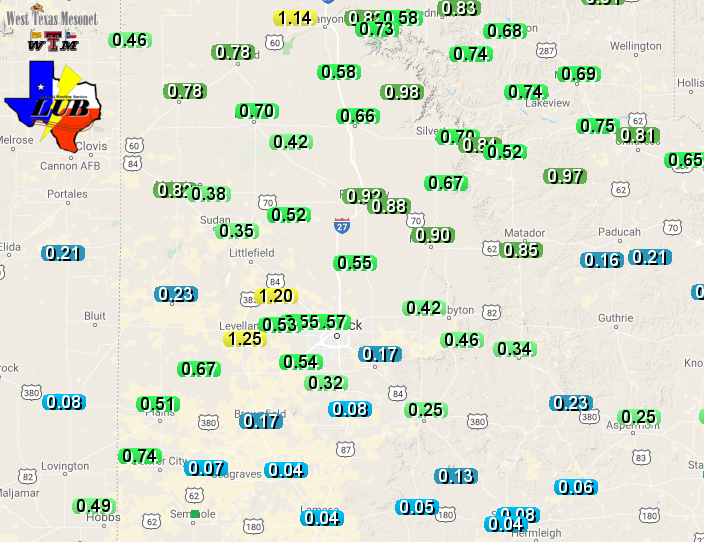
| As the below map shows, the West Texas Mesonet site near Levelland recorded the most rainfall, tallying 1.25 inches. Officially, Lubbock measured 0.65 inches of rain and Childress recorded 0.62 inches. | ||
 |
||
| 48-hour rain totals (inches) observed by the West Texas Mesonet, ending at 9 pm on 28 December 2019. | ||

