|
Early June Thunderstorms & Rain |
|
 |
|
|
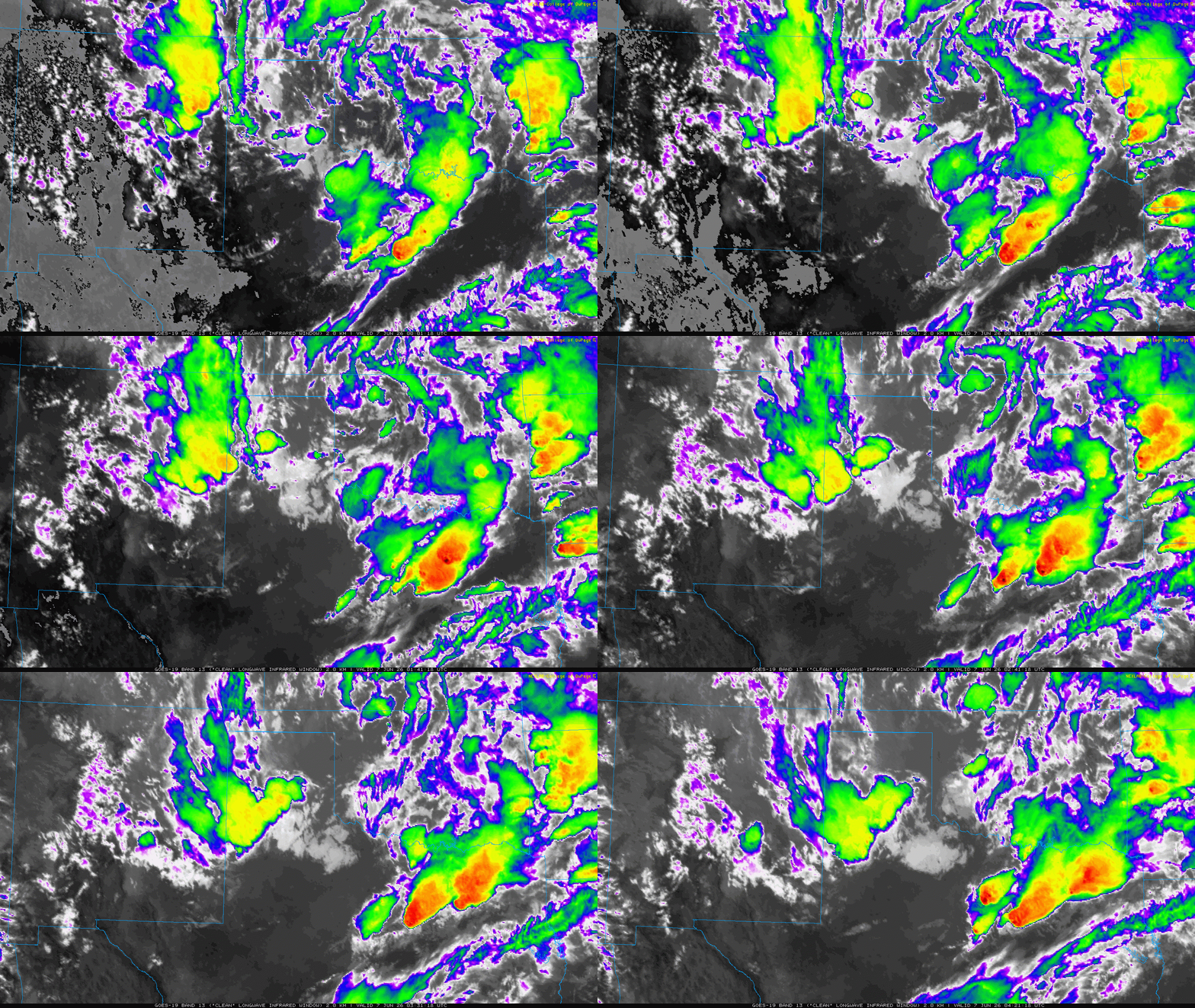
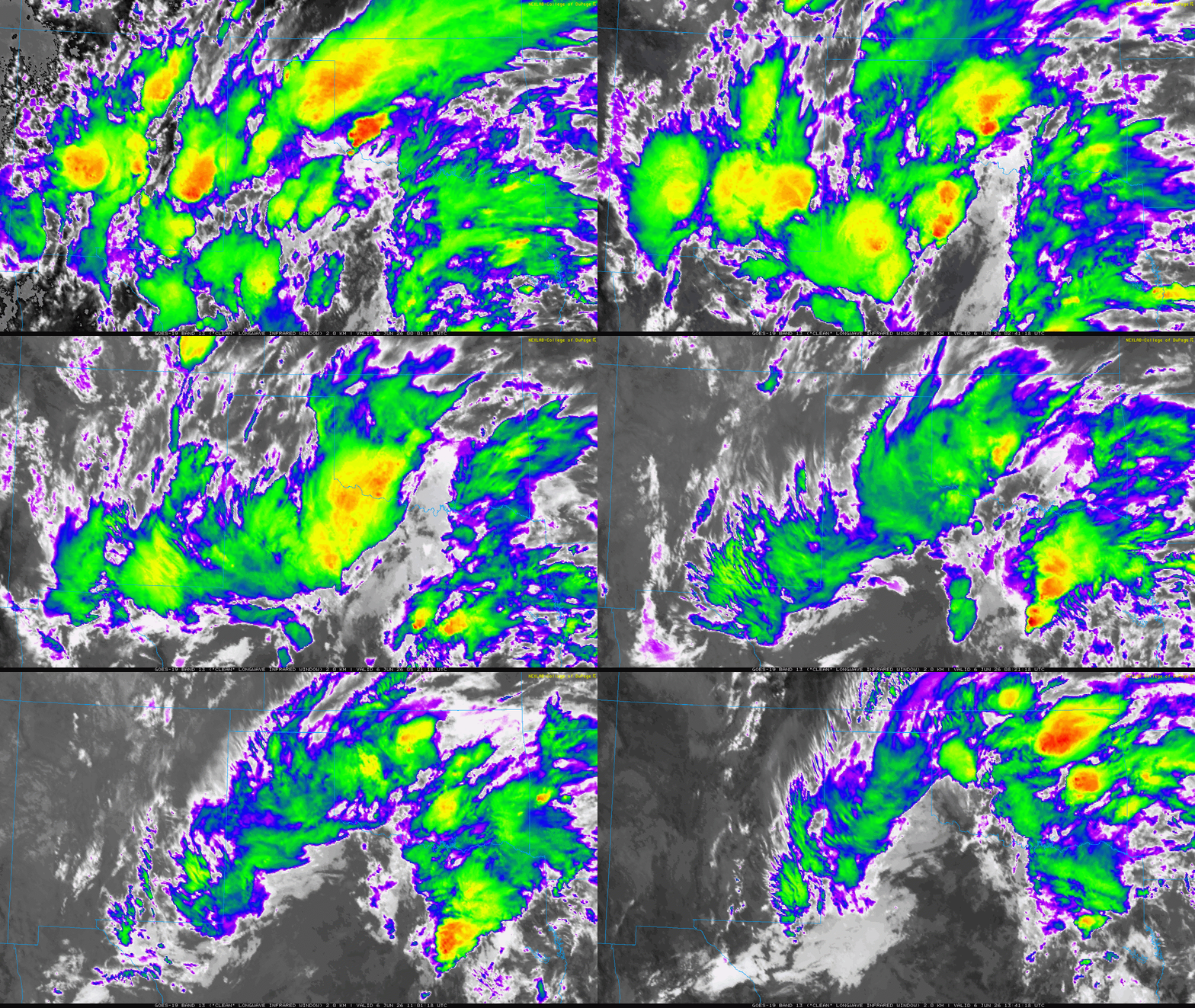
Infrared satellite loop valid from 7:01 pm on Friday to 8:41 am on Saturday (5-6 June 2026). An additional infrared satellite loop, valid from 7:01 pm to 11:21 pm on Saturday, can be VIEWED HERE. |
|
|
The active weather to end May and start June continued into the first weekend in June. Specifically, a slow-moving mid-upper level storm system took advantage of abundant moisture, to bring rounds of showers and thunderstorms to much of West Texas on Friday and Saturday (5-6 June 2026). |
|
 |
|
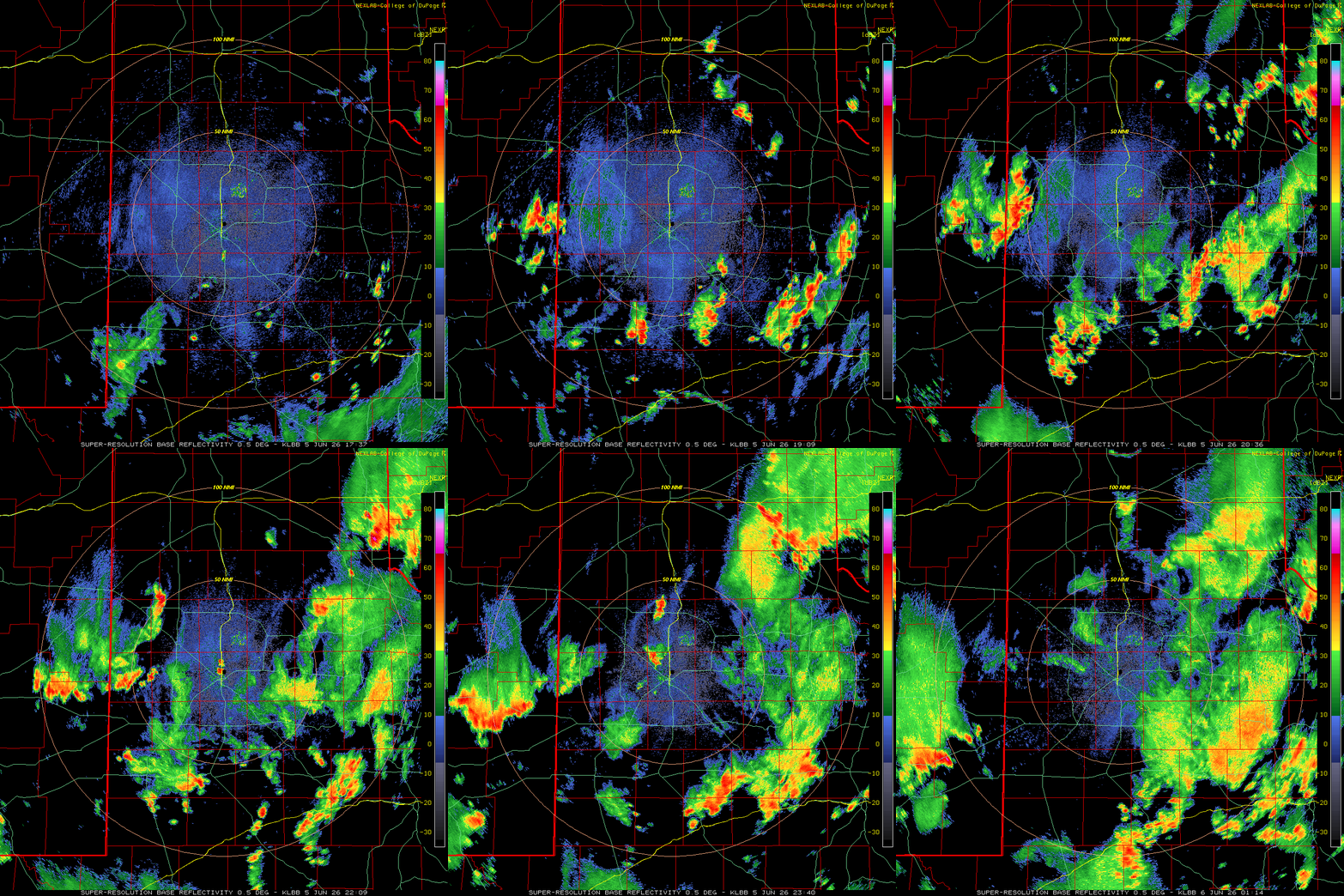
| Lubbock WSR-88D radar animation valid from 12:27 pm to 8:14 pm on Friday (5 June 2026). A regional radar animation, valid from 12:16 pm on Friday to 9:01 am on Saturday (5-6 June), can be FOUND HERE. | |
| The action kicked off in earnest on Friday afternoon as scattered thunderstorms quickly developed over the southern and western South Plains, southern Rolling Plains and southeast Texas Panhandle. This activity expanded in coverage through the early evening hours, and although it generally lacked organization, the strongest storms did produce brief bouts of torrential rainfall. The overall coverage and intensity of the rainfall faded over the South Plains region by late Friday evening, though it persisted over parts of the Permian Basin into the Big Country and western North Texas. | |
 |
|
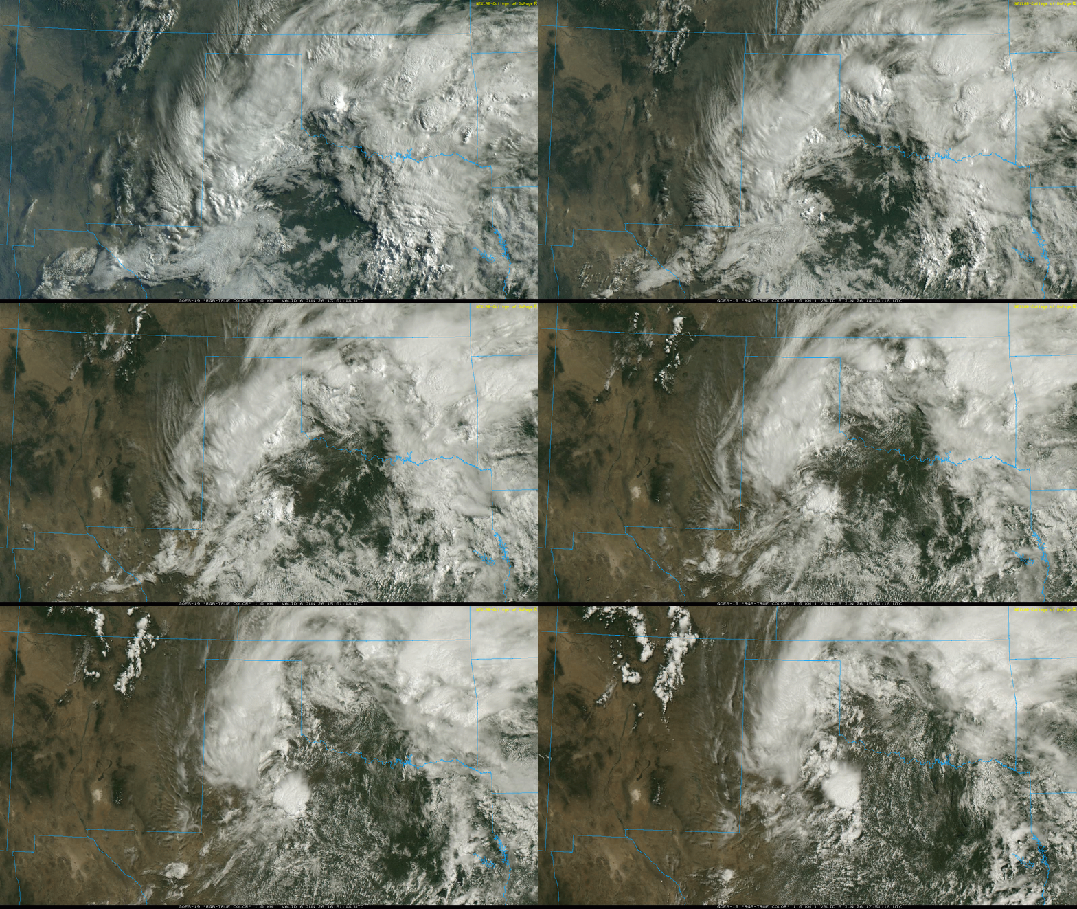
| "RGB-True Color" satellite loop valid from 8:01 am to 12:51 pm on Saturday (6 June 2026). | |
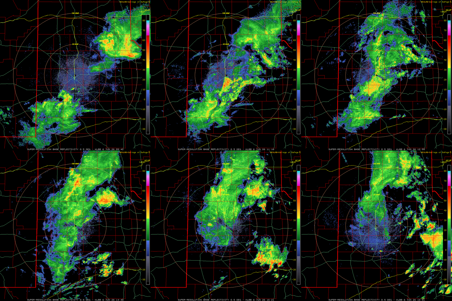
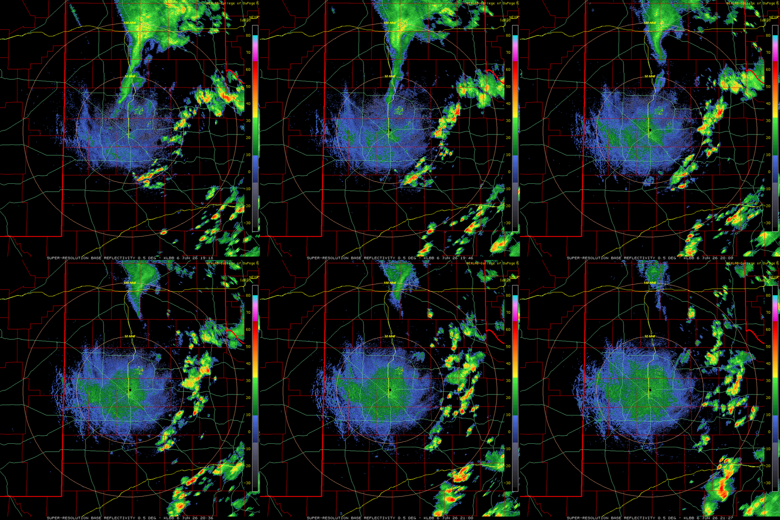
| Following the overnight lull, rain showers, along with a few embedded thunderstorms, blossomed early Saturday morning, focused in a north-to-south oriented band along/near the Interstate 27 and Highway 87 Corridor. This band of rain, occasionally moderate to heavy, persisted through most of the morning before diminishing during the early afternoon. Farther east, where morning rain was more limited and some sunshine allowed temperatures to rebound into the upper 70s and lower 80s, scattered thunderstorms formed off the Caprock Saturday afternoon, dropping additional pockets of heavy rain. | |
 |
|
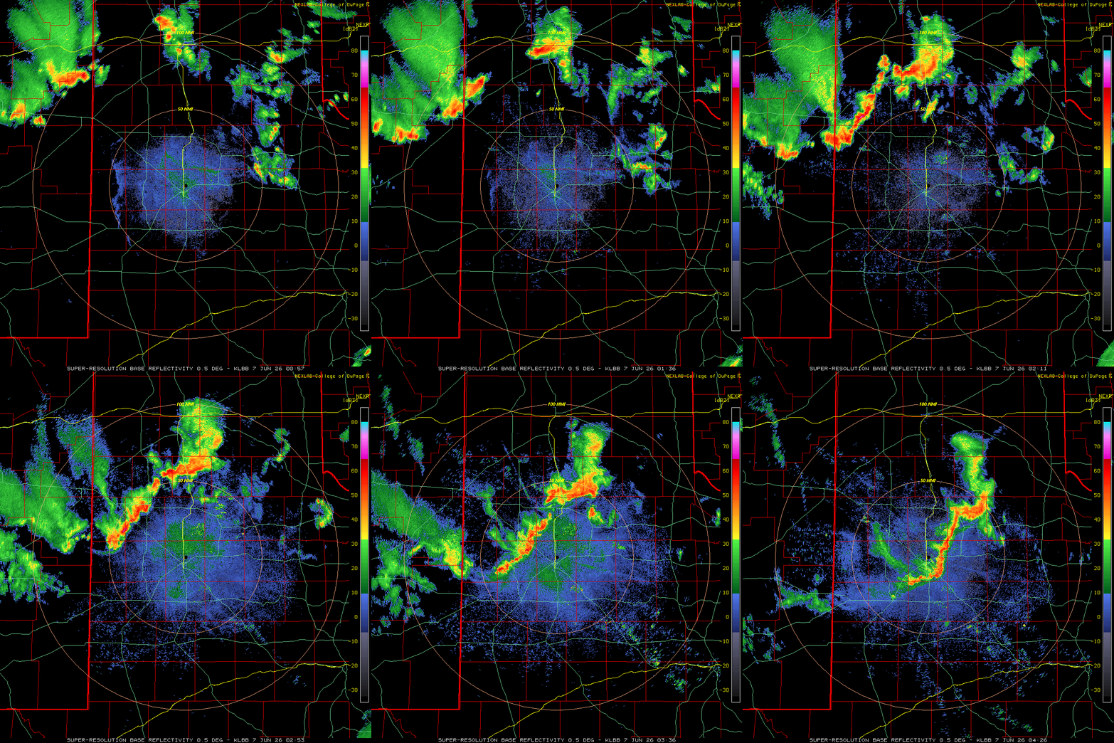
| Regional radar animation valid from 1:36 am on Saturday to 8:41 am on Sunday (6-7 June). Additional Lubbock WSR-88D radar animations can be viewed at: 5:54 pm on Friday to 9 am on Saturday (5-6 June); 4:42 am to 1:01 pm on Saturday; 2:18 pm to 4:27 pm on Saturday; 7:57 pm to 11:26 pm on Saturday; and 5:43 pm on Saturday to 9:44 on Sunday (6-7 June). | |
| One final broken line of thunderstorms, racing out of northeast New Mexico, pivoted across much of the South Plains late Saturday evening, complete with gusty winds, brief heavy downpours and plentiful lightning. A wind gust to 71 mph was measured by the Reese Center West Texas Mesonet (WTM) as these storms moved by. These late evening storms decreased in coverage and intensity as they moved into the Rolling Plains, but they did reinvigorate as they approached the Red River Valley of North Texas early Sunday morning. | |
 |
 |
 |
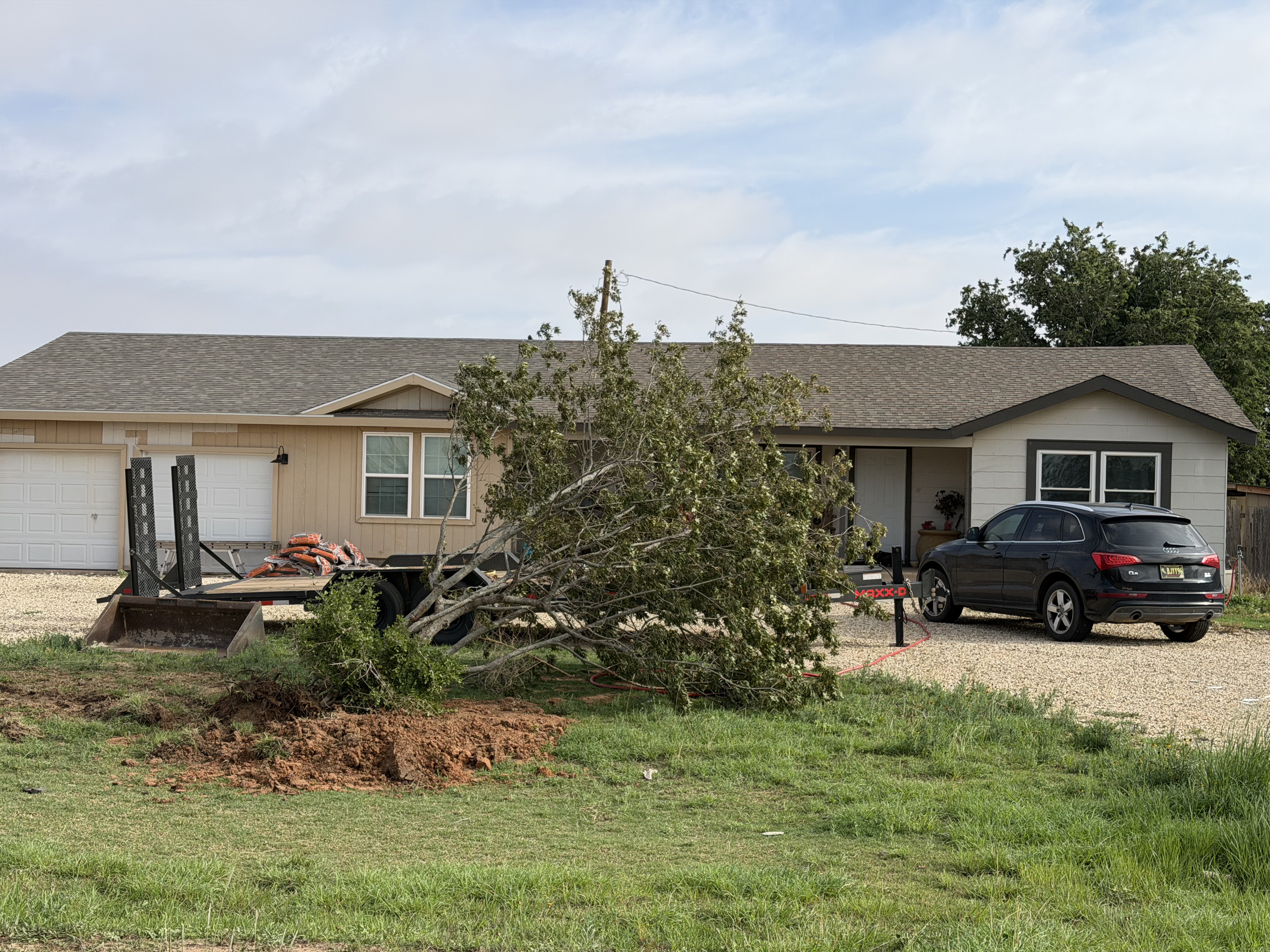 |
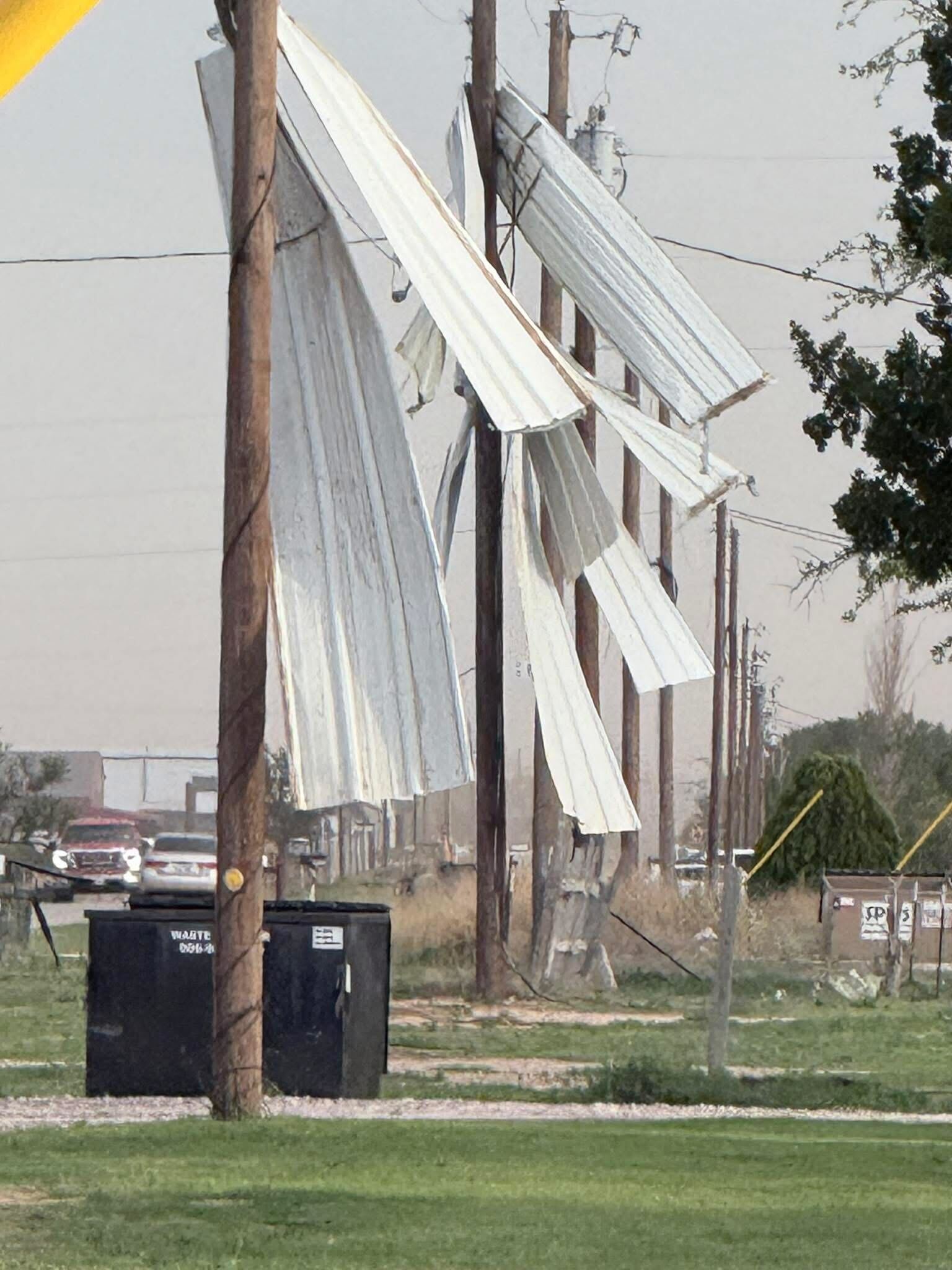
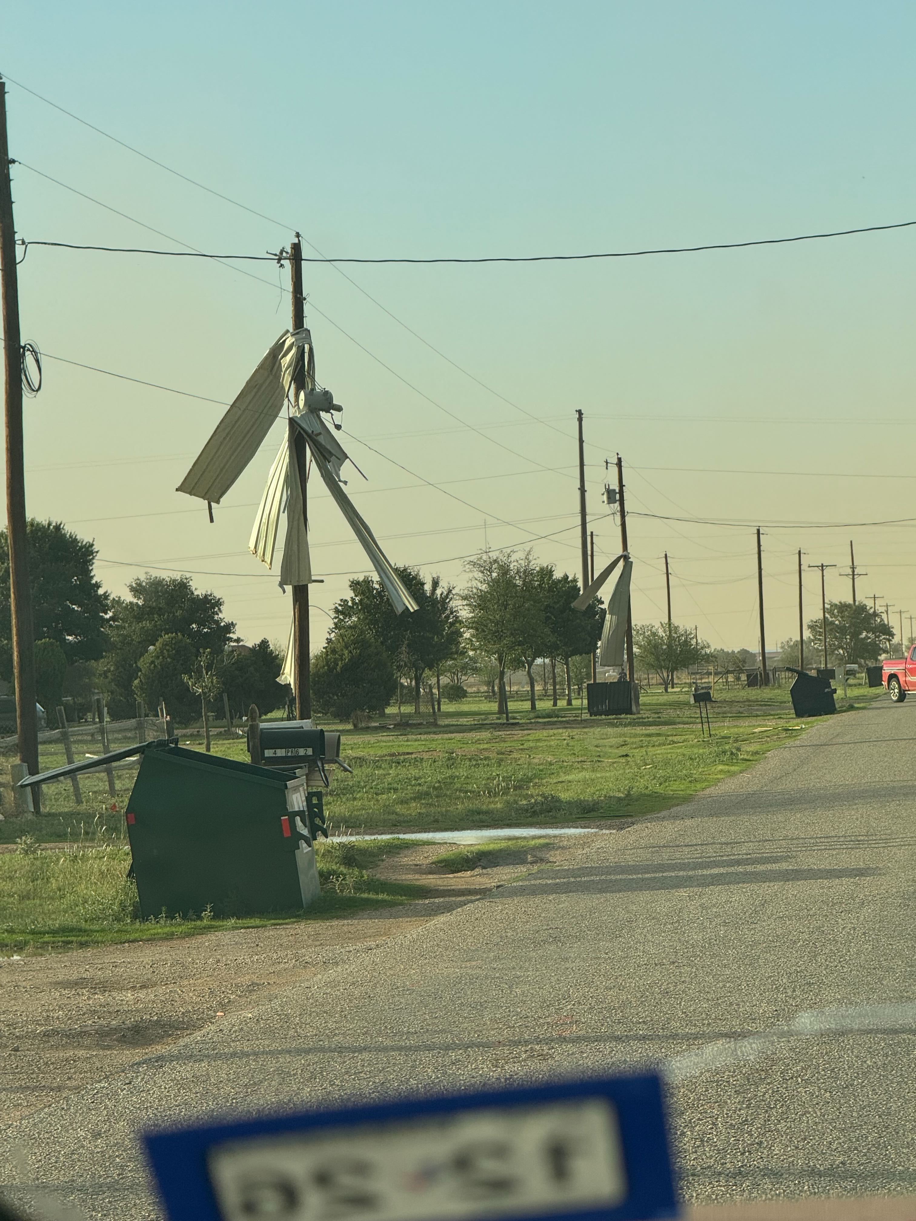
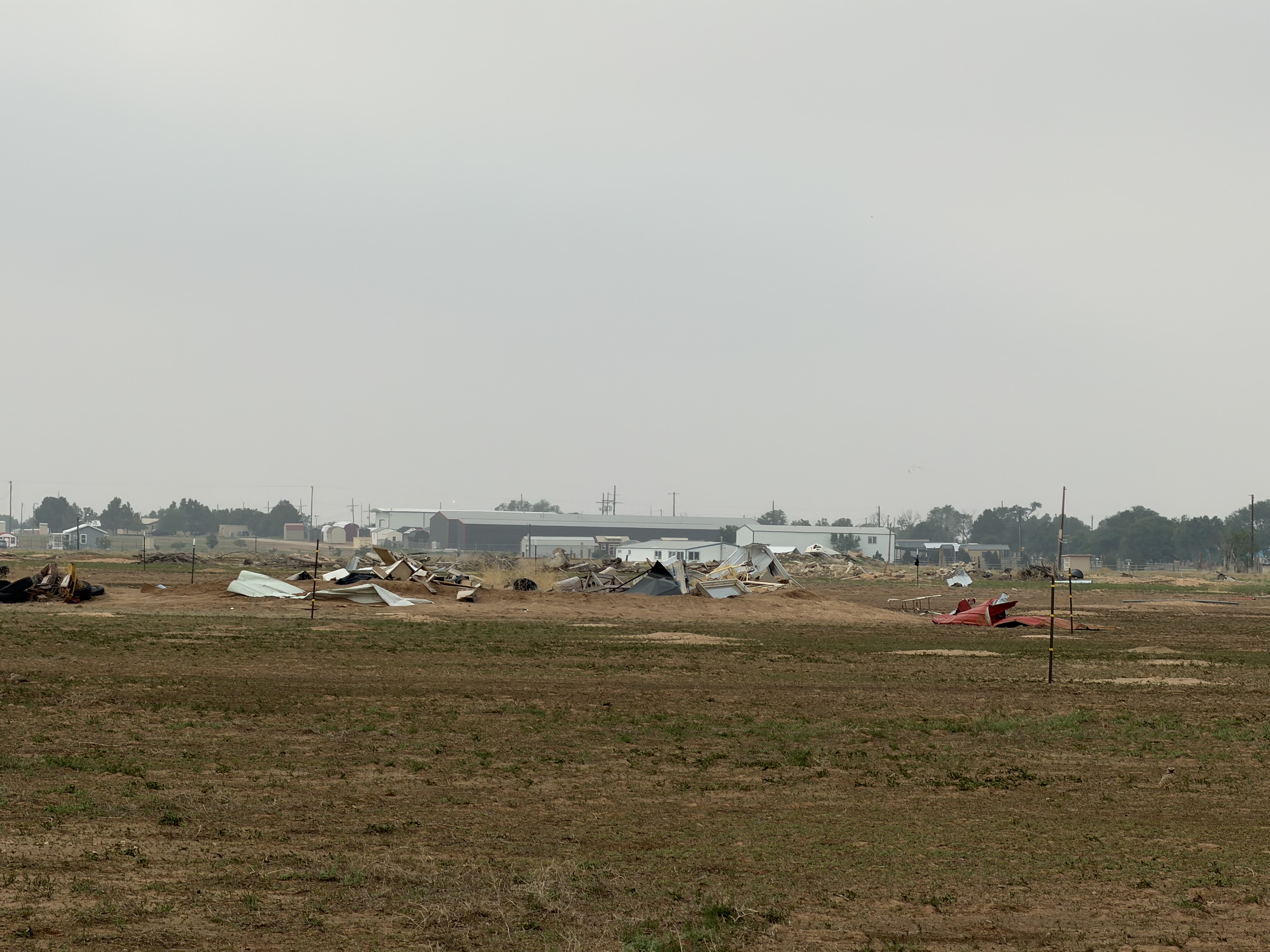
| Wind damage that occurred in western Lubbock County (along and near West 34th Street and County Road 1200) on Sunday evening (6 June 2026). The upper left image is courtesy of Jacob Riley and the upper right image is courtesy of Kevin Henricks. The bottom two images were taken during a damage survey conducted by the NWS the following morning. | |
| Hotter and drier conditions overspread West Texas on Sunday, in the wake of the storm system as it shifted off to the northeast into the Central Plains. Despite the drier conditions, intense heating, with temperatures peaking in the upper 90s at most locations, led to the development of a small area of thunderstorms over the west-central South Plains late Sunday afternoon (7 June). | |
 |
|
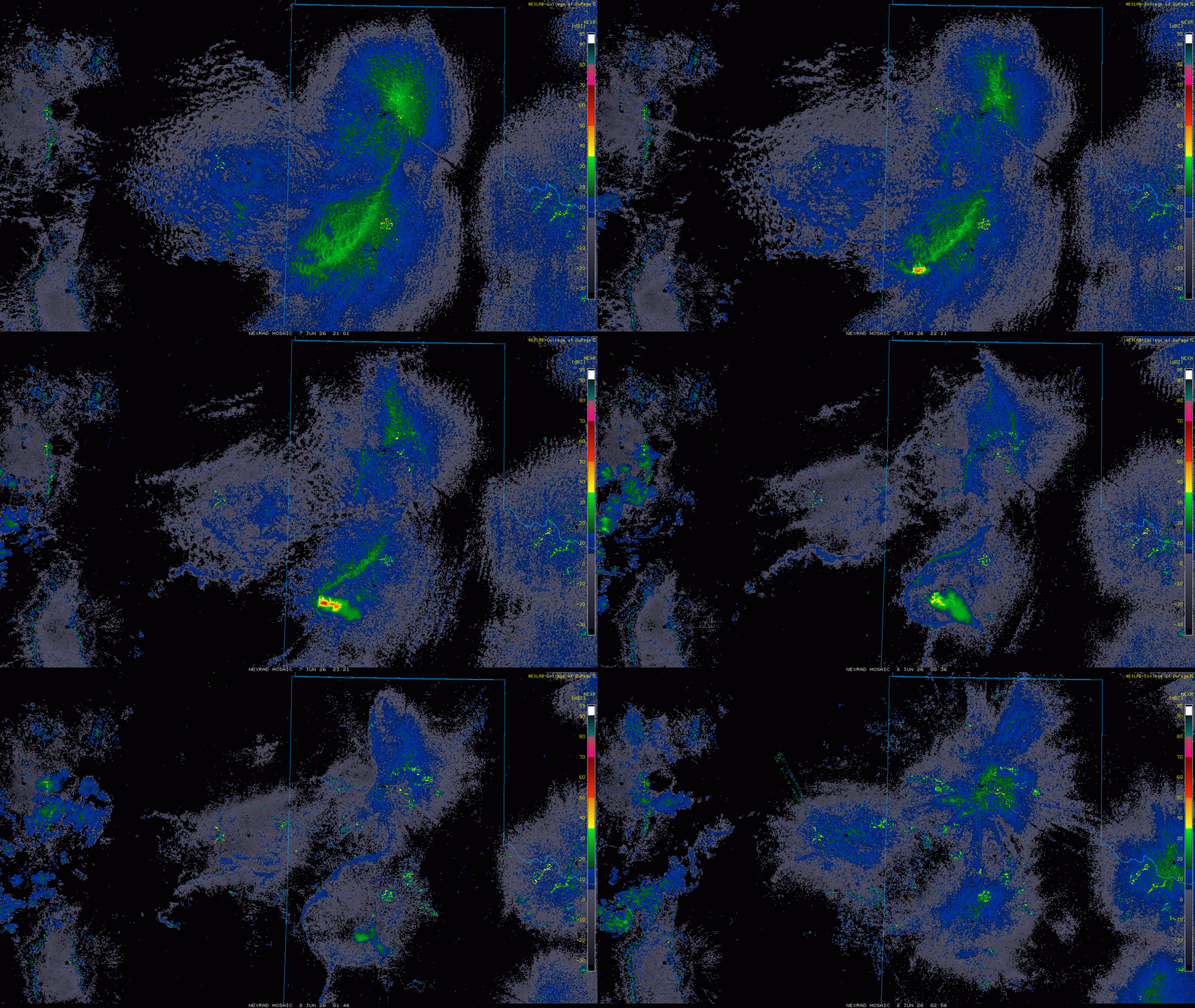
| Regional radar animation valid from 4:06 pm to 9:56 pm on Sunday (7 June 2026). A Lubbock WSR-88D radar animation, valid from 2:29 pm on Sunday to 7:08 am on Monday (7-8 June), can be FOUND HERE. | |
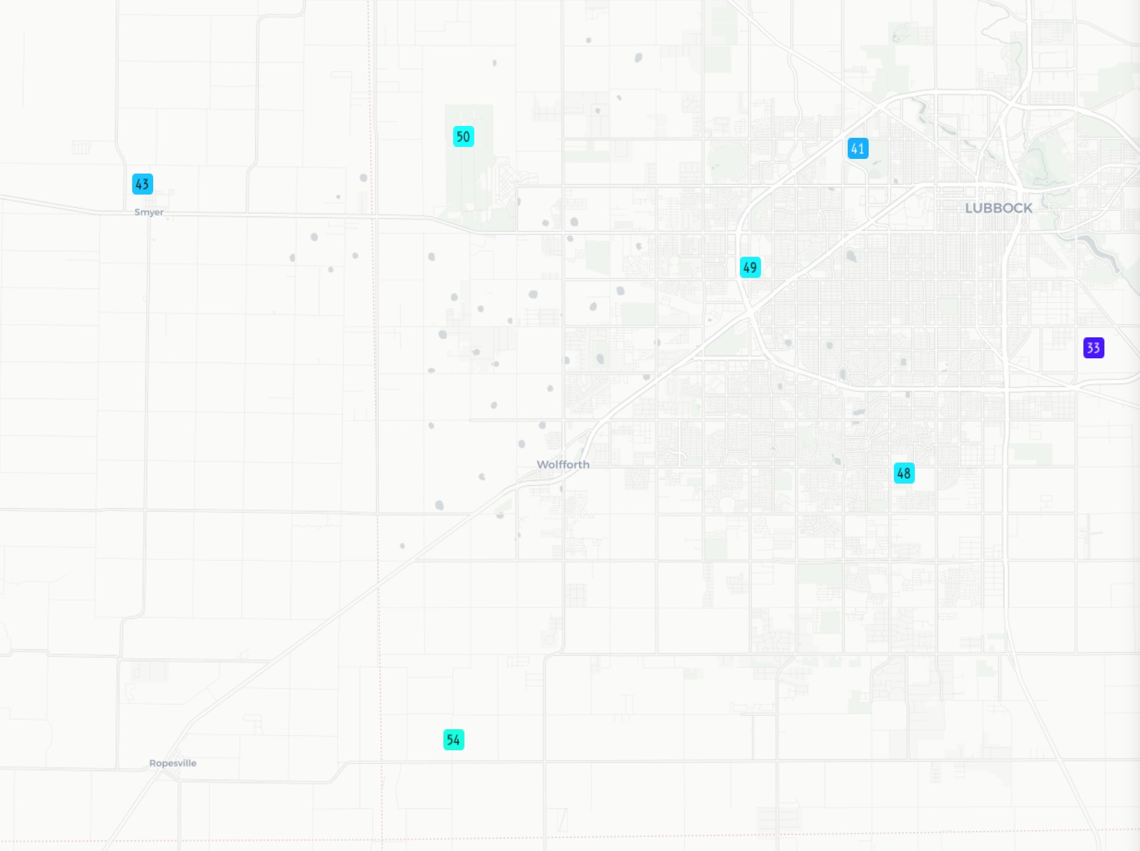
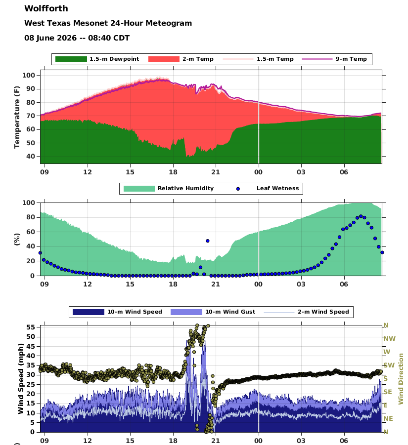
| Unlike previous days, this activity had a lot less moisture to work with and was much higher-based. The dearth of moisture limited the coverage and overall amount of rain that reached the ground before evaporating. Even so, a small swath in south-central and southwest Hockley County likely received meaningful rainfall. However, more widespread was the strong wind gusts generated by this high-based activity. Many locations across western Lubbock and eastern Hockley Counties experienced wind gusts near and in excess of 50 mph. | |
 |
|
| Peak wind gusts measured by the West Texas Mesonet (WTM) on Sunday evening (7 June 2026). | |
| The intense wind gusts kicked up a lot of dust and even caused isolated pockets of damage. In particular, out buildings were damaged or destroyed and dumpsters were blown about in western Lubbock County. Sheet metal tossed into power lines resulted in localized power outages. | |
 |
|
| Wolfforth WTM meteogram displaying temperatures (F) and dewpoint (F) on the top graphic, relative humidity (%) and leaf wetness (%) on the middle graphic, and wind speeds, wind gust and wind direction on the bottom graphic. The meteogram is from Sunday morning through early Monday (7-8 June 2026). | |
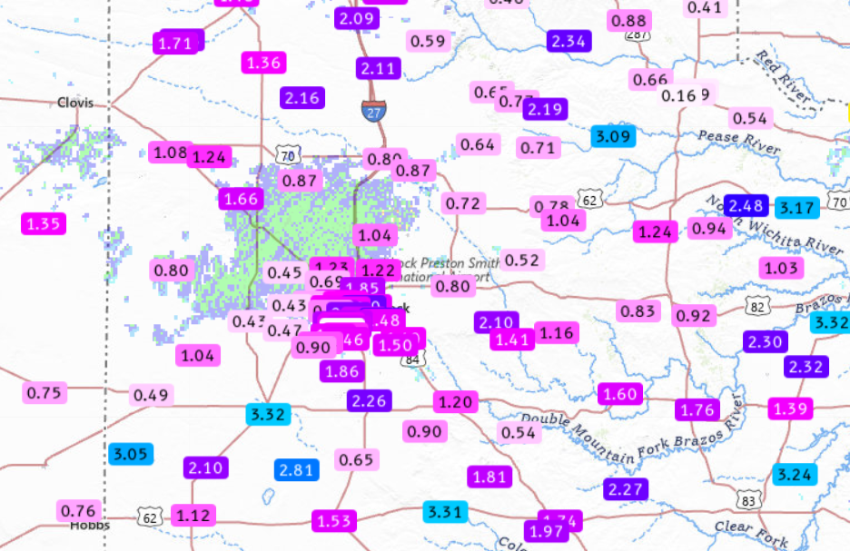
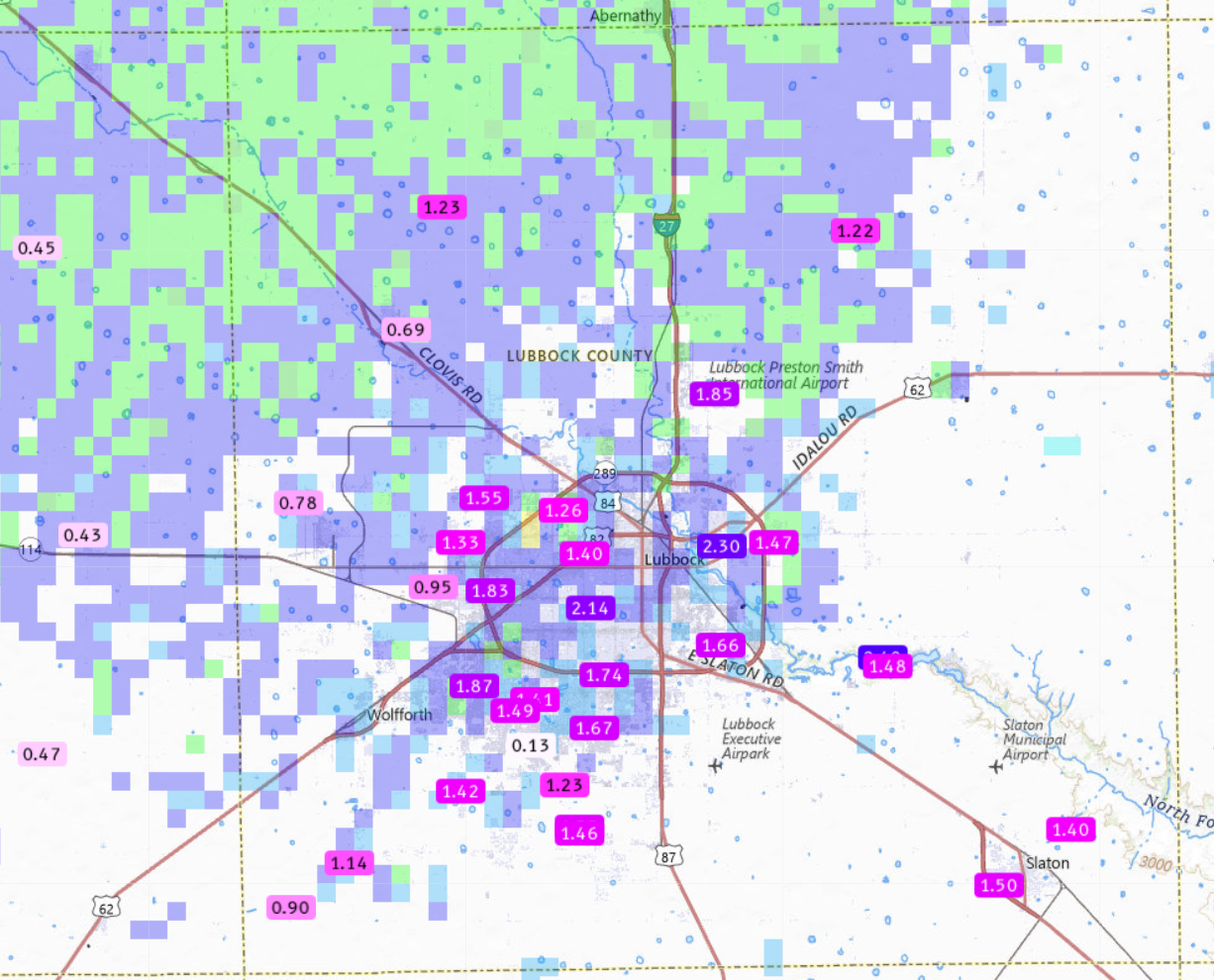
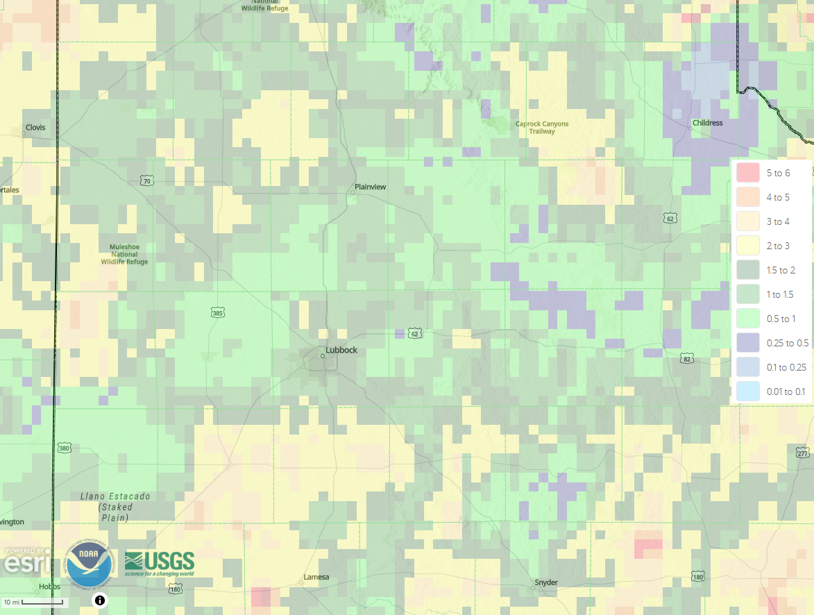
| Where the strongest winds occurred Sunday evening, rainfall was generally limited to trace amounts, plus any dust that fell. Despite this, over the course of previous days meaningful rain fell over the entire region. As the below graphic illustrates, rain totals of 1 to 2+ inches were common, with localized 3+ inch pockets. Where the heaviest rain fell, localized flooding occurred. | |
 |
|
| 7-day radar-estimated and bias-corrected rainfall ending at 7 am on Monday (8 June 2026). Measured 7-day rainfall totals from the National Weather Service (NWS) and West Texas Mesonet (WTM), ending at 1 pm on Monday, can be VIEWED HERE, with a zoomed in view of Lubbock County HERE. | |
|
Officially, the Lubbock Airport measured 1.72 inches of rain over the first week of June, boosting the year-to-date total to 5.64 inches. Childress wasn't as fortunate, only recording 0.19 inches the first 7 days of June. A list of the preliminary storm reports collected over the active first weekend of June can be found below. |
|
Preliminary Local Storm Report
National Weather Service Lubbock TX
1101 PM CDT Sat Jun 6 2026

..TIME...   ...EVENT...      ...CITY LOCATION...     ...LAT.LON...
..DATE...   ....MAG....      ..COUNTY LOCATION..ST.. ...SOURCE....
            ..REMARKS..

1246 PM     Tstm Wnd Gst     7 W Lakeview            34.66N 100.81W
06/04/2026  M65 MPH          Hall               TX   Mesonet

            Gusts of 58 to 65 mph from 12:38 to 12:48
            PM. Measured by the West Texas Mesonet.

0446 PM     Flash Flood      10 NNE Bledsoe          33.76N 102.96W
06/05/2026                   Cochran            TX   Storm Chaser

            4 inches of water over the road at
            intersection of TX114/CR55. Flowing west to
            east. Road is still passable at this time.
            Flow rate increasing.

1054 PM     Tstm Wnd Gst     Reese Center            33.61N 102.05W
06/06/2026  M71 MPH          Lubbock            TX   Mesonet



 Follow us on X
 Follow us on Facebook
 Follow us on YouTube
 LUB RSS Feed