Overview
|
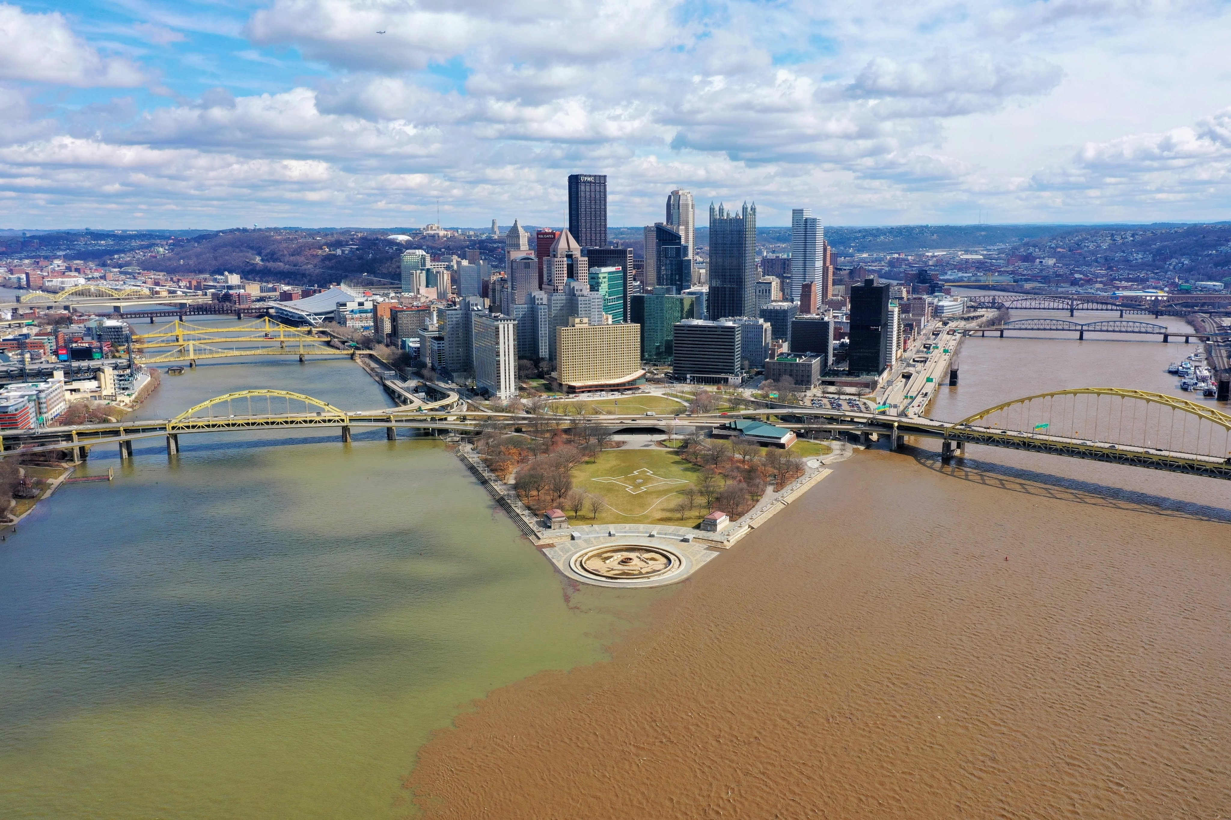
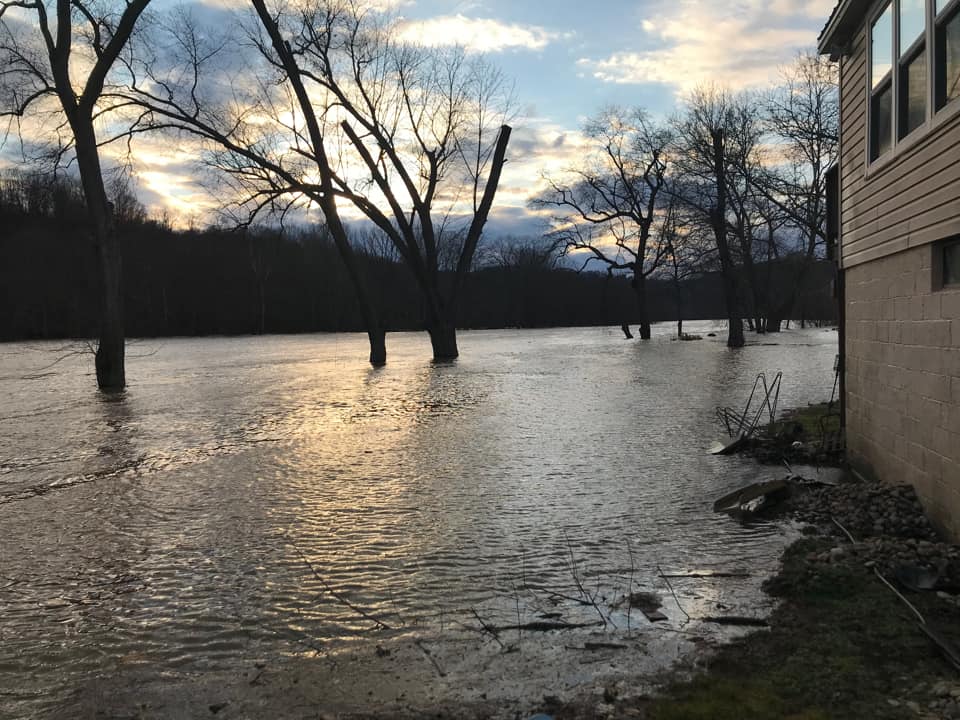
The weekend of February 27th and 28th of 2021 turned out to be a very wet weekend. The stage was set with an above average year for snowfall across the mountains in WV. A quick transition from an Arctic air mass to a warmer air mass brought up from the south led to some significant snow melt. Snow Water Equivalents in the higher terrain of 2 to 3 inches with the average snow depth of 7 to 12 inches will push river points higher along the Cheat and the Monongahela River basins, eventually flowing into the Ohio. The scenario got more concerning when high pressure set up just off the southeast coast allowing Gulf of America and Atlantic Ocean moisture to be brought north into the Ohio Valley. A stationary frontal boundary set up along the axis of this swath of moisture. This created a focal point for efficient rainfall production into the OH Valley and especially along and near the river points along the Cheat and Monongahela River Basins. The bulk of the rainfall fell here in the WV Counties with 1 to 3 inches of rainfall in most locations. The heavy rainfall even still made it a bit further north into the Youghiogheny River Valley where 1 to 2 inches fell. Rivers across the forecast area remained elevated into March 1st and then concerning points along the Ohio River March 2nd and 3rd. |
(Credit: Jared Rackley) |
Flooding
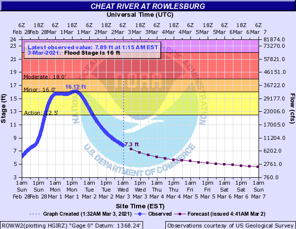
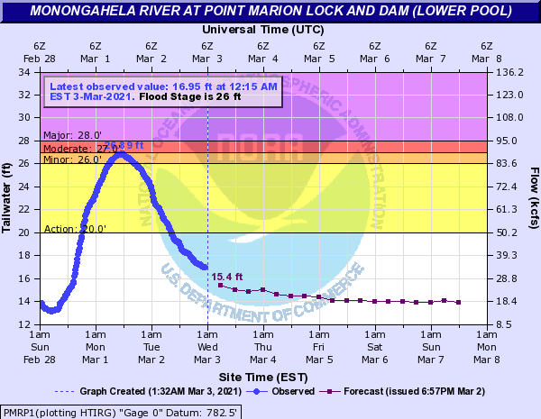
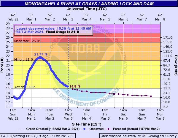
Hydrographs
 |
 |
 |
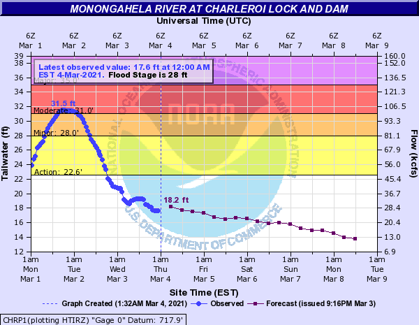 |
| Cheat River at Rowlesburg | Monongahela River at Point Marion | Monongahela River at Grey's Landing | Monongahela River at Charleroi Lock and Dam |
 |
 |
 |
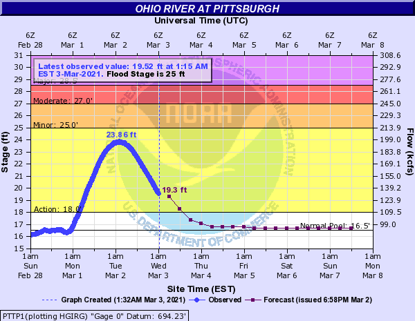 |
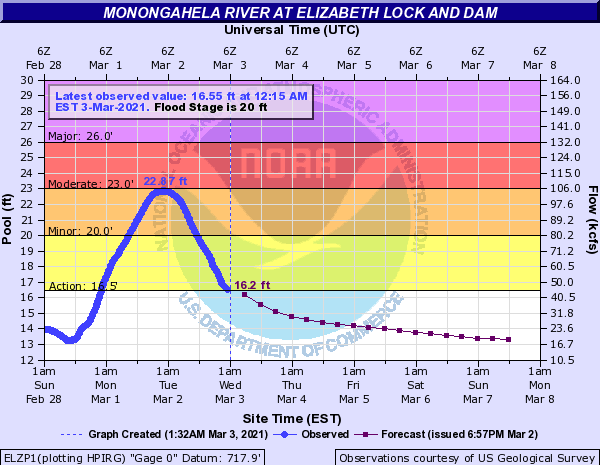
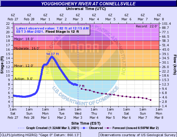
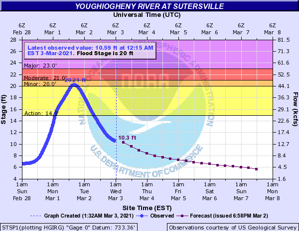
| Monongahela River at Elizabeth Lock and Dam | Youghiogheny River at Connellsville | Youghiogheny River at Sutersville | Ohio River at Pittsburgh |
Photos & Video
Header
 |
 |
 |
 |
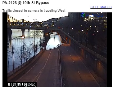
| 10th Street Bypass Pittsburgh (Credit: PENNDOT) |
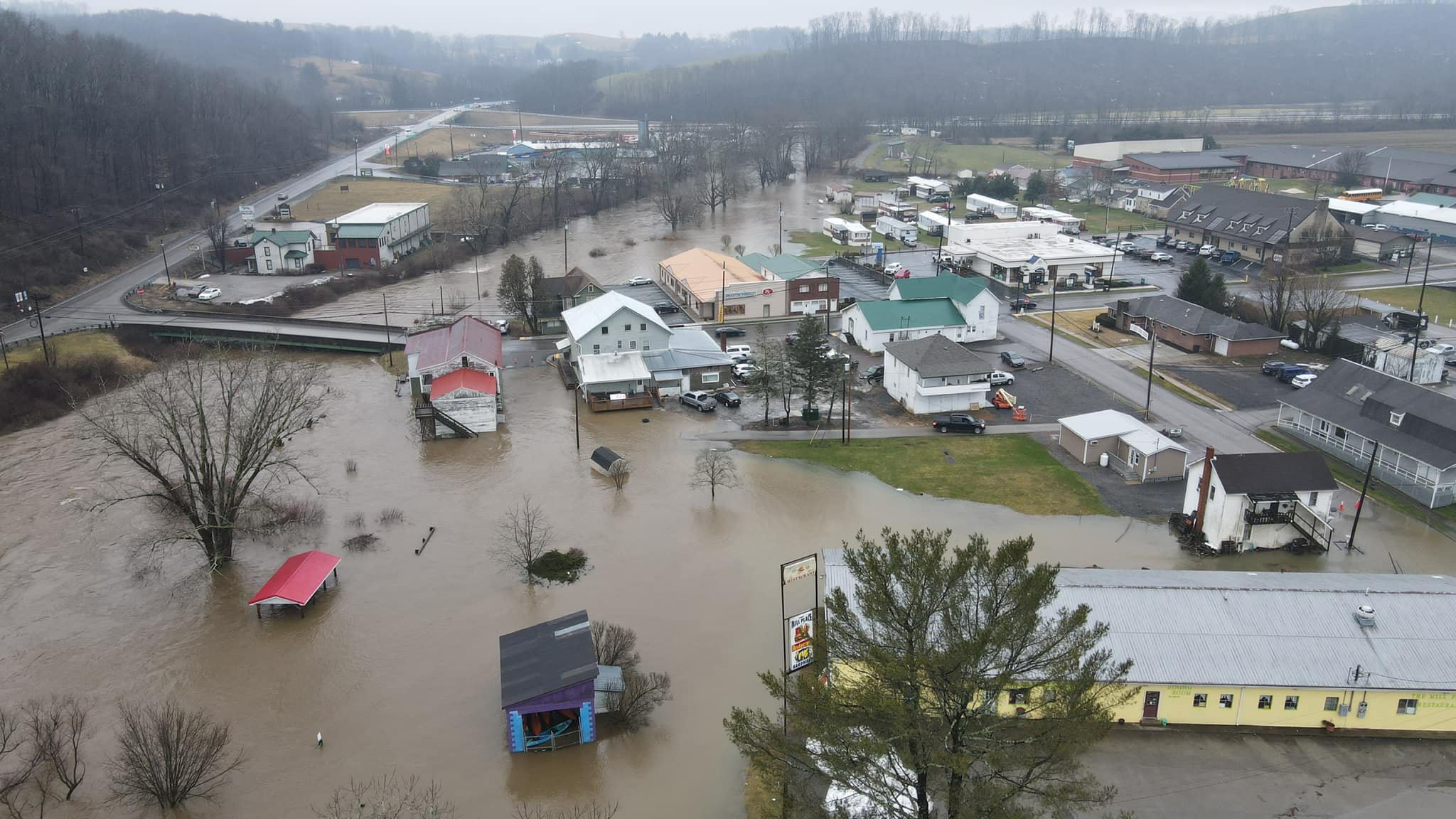
Bruceton Mills (Credit: Duncan Slade) |
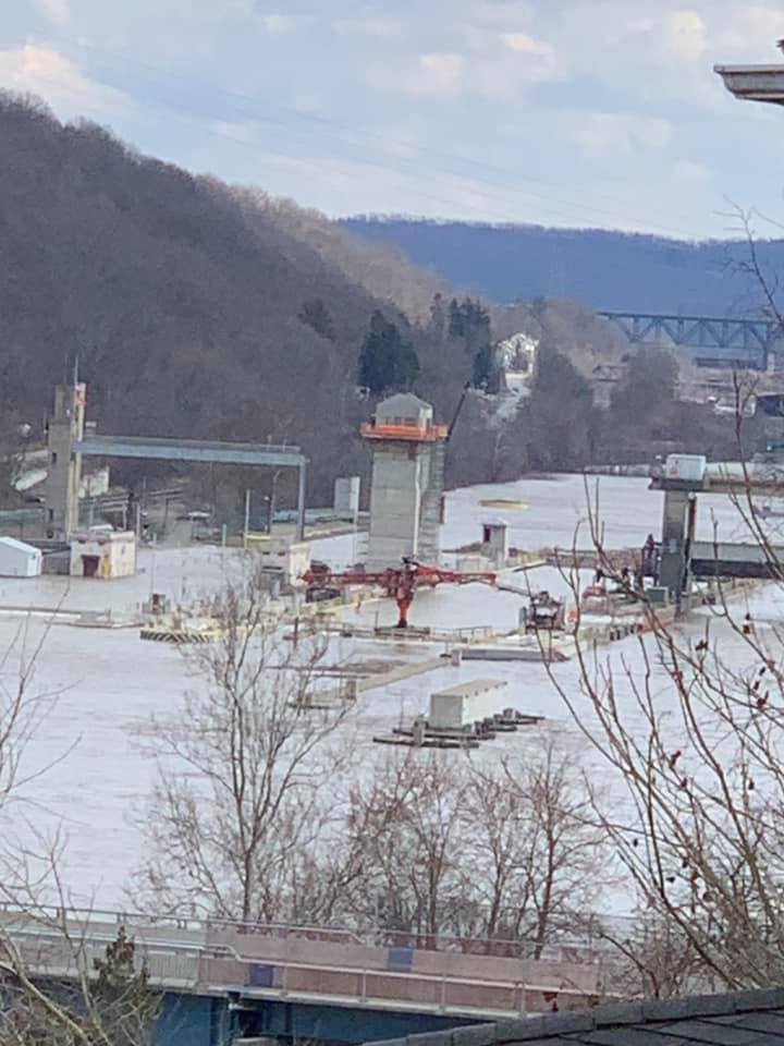
North Charleroi Lock and Dam (Credit: Cheryl Boda) |
Sutersville (Credit: Jeff Weishorn) |
Rain Reports
Public Information Statement
National Weather Service Pittsburgh PA
814 AM EST Mon Mar 1 2021

...48 HOUR PRECIPITATION REPORTS...

Location                     Amount    Time/Date       Lat/Lon

...Ohio...

...Belmont County...
2.9 SW Mount Pleasant        1.08 in   0700 AM 03/01   40.14N/80.82W

...Carroll County...
Amsterdam                    1.23 in   0700 AM 03/01   40.48N/80.92W

...Columbiana County...
1 W Washingtonville          0.89 in   0745 AM 03/01   40.90N/80.78W
2.3 N Summitville            0.88 in   0715 AM 03/01   40.71N/80.88W
0.6 S East Palestine         0.87 in   0715 AM 03/01   40.83N/80.54W
1 E Lisbon                   0.69 in   0700 AM 03/01   40.77N/80.75W

...Coshocton County...
3 N Coshocton                1.36 in   0700 AM 03/01   40.31N/81.85W
3.0 SE Conesville            1.04 in   0745 AM 03/01   40.16N/81.85W

...Harrison County...
1 W Jewett                   0.84 in   0700 AM 03/01   40.37N/81.01W
2 S Bowerston                0.72 in   0800 AM 03/01   40.39N/81.19W

...Monroe County...
Merrell Ridge                1.45 in   0738 AM 03/01   39.61N/81.17W

...Muskingum County...
Adamsville                   1.20 in   0800 AM 03/01   40.07N/81.88W

...Noble County...
Summerfield                  0.76 in   0800 AM 03/01   39.80N/81.33W

...Tuscarawas County...
New Philadelphia             1.83 in   0802 AM 03/01   40.42N/81.47W
Sugarcreek                   0.98 in   0802 AM 03/01   40.51N/81.65W
Zoar                         0.89 in   0715 AM 03/01   40.61N/81.42W
4 SE Port Washington         0.72 in   0700 AM 03/01   40.29N/81.46W

...Pennsylvania...

...Allegheny County...
Pittsburgh Intl Airport      0.99 in   0751 AM 03/01   40.50N/80.27W
3.6 NNW Pittsburgh           0.94 in   0600 AM 03/01   40.49N/80.00W
Upper Saint Clair            0.91 in   0805 AM 03/01   40.33N/80.08W
1.7 NW Jefferson             0.90 in   1000 PM 02/28   40.31N/79.95W
Fox Chapel                   0.81 in   0805 AM 03/01   40.52N/79.88W
Sewickley                    0.80 in   0805 AM 03/01   40.54N/80.19W
Pennsbury Village            0.68 in   0805 AM 03/01   40.43N/80.09W

...Armstrong County...
Kittanning                   1.23 in   0758 AM 03/01   40.83N/79.56W
0.8 NE North Apollo          0.50 in   0800 AM 03/01   40.60N/79.55W

...Beaver County...
Hookstown                    0.63 in   0805 AM 03/01   40.60N/80.47W

...Butler County...
Butler County Airport        0.60 in   0756 AM 03/01   40.77N/79.95W

...Clarion County...
Cooksburg                    0.72 in   0730 AM 03/01   41.36N/79.22W

...Fayette County...
6 SW Ohiopyle                1.95 in   0600 AM 03/01   39.81N/79.59W

...Forest County...
Allegheny                    0.56 in   0707 AM 03/01   41.54N/79.13W

...Greene County...
5 WNW Spraggs                1.27 in   0805 AM 03/01   39.81N/80.31W

...Indiana County...
Rochester Mills              1.04 in   0804 AM 03/01   40.82N/79.07W

...Jefferson County...
DuBois Airport               0.87 in   0753 AM 03/01   41.17N/78.90W

...Lawrence County...
New Castle Northwest         1.00 in   0745 AM 03/01   41.02N/80.36W

...Mercer County...
Mercer                       0.63 in   0801 AM 03/01   41.29N/80.18W

...Washington County...
1 SW California              1.46 in   0805 AM 03/01   40.05N/79.93W

...Westmoreland County...
2 S Saltsburg                1.26 in   0715 AM 03/01   40.46N/79.45W
1 N Greensburg               1.20 in   0805 AM 03/01   40.33N/79.54W

...West Virginia...

...Brooke County...
3 N West Liberty             1.24 in   0600 AM 03/01   40.20N/80.61W
1 NW West Liberty            1.08 in   0500 AM 03/01   40.18N/80.61W

...Marshall County...
Cameron                      1.05 in   0715 AM 03/01   39.83N/80.57W

...Monongalia County...
Morgantown Dam               2.24 in   0700 AM 03/01   39.62N/79.97W
3 S Wadestown                0.52 in   0500 AM 03/01   39.64N/80.33W

...Ohio County...
Wheeling Airport             1.00 in   0753 AM 03/01   40.17N/80.65W

...Preston County...
3.9 N Bruceton Mills         3.60 in   0800 AM 03/01   39.71N/79.66W
2.4 S Tunnelton              1.92 in   0800 AM 03/01   39.36N/79.74W
Afton                        1.64 in   0800 AM 03/01   39.54N/79.53W
&&

**METADATA**
:3/01/2021,0700 AM, OH, Belmont, 2.9 SW Mount Pleasant, , , 40.1372, -80.8231, RAIN_48, 1.08, Inch, IFLOWS, 48 hour rainfall,
:3/01/2021,0700 AM, OH, Carroll, Amsterdam, , , 40.4753, -80.9244, RAIN_48, 1.23, Inch, HADS, 48 hour rainfall,
:3/01/2021,0700 AM, OH, Columbiana, 1 E Lisbon, , , 40.7722, -80.7508, RAIN_48, 0.69, Inch, HADS, 48 hour rainfall,
:3/01/2021,0715 AM, OH, Columbiana, 0.6 S East Palestine, , , 40.8292, -80.5442, RAIN_48, 0.87, Inch, HADS, 48 hour rainfall,
:3/01/2021,0715 AM, OH, Columbiana, 2.3 N Summitville, , , 40.71, -80.8789, RAIN_48, 0.88, Inch, HADS, 48 hour rainfall,
:3/01/2021,0745 AM, OH, Columbiana, 1 W Washingtonville, , , 40.8975, -80.7808, RAIN_48, 0.89, Inch, HADS, 48 hour rainfall,
:3/01/2021,0745 AM, OH, Coshocton, 3.0 SE Conesville, , , 40.1594, -81.8475, RAIN_48, 1.04, Inch, HADS, 48 hour rainfall,
:3/01/2021,0700 AM, OH, Coshocton, 3 N Coshocton, , , 40.3075, -81.8539, RAIN_48, 1.36, Inch, IFLOWS, 48 hour rainfall,
:3/01/2021,0800 AM, OH, Harrison, 2 S Bowerston, , , 40.3944, -81.1878, RAIN_48, 0.72, Inch, IFLOWS, 48 hour rainfall,
:3/01/2021,0700 AM, OH, Harrison, 1 W Jewett, , , 40.3703, -81.0125, RAIN_48, 0.84, Inch, IFLOWS, 48 hour rainfall,
:3/01/2021,0738 AM, OH, Monroe, Merrell Ridge, , , 39.6093, -81.1671, RAIN_48, 1.45, Inch, RAWS, 48 hour rainfall,
:3/01/2021,0800 AM, OH, Muskingum, Adamsville, , , 40.0708, -81.8833, RAIN_48, 1.2, Inch, IFLOWS, 48 hour rainfall,
:3/01/2021,0800 AM, OH, Noble, Summerfield, , , 39.7967, -81.335, RAIN_48, 0.76, Inch, IFLOWS, 48 hour rainfall,
:3/01/2021,0700 AM, OH, Tuscarawas, 4 SE Port Washington, , , 40.2867, -81.4642, RAIN_48, 0.72, Inch, IFLOWS, 48 hour rainfall,
:3/01/2021,0715 AM, OH, Tuscarawas, Zoar, , , 40.6128, -81.4175, RAIN_48, 0.89, Inch, HADS, 48 hour rainfall,
:3/01/2021,0802 AM, OH, Tuscarawas, Sugarcreek, , , 40.5122, -81.6525, RAIN_48, 0.98, Inch, CWOP, 48 hour rainfall,
:3/01/2021,0802 AM, OH, Tuscarawas, New Philadelphia, , , 40.4238, -81.4672, RAIN_48, 1.83, Inch, CWOP, 48 hour rainfall,
:3/01/2021,0805 AM, PA, Allegheny, Pennsbury Village, , , 40.4274, -80.0947, RAIN_48, 0.68, Inch, AWS, 48 hour rainfall,
:3/01/2021,0805 AM, PA, Allegheny, Sewickley, , , 40.5436, -80.1894, RAIN_48, 0.8, Inch, AWS, 48 hour rainfall,
:3/01/2021,0805 AM, PA, Allegheny, Fox Chapel, , , 40.5222, -79.8772, RAIN_48, 0.81, Inch, AWS, 48 hour rainfall,
:2/28/2021,1000 PM, PA, Allegheny, 1.7 NW Jefferson, , , 40.3131, -79.9523, RAIN_48, 0.9, Inch, COCORAHS, 48 hour rainfall,
:3/01/2021,0805 AM, PA, Allegheny, Upper Saint Clair, , , 40.3311, -80.0778, RAIN_48, 0.91, Inch, AWS, 48 hour rainfall,
:3/01/2021,0600 AM, PA, Allegheny, 3.6 NNW Pittsburgh, , , 40.4888, -80.0006, RAIN_48, 0.94, Inch, COCORAHS, 48 hour rainfall,
:3/01/2021,0751 AM, PA, Allegheny, Pittsburgh Intl Airport, , , 40.5, -80.2667, RAIN_48, 0.99, Inch, ASOS, 48 hour rainfall,
:3/01/2021,0800 AM, PA, Armstrong, 0.8 NE North Apollo, , , 40.6044, -79.5522, RAIN_48, 0.5, Inch, HADS, 48 hour rainfall,
:3/01/2021,0758 AM, PA, Armstrong, Kittanning, , , 40.8317, -79.5575, RAIN_48, 1.23, Inch, CWOP, 48 hour rainfall,
:3/01/2021,0805 AM, PA, Beaver, Hookstown, , , 40.5997, -80.4733, RAIN_48, 0.63, Inch, AWS, 48 hour rainfall,
:3/01/2021,0756 AM, PA, Butler, Butler County Airport, , , 40.7667, -79.95, RAIN_48, 0.6, Inch, AWOS, 48 hour rainfall,
:3/01/2021,0730 AM, PA, Clarion, Cooksburg, , , 41.3575, -79.2172, RAIN_48, 0.72, Inch, COOP, 48 hour rainfall,
:3/01/2021,0600 AM, PA, Fayette, 6 SW Ohiopyle, , , 39.815, -79.5867, RAIN_48, 1.95, Inch, HADS, 48 hour rainfall,
:3/01/2021,0707 AM, PA, Forest, Allegheny, , , 41.5422, -79.1267, RAIN_48, 0.56, Inch, RAWS, 48 hour rainfall,
:3/01/2021,0805 AM, PA, Greene, 5 WNW Spraggs, , , 39.8061, -80.3083, RAIN_48, 1.27, Inch, AWS, 48 hour rainfall,
:3/01/2021,0804 AM, PA, Indiana, Rochester Mills, , , 40.8156, -79.0724, RAIN_48, 1.04, Inch, CWOP, 48 hour rainfall,
:3/01/2021,0753 AM, PA, Jefferson, DuBois Airport, , , 41.1667, -78.9, RAIN_48, 0.87, Inch, ASOS, 48 hour rainfall,
:3/01/2021,0745 AM, PA, Lawrence, New Castle Northwest, , , 41.0178, -80.3628, RAIN_48, 1, Inch, HADS, 48 hour rainfall,
:3/01/2021,0801 AM, PA, Mercer, Mercer, , , 41.2908, -80.1818, RAIN_48, 0.63, Inch, CWOP, 48 hour rainfall,
:3/01/2021,0805 AM, PA, Washington, 1 SW California, , , 40.0477, -79.9269, RAIN_48, 1.46, Inch, AWS, 48 hour rainfall,
:3/01/2021,0805 AM, PA, Westmoreland, 1 N Greensburg, , , 40.3269, -79.5424, RAIN_48, 1.2, Inch, AWS, 48 hour rainfall,
:3/01/2021,0715 AM, PA, Westmoreland, 2 S Saltsburg, , , 40.4569, -79.4528, RAIN_48, 1.26, Inch, HADS, 48 hour rainfall,
:3/01/2021,0500 AM, WV, Brooke, 1 NW West Liberty, , , 40.1811, -80.6077, RAIN_48, 1.08, Inch, IFLOWS, 48 hour rainfall,
:3/01/2021,0600 AM, WV, Brooke, 3 N West Liberty, , , 40.2044, -80.6075, RAIN_48, 1.24, Inch, USGS, 48 hour rainfall,
:3/01/2021,0715 AM, WV, Marshall, Cameron, , , 39.8289, -80.5736, RAIN_48, 1.05, Inch, HADS, 48 hour rainfall,
:3/01/2021,0500 AM, WV, Monongalia, 3 S Wadestown, , , 39.6372, -80.3267, RAIN_48, 0.52, Inch, IFLOWS, 48 hour rainfall,
:3/01/2021,0700 AM, WV, Monongalia, Morgantown Dam, , , 39.62, -79.97, RAIN_48, 2.24, Inch, COOP, 48 hour rainfall,
:3/01/2021,0753 AM, WV, Ohio, Wheeling Airport, , , 40.1667, -80.65, RAIN_48, 1, Inch, ASOS, 48 hour rainfall,
:3/01/2021,0800 AM, WV, Preston, Afton, , , 39.5356, -79.5306, RAIN_48, 1.64, Inch, IFLOWS, 48 hour rainfall,
:3/01/2021,0800 AM, WV, Preston, 2.4 S Tunnelton, , , 39.3592, -79.7378, RAIN_48, 1.92, Inch, IFLOWS, 48 hour rainfall,
:3/01/2021,0800 AM, WV, Preston, 3.9 N Bruceton Mills, , , 39.7144, -79.6603, RAIN_48, 3.6, Inch, IFLOWS, 48 hour rainfall,

Observations are collected from a variety of sources with varying
equipment and exposures. We thank all volunteer weather observers
for their dedication. Not all data listed are considered official.
Environment
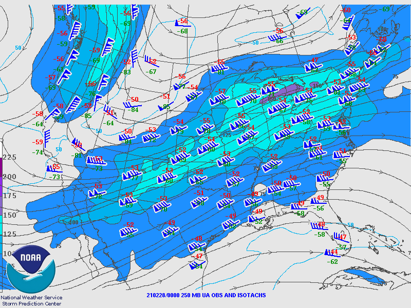
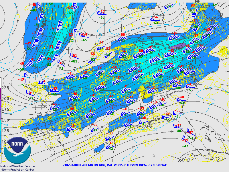
Upper Air Maps from SPC
February 28th 00Z Maps
 |
 |
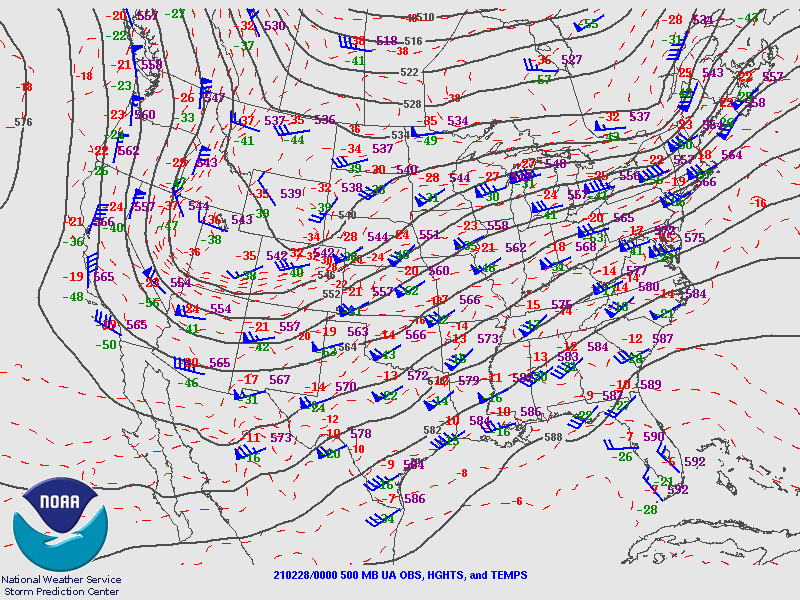 |
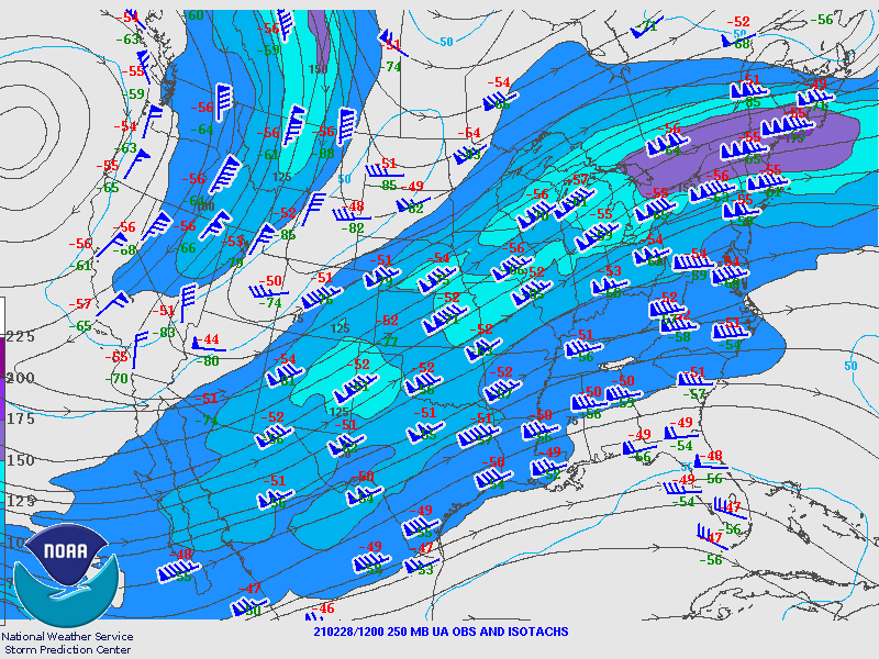
| Figure 1: 250MB | Figure 2: 300MB | Figure 3: 500MB |
 |
 |
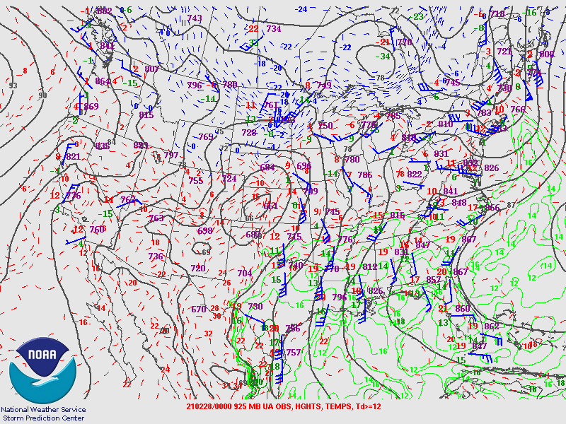 |
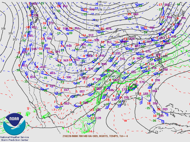
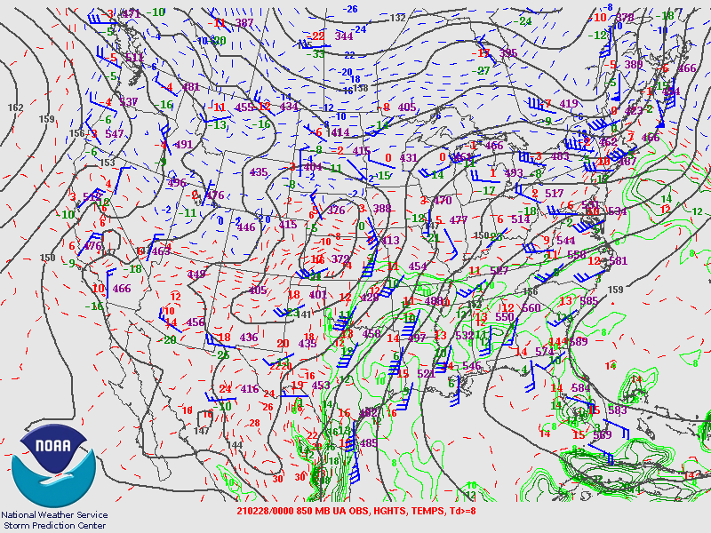
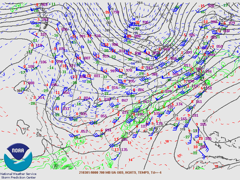
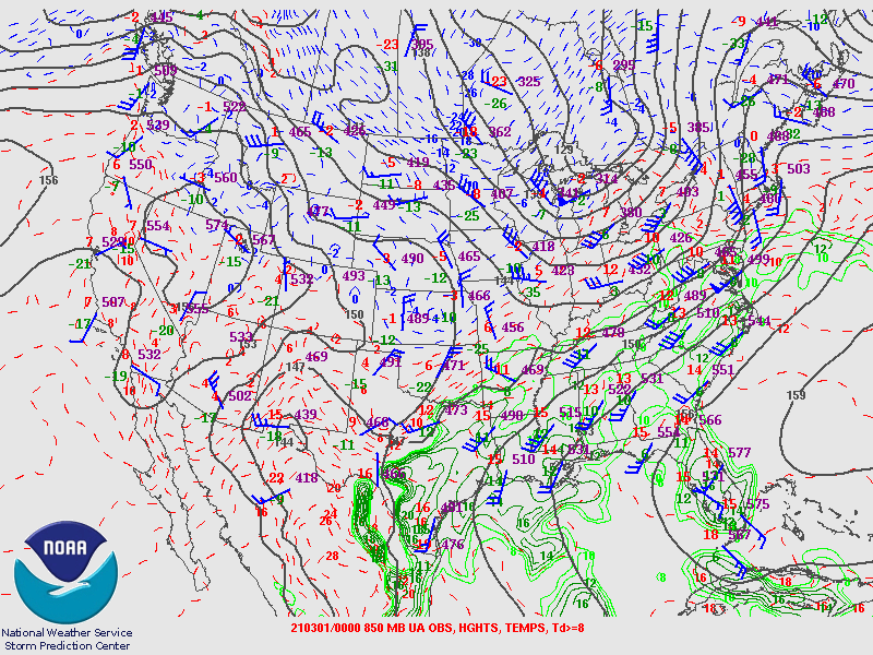
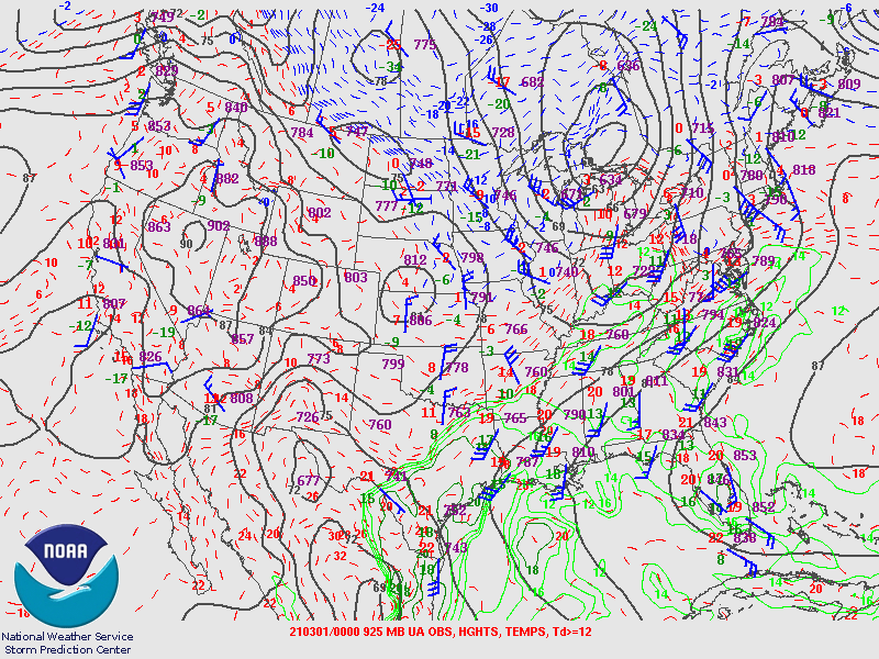
| Figure 4: 700MB | Figure 5: 850MB | Figure 6: 925MB |
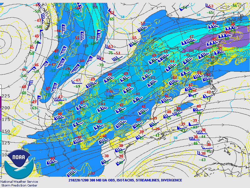
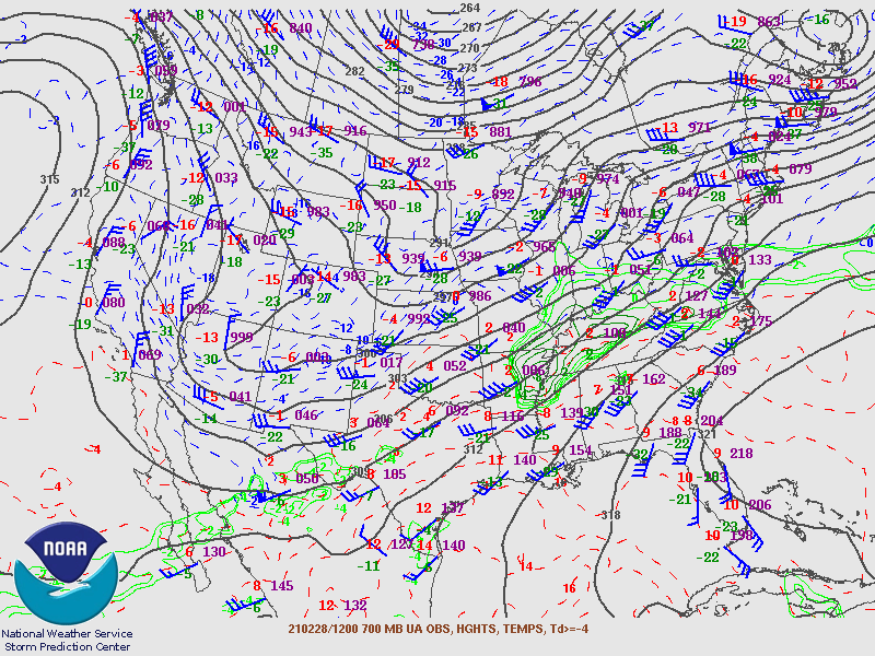
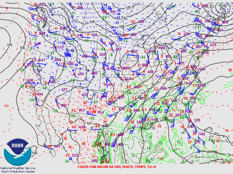
February 28th 12Z Maps
 |
 |
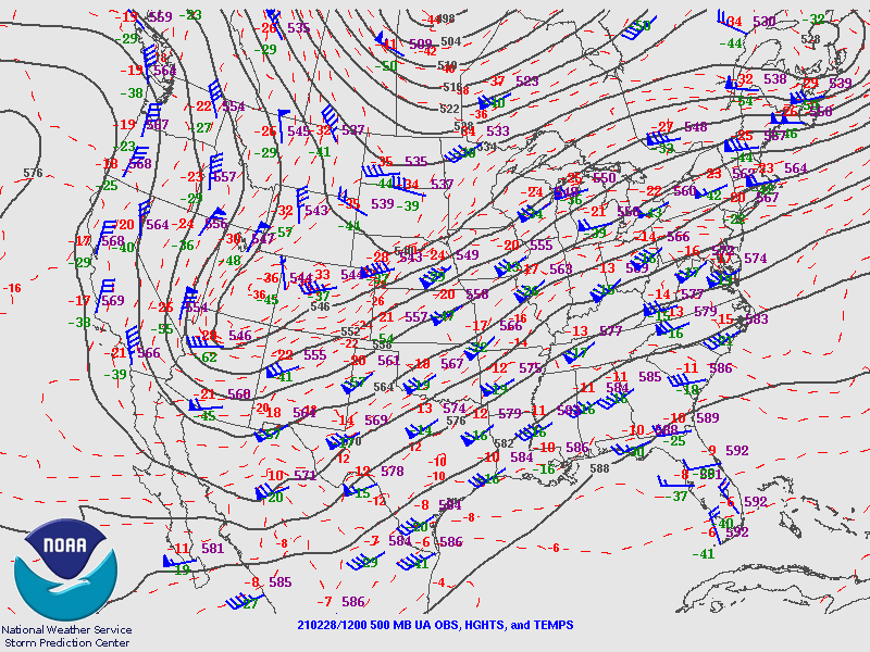 |
| Figure 7: 250MB | Figure 8: 300MB | Figure 9: 500MB |
 |
 |
 |
| Figure 10: 700MB | Figure 11: 850MB | Figure 12: 925MB |
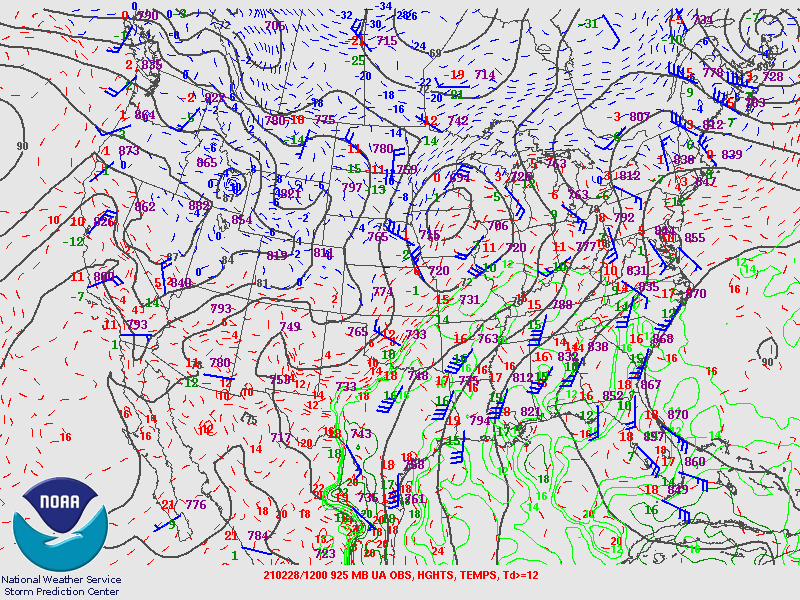
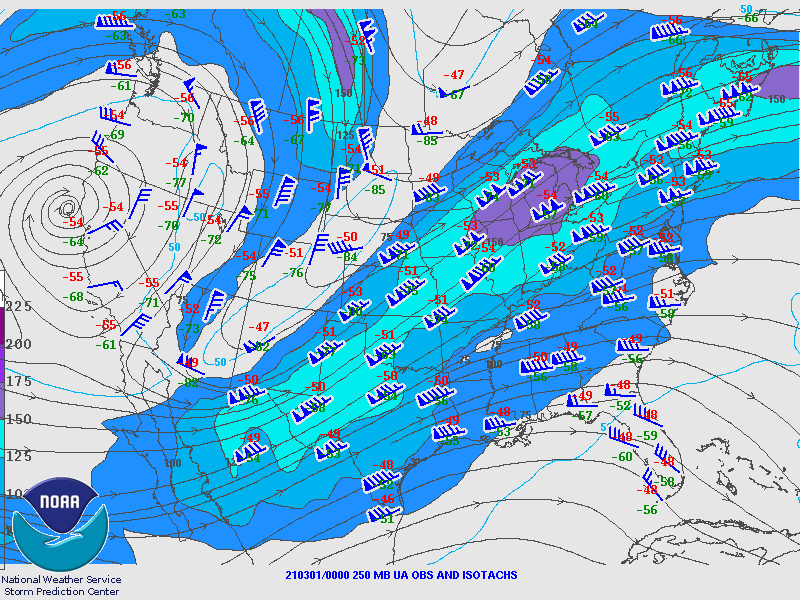
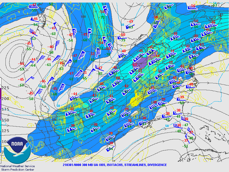
March 1st 00Z Maps
 |
 |
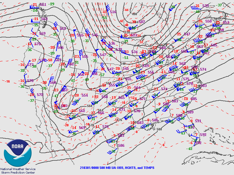 |
| Figure 13: 250MB | Figure 14: 300MB | Figure 15: 500MB |
 |
 |
 |
| Figure 16: 700MB | Figure 17: 850MB | Figure 18: 925MB |
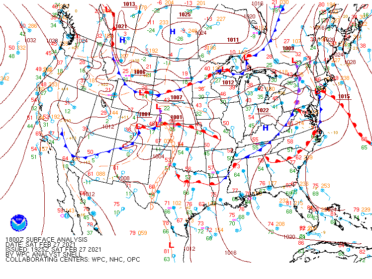
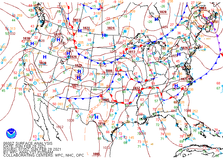
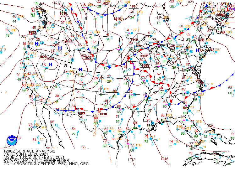
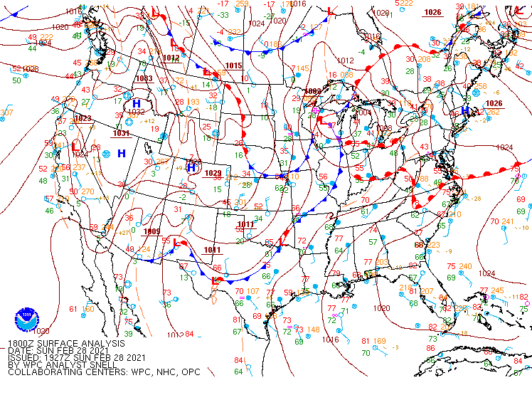
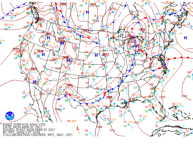
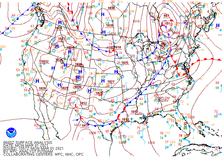
Surface Maps from WPC.
 |
 |
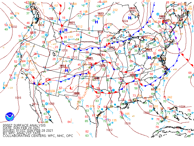 |
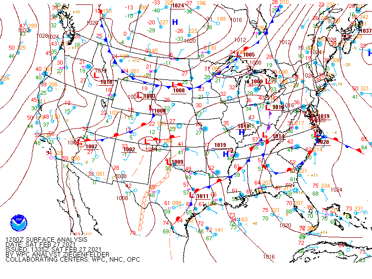
| Figure 1: February 27th 12Z | Figure 2: February 27th 18Z | Figure 3: February 28th 00Z |
 |
 |
 |
| Figure 4: February 28th 06Z | Figure 5: February 28th 12Z | Figure 6: February 28th 18Z |
 |
 |
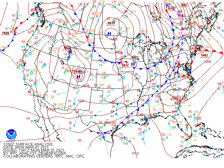 |
| Figure 7: March 1st 00Z | Figure 8: March 1st 06Z | Figure 9: March1st 28th 12Z |
 |
Media use of NWS Web News Stories is encouraged! Please acknowledge the NWS as the source of any news information accessed from this site. |
|