Overview
|
A corridor of modest boundary-layer heating is expected ahead of the primary surface cyclone drifting across northern Ohio toward Lake Erie. A cold front developed out west and tracked east through the day. This forcing coupled with cooling mid-level temperatures, weak surface-based buoyancy was present during the afternoon. The set up allowed for southerly winds at the surface along with westerly winds aloft allowing for some low level shear that did result in some rotating updrafts. The amount of instability was enough to allow for sustained updrafts. This resulted in some tornadic development as well as some damaging wind reports. |
.jpg) Tornado Watch #310 |
Tornadoes
Select a tornado from the table to zoom into the track and view more information. The default table view is limited to 8 tracks, but can be scrolled by a mouse wheel or dynamically expanded. Additionally, the table can fill the entire window by clicking the small circular expanding arrow icon at the very top right of the table and returned to its original size by clicking the button again. The side information panel that opens over the map can be closed using the "X" on the upper right corner of the pop-up. Zoom into the map and click damage points to see detailed information and pictures from the surveys.
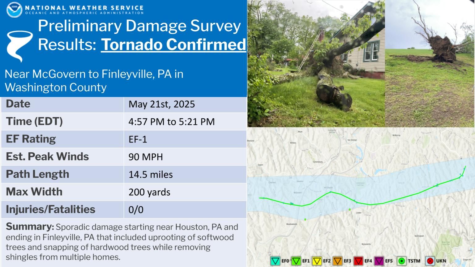 |
| Finleyville, PA EF-1 |
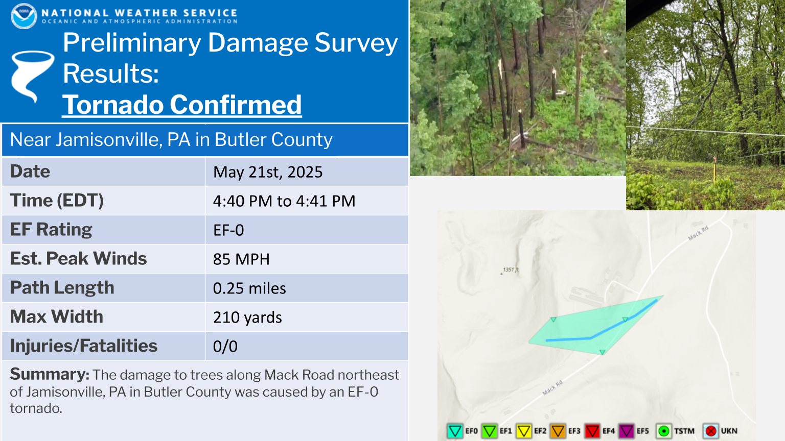 |
| Jamisonville, PA EF-0 |
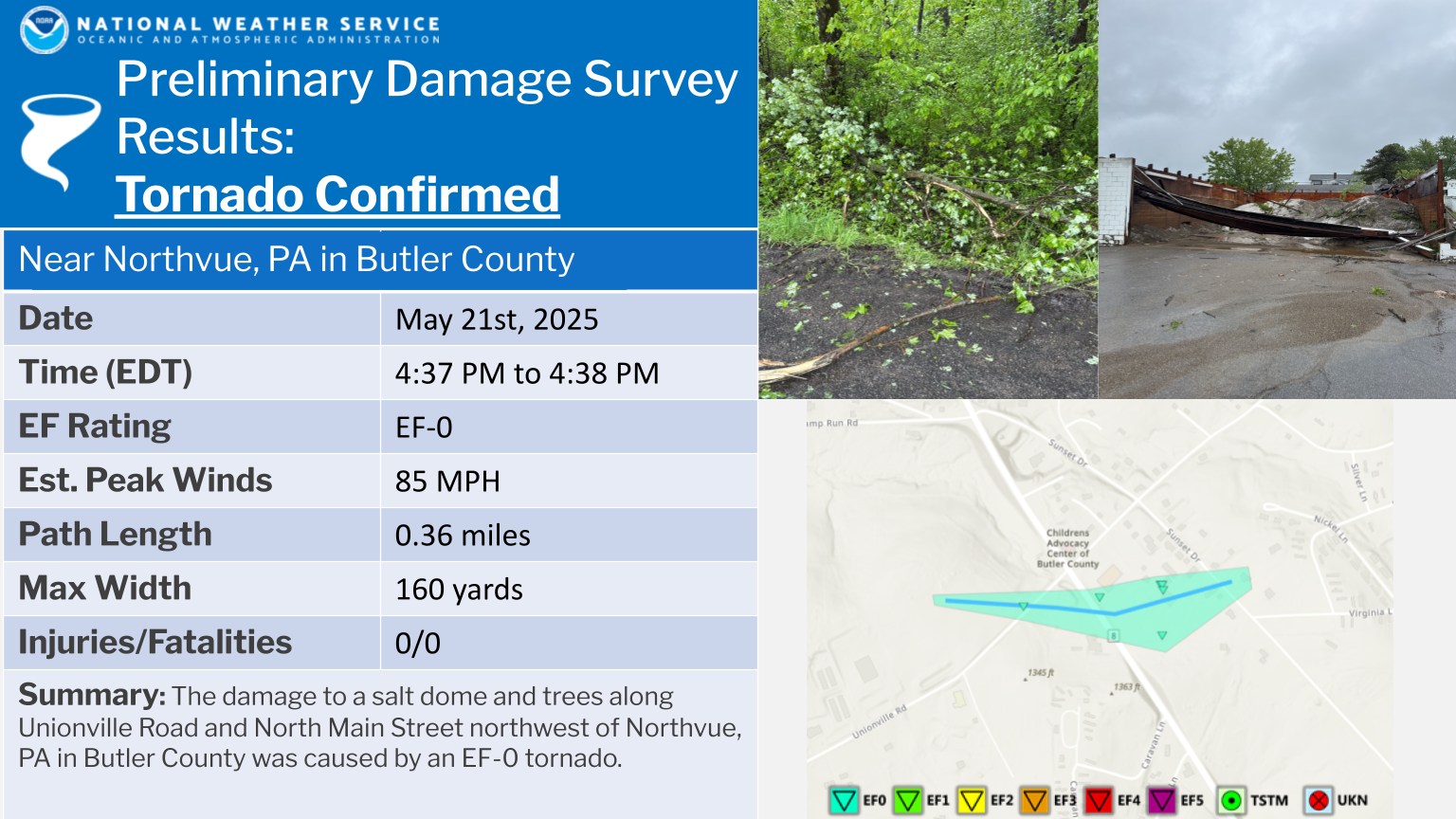 |
| Northvue, PA EF-0 |

The Enhanced Fujita (EF) Scale classifies tornadoes into the following categories:
| EF0 Weak 65-85 mph |
EF1 Moderate 86-110 mph |
EF2 Significant 111-135 mph |
EF3 Severe 136-165 mph |
EF4 Extreme 166-200 mph |
EF5 Catastrophic 200+ mph |
 |
|||||
| Tornadoes that fail to impact any ratable damage indicators on the EF-Scale are rated EF-Unknown (EF-U) | |||||
Wind and Tornado
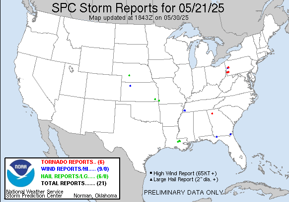 |
| Storm Reports from May 21st 2025 |
Environment
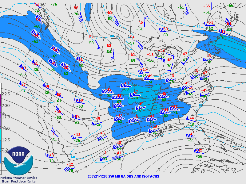
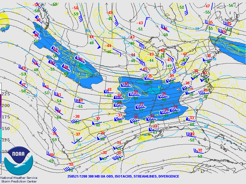
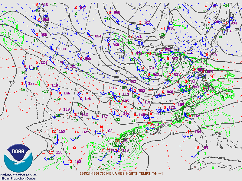
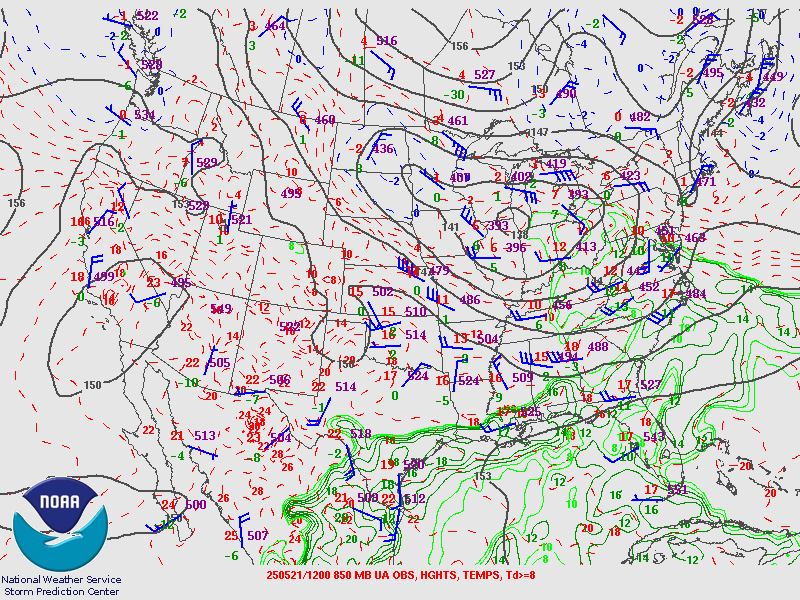
12Z Upper Air Maps from SPC
 |
 |
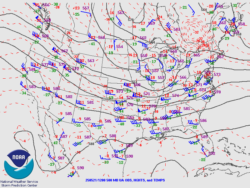 |
| 250MB | 300MB | 500MB |
 |
 |
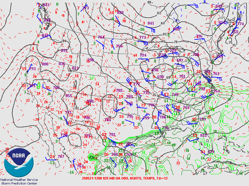 |
| 700MB | 850MB | 925MB |
Additional environmental data.
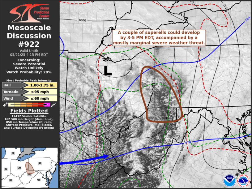 |
| Mesoscale Discussion #922 |
Storm Reports
Wind Reports
| Time | Speed(MPH) | Location | County | State | LAT | LON | Remarks | |||||||||||
| 2037 | UNK | 3 NW Shanor-Northvue | Butler | PA | 40.94 | -79.96 |
CCTV video from the Unionville Volunteer Fire Company shows possible tornado lifting roof off Center Twp salt shelter. (PBZ) |
|||||||||||
| 2102 | UNK | 2 ENE Portersville | Butler | PA | 40.94 | -80.1 |
Report of a tree down blocking the roadway along New Castle Road near Moraine State Park. (PBZ) |
|||||||||||
| 2119 | UNK | Finleyville | Washington | PA | 40.25 | -80 |
Photo showing siding pulled off building in Finleyville. Exact location TBD. Timing estimated based on radar. (PBZ) |
|||||||||||
| 2119 | UNK | Finleyville | Washington | PA | 40.26 | -80 |
Report and photo of 2 trees uprooted. Timing estimated based on radar. (PBZ) |
|||||||||||
Tornado Reports
| Time | EF_Scale | Location | County | State | LAT | LON | Remarks | |||||||||||||||||
| 2037 | UNK | 3 NW Shanor-Northvue | Butler | PA | 40.94 | -79.96 |
CCTV video from the Unionville Volunteer Fire Company shows likely tornado lifting roof off Center Twp salt shelter. (PBZ) |
|||||||||||||||||
| 2040 | UNK | 3 S West Sunbury | Butler | PA | 40.96 | -79.89 | EF0 confirmed tornado due to tree damage. (PBZ) | |||||||||||||||||
| 2048 | UNK | 2 N Buffalo | Washington | PA | 40.25 | -80.36 |
Based on damage reports provided to NWS... a brief EF0 tornado (max wind 65 mph) began near Oakleaf Rd... crossed Willow Rd and likely weakened toward Lynn Portal Rd. D (PBZ) |
|||||||||||||||||
| 2100 | UNK | 1 SE McGovern | Washington | PA | 40.23 | -80.22 |
This report designates peak intensity of tornado in Washington County in the Houston area. Survey team identified a tornado with peak intensity of EF1 began west of Hou (PBZ) |
|||||||||||||||||
| 2119 | UNK | Finleyville | Washington | PA | 40.26 | -80 | Tornado confirmed with damage noted near the Gastonville area. (PBZ) |
|
||||||||||||||||
Additional Information
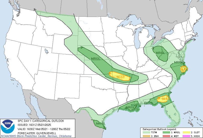
The Forecast
 |
 |
 |
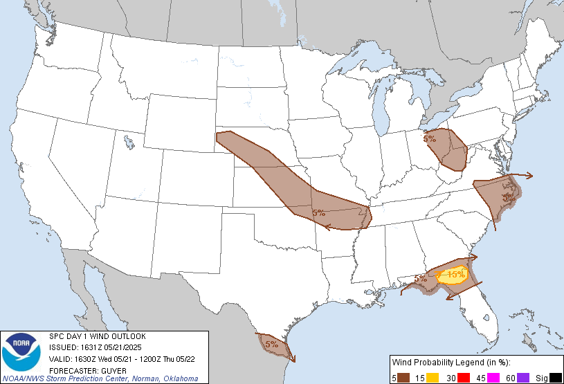 |
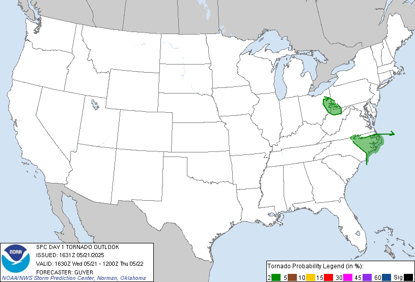
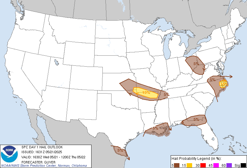
| SPC Day 1 Categorical Outlook | SPC Day 1 Tornado Outlook | SPC Day 1 Hail Outlook | SPC Day 1 Wind Outlook |
 |
Media use of NWS Web News Stories is encouraged! Please acknowledge the NWS as the source of any news information accessed from this site. |
|

