 |
| In Lyons, IL, from Kevin Sheeley |
PRELIMINARY LOCAL STORM REPORT...SUMMARY
NATIONAL WEATHER SERVICE CHICAGO/ROMEOVILLE IL
434 AM CDT THU MAR 17 2016
..TIME... ...EVENT... ...CITY LOCATION... ...LAT.LON...
..DATE... ....MAG.... ..COUNTY LOCATION..ST.. ...SOURCE....
..REMARKS..
1200 PM NON-TSTM WND DMG WHEATON 41.86N 88.11W
03/16/2016 DUPAGE IL PUBLIC
SMALL TREE BLOWN DOWN IN BACKYARD. TIME ESTIMATED. REPORT
RELAYED VIA TWITTER.
1249 PM NON-TSTM WND GST LIBERTYVILLE 42.28N 87.97W
03/16/2016 M55.00 MPH LAKE IL EMERGENCY MNGR
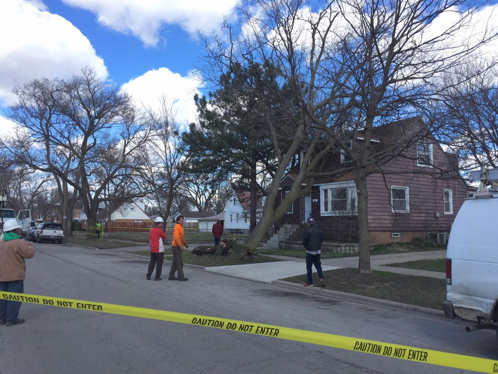
0200 PM NON-TSTM WND DMG LYONS 41.81N 87.82W
03/16/2016 COOK IL PUBLIC
TREE UPROOTED AND FELL ON HOUSE. REPORT RELAYED VIA
FACEBOOK. TIME ESTIMATED.
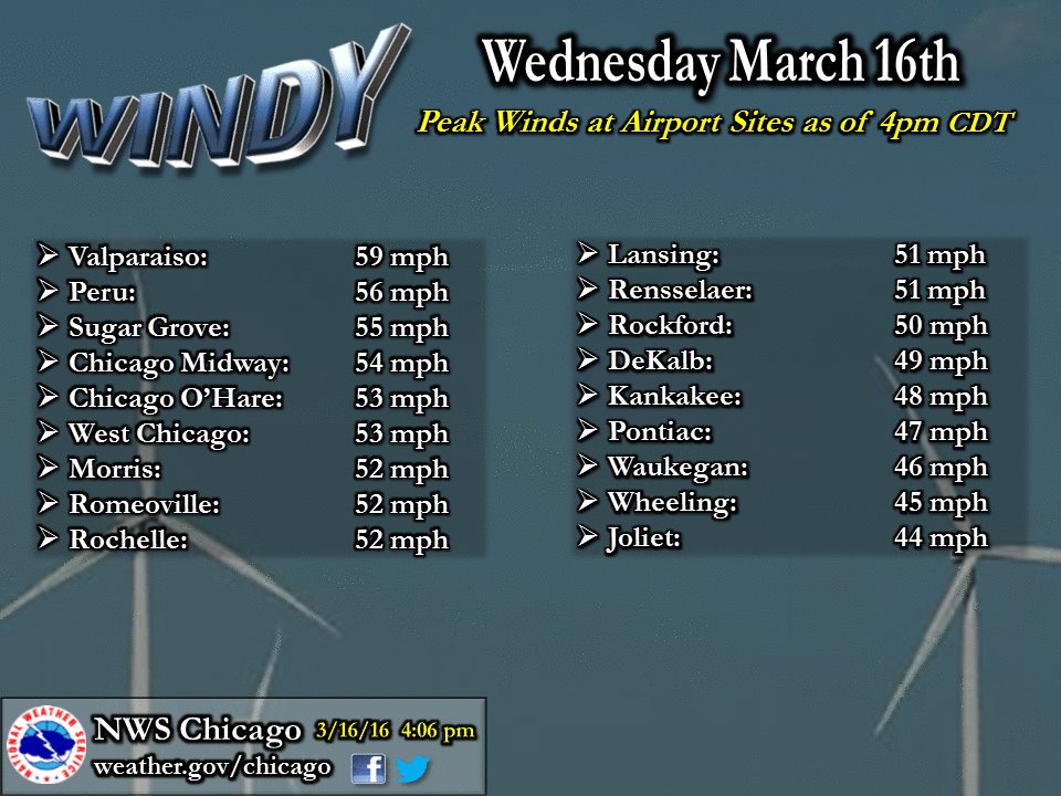
0255 PM NON-TSTM WND GST VALPARAISO 41.48N 87.05W
03/16/2016 M59.00 MPH PORTER IN ASOS
51 KT GUST.
0310 PM NON-TSTM WND DMG BENSENVILLE 41.96N 87.94W
03/16/2016 DUPAGE IL EMERGENCY MNGR
AN 18-20 INCH DIAMETER TREE SNAPPED AT BASE AND FELL ONTO
POWER LINES. TIME IS ESTIMATED FROM THE POWER OUTAGE
REPORTS FROM EMERGENCY MANAGEMENT.
0330 PM NON-TSTM WND DMG CHERRY VALLEY 42.24N 88.96W
03/16/2016 WINNEBAGO IL BROADCAST MEDIA
THREE FOOT DIAMETER TREE BLOWN DOWN.
0400 PM NON-TSTM WND DMG CHICAGO 41.88N 87.63W
03/16/2016 COOK IL PUBLIC
STREET LAMP DOWN. EXACT TIME ESTIMATED/UNKNOWN. RELAYED
VIA TWITTER.
0400 PM NON-TSTM WND DMG BENSENVILLE 41.96N 87.94W
03/16/2016 DUPAGE IL EMERGENCY MNGR
EMERGENCY MANAGEMENT RELAYED THAT A TREE FELL ONTO A HOME
IN BENSENVILLE IL.
0452 PM NON-TSTM WND GST 5 SSE BEACH PARK 42.36N 87.81W
03/16/2016 M58.00 MPH LMZ740 IL C-MAN STATION
&&
$$
MTF
 |
| Mean sea-level pressure loop through the day Wednesday, March 16th |
 |
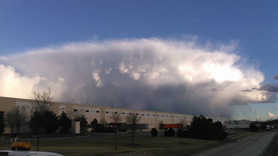
| Mid-Afternoon through evening water vapor loop on March 16th showing an upper level disturbance and resulting shower and isolated storm development. |
 |
 |
| Observed Radiosonde Sounding from 7pm weather balloon launch at NWS Quad Cities in Davenport, IA on March 16th. | Observed Radiosonde Sounding from 7pm weather balloon launch at NWS Lincoln, IL on March 16th. |
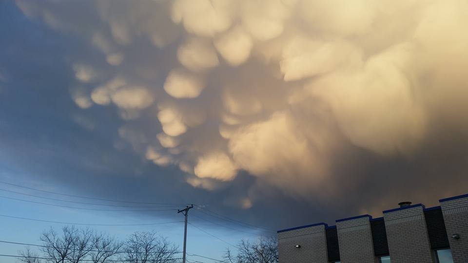
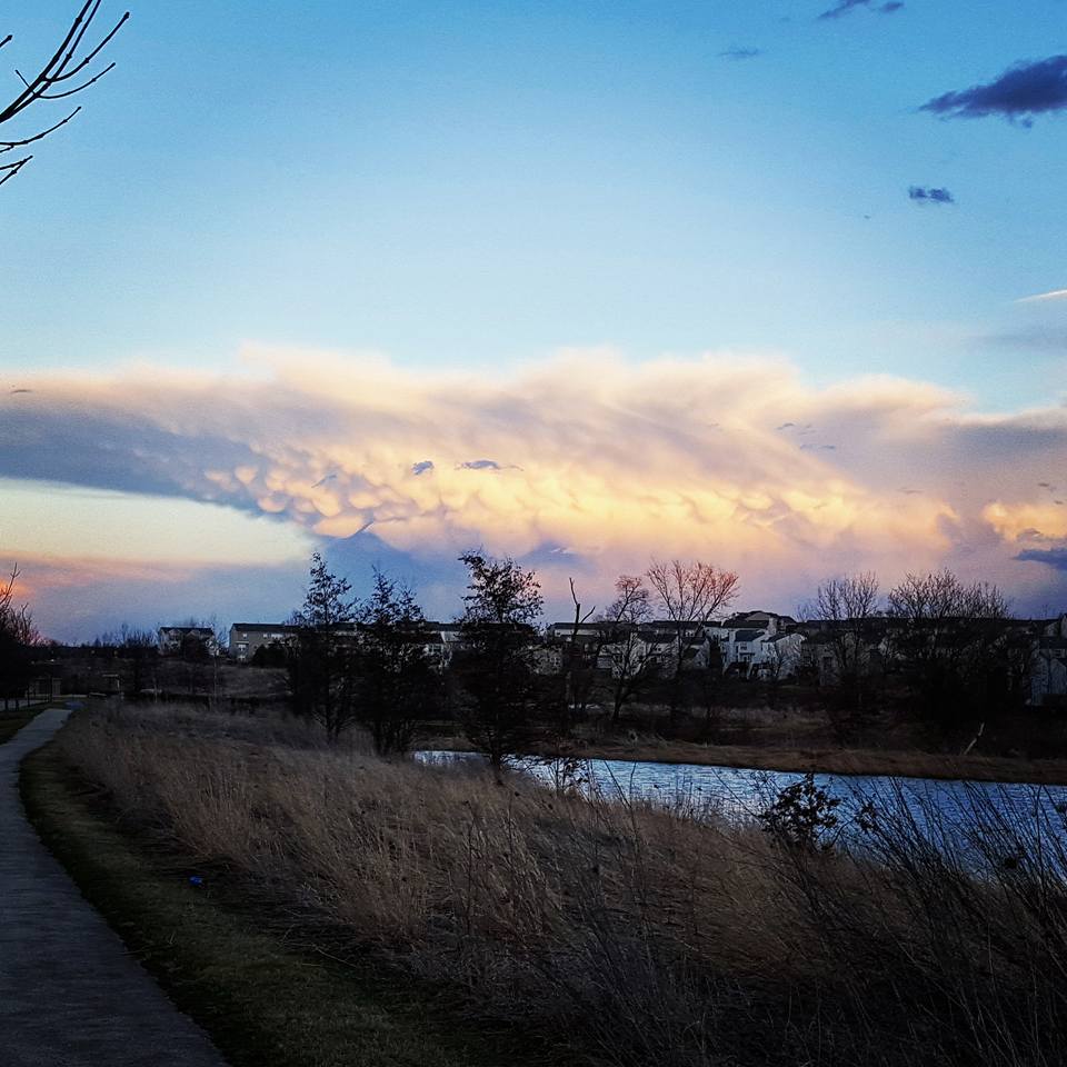
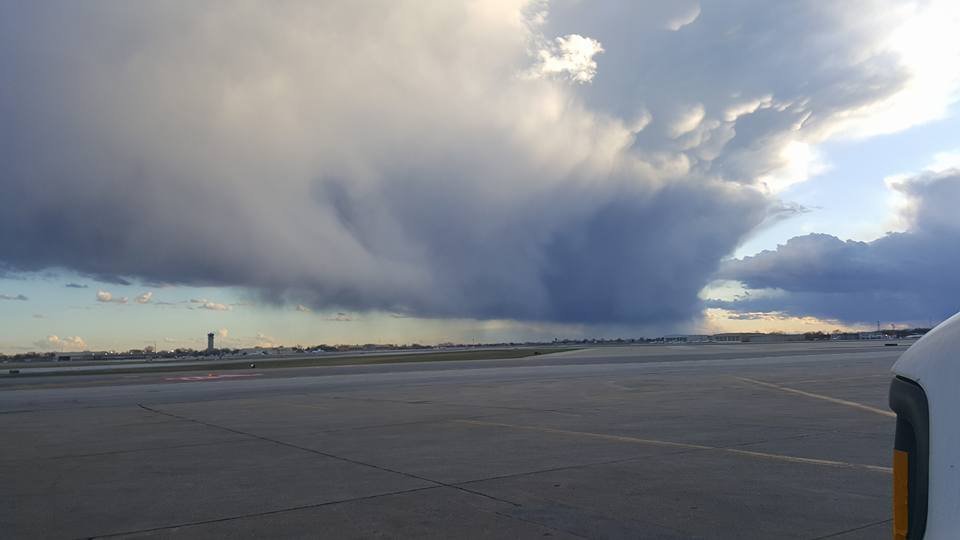
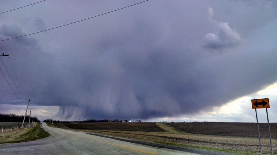
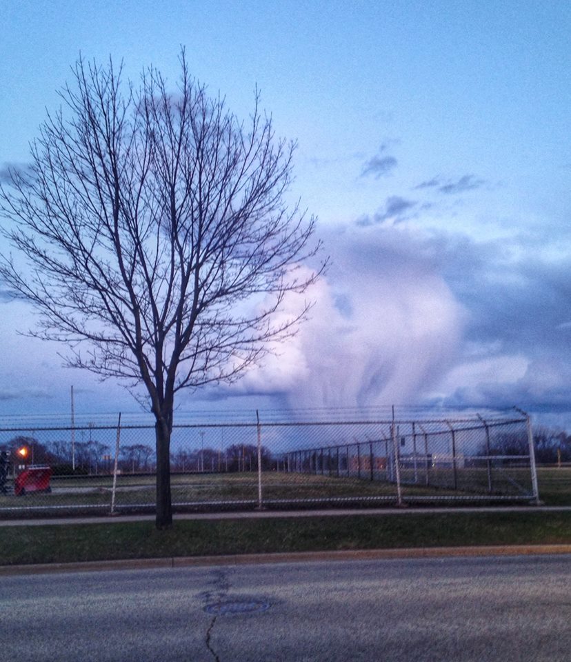
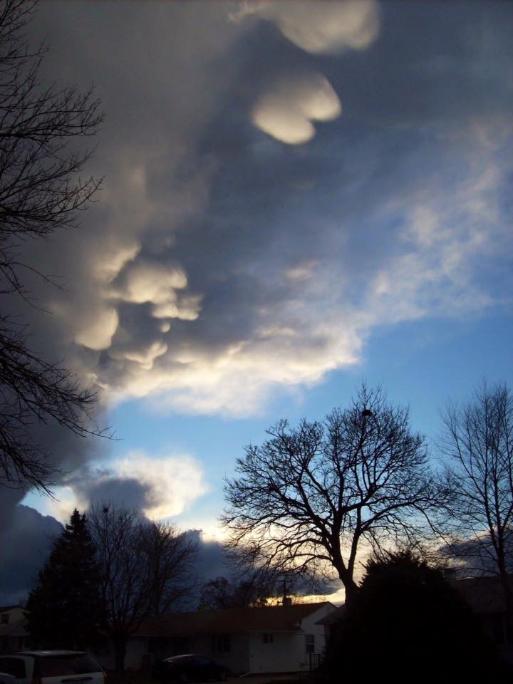
The above observed evening soundings demonstrate the dry, deeply mixed atmosphere conducive for the strong winds during the day and also the convective showers that developed late in the day. Steep lapse rates (falling temperatures with height) at a very deep layer of the atmosphere to over 10,000 feet above ground level exhibited deep atmospheric mixing. This mixing allowed strong unidirectional westerly winds throughout the column to be easily transported down as frequent wind gusts, in addition to the already strong surface winds caused by the tight pressure gradient over the region. In addition, the steep lapse rates created minor atmospheric instability, known as CAPE, and also the potential for rapid rising motions once an upper level disturbance initiated the process of lifting the airmass. Despite the overall dry airmass in place, there was just enough moisture, combined with the minor instability levels and steep lapse rates conducive for strong updrafts to create the convective showers and a few thunderstorms. These showers occurring in a dry atmosphere led to impressive cloud structure seen below.
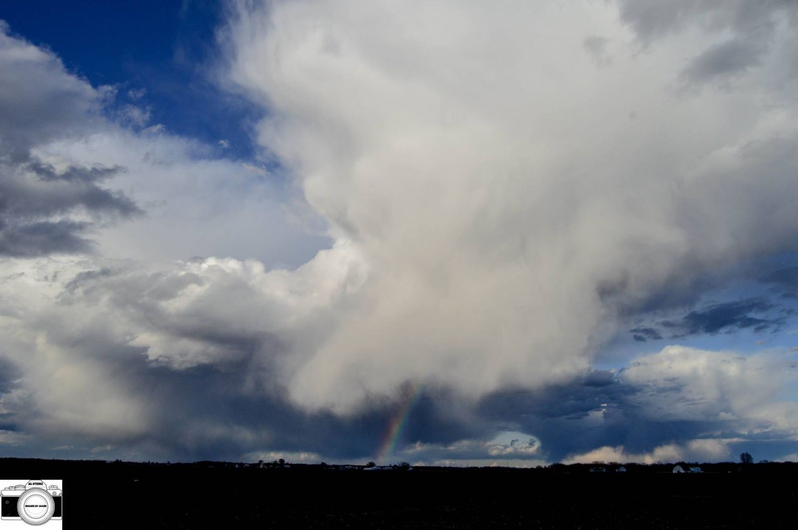 |
| Northeast of LaSalle, IL from Al Steinz |
|
|
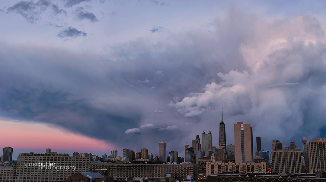 |
| Aurora from Kyle Brown | Chicago from Barry Butler |
 |
 |
| Carol Stream from Jamie Hansen | Des Plaines from Sawi Paulie |
 |
 |
| Dundee from Jen Reid | Elgin from JoAnna Marie |
 |
 |
| Chicago Midway International Airport from Derrick Helton | Between Byron and Rockford from Karissa Gelafio |
 |
 |
| Crystal Lake from Haley Denley | Hometown from Nick Lamacki |
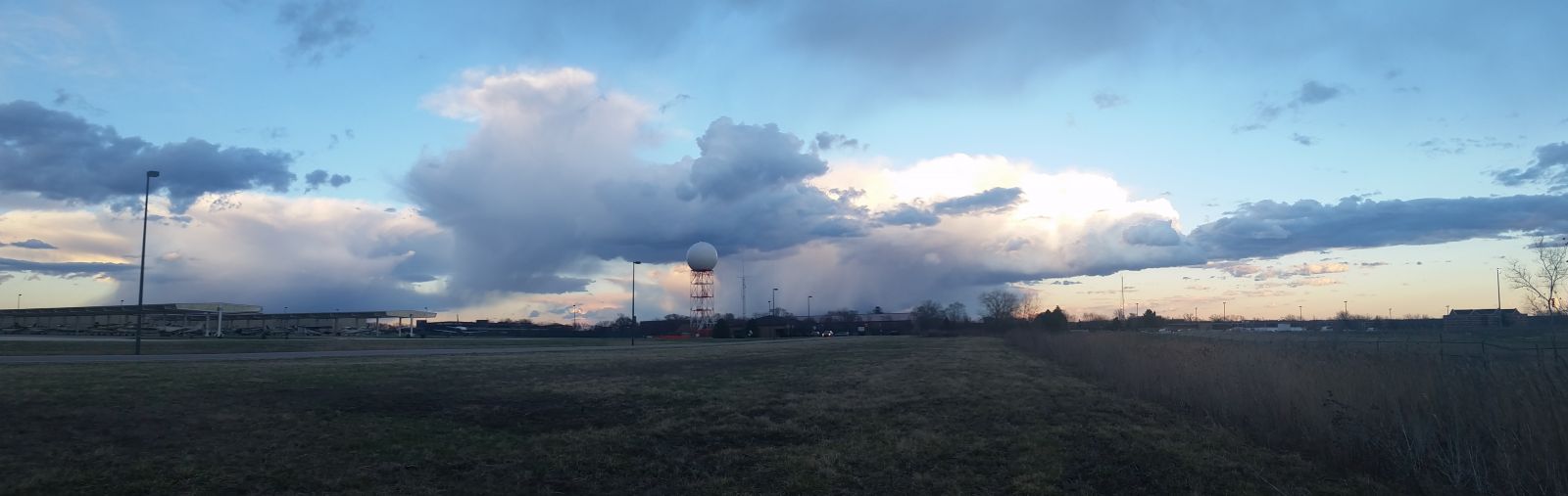 |
| Outside of NWS Chicago office in Romeoville, IL from Ricky Castro |