National Weather Service United States Department of Commerce
News Headlines
Click a location below for detailed forecast.

Last Map Update: Sun, May 3, 2026 at 2:40:18 pm MDT

A few more showers and thunderstorms will develop over western NM today then move east-northeast with gusty and erratic winds. Precipitation chances are generally less than 20 percent and little to no rainfall is expected.
West winds will increase Monday, especially around the high terrain. Southwest winds will peak on Tuesday over the southern high terrain and southeast plains of NM.
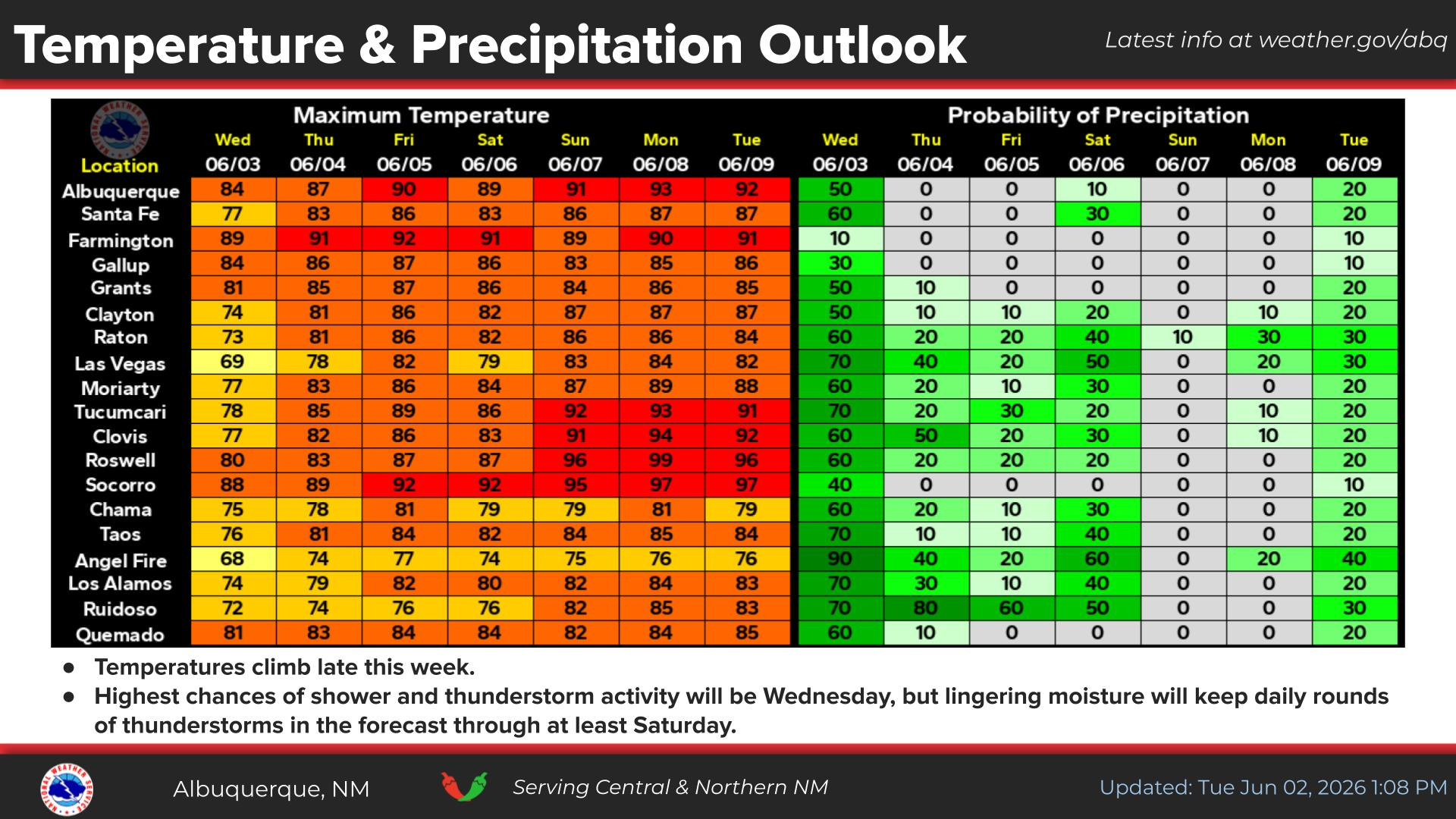
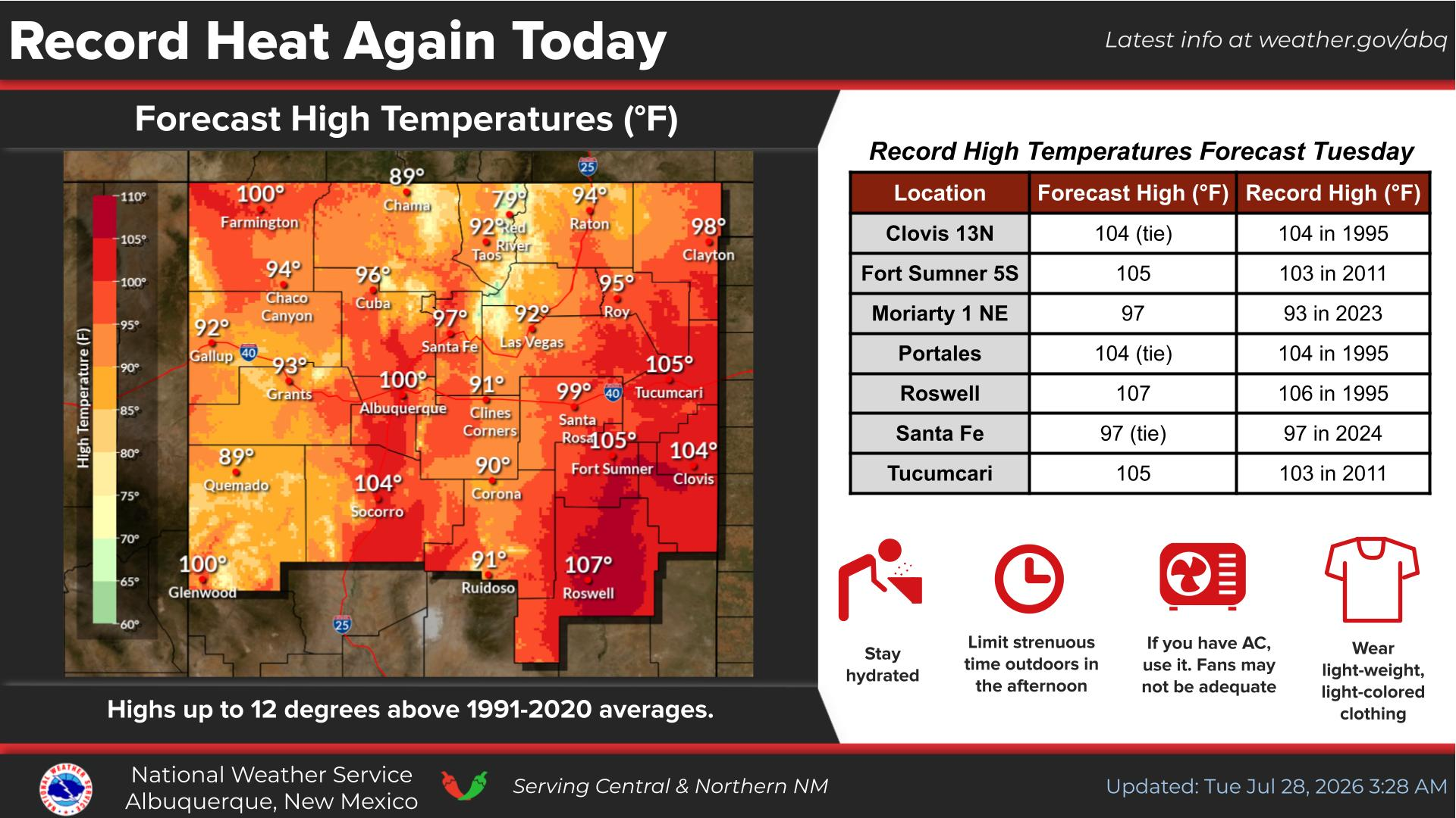
A Pacific storm system approaching from the west Tuesday will bring higher precipitation to NM through Wednesday. This storm may interact with the jet stream approaching from the north Wednesday. Showers, thunderstorms, gusty winds, and high mountain snow are possible.
Mainly isolated showers and thunderstorms are forecast with warmer temperatures today and Monday. Another storm system will cool temperatures and increase precipitation chances Tuesday and Wednesday. The week will close with isolated showers and storms and high temperatures rising above average.


Text Product Selector (Selected product opens in current window)


Submit Storm Report Icon

Submit Storm Report

Key Impacts Icon

Key Impacts

Observations Icon

Local Observations

Webcams Icon

Office Webcams

Satellite Icon

Satellite Imagery

Are You Prepared Icon

Are You Prepared?

Weekly Weather Briefing Icon

Weekly Weather Briefing

Area Forecast Discussion Icon

Area Forecast Discussion

Fire Weather Icon

Fire Weather

Aviation Weather Icon

Aviation Weather

Snow Probabilities Icon

Snow Probabilities

SKYWARN Icon

SKYWARN Spotters

On This Date in Weather History Icon

On This Date

Climate Graphs Icon

Climate Graphs

Drought Monitor Icon

Drought Monitor

Severe Weather Info and Climatology Icon

Severe Weather Climatology

Monsoon Awareness Icon

Monsoon Awareness

Winter Climatology Icon

Winter Climatology