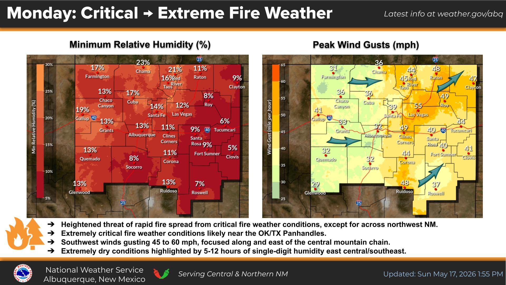
Gusty southwesterly winds alongside several hours of single-digit humidity will yield another round of critical fire weather through the middle Rio Grande Valley this afternoon where a Red Flag Warning is in effect.
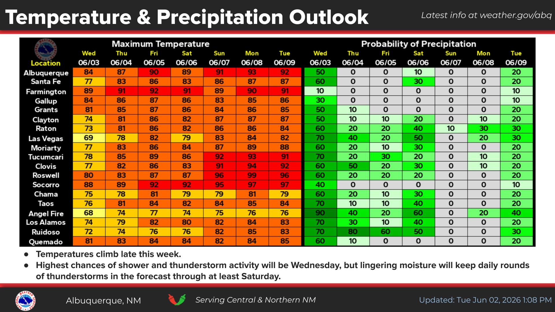
There is a marginal risk of isolated strong to severe thunderstorms over portions of southeastern and east-central NM Wednesday. Frequent lightning, strong gusty winds, and large hail are the main hazards from any passing storm.
Isolated to scattered virga showers producing little to no rainfall as a heads up will threaten erratic gusty winds to portions of northwestern and north-central NM mainly along the Continental Divide this afternoon.
Highs will remain in the 70s to 80s for many areas this week. Afternoon thunderstorm activity mainly across eastern NM trends up Wednesday and through the weekend with a brief break Friday.


 Office Webcam
 Weather Map
 Satellite Imagery