National Weather Service United States Department of Commerce
Click a location below for detailed forecast.

Last Map Update: Wed, May 7, 2025 at 11:04:23 pm MDT

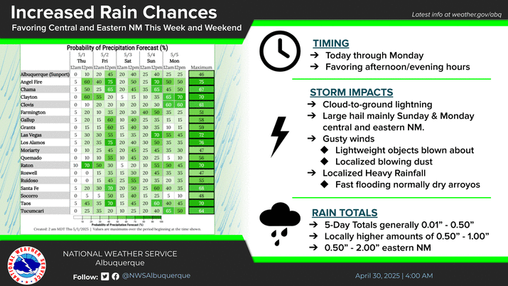
Recent heavy, late season snowfall is melting over the eastern slopes of the Sangre de Cristo mountains. Showers and thunderstorms will develop Thursday afternoon, with rain falling over snow, causing the melting to intensify. This will lead to rapid rises in streams, creeks, and rivers along the eastern slopes of the Sangre de Cristos with an increased risk of flooding over the Hermits Peak- Calf Canyon wildfire burn scar.
Scattered to numerous showers and thunderstorms will develop Thursday, mainly over the central mountain chain of New Mexico. Warmer temperatures are also forecast. Rapid snow melt and rain on top of snow will increase the risk of flooding on and near the Hermits Peak-Calf Canyon wildfire burn scar.
Cool to chilly overnight temperatures are forecast tonight with showers and thunderstorms favoring west central New Mexico this evening.


Text Product Selector (Selected product opens in current window)


Submit Storm Report Icon

Submit Storm Report

Key Impacts Icon

Key Impacts

Observations Icon

Local Observations

Webcams Icon

Office Webcams

Satellite Icon

Satellite Imagery

Are You Prepared Icon

Are You Prepared?

Weekly Weather Briefing Icon

Weekly Weather Briefing

Area Forecast Discussion Icon

Area Forecast Discussion

Fire Weather Icon

Fire Weather

Aviation Weather Icon

Aviation Weather

Snow Probabilities Icon

Snow Probabilities

SKYWARN Icon

SKYWARN Spotters

On This Date in Weather History Icon

On This Date

Climate Graphs Icon

Climate Graphs

Drought Monitor Icon

Drought Monitor

Severe Weather Info and Climatology Icon

Severe Weather Climatology

Monsoon Awareness Icon

Monsoon Awareness

Winter Climatology Icon

Winter Climatology