National Weather Service United States Department of Commerce
News Headlines
Click a location below for detailed forecast.

Last Map Update: Thu, May 21, 2026 at 2:48:18 am MDT

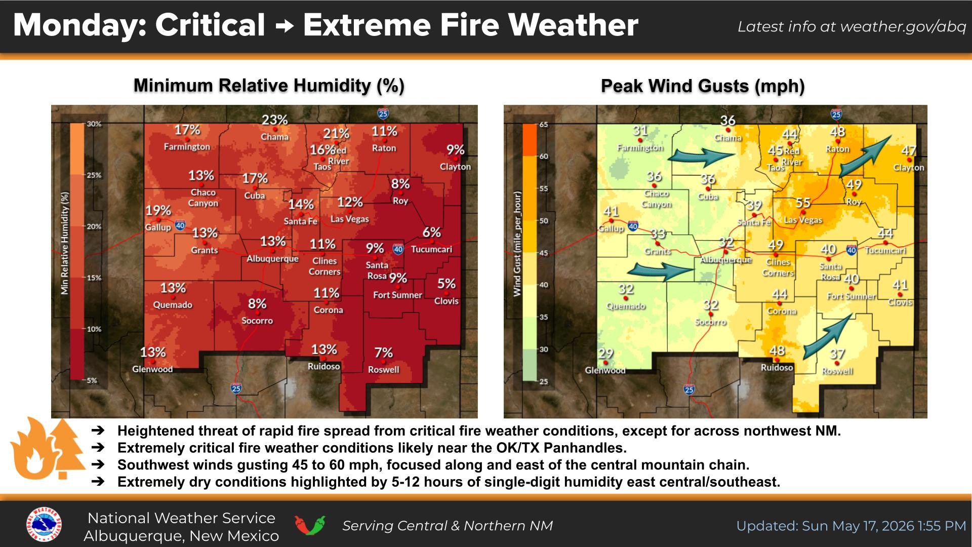
There is a Marginal Risk for severe storms in far eastern New Mexico Thursday afternoon and evening. Large hail and damaging wind gusts are the primary severe threats.
There is a marginal risk of strong to severe thunderstorms over portions of east central NM Friday. Frequent lightning, strong gusty winds, and large hail are the main hazards from any passing storm.
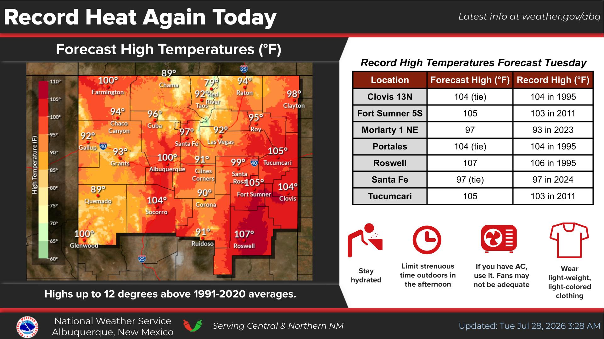
Highs will remain in the 70s and 80s for the most part the next seven days. Showers and thunderstorms favor eastern NM through Sunday before becoming more widespread Monday and Tuesday.


Text Product Selector (Selected product opens in current window)


Submit Storm Report Icon

Submit Storm Report

Key Impacts Icon

Key Impacts

Observations Icon

Local Observations

Webcams Icon

Office Webcams

Satellite Icon

Satellite Imagery

Are You Prepared Icon

Are You Prepared?

Weekly Weather Briefing Icon

Weekly Weather Briefing

Area Forecast Discussion Icon

Area Forecast Discussion

Fire Weather Icon

Fire Weather

Aviation Weather Icon

Aviation Weather

Snow Probabilities Icon

Snow Probabilities

SKYWARN Icon

SKYWARN Spotters

On This Date in Weather History Icon

On This Date

Climate Graphs Icon

Climate Graphs

Drought Monitor Icon

Drought Monitor

Severe Weather Info and Climatology Icon

Severe Weather Climatology

Monsoon Awareness Icon

Monsoon Awareness

Winter Climatology Icon

Winter Climatology