Thunderstorms will move erratically across the region near 5 to 15 mph today. A few of the stronger storms will be capable of producing rainfall amounts over 1" in less than an hour. This may result in localized flooding.
Locally heavy rain at rates over 1 inch per hour will probably produce isolated flash flooding today. Turn around when you encounter a flooded road, so you don't drown.
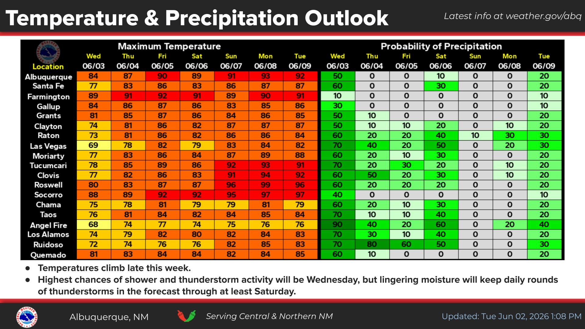
With rich monsoon moisture in place, some showers and thunderstorms will be capable of producing rain at rates over 1.5 inches per hour through Saturday. The greatest risk of flash flooding will be over western and southern areas.
A Flash Flood Watch is in effect for parts of western NM through 9 PM today then for the Ruidoso area Saturday from 12 PM to 6 PM. Today's stronger storms will be capable of rain rates over 1 inch per hour with a moderate risk of flash flooding.
The higher storm chances will favor the central mountain chain westward over the next seven days. There will be less storm coverage with warmer temperatures over eastern NM.


 Office Webcam
 Weather Map
 Satellite Imagery