National Weather Service United States Department of Commerce
Click a location below for detailed forecast.

Last Map Update: Thu, Jul 17, 2025 at 1:02:03 am MDT

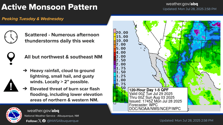
Rich monsoon moisture with embedded disturbances will produce numerous showers and thunderstorms on Thursday afternoon and evening. Some storms will be capable of producing rain at rates over 1 inch per hour with a risk of flash flooding, especially below recent burn scars.
A Flash Flood Watch is in effect for Thursday for wildfire burn scar areas, and this may be expanded. Remember, a Watch means conditions are aligning for the potential for heavy rainfall and flash flooding. This is your notification to be prepared to take action should a Warning be issued.
The risk of flash flooding will increase on Thursday, particularly in northeastern New Mexico where 24-hour rainfall totals may exceed 2 inches. That being said, there is at least a low risk of flash flooding across almost all of central and northern New Mexico due to numerous showers and storms with heavy rainfall rates of 1 to 2 inches per hour.
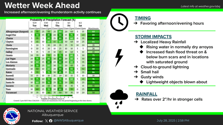
The thunderstorm threat matrix indicates the probability of thunderstorms over wildfire burn areas.
After a wildfire, flash floods and debris flows can develop abruptly! This includes the Hermits Peak-Calf Canyon wildfire scar in northeastern New Mexico and also the Ruidoso area burn scars. A Flash Flood Watch is in effect for Thursday for these areas. Be prepared to take action should a Warning be issued.
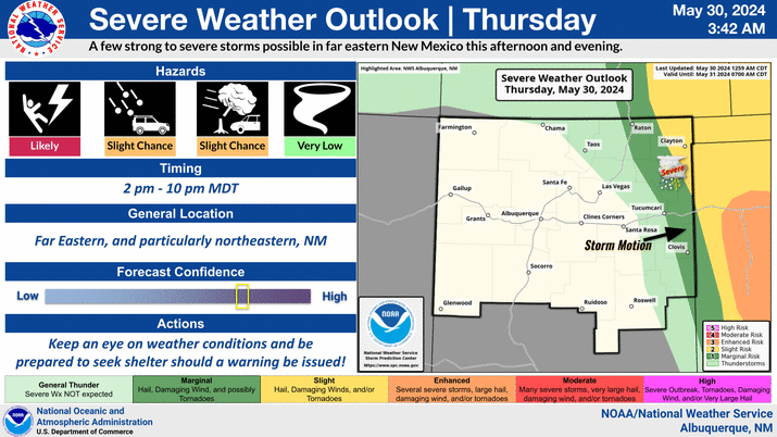
Showers and thunderstorms will be concentrated in western and northeastern New Mexico this evening with less activity struggling to fill into central areas. Storms in northeastern areas will be strong to severe with large hail, damaging winds, and heavy downpours that will potentially create flash flooding.


Text Product Selector (Selected product opens in current window)


Submit Storm Report Icon

Submit Storm Report

Key Impacts Icon

Key Impacts

Observations Icon

Local Observations

Webcams Icon

Office Webcams

Satellite Icon

Satellite Imagery

Are You Prepared Icon

Are You Prepared?

Weekly Weather Briefing Icon

Weekly Weather Briefing

Area Forecast Discussion Icon

Area Forecast Discussion

Fire Weather Icon

Fire Weather

Aviation Weather Icon

Aviation Weather

Snow Probabilities Icon

Snow Probabilities

SKYWARN Icon

SKYWARN Spotters

On This Date in Weather History Icon

On This Date

Climate Graphs Icon

Climate Graphs

Drought Monitor Icon

Drought Monitor

Severe Weather Info and Climatology Icon

Severe Weather Climatology

Monsoon Awareness Icon

Monsoon Awareness

Winter Climatology Icon

Winter Climatology