National Weather Service United States Department of Commerce
Click a location below for detailed forecast.

Last Map Update: Thu, Jun 11, 2026 at 1:42:21 pm MDT

Gusty east canyon wind gusts of 35 to 45 mph tonight into Friday morning will create difficult crosswinds on north to south oriented roadways.
12PM MDT Update: The Marginal Risk for severe storms on Friday (tomorrow) has shifted eastward. Areas along and east of the central mountain chain will have the potential to turn strong to severe with hail and damaging winds.
The heat persists with minor to moderate heat-related impacts likely. Moderate heat risk affects those who are sensitive to heat, especially those without cooling/hydration, and some health systems and industries.
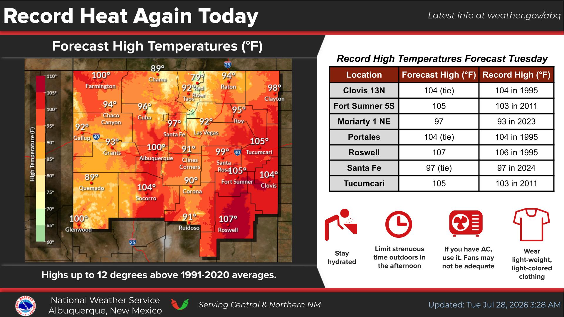
Hot temperatures are likely in most areas through Saturday, with highs dropping near to below average early next week. Most areas look to remain dry, but isolated to scattered afternoon thunderstorms will leave "winners" and "losers" of rainfall this weekend.


Text Product Selector (Selected product opens in current window)


Submit Storm Report Icon

Submit Storm Report

Key Impacts Icon

Key Impacts

Observations Icon

Local Observations

Webcams Icon

Office Webcams

Satellite Icon

Satellite Imagery

Are You Prepared Icon

Are You Prepared?

Weekly Weather Briefing Icon

Weekly Weather Briefing

Area Forecast Discussion Icon

Area Forecast Discussion

Fire Weather Icon

Fire Weather

Aviation Weather Icon

Aviation Weather

Snow Probabilities Icon

Snow Probabilities

SKYWARN Icon

SKYWARN Spotters

On This Date in Weather History Icon

On This Date

Climate Graphs Icon

Climate Graphs

Drought Monitor Icon

Drought Monitor

Severe Weather Info and Climatology Icon

Severe Weather Climatology

Monsoon Awareness Icon

Monsoon Awareness

Winter Climatology Icon

Winter Climatology