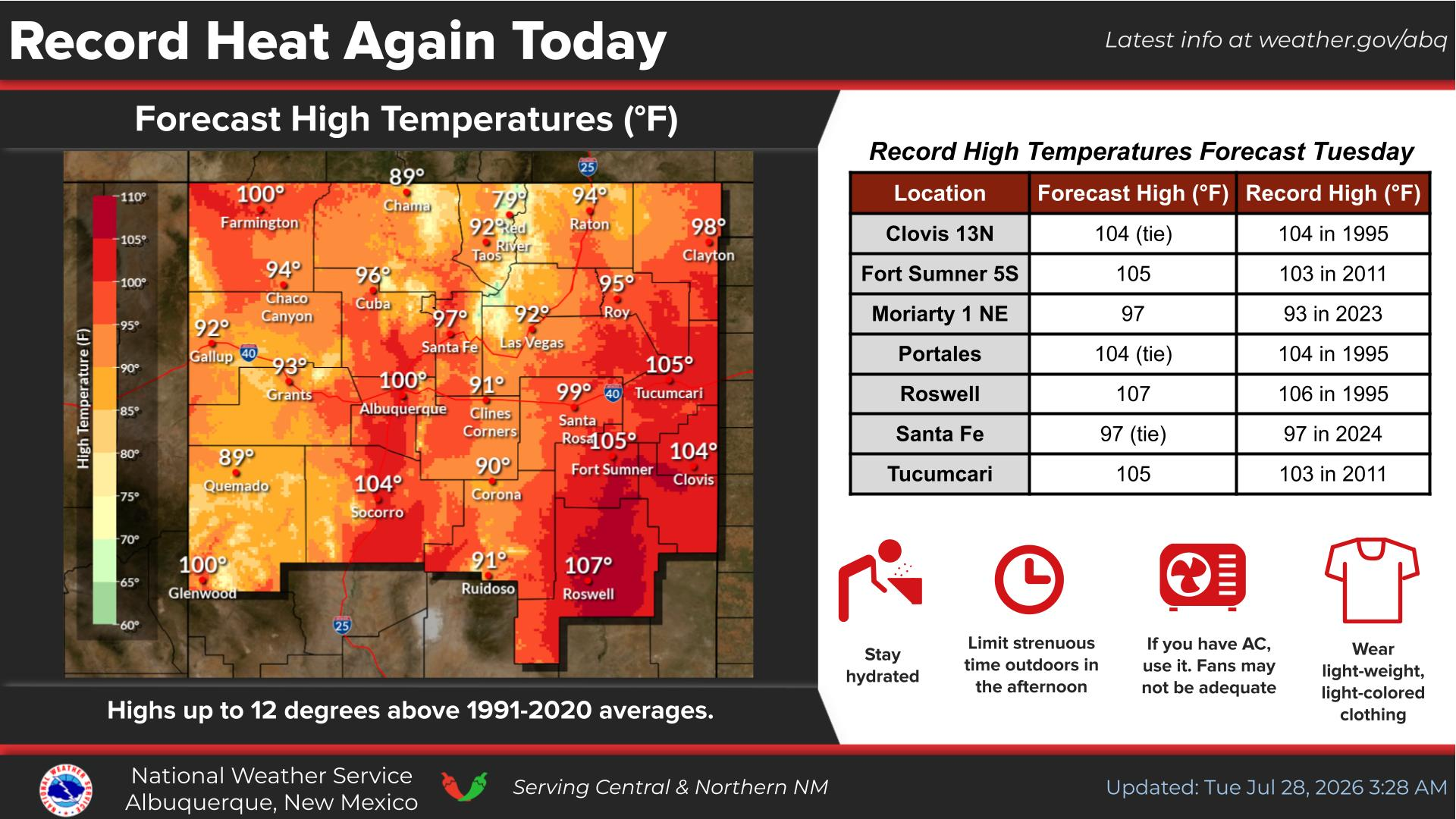
National Weather Service United States Department of Commerce
Click a location below for detailed forecast.

Last Map Update: Mon, Jan 19, 2026 at 12:38:14 am MST

A pattern change late in the week will make timing additional cold fronts across eastern New Mexico difficult. Thus, there is considerable uncertainty regarding high temperatures late in the week.
Temperatures oscillate across eastern NM this week while remaining stagnant across western NM. Low precipitation chances return late week, with rain favoring western NM and winter precipitation favoring eastern NM.
Some long-range models show potential for a fairly warm weather system that may bring a chance for light precipitation to western and central New Mexico Friday through next Sunday (January 23rd through 25th). Forecast confidence in precipitation chances during this period are very low (20% or less).


Text Product Selector (Selected product opens in current window)


Submit Storm Report Icon

Submit Storm Report

Key Impacts Icon

Key Impacts

Observations Icon

Local Observations

Webcams Icon

Office Webcams

Satellite Icon

Satellite Imagery

Are You Prepared Icon

Are You Prepared?

Weekly Weather Briefing Icon

Weekly Weather Briefing

Area Forecast Discussion Icon

Area Forecast Discussion

Fire Weather Icon

Fire Weather

Aviation Weather Icon

Aviation Weather

Snow Probabilities Icon

Snow Probabilities

SKYWARN Icon

SKYWARN Spotters

On This Date in Weather History Icon

On This Date

Climate Graphs Icon

Climate Graphs

Drought Monitor Icon

Drought Monitor

Severe Weather Info and Climatology Icon

Severe Weather Climatology

Monsoon Awareness Icon

Monsoon Awareness

Winter Climatology Icon

Winter Climatology