National Weather Service United States Department of Commerce
Click a location below for detailed forecast.

Last Map Update: Sun, Jun 21, 2026 at 9:02:18 am MDT

With a UV Index forecast to be near the highest in the country near 13, it's time to remember to protect yourself from the rays!
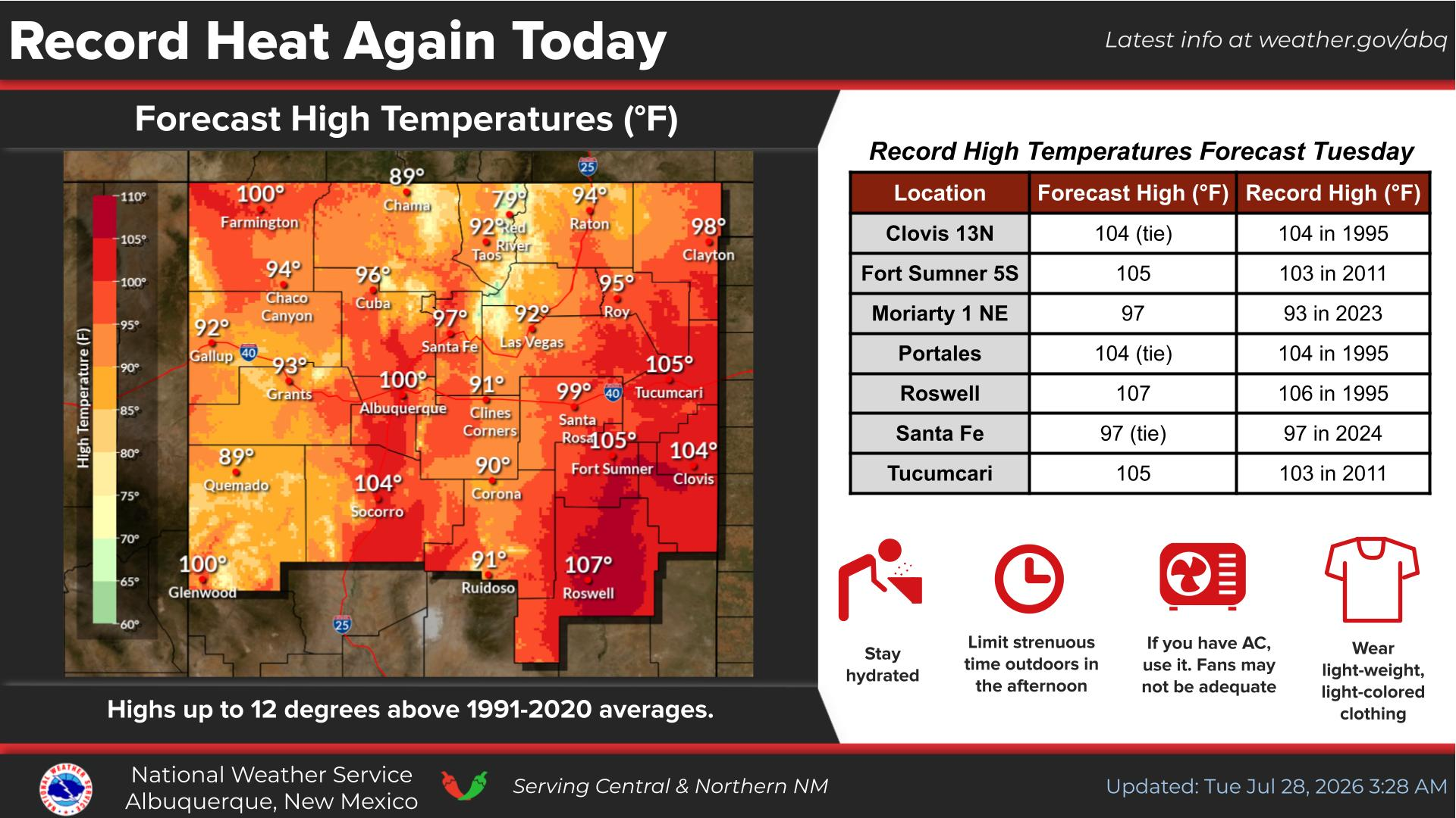
Moderate heat risk across lower elevations of central and eastern NM Sunday due to highs in the 90s to mid 100s. Cooler across much of eastern NM Monday.
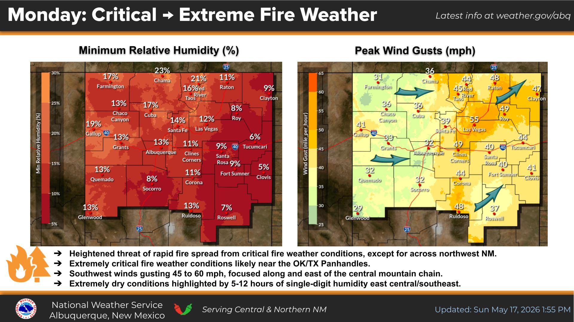
Scattered virga and isolated dry thunderstorms will threaten abrupt and erratic gusty winds and dry lightning across portions of western NM into the Rio Grande Valley Tuesday through Friday.
There is a low probability of a strong to severe thunderstorm clipping far northeastern NM late this evening.
There is a low probability for a stray strong to severe thunderstorm to clip northeastern and east-central NM Monday evening.
Heat continues with a brief cool down across eastern NM Monday. Chances for afternoon thunderstorms return Tuesday through Friday, although many storms across western and central NM will be on the dry side.


Text Product Selector (Selected product opens in current window)


Submit Storm Report Icon

Submit Storm Report

Key Impacts Icon

Key Impacts

Observations Icon

Local Observations

Webcams Icon

Office Webcams

Satellite Icon

Satellite Imagery

Are You Prepared Icon

Are You Prepared?

Weekly Weather Briefing Icon

Weekly Weather Briefing

Area Forecast Discussion Icon

Area Forecast Discussion

Fire Weather Icon

Fire Weather

Aviation Weather Icon

Aviation Weather

Snow Probabilities Icon

Snow Probabilities

SKYWARN Icon

SKYWARN Spotters

On This Date in Weather History Icon

On This Date

Climate Graphs Icon

Climate Graphs

Drought Monitor Icon

Drought Monitor

Severe Weather Info and Climatology Icon

Severe Weather Climatology

Monsoon Awareness Icon

Monsoon Awareness

Winter Climatology Icon

Winter Climatology