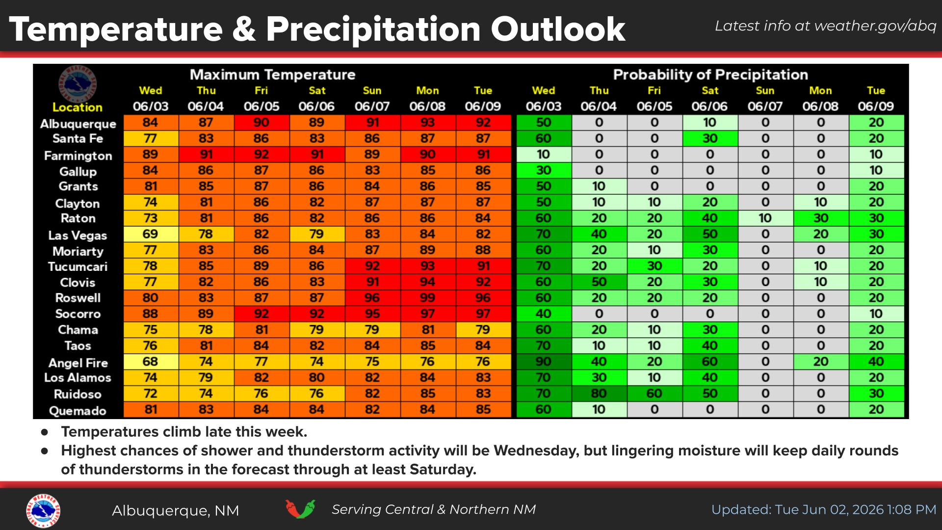
National Weather Service United States Department of Commerce
Click a location below for detailed forecast.

Last Map Update: Mon, Jan 19, 2026 at 8:28:35 am MST

High temperatures will continue to oscillate across eastern New Mexico as periodic cold fronts move through the area. The strongest cold front is expected Friday with very cold temperatures lingering into Saturday.
Precipitation chances return Friday and Saturday across the area. Rain and snow will be the dominant precipitation types across western and central New Mexico. Across northeast NM, snow will prevail, but across east central and southeast areas, there is a low chance for a wintry mix of freezing rain, sleet and snow Friday night into Saturday.


Text Product Selector (Selected product opens in current window)


Submit Storm Report Icon

Submit Storm Report

Key Impacts Icon

Key Impacts

Observations Icon

Local Observations

Webcams Icon

Office Webcams

Satellite Icon

Satellite Imagery

Are You Prepared Icon

Are You Prepared?

Weekly Weather Briefing Icon

Weekly Weather Briefing

Area Forecast Discussion Icon

Area Forecast Discussion

Fire Weather Icon

Fire Weather

Aviation Weather Icon

Aviation Weather

Snow Probabilities Icon

Snow Probabilities

SKYWARN Icon

SKYWARN Spotters

On This Date in Weather History Icon

On This Date

Climate Graphs Icon

Climate Graphs

Drought Monitor Icon

Drought Monitor

Severe Weather Info and Climatology Icon

Severe Weather Climatology

Monsoon Awareness Icon

Monsoon Awareness

Winter Climatology Icon

Winter Climatology