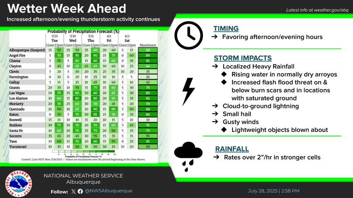
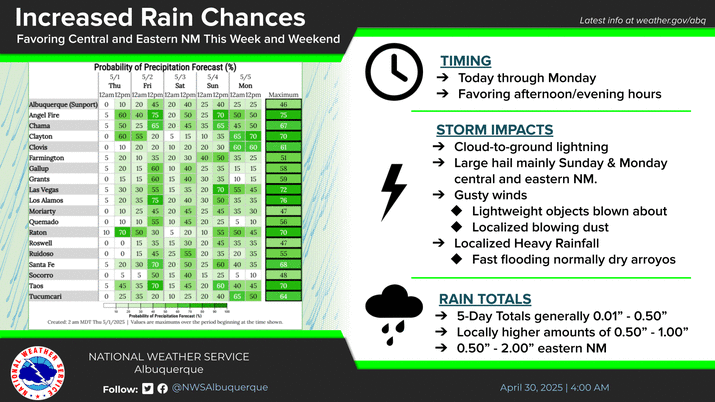
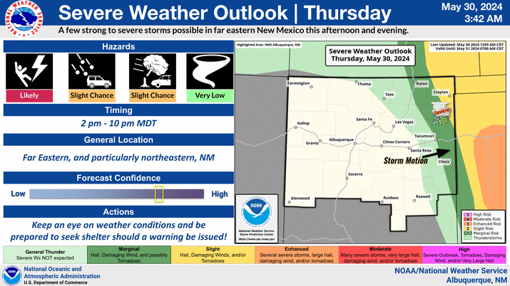
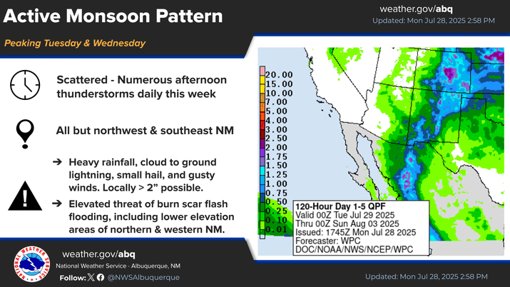
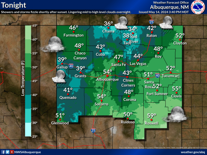
Storm chances peak on Friday as an upper level trough approaches the state. A line of showers and thunderstorms is expected, starting across northwest NM then progressing eastward throughout the day. A few strong to severe storms will be capable of damaging winds and hail. The greatest flash flood risk exists over burn scars, though a low threat for flash flooding exists across northwest and north central NM. Storm motions will be quick, so storms moving over the same areas repeatedly will be the main concern.
