State College, PA
Weather Forecast Office
Overview
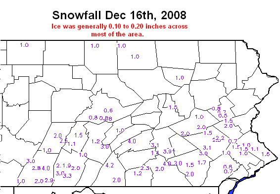
A storm system moved west to east along a frontal boundary that had stalled just to the south of Pennsylvania on the 15th and 16th. This storm brought snow to areas along the PA Turnpike during the morning of the 16th. The snow then moved to the north into the central mountains and additional snow broke out across the northern tier. The precipitation began to change to sleet and freezing rain over the southern half of the state in the late afternoon and evening. By midnight, the precipitation had begun to taper off, but was mainly freezing rain by then. Ice accretions were generally two tenths of an inch or less, and the snow totals were only a few inches at most, mainly right along the Turnpike.
 |
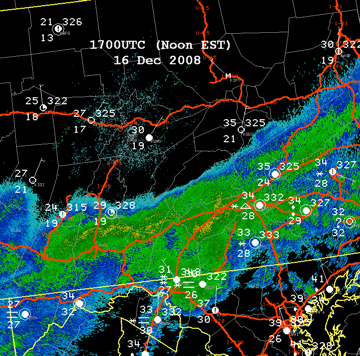 |
| Map of Snowfall and Ice Accretions | KCCX Reflectivity and Observations at 17Z 16Dec2008 |
 |
Media use of NWS Web News Stories is encouraged! Please acknowledge the NWS as the source of any news information accessed from this site. |
|
US Dept of Commerce
National Oceanic and Atmospheric Administration
National Weather Service
State College, PA
328 Innovation Blvd, Suite 330
State College, PA 16803
(814)954-6440
Comments? Questions? Please Contact Us.


 Send Us a Report