Overview
|
Another La Niña Winter's Storm arrived in Central Pennsylvania Tuesday, and lasted into Wednesday morning (27th). It brought heavy snow to the far Northern Tier of the State, but a messy mix of Sleet and Snow to areas from I-80 to Route 6, and mostly Rain and Freezing Rain to the rest of the region. While the precipitation started as snow over most of Central Pennsylvania early on Tuesday morning, making a messy morning rush hour commute, the temperatures warmed up very quickly aloft (See SkewT) and turned the precipitation to rain in the south and freezing rain in central areas rather early on Tuesday. The precipitation stayed Snow for all of the 24 to 30 Hours in the northlands. |
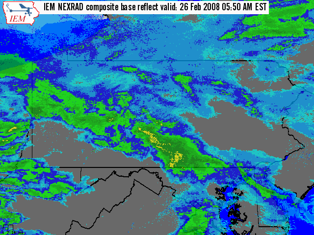 Animation of radar pictures/mosaic from 6 AM to 1 PM Tuesday (26th) |
Maps & Figures
 |
 |
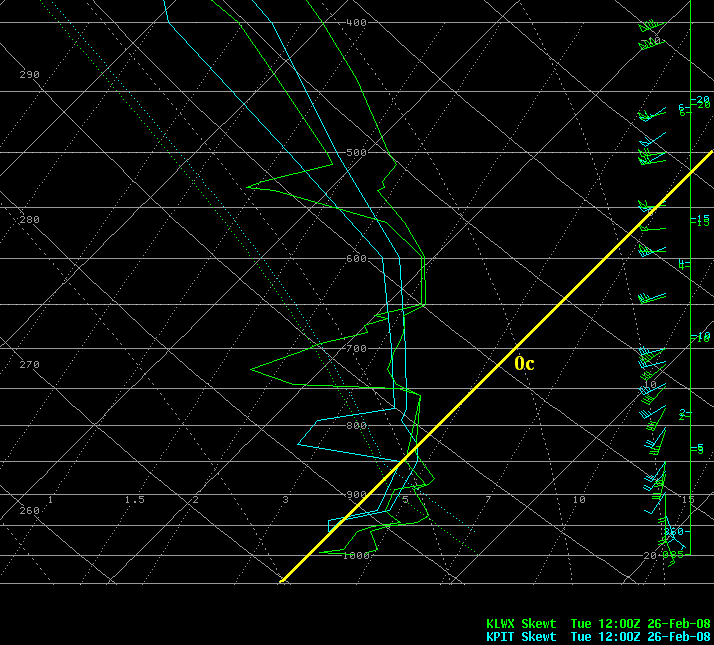 |
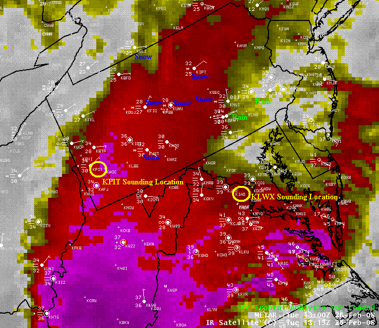
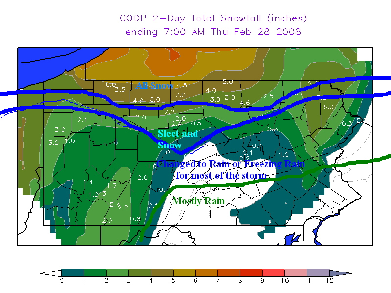
| IR Satellite Picture with 13z (8 AM EST) Observations | Coop 2-day Snowfall Total from 7:00 am Tues Feb 26th thru 7:00 am Thursday Feb 28th | 12z Skew T Diagrams (Upper Air soundings) - note the above freezing air aloft (and at the surface at KLWX) |
 |
Media use of NWS Web News Stories is encouraged! Please acknowledge the NWS as the source of any news information accessed from this site. |
|


 Send Us a Report