State College, PA
Weather Forecast Office
| Destructive Early Season Snowfall in Southern and Eastern PA |
| An early season winter storm brought generally 3-8 inches of snow to Southern and Eastern PA on October 29th, 2011. The storm was a classic Nor'Easter, deepening rapidly late Friday Night and Saturday (29th) as it moved up the East Coast - just off shore. The storm produced gusty winds on Saturday in Southeastern PA, knocking down trees and power lines, interrupting electric service to more than 400,000 homes and businesses across the state. Many trees still had leaves on them, and the heavy, wet snow (snow to liquid ratios were anywhere from 6:1 to 12:1) weighed down the trees and led to widespread damage. |
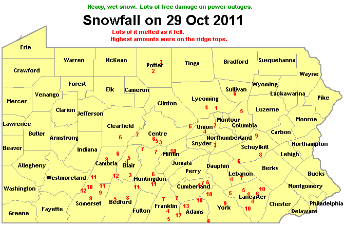
| Snowfall Accumulations for 29 October 2011 (inches) |
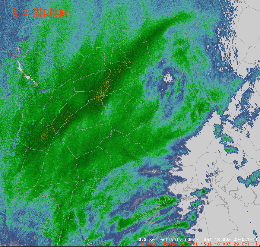
| Lightning strike on Radar Mosaic 18z (2 pm EDT) |

| IR Satellite Image of the Nor'Easter deepening off the coast at 18z (2 pm EDT) |
US Dept of Commerce
National Oceanic and Atmospheric Administration
National Weather Service
State College, PA
328 Innovation Blvd, Suite 330
State College, PA 16803
(814)954-6440
Comments? Questions? Please Contact Us.


 Send Us a Report