| Hurricane Agnes June 19-24, 1972 |
View the multi-agency StoryMap created for the 50th Anniversary of Agnes by visiting https://agnes50-noaa.hub.arcgis.com/.
You can view the Weather Prediction Center write-up on Agnes at www.wpc.ncep.noaa.gov/tropical/rain/agnes1972.html.
Check out the Facebook Live panel session discussing Hurricane Agnes, the storm/flooding, improvements and the lessons learned.
| Hurricane Agnes remains one of the most costly natural disasters in Pennsylvania history. Nationwide, there were 122 deaths attributed to Agnes, 50 in the state of Pennsylvania. Total damages from the storm reached over $3 billion dollars nationwide, with over $2 billion dollars in losses occurring in the Susquehanna River basin. It has been estimated that damage from Agnes (if adjusted to 2017 dollars) would be around $17.5 billion dollars. Hurricane Agnes was the nations' most costly natural disaster at the time. |
|
|
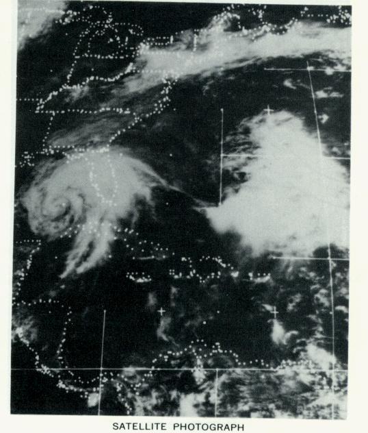
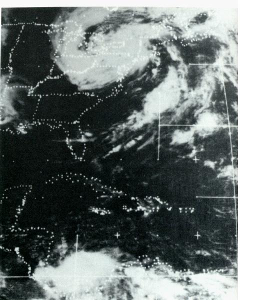
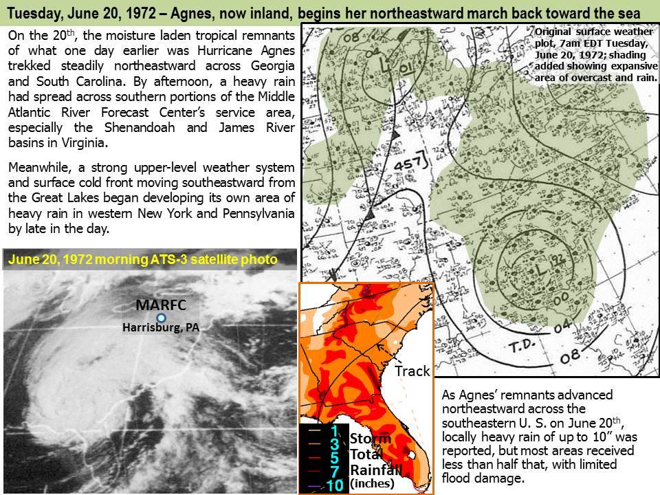
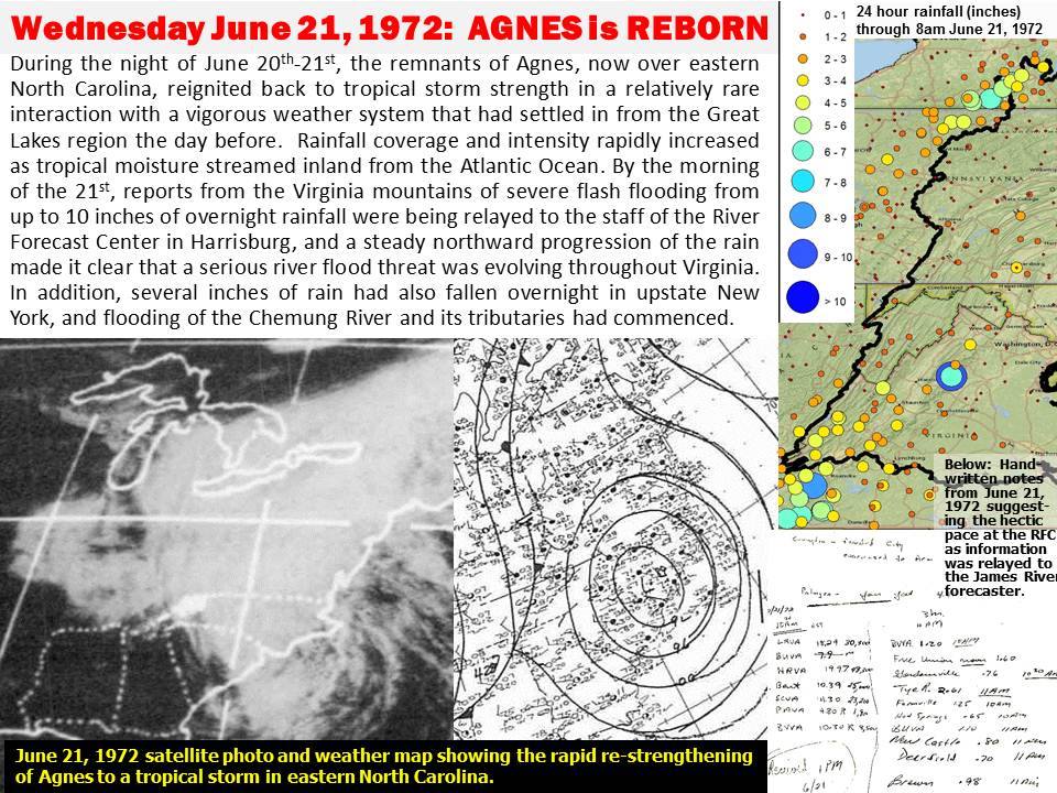
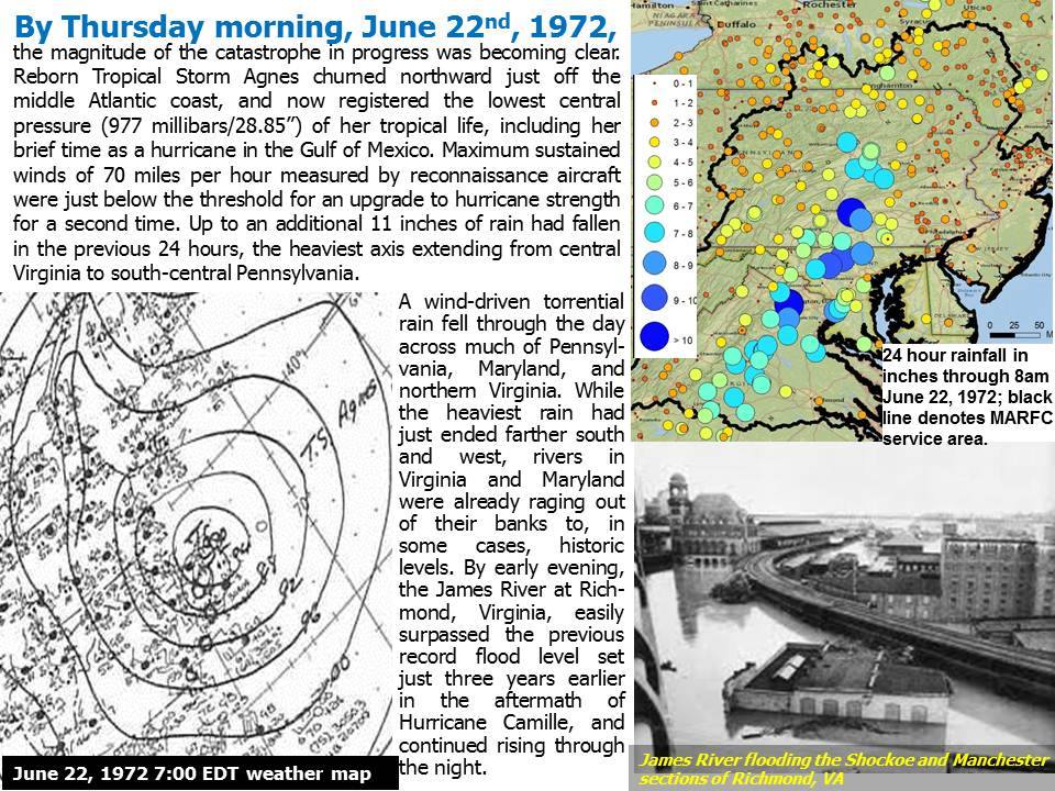
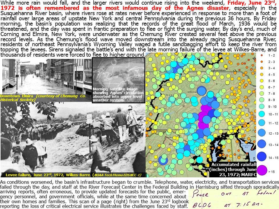
STORM SUMMARYDevastating floods occurred across the Mid-Atlantic region resulting from the remnants of Hurricane Agnes in late June of 1972. Hurricane Agnes came onshore over the Florida Panhandle during the afternoon of June 19th. The storm weakened to tropical depression status over the Carolinas, only to re-intensify to tropical storm strength as it reached the Virginia coast on the 21st. The storm then moved North, weakening to extra-tropical strength as it passed just west of New York city before recurving to the West across Central New York state. The storm then looped back to the East, crossing Northern Pennsylvania before dissipating. |
 |
 |
|
The slow moving remnants of the storm moved across Pennsylvania and dropped generally between 7 and 10 inches of rain across the region, although there were some local reports of nearly 18 inches of rain. Eight to 12 inch amounts were also common across Virginia, with 2 to 6 inch amounts across the southern tier of New York. The heavy rain of Agnes followed a relatively wet May, in which 3 to 4 inches of rain fell across the area. |
|

The slow moving remnants of the storm moved across Pennsylvania and dropped generally between 7 and 10 inches of rain across the region, although there were some local reports of nearly 18 inches of rain. Eight to 12 inch amounts were also common across Virginia, with 2 to 6 inch amounts across the southern tier of New York. The heavy rain of Agnes followed a relatively wet May, in which 3 to 4 inches of rain fell across the area.
Rainfall amounts across Central Pennsylvania for the four day period from June 20th through June 24th ranged in general from 8 to 10 inches. Isolated amounts however approached 18 inches. The heaviest rain (12 to 16 inches) fell in a corridor from Williamsport South through Harrisburg and York. The heaviest reported 24 hour rainfall was recorded at Harrisburg, where 12.53 inches fell between 8 pm on June 21st through 8 pm on June 22nd. Other rainfall totals (June 20-24) include:
HARRISBURG     15 INCHES
WILLIAMSPORT   12 INCHES
YORK           16 INCHES
LEWISTOWN      12 INCHES
STATE COLLEGE   8.5 INCHES
TIOGA           8 INCHES
BRADFORD        8 INCHES
ALTOONA         9 INCHES
JOHNSTOWN       7 INCHES
Many record river crests were achieved along the Susquehanna and Juniata rivers, as well as their tributaries. Most of the previous records were established back in March of 1936, when heavy rainfall on a deep snowpack produced record flooding. Some more notable river crests due to Agnes include:
SITE                RIVER OR TRIBUTARY  CREST     FLOOD STAGE
                                        (FEET)    (FEET)

BLOOMSBURG          SUSQUEHANNA         31.20     19.00
DANVILLE            SUSQUEHANNA         32.32     20.00
SUNBURY             SUSQUEHANNA         35.80     24.00
HARRISBURG          SUSQUEHANNA         32.57     17.00
MARIETTA            SUSQUEHANNA         64.54     49.00

SINNEMAHONING       SINNEMAHONING CR    19.50     17.00
RENOVO              WEST BRANCH SUSQ    26.56     16.00
LOCK HAVEN          WEST BRANCH SUSQ    31.30     21.00
JERSEY SHORE        WEST BRANCH SUSQ    38.40     26.00
WILLIAMSPORT        WEST BRANCH SUSQ    34.75     20.00
MILTON              WEST BRANCH SUSQ    34.55     19.00
LEWISBURG           WEST BRANCH SUSQ    34.23     18.00

CEDAR RUN           PINE CREEK          16.00     12.00
BEECH CR STATION    BALD EAGLE CREEK    12.29     11.00
LOYALSOCKVILLE      LOYALSOCK CREEK     14.74     12.00

WILLIAMSBURG        JUNIATA             18.38     12.00
HUNTINGDON          JUNIATA             20.03     12.00
MAPLETON DEPOT      JUNIATA             33.07     20.00
LEWISTOWN           JUNIATA             42.10     23.00
NEWPORT             JUNIATA             33.97     20.00

CAMP HILL           YELLOW BREECHES CR  18.33      7.00
HOGESTOWN           CONODOGUINET CREEK  17.01      8.00
LANCASTER           CONESTOGA CREEK     27.80     11.00
HARPERS TAVERN      SWATARA CREEK       23.72      9.00
SHERMANSDALE        SHERMAN CREEK       18.09      9.00
PENNS CR STATION    PENNS CREEK         14.85      8.00
 |
 |
 |
 |
 |
 |
 |
 |
 |
 |
 |
 |
 |
 |


 Send Us a Report