|
Pennsylvania Emergency Managers Briefing Tool
|
|
Preliminary Local Storm Reports |
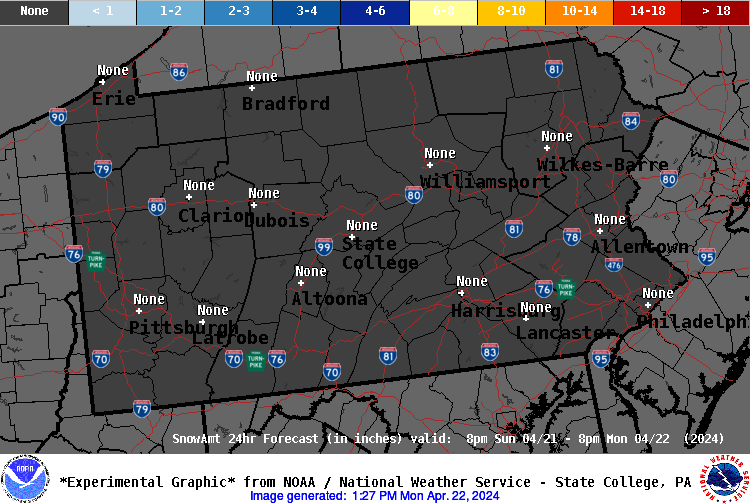
Storm Total Snowfall Forecast
Storm Total Ice Accumulation Forecast
|
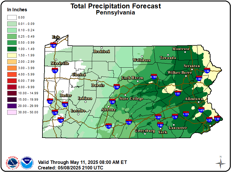
PA State Storm Total Rainfall
|
| 12 Hour Liquid Precip, Period 1 |
 |
| 12 Hour Liquid Precip, Period 2 |
 |
| 12 Hour Liquid Precip, Period 3 |
 |
| 12 Hour Liquid Precip, Period 4 |
 |
| 12 Hour Liquid Precip, Period 5 |
 |
| 12 Hour Liquid Precip, Period 6 |
 |
| 24 Hour Liquid Precip |
 |
| 48 Hour Liquid Precip |
0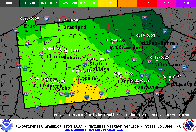 |
| Storm Total Liquid Precip |
 |
| Day 1 Total Precipitation |
 |
| Day 2 Precipitation |
 |
| Day 3 Precipitation |
 |
| Days 1 and 2 Total Precipitation |
 |
| Days 1 - 3 Total Precipitation |
 |
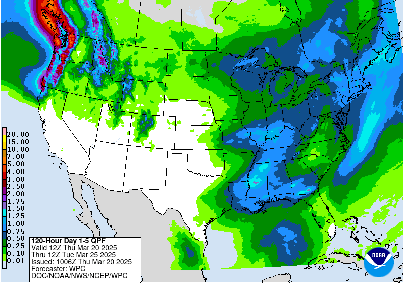
| Days 1 - 5 Total Precipitation |
 |
|
|
|
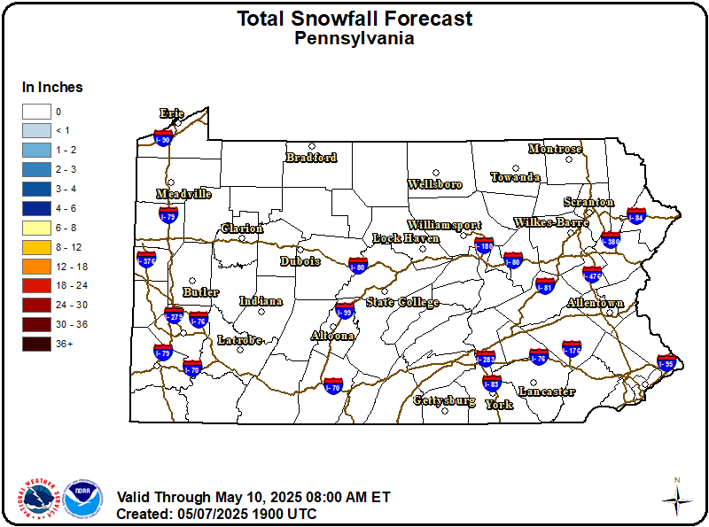
PA State Storm Total Snowfall
|
| Storm Total Snowfall Period 1 and Ice Accumulation Graphic |
| 12 Hour Snowfall Period 1 |
 |
|
12 Hour Snowfall Period 2
|
 |
|
12 Hour Snowfall Period 3
|
 |
| 24 Hour Snowfall Period 1 |
 |
| 24 Hour Snowfall Period 2 |
 |
| 48 Hour Snowfall |
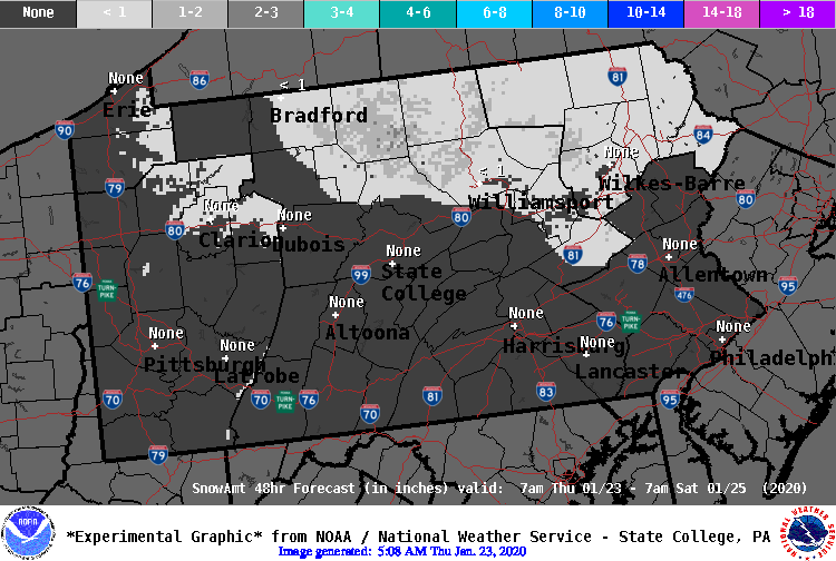 |
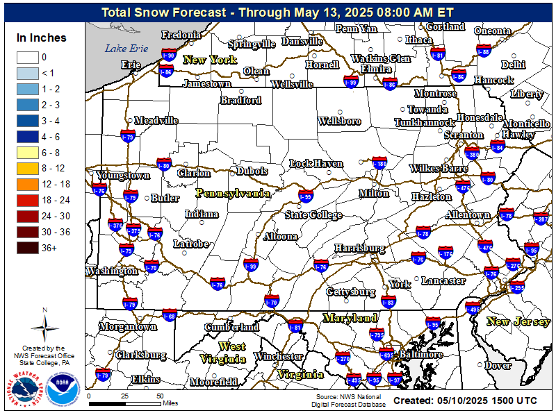
| Storm Total Snowfall |
 |
| DAY 1 PROBABILITY >4" SNOW |
 |
| DAY 1 PROBABILITY >8" SNOW |
 |
| DAY 1 PROBABILITY >12" SNOW |
 |
| DAY 2 PROBABILITY >4" SNOW |
 |
| DAY 2 PROBABILITY >8" SNOW |
 |
| DAY 2 PROBABILITY >12" SNOW |
 |
| DAY 3 PROBABILITY >4" SNOW |
 |
| DAY 3 PROBABILITY >8" SNOW |
 |
| DAY 3 PROBABILITY >12" SNOW |
 |
|
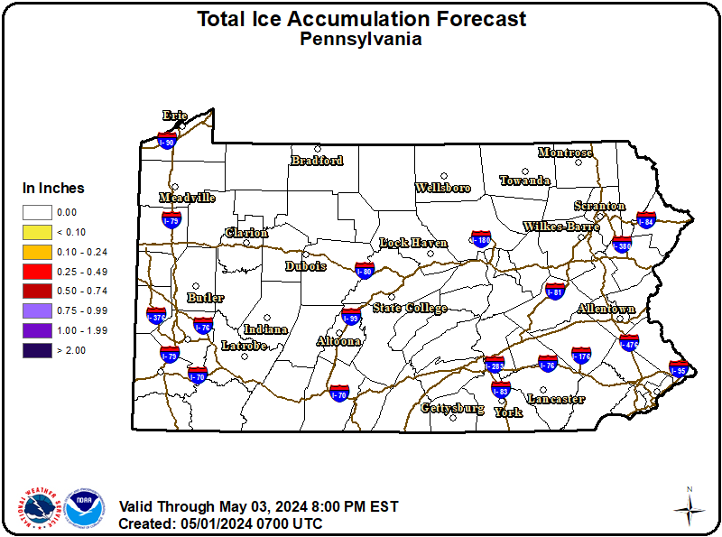
PA State Storm Total Ice Accumulation
|
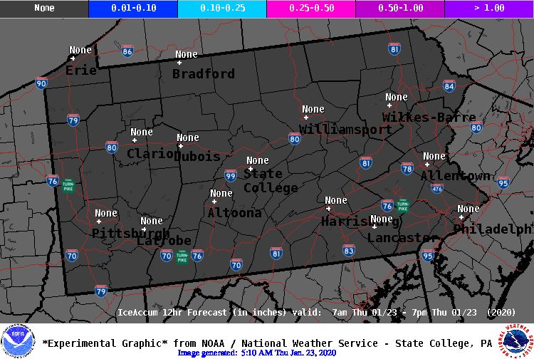
| 12 Hour Ice Accumulation Period 1 |
 |
| 12 Hour Ice Accumulation Period 2 |
 |
| 12 Hour Ice Accumulation Period 3 |
 |
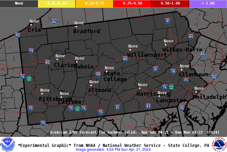
| 24 Hour Ice Accumulation |
 |
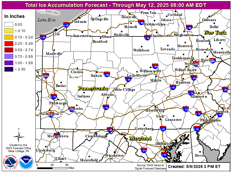
| Storm Total Ice Accumulation |
 |
| DAY 1 PROBABILITY ICE ACCUMULATION >0.25" |
 |
| DAY 2 PROBABILITY ICE ACCUMULATION >0.25" |
 |
| DAY 3 PROBABILITY ICE ACCUMULATION >0.25" |
 |


 Send Us a Report