May 9th, 2020 was one of the coldest May days in recorded history as numerous sites set records for coldest low and high temperatures. Please click through the photos as we attempt to contextualize one of the coldest days in May ever observed in Pennsylvania!
May 9th Records
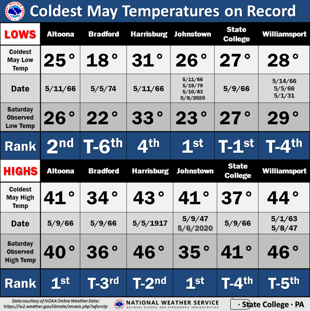
All-Time May Records
Saturday Temperature Anomalies
Eastern US Record Cold
Air Mass Origin
Surface Map Comparisons
Summary Narrative
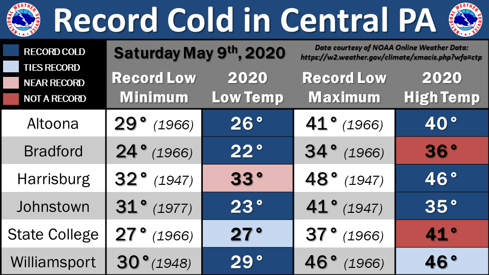
Here are the observed temperatures and previous cold temperature records for Saturday.
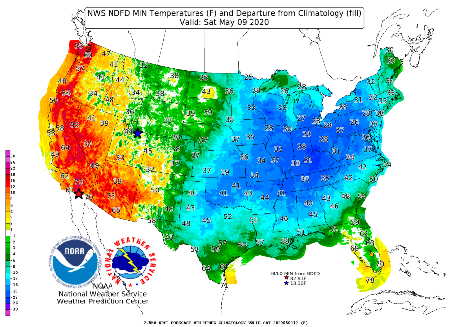
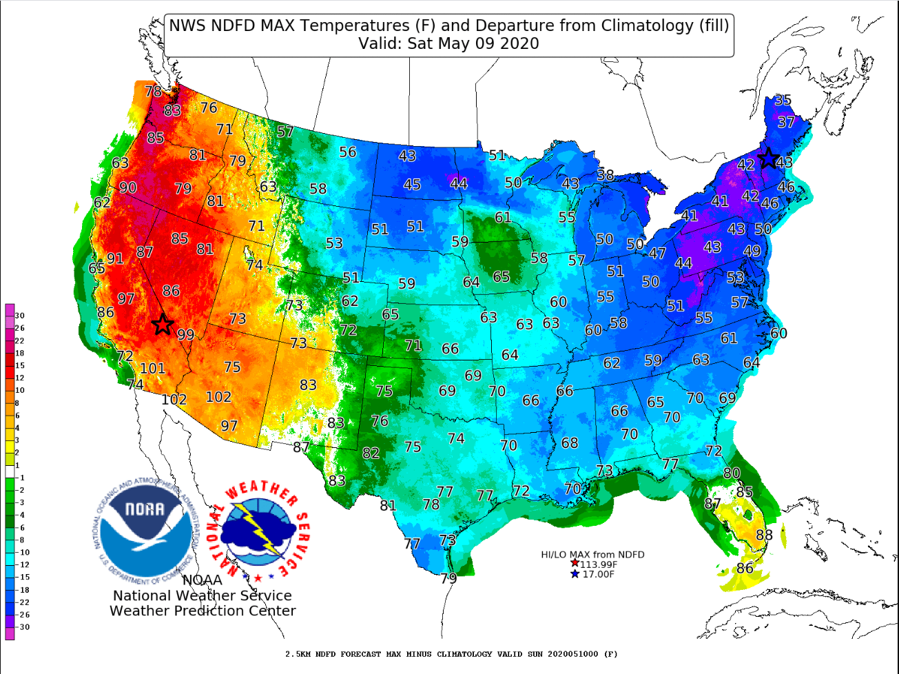
Minimum and maximum temperatures on Saturday were highly anomalous with low temperatures greater than 15 degrees below normal and high temperatures greater than 25 degrees below normal in Pennsylvania.
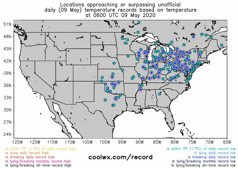
Records were set across most of the Eastern US Saturday morning. Here's a depiction of the record cold temperatures. Notice the dark blue circles in PA indicating temperatures that break the monthly record low.
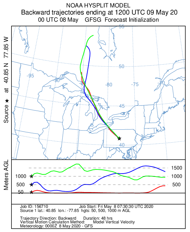
If we track where Saturday's air mass originated, it becomes clear why it was so cold. Air from northern Canada sunk into the Mid-Atlantic on Saturday, resulting in temperatures in the 30s in northern PA and 40s in southern PA.
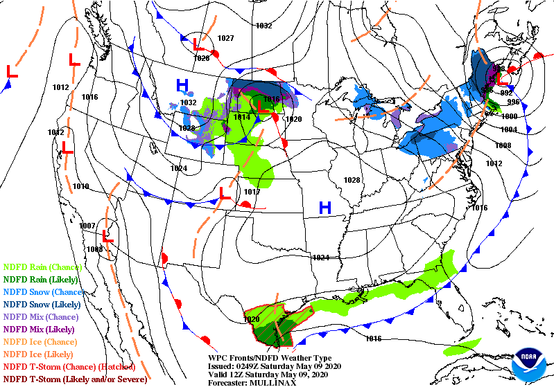
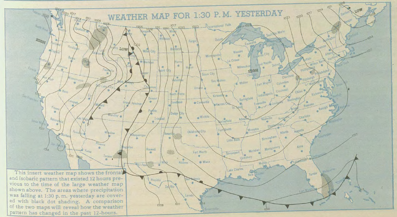
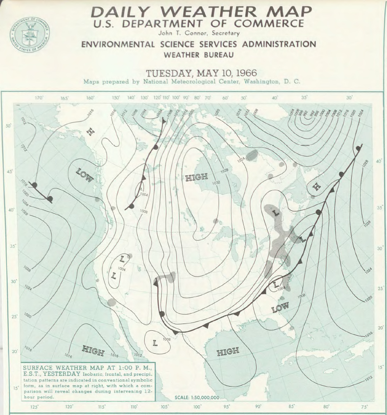
An expansive area of surface high pressure surged into the eastern US, as shown in this NWS Weather Prediction Center map valid at 8AM Saturday. See surface maps from the record-setting May 9ths of 1947 and 1966 below for comparison.


 Send Us a Report