National Weather Service United States Department of Commerce

Heavy Snow and Disruptive Ice in the Upper Midwest; Severe Thunderstorms in the Southern Plains

A late season winter storm will produce a combination of heavy snow and disruptive ice starting this evening in the Northern Plains and moving into the Upper Midwest and Great Lakes by tonight continuing through Thursday. Severe thunderstorms will likely produce severe wind gusts, large hail, a few tornadoes, and heavy rainfall across the southern and central Plains today. Read More >

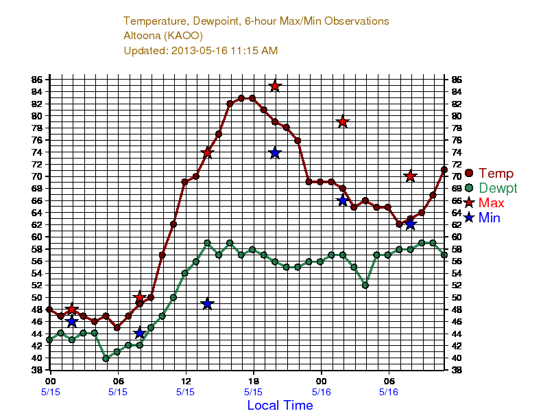
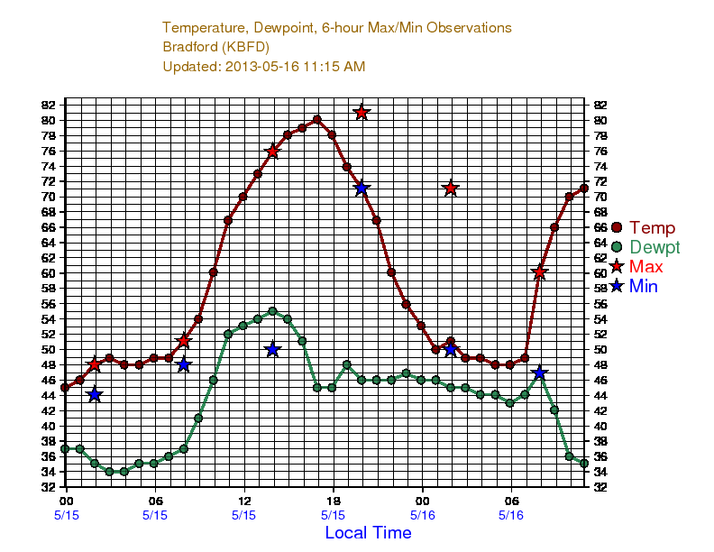
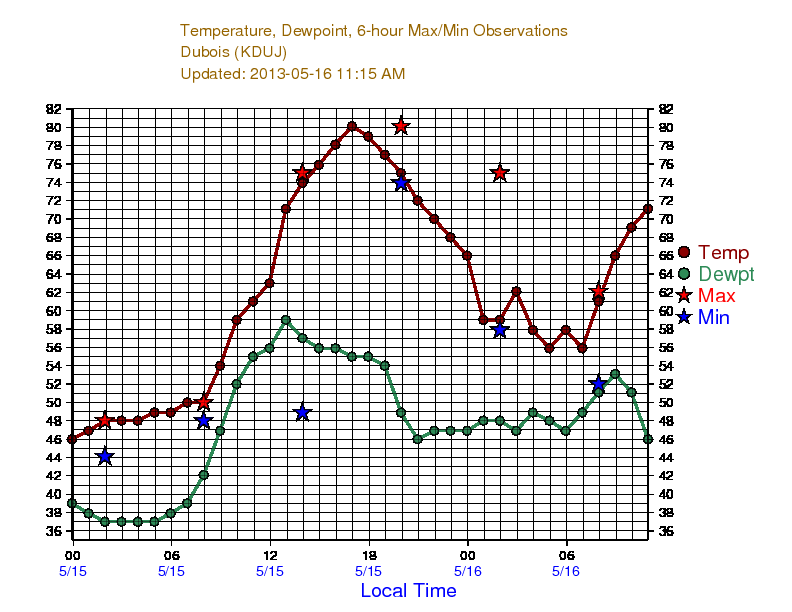
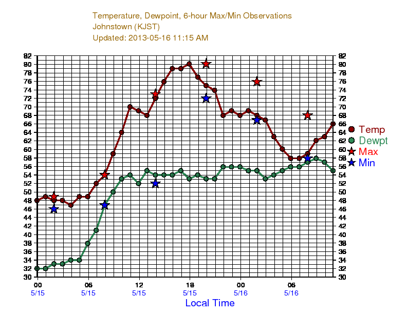
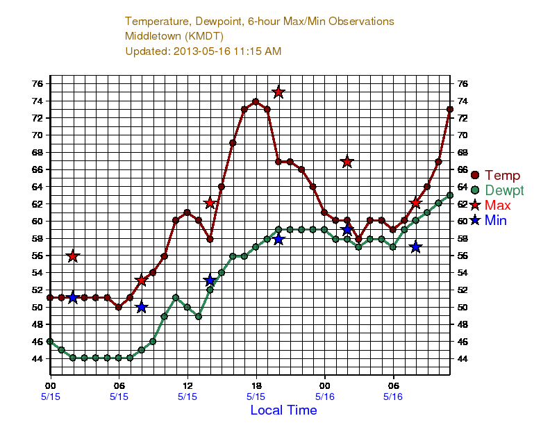
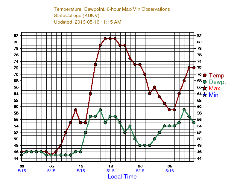
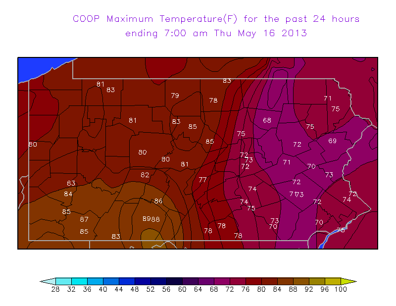
Dramatic Temperature Rise May 15, 2013
A dramatic temperature rise occurred over Central Pennsylvania during the late morning and afternoon hours of May 15, 2013. The temperature graphs below record large temperature changes as a warm front moved across the area. For example, in 4 hours, State College rose from 55 to 81. That's almost 7 degrees per hour.


Altoona temp trace

Du Bois temp trace

Clearfield temp trace

Johnstown temp trace

Harrisburg Temp Trace

State College temp trace

max temperature 5/15

COOP Max Temperature for May 15, 2013

Surface Map 1700 UTC

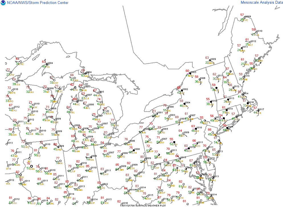
Surface Map 1700 UTC May 15, 2013