Severe Weather Outbreak from Dynamic Mid-Latitude Storm System on March 15th and 16th, 2008
 |
 |
 |
 |
|
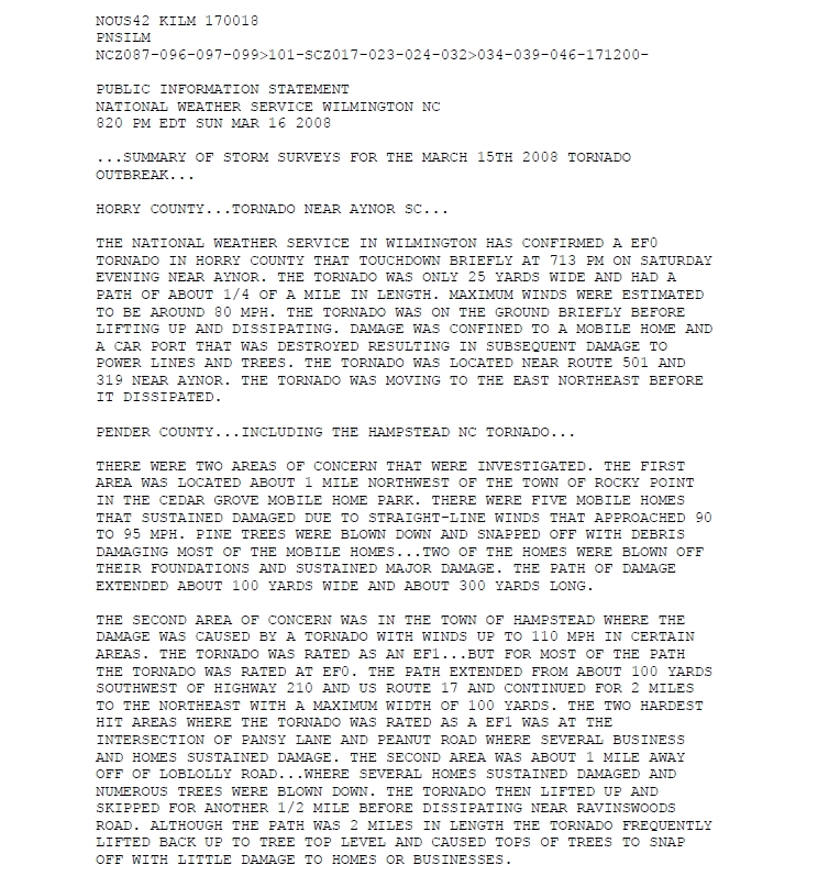
Public Information Statement detailing the damage |
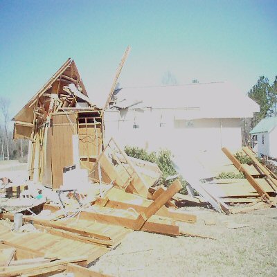
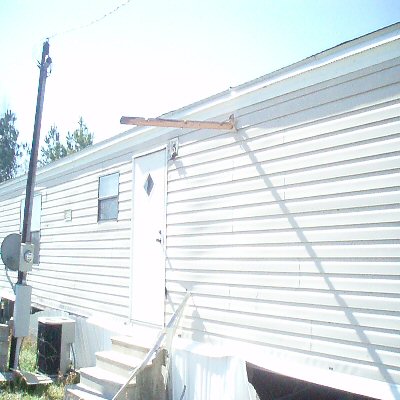
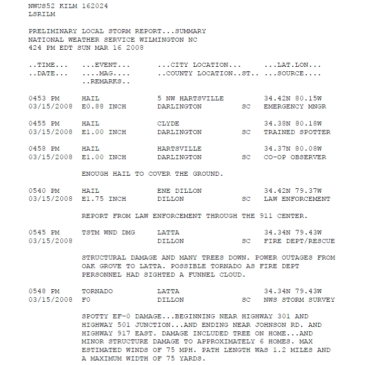
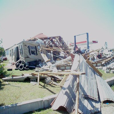
Damage from the Sardis Community in South Carolina from the EF1 tornado | A 2x4 driven into a destroyed mobil home northeast of Trio in Williamsburg County South Carolina from an EF1 tornado | Summary of Local Storm Reports |
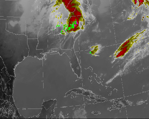
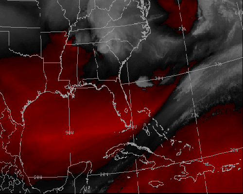
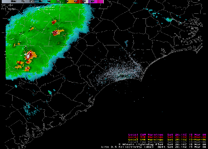
Loops of Satellite and Radar Images
 |
 |
 |
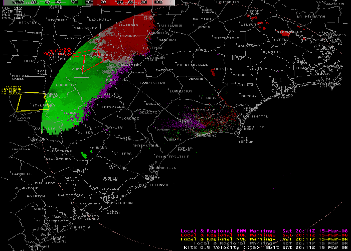 |
| Infrared Satellite Loop | Water Vapor Satellite Loop | Radar Reflectivity Loop | Radar Velocity Loop |
Damage Photos
 |
 |
 |
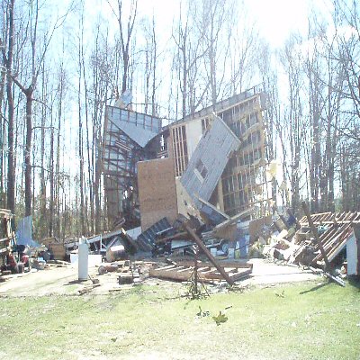 |
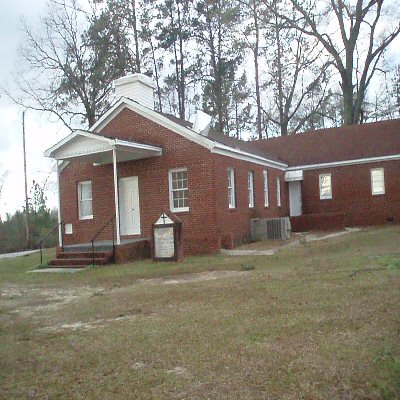
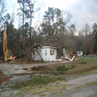
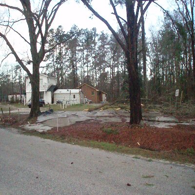
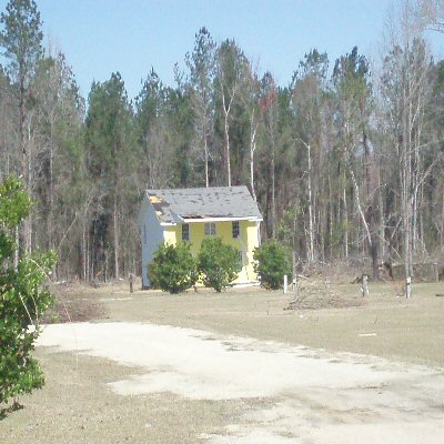
| Steeple down on a church between Latta and Temperance Hill in Dillon County South Carolina. | Damage in Latta from an EF-0 tornado | Damage near Cartersville South Carolina | Workshop destroyed east of Cartersville South Carolina. |
 |
 |
 |
 |
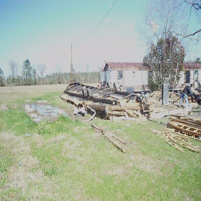
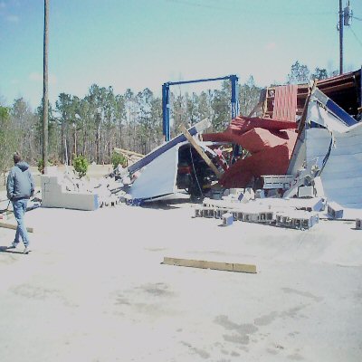
| Workshop destroyed east of Cartersville South Carolina. | Damage at an Exxon gas station from an EF1 as well...on I-95 exit 150 | More damage at the Exxon Station near Sardis in South Carolina on I-95 exit 150 | Building damage near Sardis South Carolina. |
Maps of Tornado Tracks and Damage
 |
 |
 |
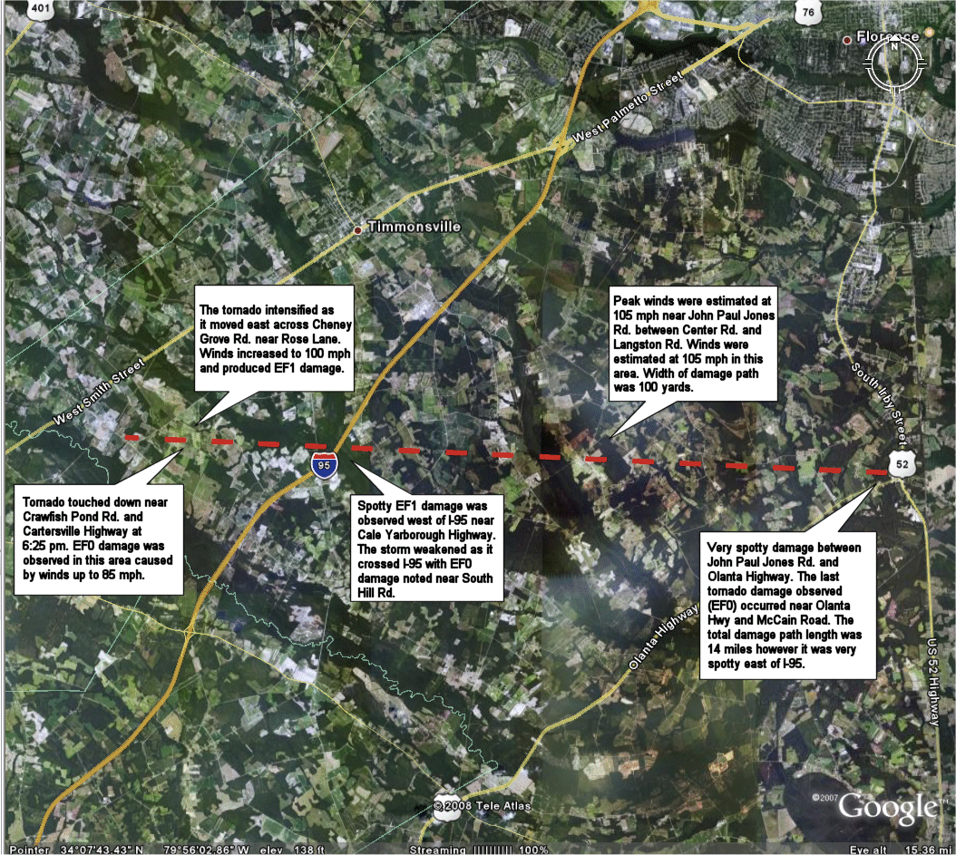 |
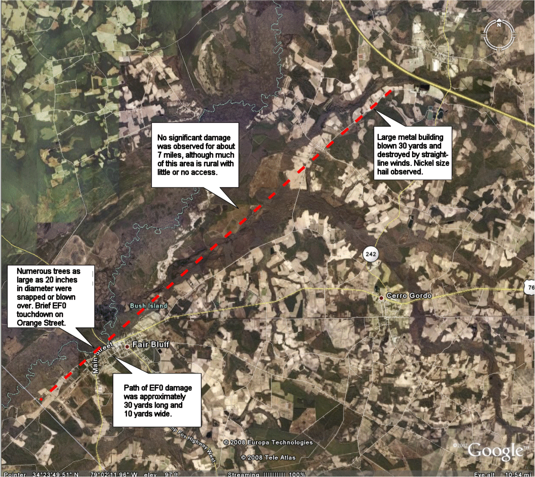
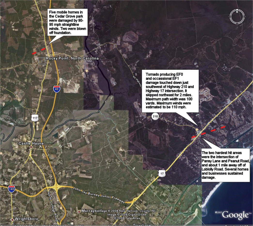
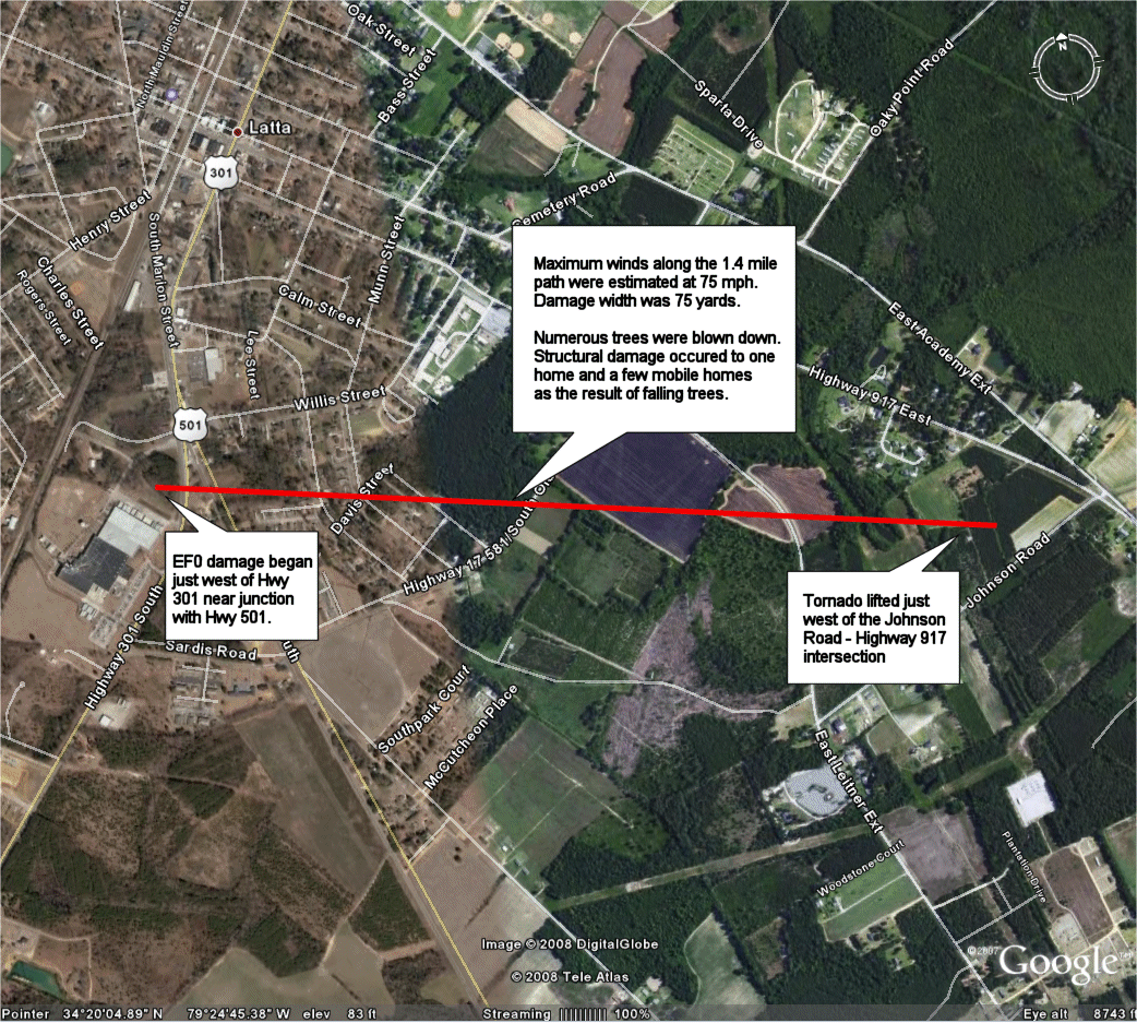
| Map of Tornado Path and Damage across Columbus County, NC | Map of Tornado Path and Damage across Pender County, NC | Map of Tornado Path and Damage across Dillon County, SC | Map of Tornado Path and Damage across Florence County, SC |
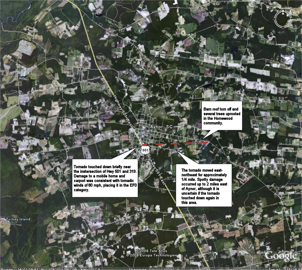 |
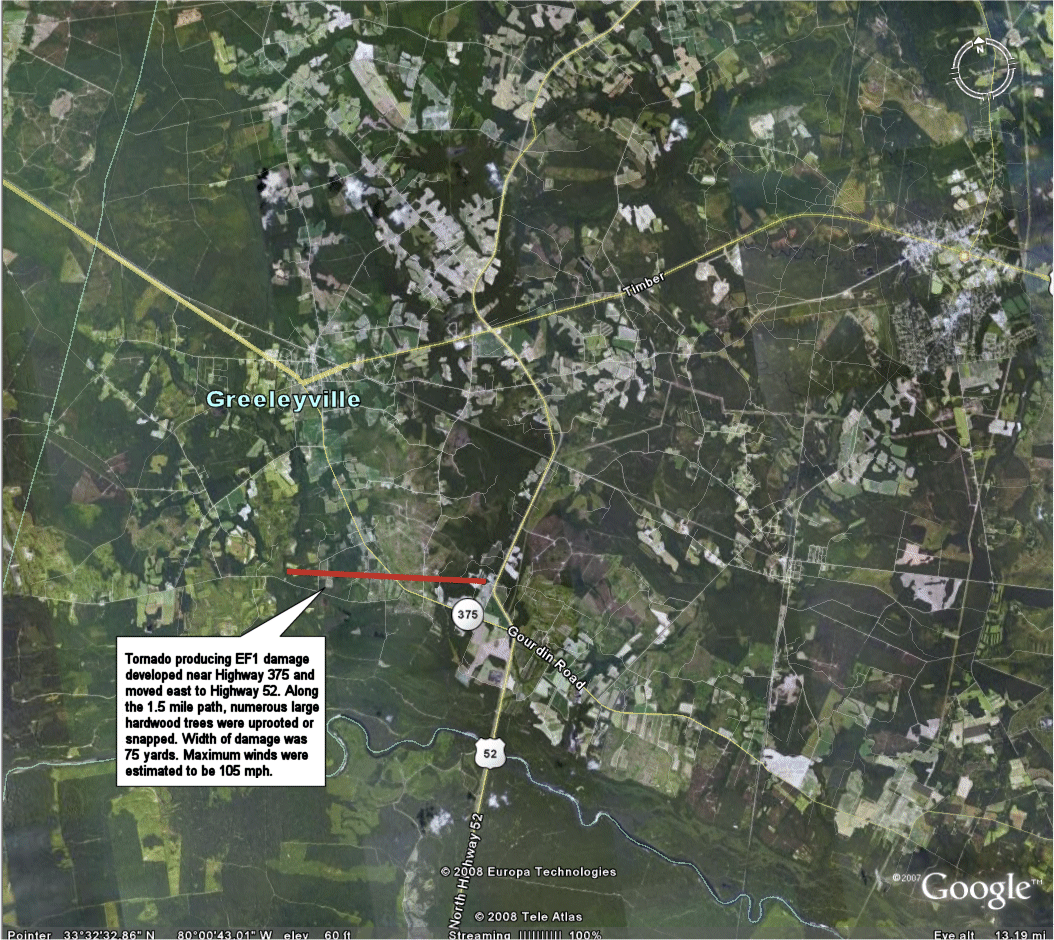 |
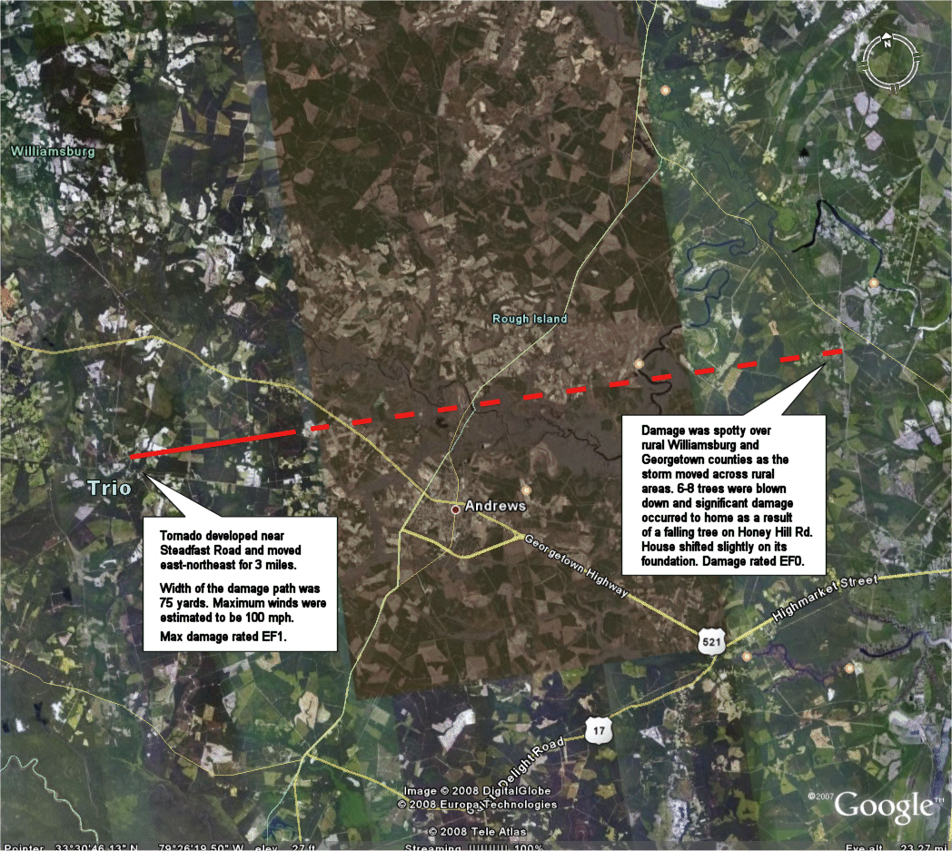 |
| Map of Tornado Path and Damage across Horry County, SC | Map of Tornado Path and Damage across Williamsburg County, SC | Map of Tornado Path and Damage across Williamsburg County, SC |


 Coastal Flood