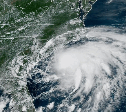
A tropical depression developed east of Jacksonville, FL during the afternoon of July 4, 2025. Over the next day the system drifted north and strengthened into Tropical Storm Chantal, the third named storm of the 2025 Atlantic hurricane season. Chantal battled southerly wind shear which kept the system tilted and disorganized during the day on July 5. However shear relaxed that night and the storm strengthened in the six hours before landfall with maximum sustained winds estimated near 60 mph along with a pressure of 1002 millibars at 2:00 AM EDT on July 6. Chantal's landfall occurred near Litchfield Beach, SC around 4:00 AM EDT on July 6.
|
GOES satellite imagery from July 5 to 6, 2025 showing Chantal's move inland across the Carolinas |
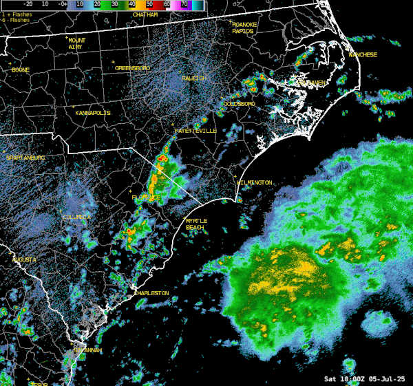
Regional composite radar loop showing Chantal's landfall on the South Carolina coast on July 6, 2025 |
Along the coast of the Carolinas, wind gusts as high as 56 mph were measured at Springmaid Pier in Myrtle Beach. Rainfall amounts of 4 to 6 inches were estimated by radar in a swath extending from northern Horry County, SC through Whiteville and into the Lumberton and Red Springs areas in southeastern North Carolina.
A summary of storm total rainfall amounts is available here and peak wind gusts are available here.
One tornado touchdown has been confirmed in Wilmington. At 4:27 AM EDT on July 6 a tornado touched down in the Kings Grant community just east of the Wilmington airport. The tornado was on the ground for over a mile with damage to trees and roofs noted. Details on this tornado are available here.
A technical summary of meteorological/tidal data and impacts can be found here - data is in .csv and .pdf documents and you must search on the page for 2025 Tropical Storm Chantal.
Page Author: Tim Armstrong
Last Updated: February 4, 2026


 Coastal Flood