Total Ice and Snow/Sleet Accumulation Analysis from
January 21-22, 2022 Winter Storm
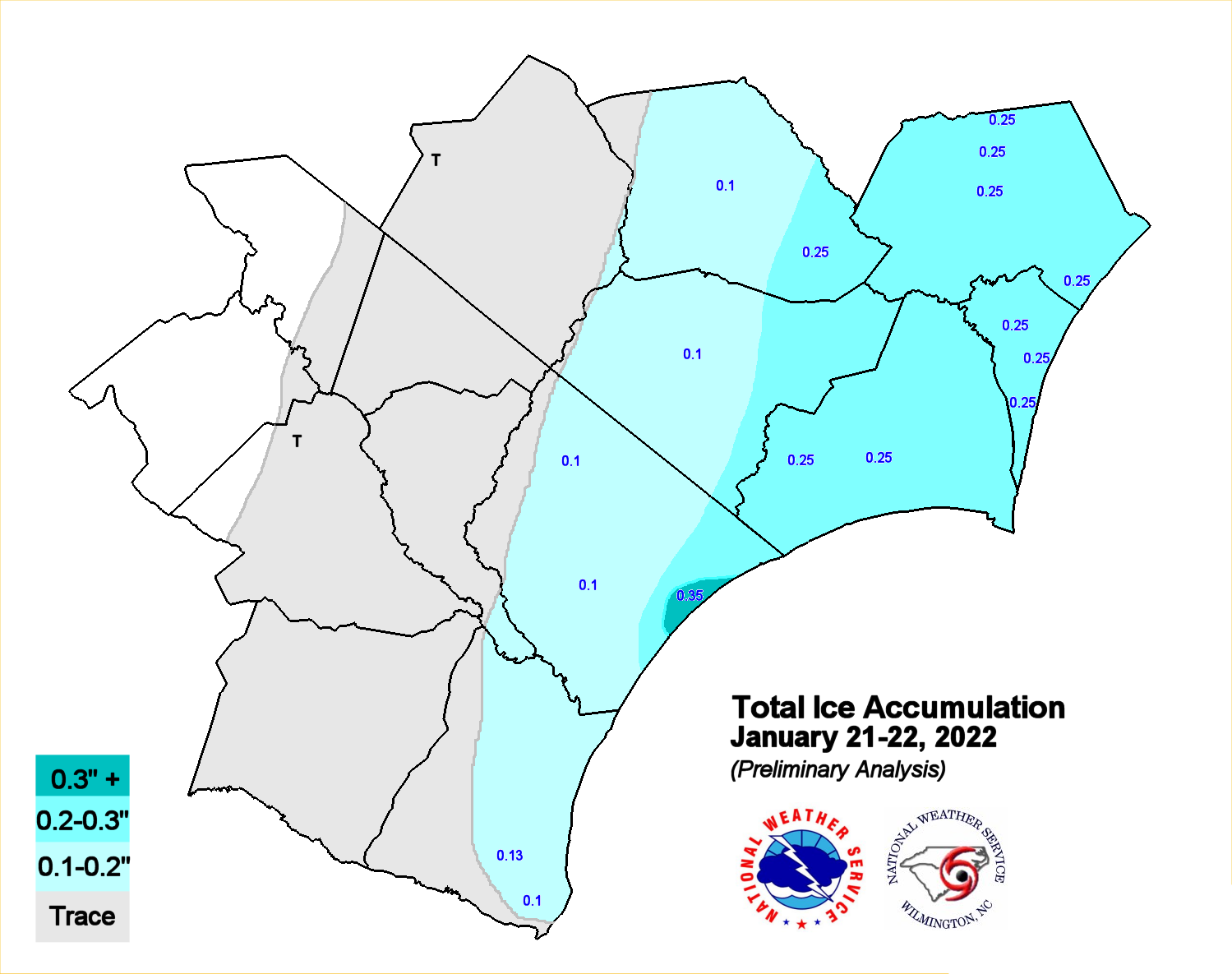
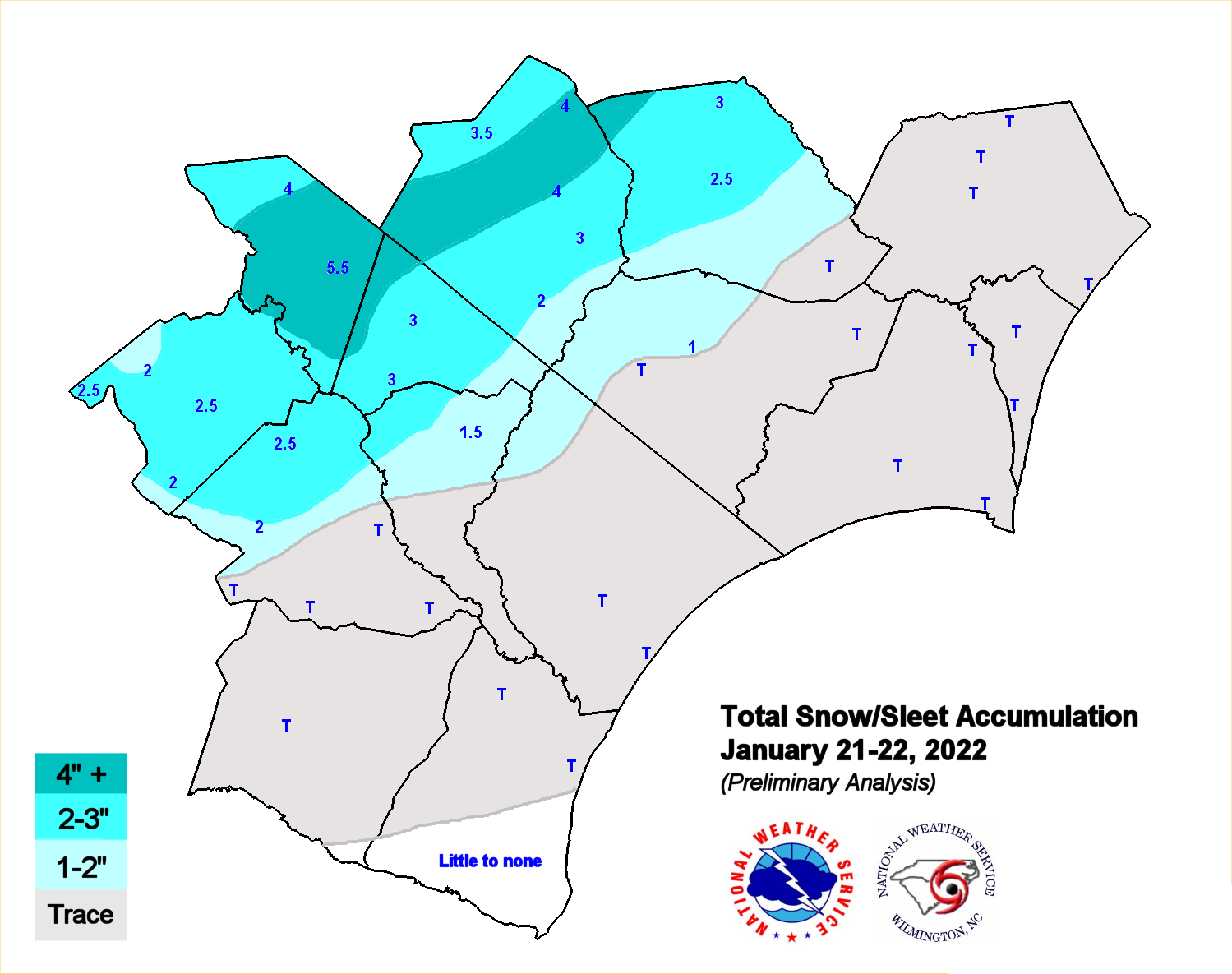
A wave of low pressure developed and moved northward along an arctic cold front stalled off the Carolina coast on Friday January 21st, spreading a wintry mix of precipitation across the Carolinas. As temperatures fell below freezing on Friday and rain spread northward. it transitioned to freezing rain then sleet and snow in places into Friday night as the air mass continued to cool.
Areas near the coast reported mainly ice accumulation from freezing rain, while farther inland closer to I-95, snow mostly fell with almost half a foot in a few spots. Other areas reported both ice and snow, while some locations observed bursts of sleet at times. The maps show accumulations of snow versus ice and in some cases the overlap of both. This was followed by the coldest air in several years across the region. Here is some information on past ice storms that affected the Wilmington area.
The following maps represent preliminary data and may be revised as additional information is received.
For a text version click here.


 Coastal Flood