Hurricane Isaias made landfall near Pensacola, Florida on October 9, 2026 accompanied by destructive winds and a large storm surge. After moving farther inland and weakening on October 10, Isaias dumped heavy rain which led to flooding across the mountains of western North Carolina.
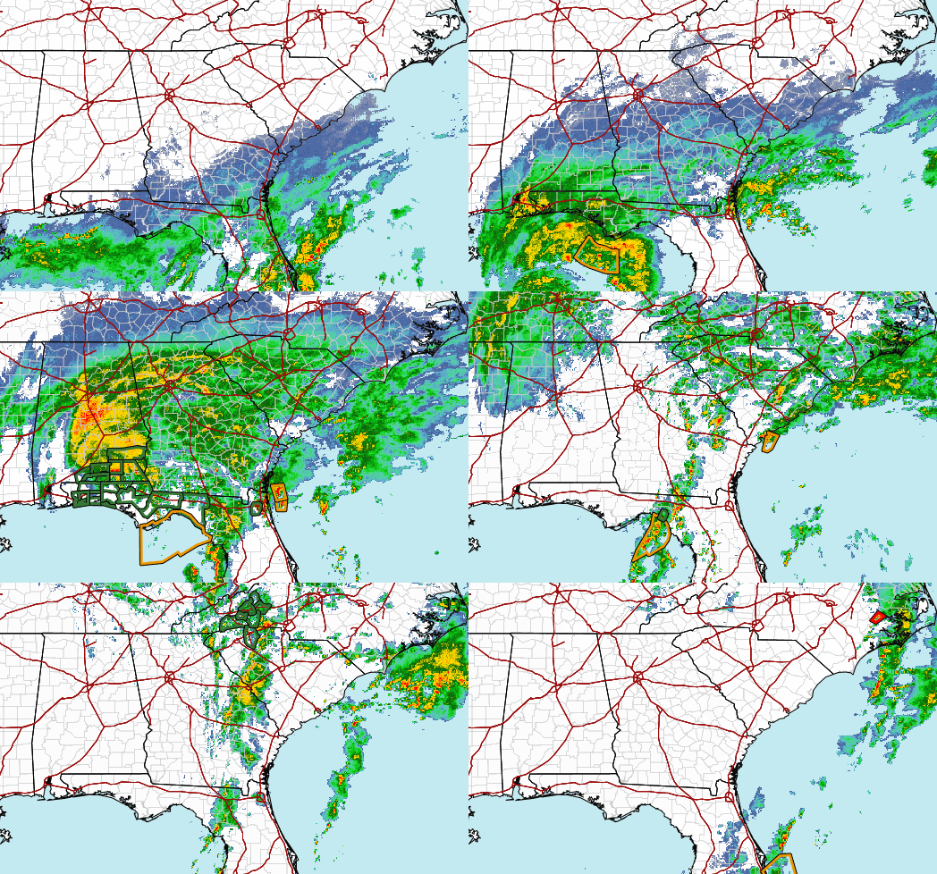
Tornadoes developed across central and eastern North Carolina on October 11 along a persistent convergence line that swept east across the state. Here are details on tornado touchdowns in the area served by the NWS office in Wilmington, NC.
East Arcadia Tornado
|
Touchdown: 1 mile SW of East Arcadia in Bladen County, NC at 12:54 PM EDT on October 11, 2026 Lifted: 1 mile north of East Arcadia at 12:58 PM EDT after 1.68 miles on the ground. Maximum Wind Speed: 75 mph (EF-0 intensity) with a maximum width of 235 yards.
Damage began near East Arcadia Road and Old Lake Road in Bladen
County. Several large trees had been snapped or uprooted at this
location. The damage occurred to a mix of softwood and hardwood
trees. Limbs and other debris were scattered throughout a
resident's front yard and a nearby field. Along East Arcadia Road,
large hardwood limbs had been downed near the roadway. The damage
in this area was facing northwest and personal accounts indicated
that the tornado had been observed and remained northwest of the
resident's home. This damage was likely due to strong inflow ahead
of the circulation.

To the northeast, a large pine tree had been knocked down along
Kennedy Road near the intersection of East Arcadia Road. The
damage at this location was facing northeast and was consistent
with the direction of the tornado on radar. A large amount of tree
debris was also observed in the area. Additional softwood and
hardwood tree debris was observed along Smith Road with tree limbs
and downed trees providing confidence in the path. This tree
debris was used to estimate the path width. Personal accounts and
damage indicators confirmed that this was a weak, but broad
tornado.

The most significant damage was observed along Graham Road near a
turf field. Several large softwood trees had been downed with
large limbs snapped. A few smaller hardwood trees also sustained
damage. Debris was scattered in a single direction across the
field from the tree line toward the northeast for approximately
150 yards. A resident shared video of the tornado as it moved
through the field. The circulation was obvious on video and debris
could be seen flying in multiple directions. Consistent with
personal accounts from other locations, the circulation was broad
and weak. The time and location is consistent with a tornado
debris signature on radar. This was the end of the tornado's path.

No additional damage was observed to the northeast beyond this
point. Damage indicators and public accounts confirm that the
tornado lifted, crossing the Cape Fear River. The survey team
observed a few downed trees along Salt Marsh Road, but many of
these trees were unhealthy or rotted. It was decided not to
include this as part of the damage path due to the isolated nature
of the damage and poor health of the downed trees. Radar also
supports a weakening circulation at this point.

A report was received from Atkinson, NC around 1:30 PM stating
that the tornado had been spotted, passing near the town. The
survey team searched the area for damage, but none was found. The
team also contacted emergency services personnel which confirmed
that no emergency services had been requested and that there was
no known damage. It is likely, based on radar signatures and
visual reports, that the circulation could be seen as it continued
into northwestern Pender County, but remained broad and elevated.
Radar loop of the tornado near East Arcadia, NC on October 11, 2026. Reflectivity at 0.5 degrees is on the left and storm-relative velocity at 0.5 degrees is on the right. |
Clarendon Tornado
|
Touchdown: 2 miles NE of Clarendon in Columbus County, NC at 12:03 PM EDT on October 11, 2026 Lifted: 2 miles NE of Clarendon at 12:04 PM EDT after 0.13 miles on the ground. Maximum Wind Speed: 80 mph (EF-0 intensity) with a maximum width of 20 yards.
The tornado occurred at a property along Roseland Rd east of Joe
Brown Hwy South. Several open farm buildings were destroyed due
to roof uplift and subsequent wall failure. Debris was scattered
along a narrow path. An empty grain bin was also lifted off its
foundation and shifted. Sheet metal roofing and wooden building
materials were scattered along the path including high into tree
canopies and into an adjacent field beyond the grove of trees.
Since the grove of trees lacked any notable damage, the tornado
is estimated to have lifted just before the grove of trees.
Radar loop of the tornado near Clarendon, NC on October 11, 2026. Reflectivity at 0.5 degrees is on the left and storm-relative velocity at 0.5 degrees is on the right.
|
For information about tornadoes in other parts of North Carolina on October 11, please see webpages for the NWS Raleigh and Newport/Morehead City offices.
Page Author: Tim Armstrong
Last Updated: October 12, 2026





 Radar
 Current Weather
 Rivers & Lakes
 Satellite
 Forecast Maps
 Hour by Hour Forecast
 Winter Weather
 Graphical Hazards
 Weather Hazard Briefing
 Forecaster's Discussion
 Text Bulletins
 Climate
 Skywarn
 NOAA Weather Radio
 Sunrise/Sunset
 Marine Forecasts
 Beach & Surf
 Coastal Flood
 Follow us on X
 Follow us on Facebook
 Follow us on YouTube
 ILM RSS Feed