A compact area of low pressure moving across eastern South Carolina and southern North Carolina created several hours of strong winds during the evening hours of April 23, 2020. Gusts as high as 61 mph were recorded at Johnny Mercer Pier in Wrightsville Beach, NC. Although thunderstorms and some heavy rainfall occurred in association with this weather system, the storms themselves were not responsible for the strong winds.
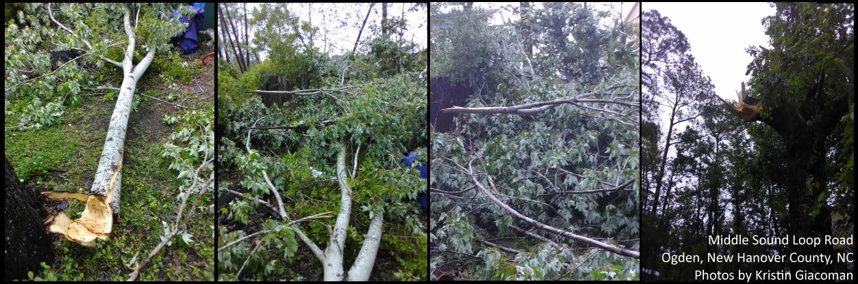
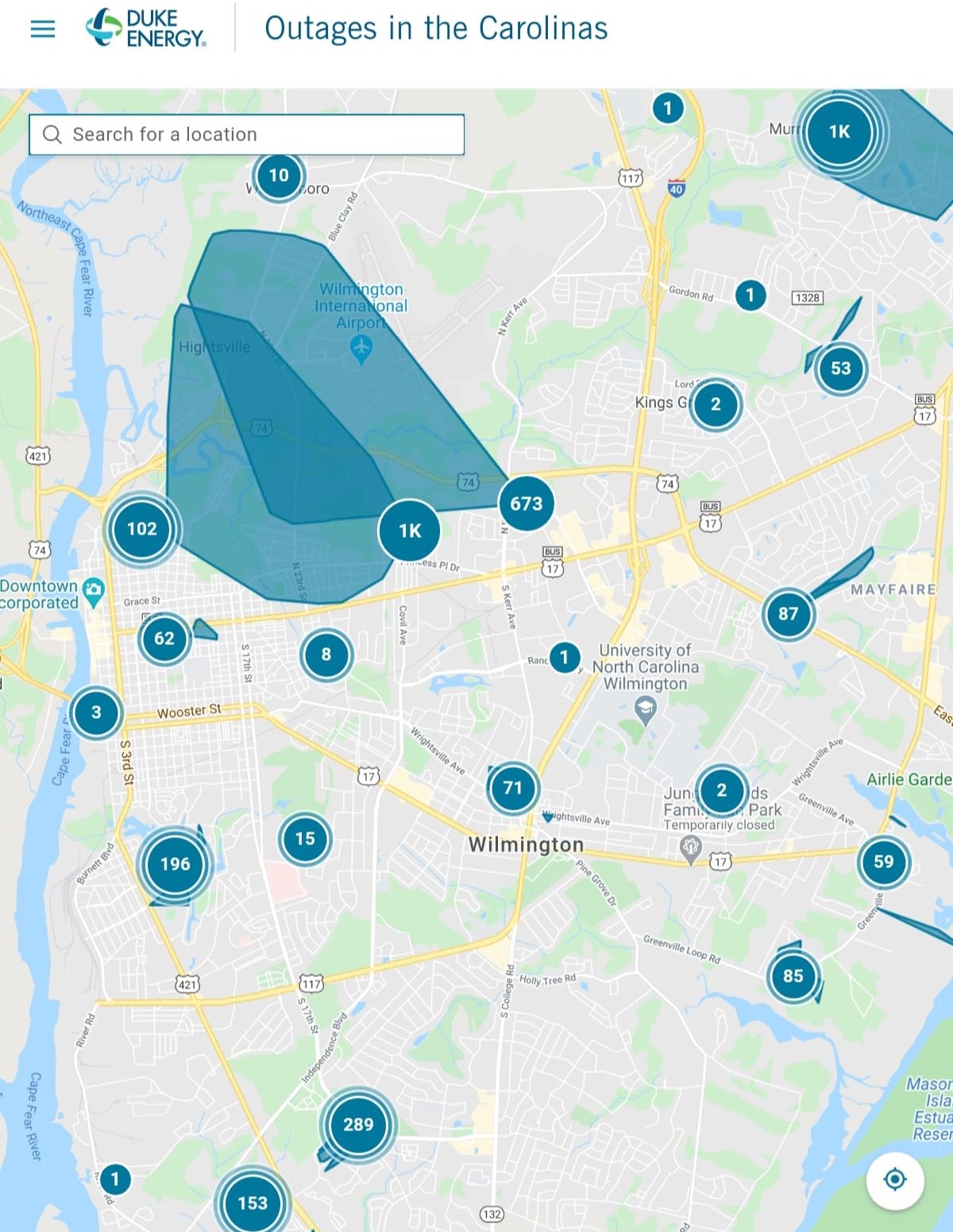
Damage was limited to generally tree limbs and some large dead trees. Power outages occurred across the Wilmington metro area, at one point affecting several thousand customers. Most of the outages had been restored by 9:00 a.m. Friday morning.
|
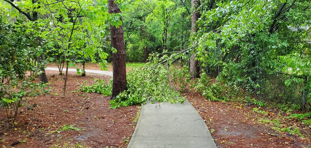
Some small tree limbs were blown down in Hugh MacRae Park in Wilmington by strong winds during the evening of April 23, 2020
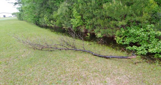
A dead tree limb fell near the NWS office at the Wilmington airport. |
A map of power outages in the Wilmington metro area from Duke Energy's website at 8:28 p.m. on April 23, 2020 |
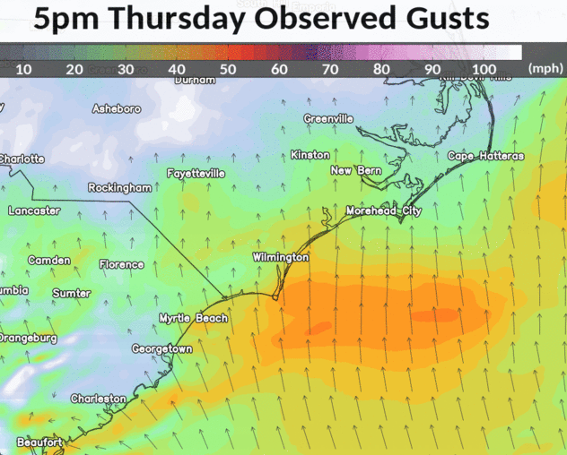
Model-analyzed wind gusts across the eastern Carolinas during the evening of April 23, 2020
***********************PEAK WIND GUSTS**********************

LOCATION                     MAX WIND     TIME/DATE   COMMENTS
                                 GUST            OF
                                 MPH    MEASUREMENT

NORTH CAROLINA

...BLADEN COUNTY...
   ELIZABETHTOWN AIRPORT           38   335 PM  4/23  AWOS

...BRUNSWICK COUNTY...
   SOUTHPORT-CAPE FEAR RVR PILOTS  51   557 PM  4/23  MESONET
   SUNSET BEACH                    47   449 PM  4/23  MESONET
   OAK ISLAND                      45   537 PM  4/23  WXFLOW
   LOCKWOODS FOLLY                 35   509 PM  4/23  WXFLOW
   NATURE CONSERVANCY-GREEN SWAMP  34   718 PM  4/23  RAWS
   BALD HEAD ISLAND                34   605 PM  4/23  MESONET
   SUNNY POINT RAWS                33   918 PM  4/23  RAWS
   SOUTHPORT AIRPORT               33   615 PM  4/23  AWOS
   CALABASH                        31   817 PM  4/23  CWOP

...COLUMBUS COUNTY...
   WHITEVILLE RAWS                 38   818 PM  4/23  RAWS

...NEW HANOVER COUNTY...
   WRIGHTSVILLE BEACH-MERCER PIER  61   736 PM  4/23  HADS
   WRIGHTSVILLE BEACH-TOWN PARK    53   709 PM  4/23  MESONET
   WILMINGTON AIRPORT              53   708 PM  4/23  ASOS
   FEDERAL POINT                   52   612 PM  4/23  WXFLOW
   WILMINGTON STATE PORT TERMINAL  49   649 PM  4/23  MESONET
   MASONBORO ISLAND                48   845 PM  4/23  MESONET
   WILMINGTON-KINGS GRANT          44   844 PM  4/23  MESONET
   OGDEN-TORCHWOOD BLVD            37   724 PM  4/23  MESONET
   UNC-WILMINGTON CAMPUS           32   940 PM  4/23  MESOWEST

...PENDER COUNTY...
   TOPSAIL BEACH-SOUTH END         58   724 PM  4/23  MESONET
   TOPSAIL BEACH FIRE DEPARTMENT   51   739 PM  4/23  MESONET
   HOLLY SHELTER-BACK ISLAND       34   618 PM  4/23  RAWS

...ROBESON COUNTY...
   LUMBERTON RAWS                  36   314 PM  4/23  RAWS
   UNC-PEMBROKE CAMPUS             35   330 PM  4/23  MESOWEST

SOUTH CAROLINA

...DARLINGTON COUNTY...
   DARLINGTON CNTY JETPORT         37   328 PM  4/23  AWOS

...FLORENCE COUNTY...
   FLORENCE AIRPORT                48   627 PM  4/23  ASOS

...HORRY COUNTY...
   MYRTLE BEACH-BRIARCLIFFE ACRES  44   509 PM  4/23  MESONET
   LITTLE RIVER                    42   804 PM  4/23  CWOP
   LORIS                           40   700 PM  4/23  CWOP
   CHERRY GROVE BEACH PIER         37   445 PM  4/23  MESONET
   MYRTLE BEACH AIRPORT            37   504 PM  4/23  AWOS
   CONWAY                          37   425 PM  4/23  CWOP
   HORRY RAWS/CONWAY               37   442 PM  4/23  RAWS
   MYRTLE BEACH APACHE PIER        36   515 PM  4/23  MESONET
   NORTH MYRTLE BEACH AIRPORT      36   551 PM  4/23  ASOS
   MYRTLE BEACH 2ND AVENUE PIER    35   515 PM  4/23  MESONET
   CONWAY HORRY COUNTY AIRPORT     32   415 PM  4/23  AWOS

...MARION COUNTY...
   MARION AIRPORT                  43   615 PM  4/23  AWOS
   MARION RAWS                     35   743 PM  4/23  RAWS

...WILLIAMSBURG COUNTY...
   KINGSTREE AIRPORT               36   335 PM  4/23  AWOS

OFFSHORE BUOYS

   BUOY 41038-5 SE WRIGHTSVILLE    49   808 PM  4/23  CORMP
   BUOY 41037-35 SE WRIGHTSVILLE   51   808 PM  4/23  CORMP
   BUOY 41024-2 S SUNSET BEACH     43   608 PM  4/23  CORMP
   BUOY 41013-FRYING PAN SHOALS    38   1040 PM 4/23  NDBC


 Coastal Flood