January 3: Torrential rains led to flash flooding and many water rescues in north central Kentucky.
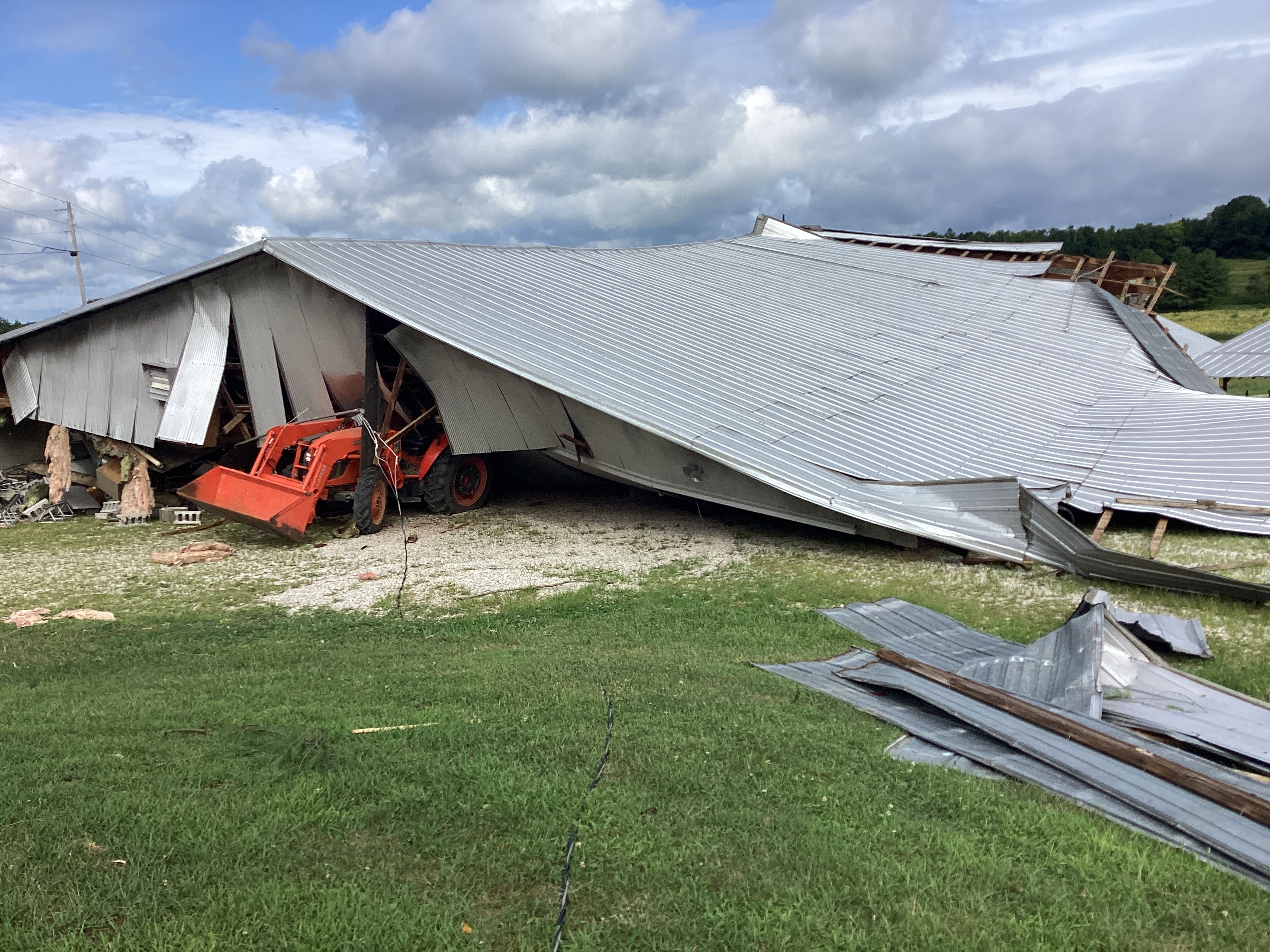
January 12: Four EF-1 tornadoes struck the Blue Grass region. The most significant was one near Harrodsburg that was on the ground for 3.6 miles.
January 19: Winds gusted over 50 mph in some spots.
January 25: Winds gusted over 50 mph in the Blue Grass, including 58 mph in Lexington.
February 22: Winds gusted to 90 mph in Scottsville, displacing a car by about 40 feet.
March 3: A historic storm brought powerful winds, severe storms, and record low barometric pressure to the Ohio Valley. Winds gusted between 70 and 80 mph in Louisville, Lexington, Harrodsburg, and Hardinsburg. Three EF-1 tornadoes struck southern Indiana. All-time record low barometric pressure records were set at Louisville and Bowling Green. Louisville also set a daily record rainfall of 2.79".
March 31 - April 1: The region was caught between major tornado outbreaks to our north and south. Here in the middle Ohio Valley there were several wind damage reports and one EF-1 tornado that was on the ground for about four miles from northeast of Anchorage to southeast of Pewee Valley.
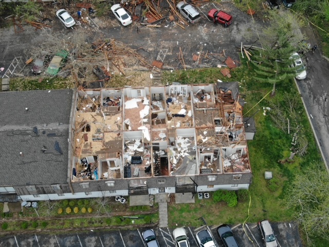
April 5: Five EF-1 tornadoes spun up along a squall line that moved across southern Indiana and central Kentucky. Three of them were in Louisville but they were all very small and brief. Still, significant damage was done to trees and an apartment building near Pleasure Ridge Park.
April 20: Very dry air and gusty winds led to the year's only Red Flag Warning for dangerous outdoor burning conditions. Afternoon relative humidity fell to 20-25% and winds gusted to 31 mph.
May 7: An unusual line of storms pressed southward from Indiana to central Kentucky during the morning hours. Between 8:42am and 9:25am six small tornadoes touched down between Floyd County and Shelby County, including one that was on the ground for nearly five miles and crossed the Ohio River from Indiana into Kentucky in the Lake Dreamland area.
May 9: Baseball sized hail fell near New Middletown in Harrison County, Indiana, at 3:12 in the morning!
June 25-26: Strong thunderstorms moved through the region bringing large hail, winds up to 110mph, and a few tornadoes. An EF-2 twister was on the ground for about a mile near Cecilia in Hardin County. Straight-line winds estimated at 100 mph struck Russell, Grayson, Edmonson, and Warren Counties. A macroburst with 110 mph estimated wind gusts damaged trees and structures along a path eight and a half miles long and two and a half miles wide just outside Richmond. Hail up to 4" in diameter pummeled Dubois County near Hillham. Hail was about 3" in diameter at West Baden Springs. The West Baden Springs Hotel had extensive hail damage which caused the closure of the atrium for several days. Many of the glass panels were original to the hotel that opened in 1902. Multiple holes were observed through the safety glass and vertical glass windows that were on the side of the atrium and in a roof access door. Many of these holes were the size of softballs or larger. Visual dents could also be seen on the parts of the roof covered in shingles.
July 2: Two EF- 1 tornadoes touched down across central and east central Kentucky, as well as numerous wind damage reports across the area. A few instances of large hail up to the size of golf balls were also reported.
July 27-28: Heat index readings rose to 105-110° both days.
August 7: Overnight severe storms produced hail, damaging winds, and tornadoes in southern Indiana. There was a total of six tornadoes, one macroburst, and several instances of straight-line wind damage. One of the tornadoes was an EF-1 that was on the ground for an amazing 25.9 miles! Two short-lived EF-1 tornadoes also briefly touched down in southern Kentucky on the south edge of Bowling Green and south of Tompkinsville.
August 24: The heat index reached 107° in Bowling Green.
August 25: Hottest day of the year with extreme heat and oppressive humidity. Louisville's heat index soared to 117°, Bowling Green 113°, Lexington 110°.
December 9: A late season storm system produced an unusually significant December tornado outbreak across the Mid- and Deep South. A long-track EF-3 tornado touched down near Clarksville, TN and lifted southwest of Bowling Green nearly 48 miles later.
December 18: Cold air and an unstable atmosphere resulted in widespread snow showers and a few snow squalls. Frankfort experienced a snow squall that reduced visibility to 1/4 mile in heavy snow with winds gusting to 42 mph. Another squall crossed Interstate 75 in Madison County and briefly reduced visibility to near zero.
December 26: Worst drought of the year with 22% of southern Indiana and central Kentucky experiencing severe drought.
| Bowling Green | Frankfort | Lexington | Louisville Ali | Louisville Bowman | |
| Highest Temperature | 99° August 25 | 97° August 25 | 98° August 25 | 99° August 25 | 98° August 25 |
| Lowest Temperature | 19° February 4 and March 20 | 14° November 29 | 16° November 29 | 20° February 4 | 18° February 4 and December 19 |
| Daily Average Temperature Most Above Normal | +27° January 2, January 3, February 22 | +26° February 15 | +27° January 3 | +27° February 15 | +26° February 15 |
| Daily Average Temperature Most Below Normal | -18° March 19 | -18° March 19 | -18° March 19 | -17° March 18 and March 19 | -18° April 23, April 24 |
| Wettest Day | 1.98" March 24 | 3.04" January 3 | 2.57" June 30 | 2.79" March 3 | 2.59" March 3 |
| Snowiest Day | Trace January 13, January 23, January 26, January 31, February 17 | 0.4" January 26 | 1.0" January 22 | ||
| Deepest Snow Cover | 0 | Trace January 27 and February 1 | Trace January 31 | ||
| Fastest Wind Gust | 69 mph March 3 | 69 mph February 9 | 78 mph March 3 | 79 mph March 3 and April 5 | 79 mph March 3 |
Kentucky Derby weather, May 6: High 79°, low 61°, 0.28" of rain (though none of that fell in the afternoon or evening). The track was fast under mostly cloudy skies.
(All data here are considered preliminary. For official final data, contact the National Centers for Environmental Information.)
| Bowling Green | ||||||
| Average Temperature | Departure from Normal | Precipitation | Departure from Normal | Snow | Departure from Normal | |
| January | 44.9° | +7.7° | 4.82" | +1.18 | T | -3.2" |
| February | 49.1° | +8.0° | 3.17" | -0.90" | T | -2.9" |
| Winter | 44.8° | +5.2° | 11.27" | -0.79" | 2.5" | -4.4" |
| March | 50.1° | +0.9° | 5.95" | +1.41" | 0 | -1.4" |
| April | 58.4° | -0.6° | 1.90" | -2.91" | 0 | -0.1" |
| May | 67.7° | -0.3° | 3.86" | -1.17" | 0 | 0 |
| Spring | 58.7° | 0° | 11.71" | -2.67" | 0 | -1.5" |
| June | 74.1° | -2.0° | 2.65" | -1.86" | 0 | 0 |
| July | 80.0° | +0.3° | 5.12" | +0.86" | 0 | 0 |
| August | 77.5° | -1.0° | 5.93" | +2.04" | 0 | 0 |
| Summer | 77.2° | -0.9° | 13.70" | +1.04" | 0 | 0 |
| September | 72.0° | +0.6° | 2.22" | -1.42" | 0 | 0 |
| October | 60.9° | +0.9° | 2.10" | -1.53" | 0 | 0 |
| November | 50.2° | +1.8° | 1.75" | -1.98" | 0 | -0.1" |
| Autumn | 61.0° | +1.1° | 6.07" | -4.93" | 0 | -0.1" |
| December | 44.3° | +3.8° | 2.15" | -2.20" | 0 | -0.8" |
| ANNUAL | 60.8° | +1.7° | 41.62" | -8.48" | T | -8.5" |
2nd warmest and least snowy calendar year on record
| Frankfort | ||||
| Average Temperature | Departure from Normal | Precipitation | Departure from Normal | |
| January | 41.7° | +7.6° | 5.82" | +2.55" |
| February | 45.3° | +7.5° | 2.87" | -0.53" |
| Winter | 41.4° | +4.7° | 11.87" | +1.43" |
| March | 46.2° | 0° | 5.24" | +0.52" |
| April | 55.8° | -0.9° | 2.54" | -2.01" |
| May | 63.8° | -1.7° | 3.20" | -1.90" |
| Spring | 55.3° | -0.8° | 10.98" | -3.39" |
| June | 69.9° | -3.8° | 5.96" | +1.62" |
| July | 76.6° | -0.6° | 3.67" | -1.02" |
| August | 75.1° | -1.0° | 2.82" | -0.33" |
| Summer | 73.9° | -1.8° | 12.45" | +0.27" |
| September | 69.7° | +0.5° | 1.88" | -1.47" |
| October | 58.4° | +0.8° | 2.70" | -0.94" |
| November | 46.6° | +0.5° | 1.61" | -1.75" |
| Autumn | 58.2° | +0.6° | 6.19" | -4.16" |
| December | 42.0° | +3.9° | 2.07" | -1.70" |
| ANNUAL | 57.6° | +1.1° | 40.38" | -6.96" |
9th warmest year on record
| Lexington | ||||||
| Average Temperature | Departure from Normal | Precipitation | Departure from Normal | Snow | Departure from Normal | |
| January | 43.0° | +9.1° | 6.29" | +2.87" | 0.7" | -4.0" |
| February | 46.9° | +9.4° | 3.72" | +0.08" | T | -4.5" |
| Winter | 42.9° | +6.5° | 13.47" | +2.21" | 2.6" | -8.5" |
| March | 47.9° | +2.0° | 4.47" | -0.01" | 0.2" | -2.6" |
| April | 57.3° | +1.1° | 2.34" | -2.08" | 0 | -0.2" |
| May | 65.0° | -0.4° | 2.53" | -2.91" | 0 | 0 |
| Spring | 56.7° | +0.9° | 9.34" | -5.00" | 0.2" | -2.8" |
| June | 71.5° | -1.8° | 6.75" | +1.79" | 0 | 0 |
| July | 78.2° | +1.5° | 5.32" | +0.20" | 0 | 0 |
| August | 76.3° | +0.6° | 2.40" | -1.31" | 0 | 0 |
| Summer | 75.3° | +0.1° | 14.47" | +0.68" | 0 | 0 |
| September | 71.4° | +2.3° | 0.99" | -2.43" | 0 | 0 |
| October | 60.6° | +2.8° | 2.30" | -1.36" | T | +T |
| November | 48.5° | +2.4° | 1.70" | -1.67" | T | -0.4" |
| Autumn | 60.2° | +2.5° | 4.99" | -5.46" | T | -0.4" |
| December | 43.9° | +6.1° | 2.44" | -1.76" | T | -1.9" |
| ANNUAL | 59.2° | +2.9° | 41.25" | -8.59" | 0.9" | -13.6" |
Warmest year and least snowy calendar year on record
| Louisville Ali | ||||||
| Average Temperature | Departure from Normal | Precipitation | Departure from Normal | Snow | Departure from Normal | |
| January | 43.4° | +7.7° | 5.36" | +1.97" | 1.2" | -3.3" |
| February | 47.4° | +7.9° | 2.70" | -0.71" | T | -4.1" |
| Winter | 43.4° | +5.1° | 11.34" | +0.41" | 4.4" | -6.4" |
| March | 49.0° | +0.6° | 7.14" | +2.54" | T | -2.1" |
| April | 59.2° | +0.2° | 2.64" | -2.16" | 0 | -0.1" |
| May | 67.5° | -0.8° | 4.06" | -1.12" | 0 | 0 |
| Spring | 58.6° | 0° | 13.84" | -0.74" | T | -2.2" |
| June | 74.4° | -2.0° | 4.99" | +0.72" | 0 | 0 |
| July | 80.5° | +0.6° | 3.77" | -0.28" | 0 | 0 |
| August | 78.3° | -0.6° | 3.54" | -0.17" | 0 | 0 |
| Summer | 77.7° | -0.7° | 12.30" | +0.27" | 0 | 0 |
| September | 74.0° | +2.0° | 0.74" | -2.92" | 0 | 0 |
| October | 61.8° | +1.5° | 2.97" | -0.75" | 0 | -0.1" |
| November | 51.0° | +2.5° | 1.32" | -2.10" | T | -0.3" |
| Autumn | 62.3° | +2.0° | 5.03" | -5.77" | T | -0.4" |
| December | 45.1° | +5.5° | 1.86" | -2.27" | 0.1" | -2.1" |
| ANNUAL | 61.0° | +2.1° | 41.09" | -7.25" | 1.3" | -12.1" |
Warmest year and least snowy calendar year on record
| Louisville Bowman | ||||
| Average Temperature | Departure from Normal | Precipitation | Departure from Normal | |
| January | 41.5° | +6.5° | 4.99" | +1.71" |
| February | 45.2° | +6.5° | 2.90" | -0.37" |
| Winter | 41.4° | +3.9° | 11.14" | +0.71" |
| March | 46.7° | -0.7° | 6.99" | +2.62" |
| April | 56.2° | -1.9° | 2.68" | -2.01" |
| May | 64.6° | -2.6° | 2.40" | -2.76" |
| Spring | 55.8° | -1.8° | 12.07" | -2.15" |
| June | 71.1° | -4.3° | 4.35" | -0.33" |
| July | 78.1° | -0.5° | 3.07" | -1.49" |
| August | 75.6° | -2.0° | 4.19" | +0.66" |
| Summer | 74.9° | -2.3° | 11.61" | -1.16" |
| September | 70.6° | +0.2° | 0.81" | -2.80" |
| October | 58.6° | -0.2° | 3.28" | -0.37" |
| November | 47.9° | +0.7° | 1.26" | -2.18" |
| Autumn | 59.0° | +0.2° | 5.35" | -5.35" |
| December | 42.6° | +3.8° | 1.77" | -2.11" |
| ANNUAL | 58.2° | +0.4° | 38.69" | -9.43" |
 |
 |
 |
 |
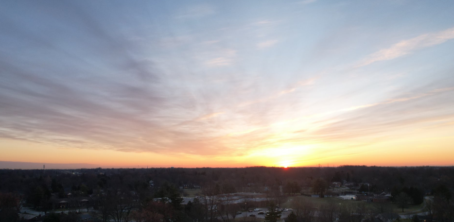
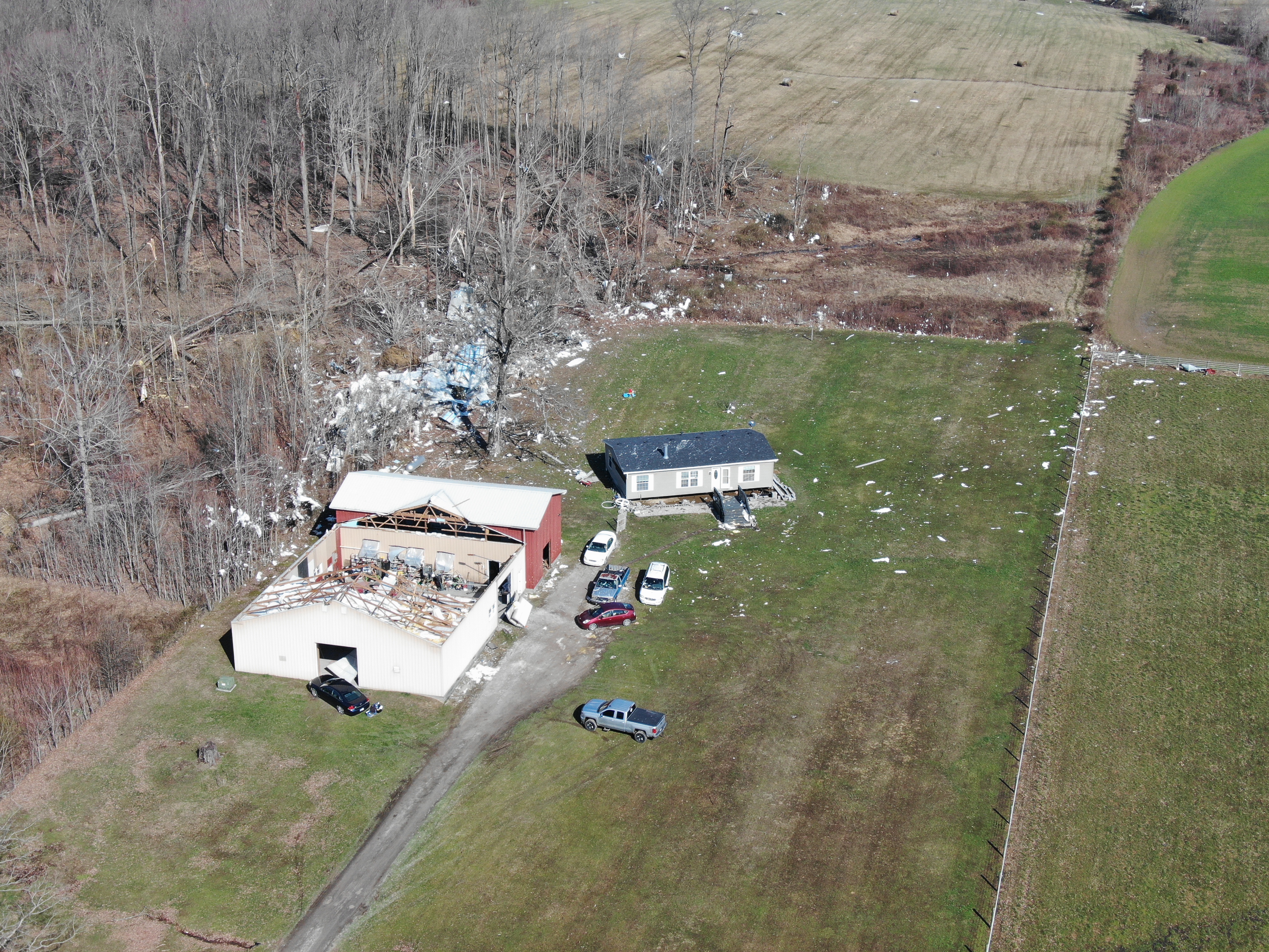
| Tornado damage near Harrodsburg January 12, 2023 | Sunrise February 21 courtesy John Gordon |
Tornado damage associated with a small tornado west of Hanover, Indiana on March 3 | EF-1 tornado damage near Pleasure Ridge Park, KY, on April 5 |
 |
 |
 |
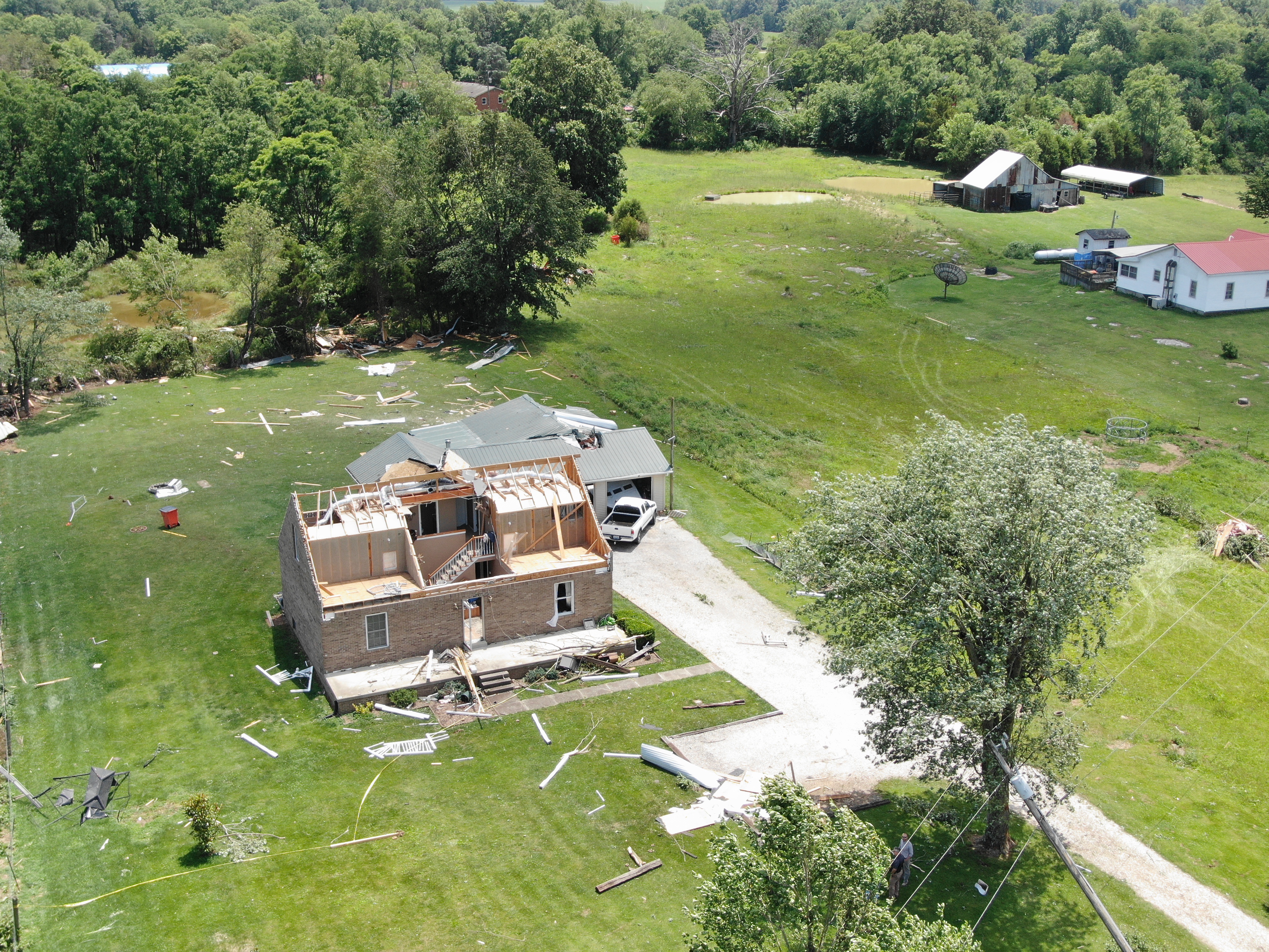 |
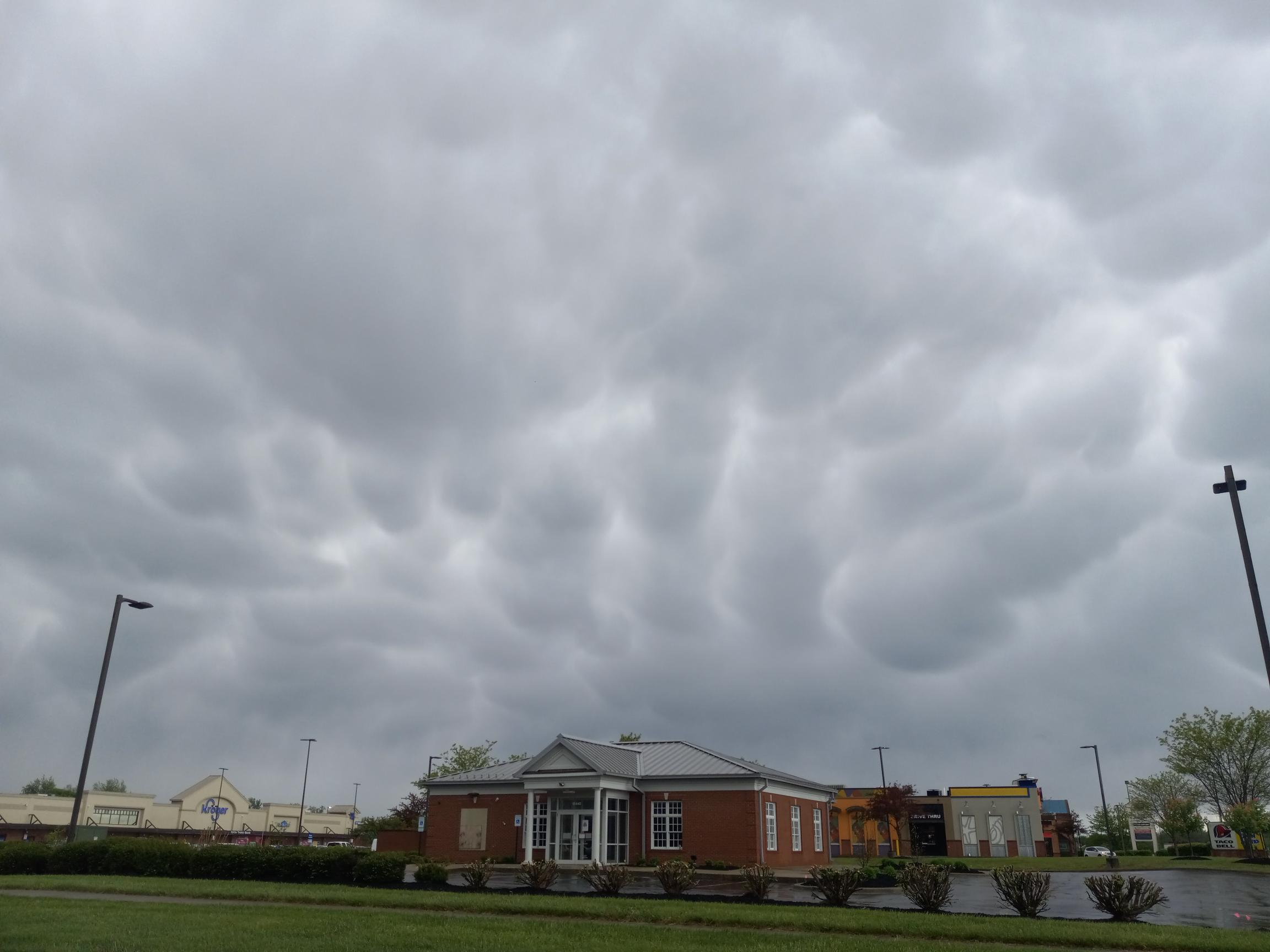
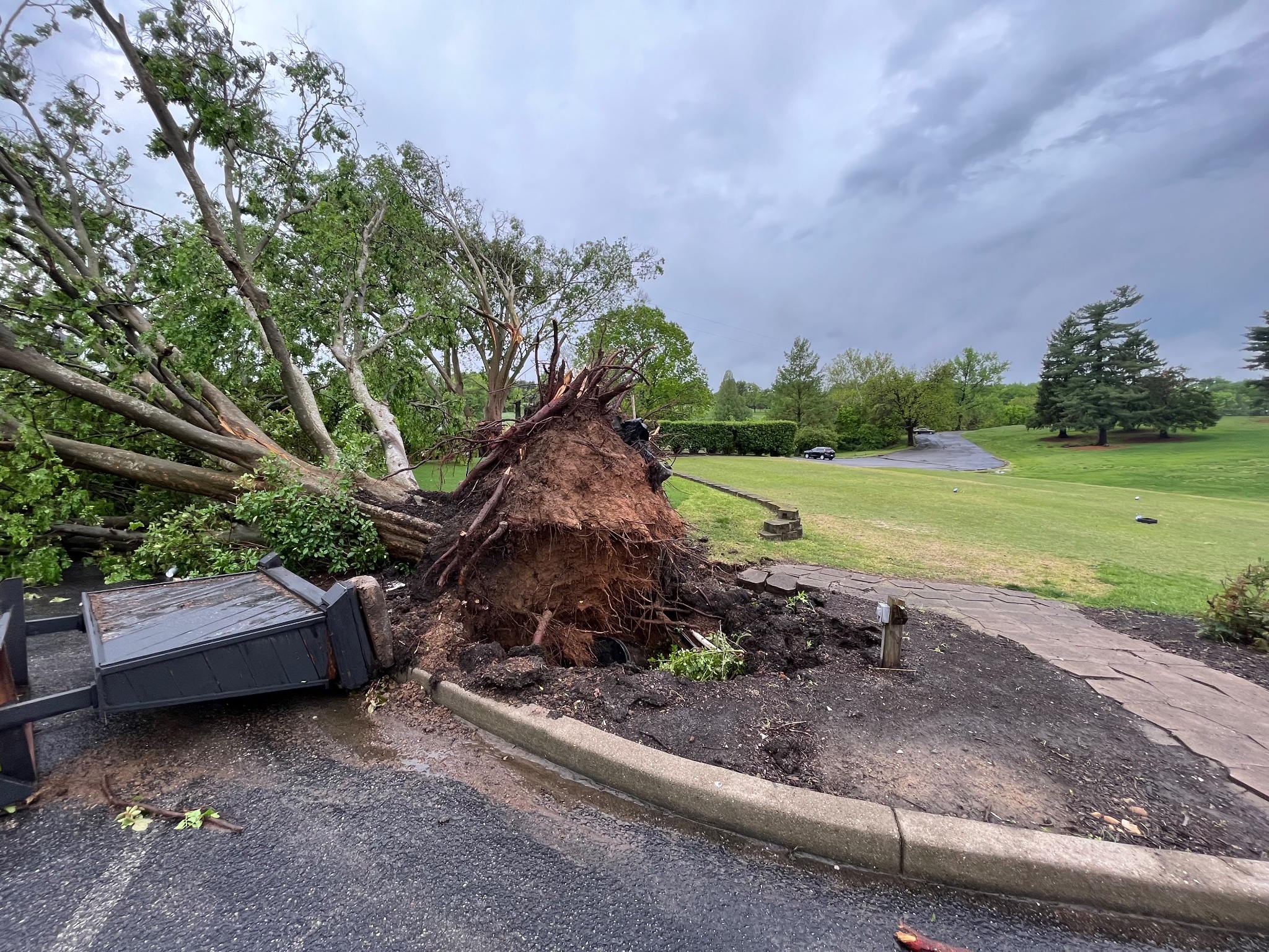
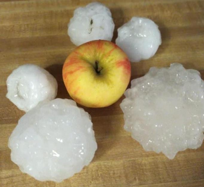
| Stormy skies over Louisville on April 30. | Straight-line winds blew this tree down at Wildwood Country Club in Louisville the morning after Derby on May 7. | Big hail in French Lick, Indiana on June 25. | Tornado damage in Hardin County on June 25. |
 |
 |
 |
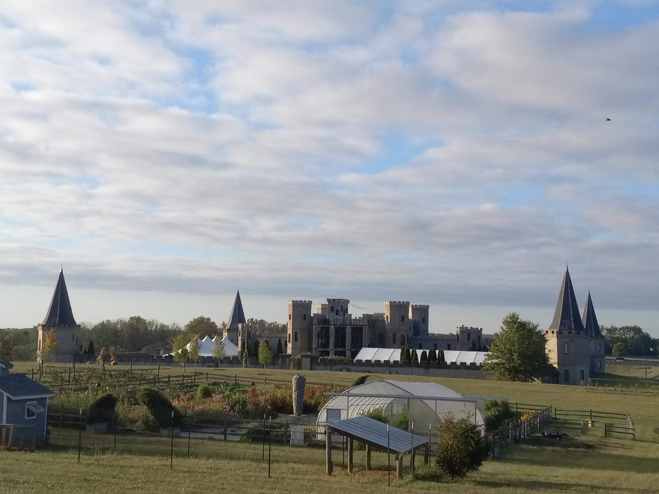 |
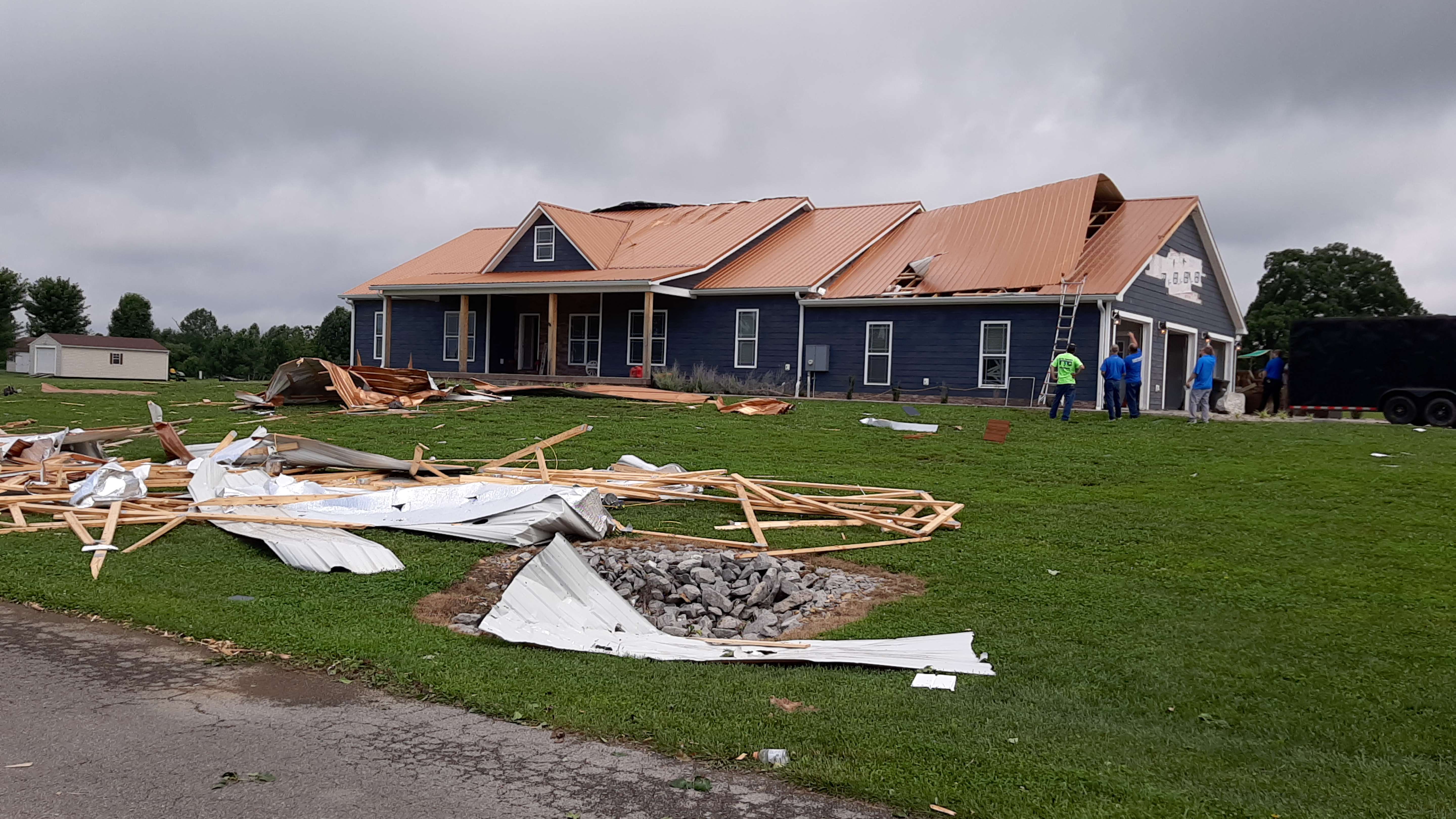
| Tornado damage in Casey County on July 2. | Tornado damage in northern Dubois County on August 7. | Partly cloudy skies over Louisville on September 16. | A partly cloudy sunrise over the Kentucky Castle between Versailles and Lexington on October 7. |


 Weather Story
 Weather Map
 Local Radar