
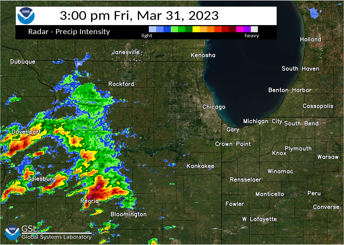
The atmospheric river over the Pacific Northwest will begin to subside today, but lingering rainfall will exacerbate ongoing catastrophic major river flooding, and landslides will continue across portions of western Washington and northwest Oregon for several days. Arctic air will plummet southward into the Northern Plains today, bringing cold air in the single digits to the region by Friday. Read More >
|
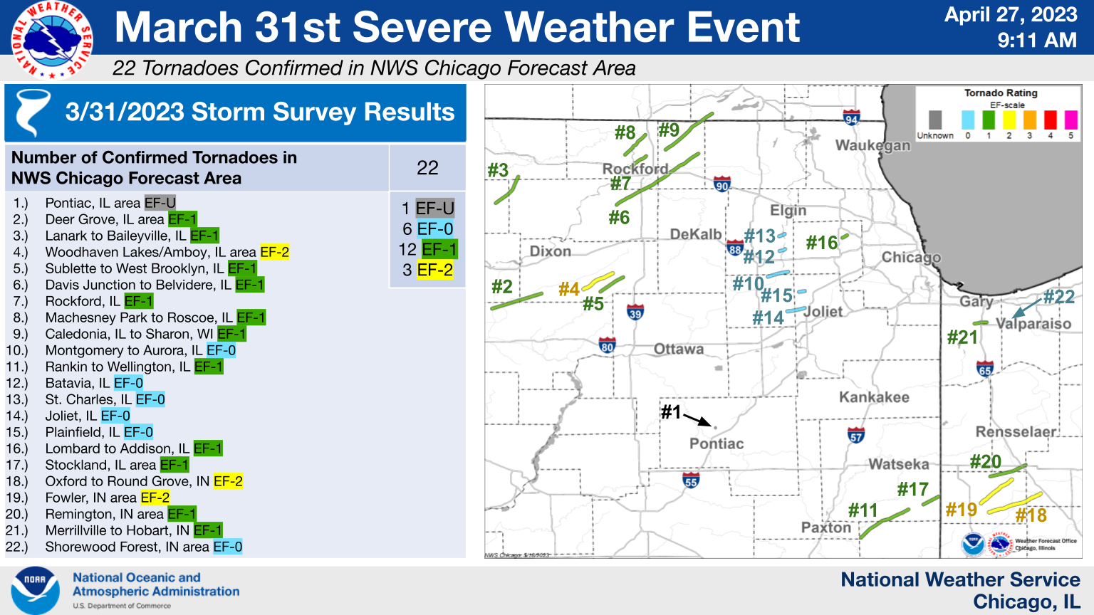
The 22 tornadoes confirmed within the NWS Chicago forecast area |
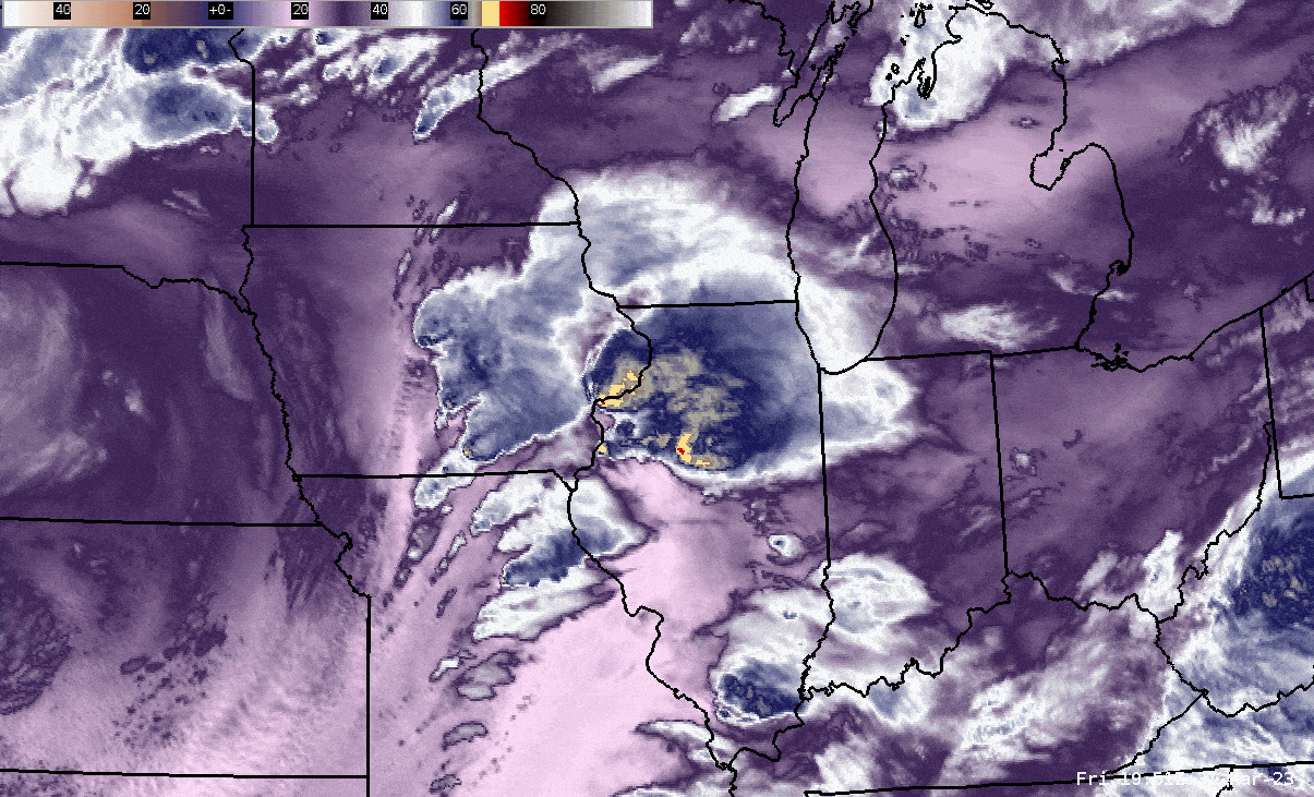
(Click to enlarge loop) Loop of GOES-16 "mid-level" water vapor imagery between approximately 3:00 and 9:30 PM CDT March 31, 2023. |
Fast Facts
|
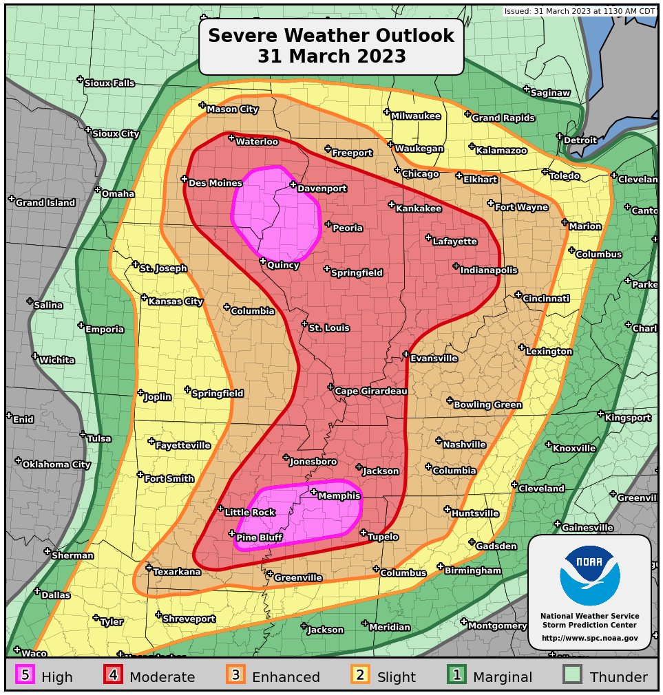
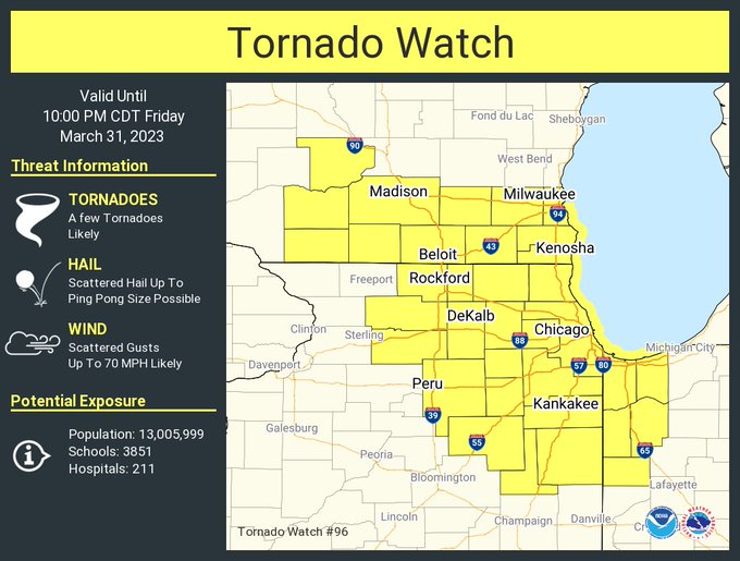
The 11:30 AM Convective Outlook issued by the Storm Prediction Center on Friday, March 31st, featuring two rare "High Risk" areas |
The Tornado Watch that was issued for the area during the early afternoon of March 31st |
Tornadoes
|
The 22 confirmed tornadoes in the NWS Chicago forecast area Downloadable KMZ File with All Tornado Tracks Downloadable Shapefile with All Tornado Tracks
Graphics and GIS data for each individual tornado can be found below. An interactive map with all 22 tornado tracks and other findings of our storm surveys can also be viewed on our Damage Viewer web application (just change the date range in the top right corner to include both 3/31/2023 and 4/1/2023). |
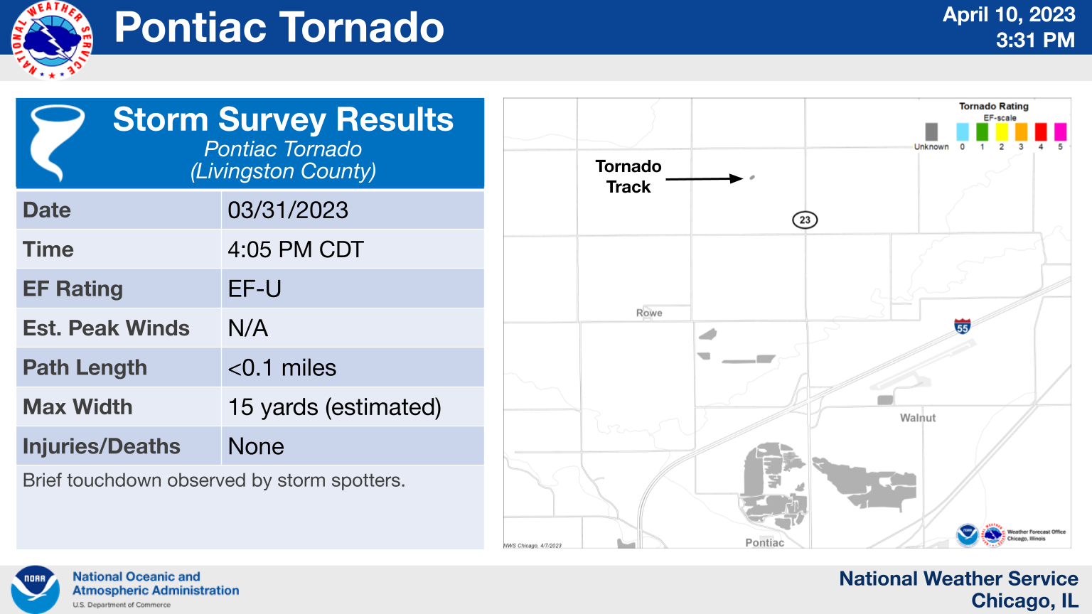
1.) Pontiac, IL Area: EF-U
|
(click on image to enlarge) |
|
This brief tornado occurred north of Pontiac, IL and was captured on video by a storm chaser. It was on the ground for about 10 seconds, only kicking up some dirt before it lifted. Since the tornado did not produce any damage, it has been assigned an EF-Unknown (EF-U) rating. |
2.) Deer Grove, IL Area: EF-1
|
(click on image to enlarge) |
|
This tornado began just south of Illinois Highway 92 in northwest Bureau County in the NWS Quad Cities County Warning Area. It then tracked through far southeast Whiteside County within 3 miles of the town of Deer Grove. This tornado would continue for 6 additional miles into southwest Lee County, where it dissipated near Maytown Road and Atkinson Road. The damage from this tornado included numerous heavily damaged outbuildings, several snapped power poles, and dozens of trees. The worst damage was to a large farmstead outbuilding along the Whiteside and Bureau County border, with the roof and two of the four walls destroyed and debris slung well into a field. |
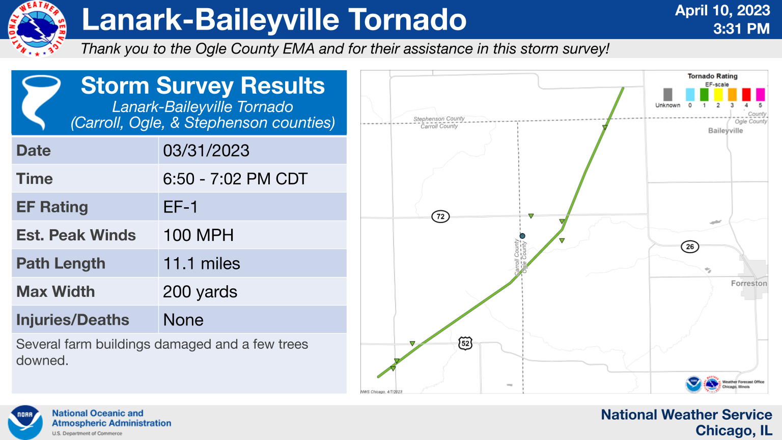
3.) Lanark - Baileyville, IL: EF-1
|
(click on image to enlarge) |
|
This tornado began southeast of Lanark in Carroll County and tracked into northwestern Lee County before lifting shortly after crossing Montague Rd. into Stephenson County west of Baileyville. This tornado caused extensive damage to several farm buildings and also downed a few trees along its path. |
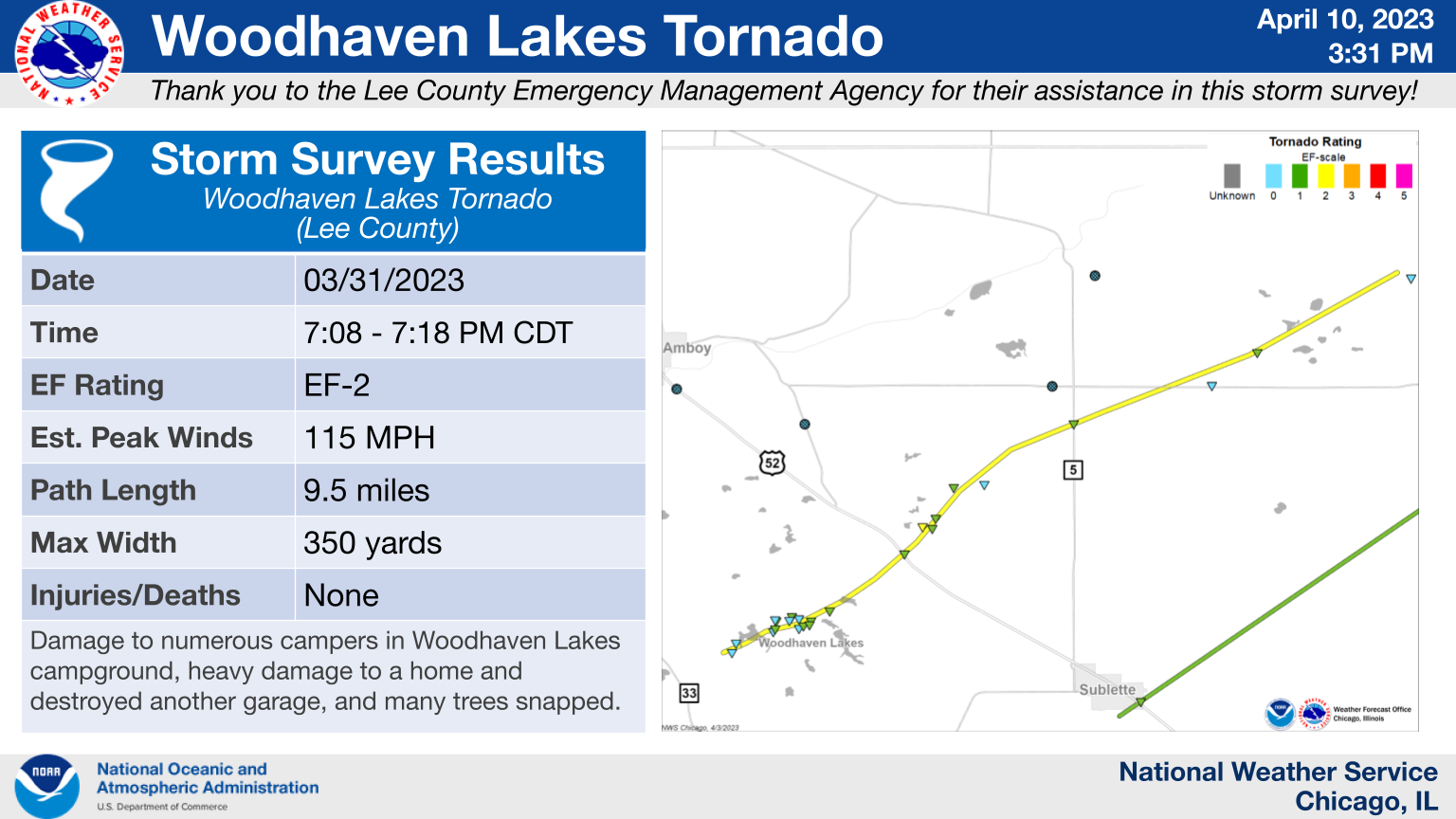
4.) Woodhaven Lakes Campground/Amboy, IL Area: EF-2
|
(click on image to enlarge) |
|
This tornado began in the Woodhaven Lakes campground and tracked across U.S. Highway 52 between Amboy and Sublette. This tornado produced substantial and concentrated tree damage along its track, with several dozen large trees snapped and many branches sheared off. Damage was clearly in a convergent pattern. Multiple campers were damaged, including at least two rolled, in the Woodhaven Lakes campground. Farther along in its path, there were two trees downed on one homestead that was basically demolished. Another nearby homestead had a large garage completely destroyed. The tornado gradually waned in intensity as it crossed Shaw Rd, causing minor damage to an additional outbuilding before lifting as it reached Butler Hill Rd. |
5.) Sublette - West Brooklyn, IL: EF-1
|
(click on image to enlarge) |
|
This tornado appeared to begin just south of Sublette as it crossed U.S. Highway 52, snapping multiple wooden utility poles. This tornado then increased in intensity as it entered the community of West Brooklyn. It downed several large trees, tore the roof of a bank in downtown, and folded an approximately 120 ft. tall tower. One of the wooden beams from the roof of the bank was impaled into a garage roof to its north-northeast. This tornado weakened prior to crossing Illinois Highway 251. |
6.) Davis Junction - Belvidere, IL: EF-1
|
(click on image to enlarge) |
|
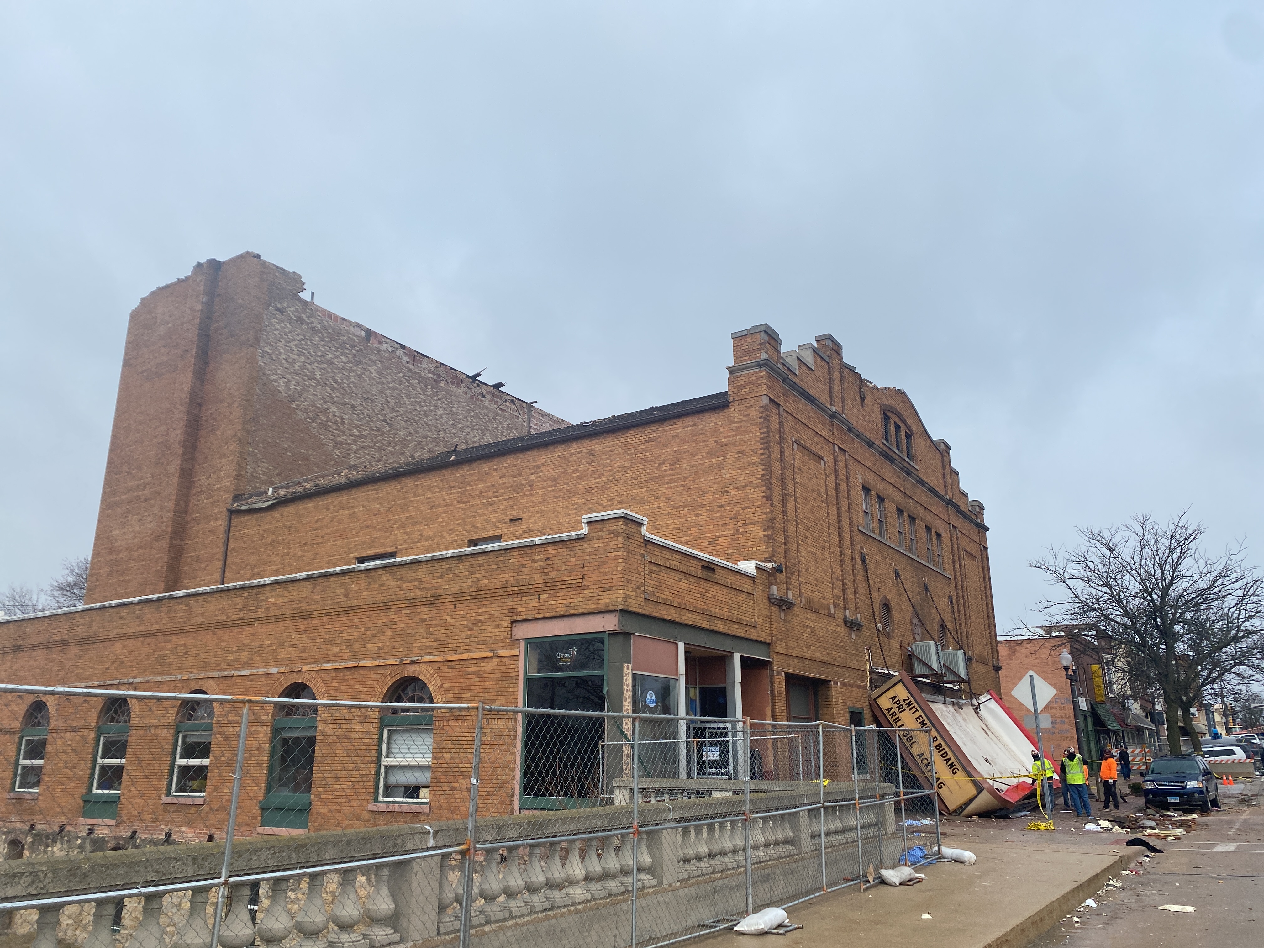
The Davis Junction to Belvidere tornado touched down in the northeast portion of Ogle County southwest of Davis Junction at 724 PM CDT. The tornado tracked northeast through the village of Davis Junction where it caused generally EF-0 damage with isolated EF-1 damage to a single family home on the north side of town. The tornado continued northeast into southeastern Winnebago County, causing generally EF-0 damage to multiple farms as the tornado reached its widest extent of about 600 yards. The tornado then continued into Boone County causing damage to farms. As the tornado neared Belvidere, the width decreased to about a quarter of a mile as it briefly intensified near the central business district. Peak winds estimated at about 100 mph occurred at the Apollo Theatre, where a portion of the roof collapsed, causing 1 fatality and 40 injuries. The tornado continued northeast into rural areas of Boone County, causing EF-0 damage until lifting near Orth Road and Capron Road at about 7:49 PM CDT. |
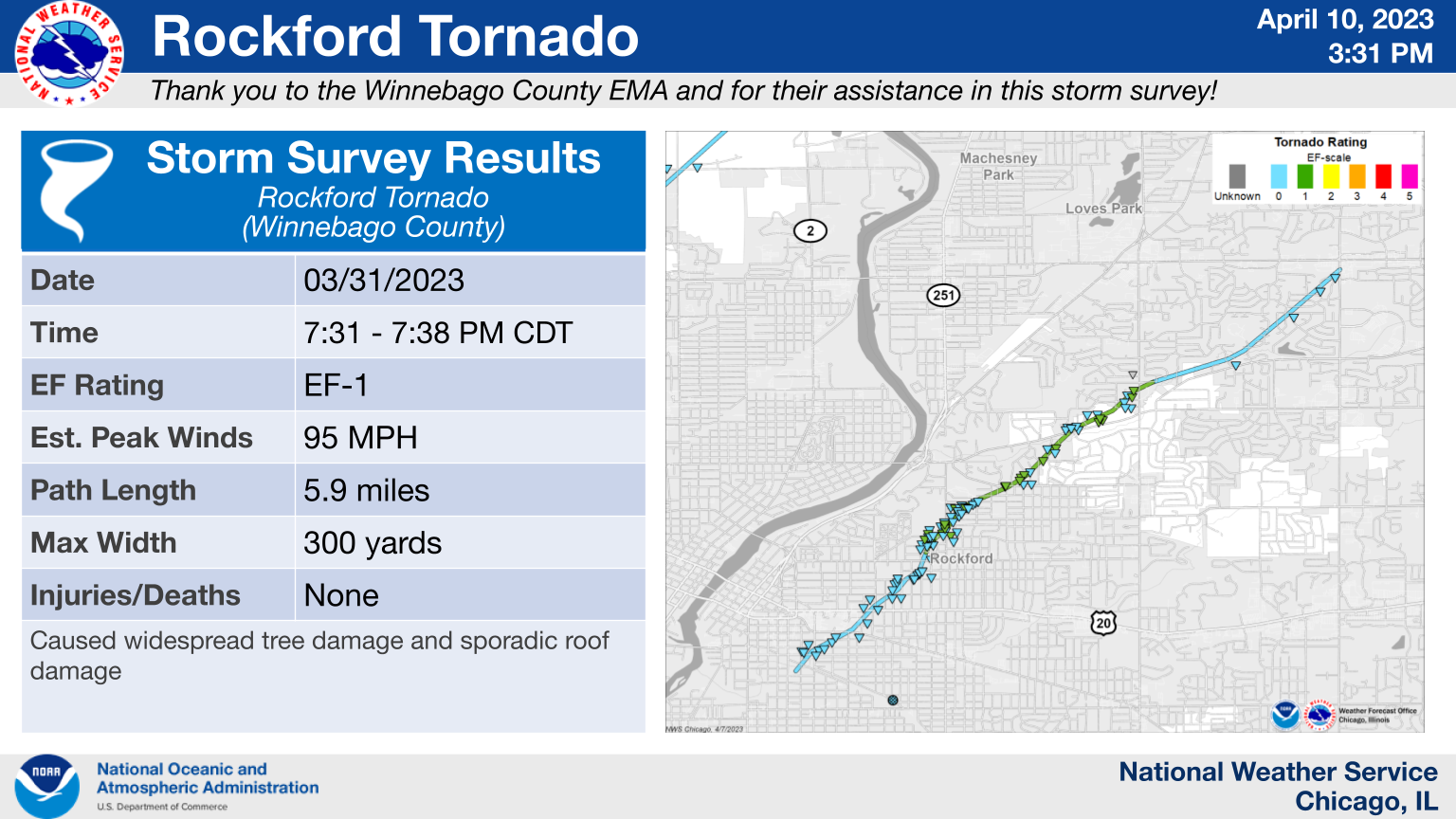
7.) Rockford, IL: EF-1
|
(click on image to enlarge) |
|
This tornado touched down about 1 mile southeast of downtown Rockford southwest of the intersection of Railroad Ave and 8th St. It then tracked northeastward through the city of Rockford for about 7 minutes and just under 6 miles before lifting as it approached the intersection of Riverside Blvd and Mulford Rd. The tornado caused widespread tree damage, which was most concentrated at and near the Sinnissippi Golf Course, where the tornado reached its peak width of about 300 yards. Most structural damage was caused by trees that were uprooted and fell onto houses, but the tornado itself did also cause mostly minor roof damage to multiple homes. |
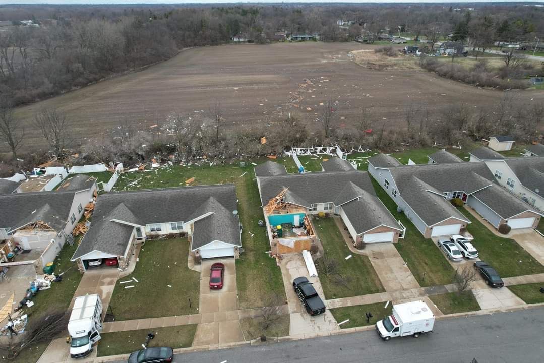
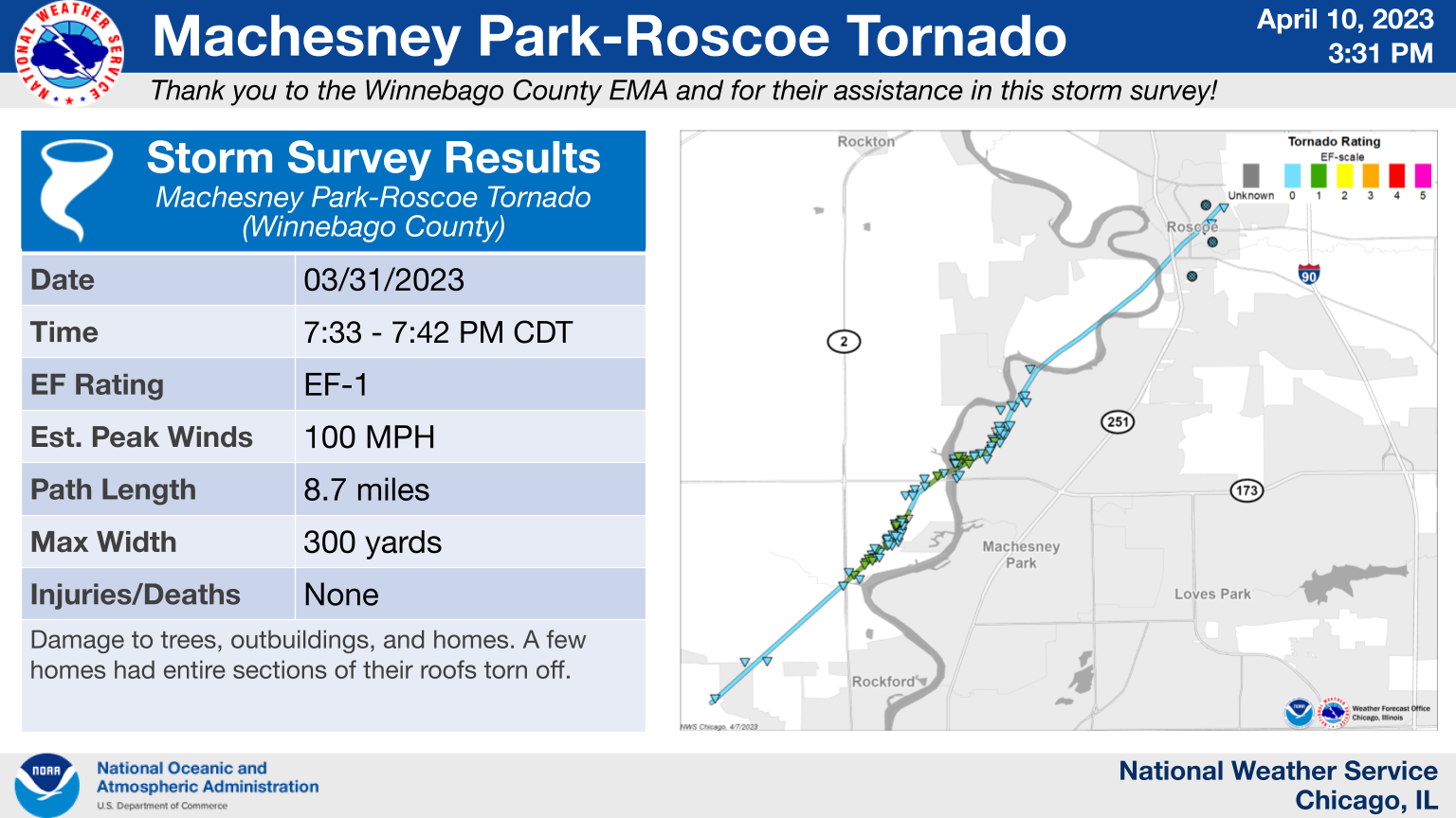
8.) Machesney Park - Roscoe, IL: EF-1
|
(click on image to enlarge) |
|
This tornado began southwest of the intersection of Elmwood Rd. and Rockton Ave. and tracked northeastward for almost 9 miles, straddling the Rock River as it tracked through the west side of Machesney Park before weakening and lifting over Roscoe. This tornado caused damage to several trees and outbuildings, as well as multiple homes, which primarily suffered roof damage. A couple of homes had entire portions of their roofs removed where the tornado was at its peak intensity and featured 90-100 mph winds. |
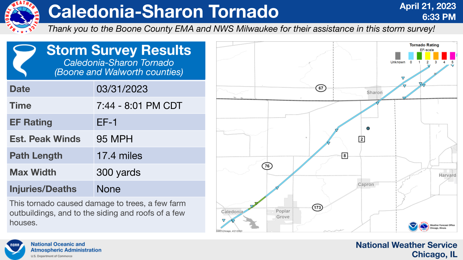
9.) Caledonia, IL - Sharon, WI: EF-1
|
(click on image to enlarge) |
|
The most extensive damage that this tornado caused was to a farm east of Caledonia on IL-173. Numerous outbuildings were destroyed along its track in Boone County. Additionally, a silo was heavily damaged and a grain bin collapsed. The rest of the path in Illinois consisted of tree damage and occasional light damage to farm outbuildings. There were also a few homes near Candlewick Lake southeast of Caledonia that sustained roof and siding damage. The tornado then continued into Wisconsin, where it went through rural areas, mainly causing damage to roofing materials on a few barns before lifting northeast of the village of Sharon. |
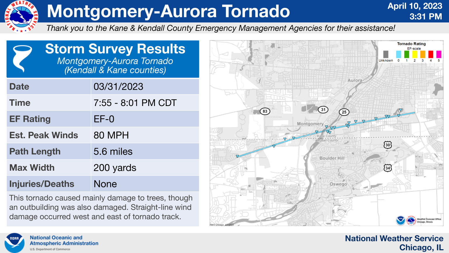
10.) Montgomery - Aurora, IL: EF-0
|
(click on image to enlarge) |
|
This tornado began near the intersection of Concord Drive and Columbia Lane in Montgomery and tracked northeast over the Fox River before dissipating near Phillips Park in Aurora. The tornado caused minor damage to an outbuilding shortly after onset, but most of the damage was confined to trees and consistent with wind speeds of 80 mph. There was also evidence of straight-line wind damage to trees near the tornado path. |
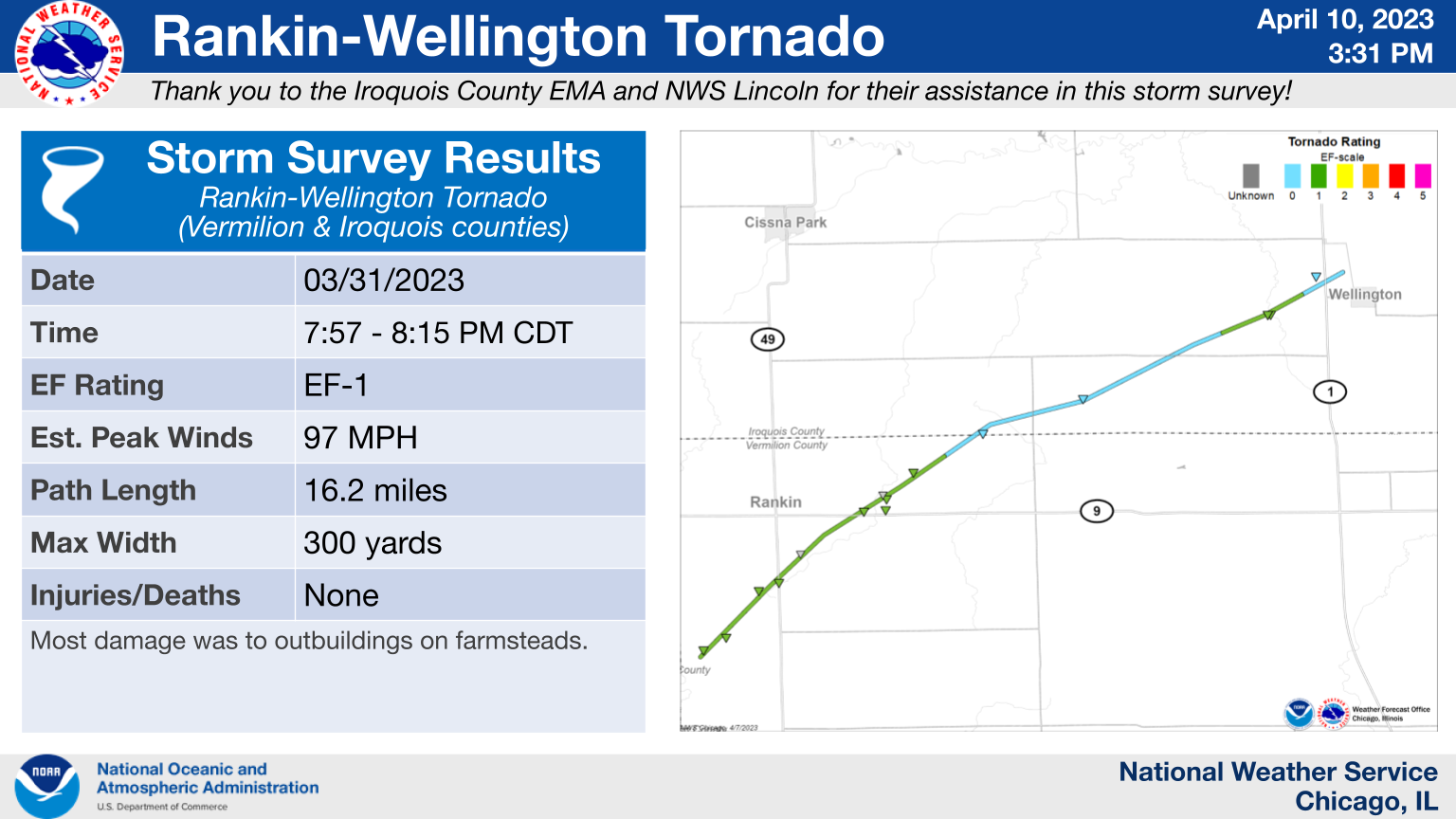
11.) Rankin - Wellington, IL: EF-1
|
(click on image to enlarge) |
|
A tornado formed over the northwest part of Vermilion County near CR-3800N with the first visible damage of uprooted trees and a nearby shed at CR-3800N and 170E occurring at approximately 7:57 PM CDT. There was a consistent path of destruction and indicators, including distinct swirls over roads in a line from 4 miles south-southwest of Rankin to just north of Wellington. |
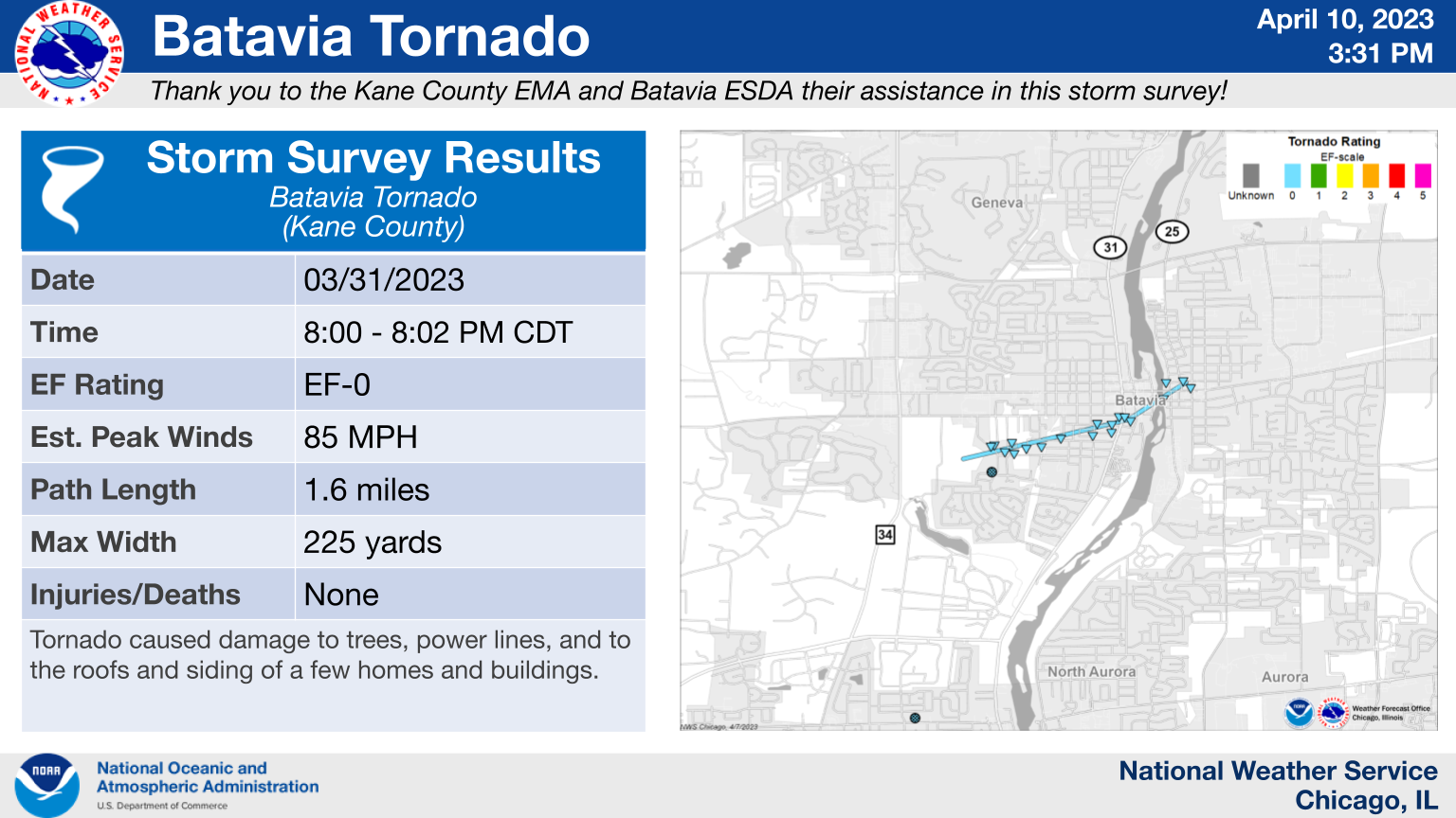
12.) Batavia, IL: EF-0
|
(click on image to enlarge) |
|
This tornado began in an open field south of Engstrom Family Park and tracked east-northeast towards downtown Batavia before lifting shortly after it crossed the Fox River near Wilson St. Damage along the tornado`s path consisted of several uprooted and damaged trees, downed fences, downed power lines, roof shingles peeled off of houses, and a toppled chimney. |
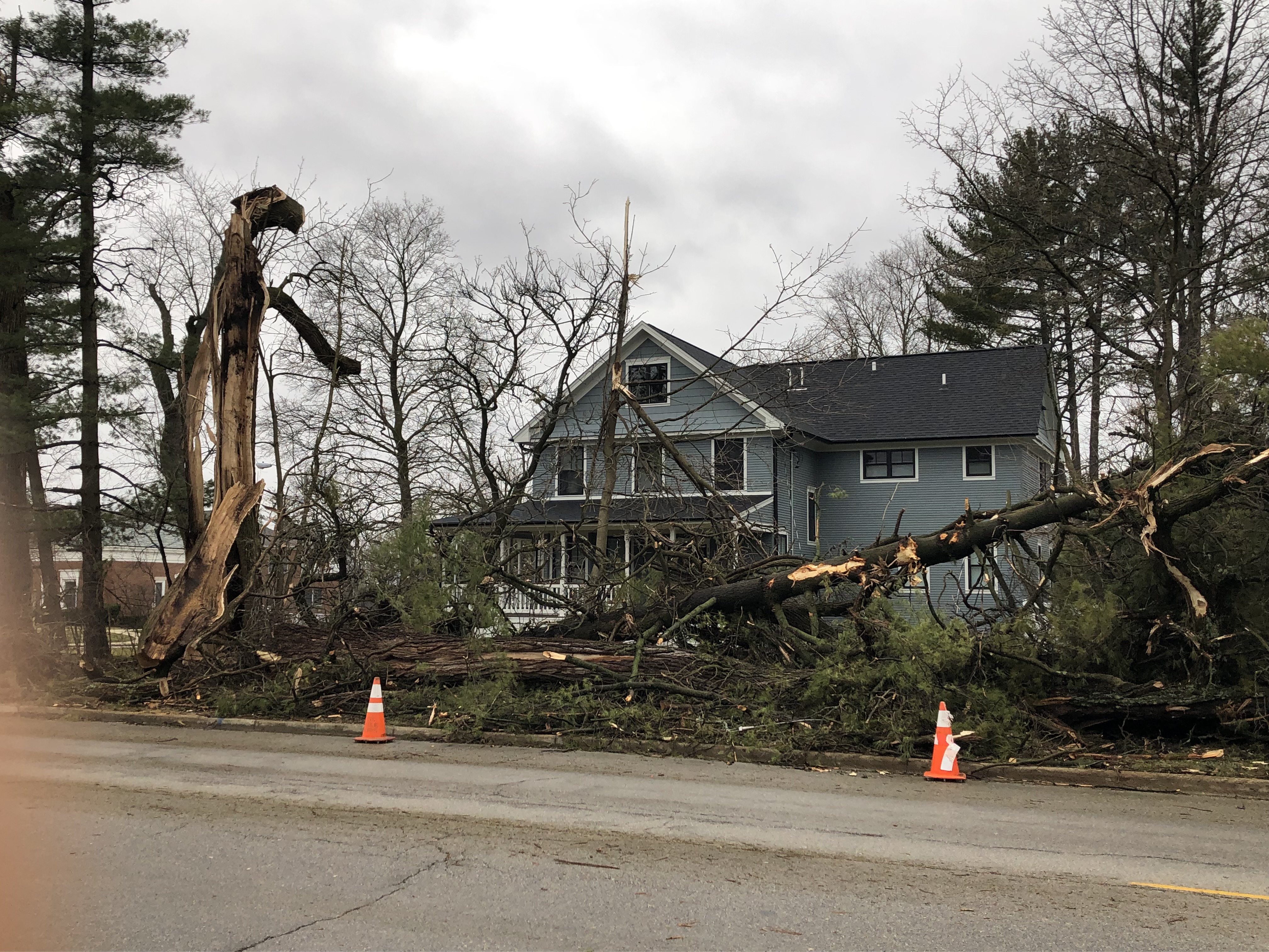
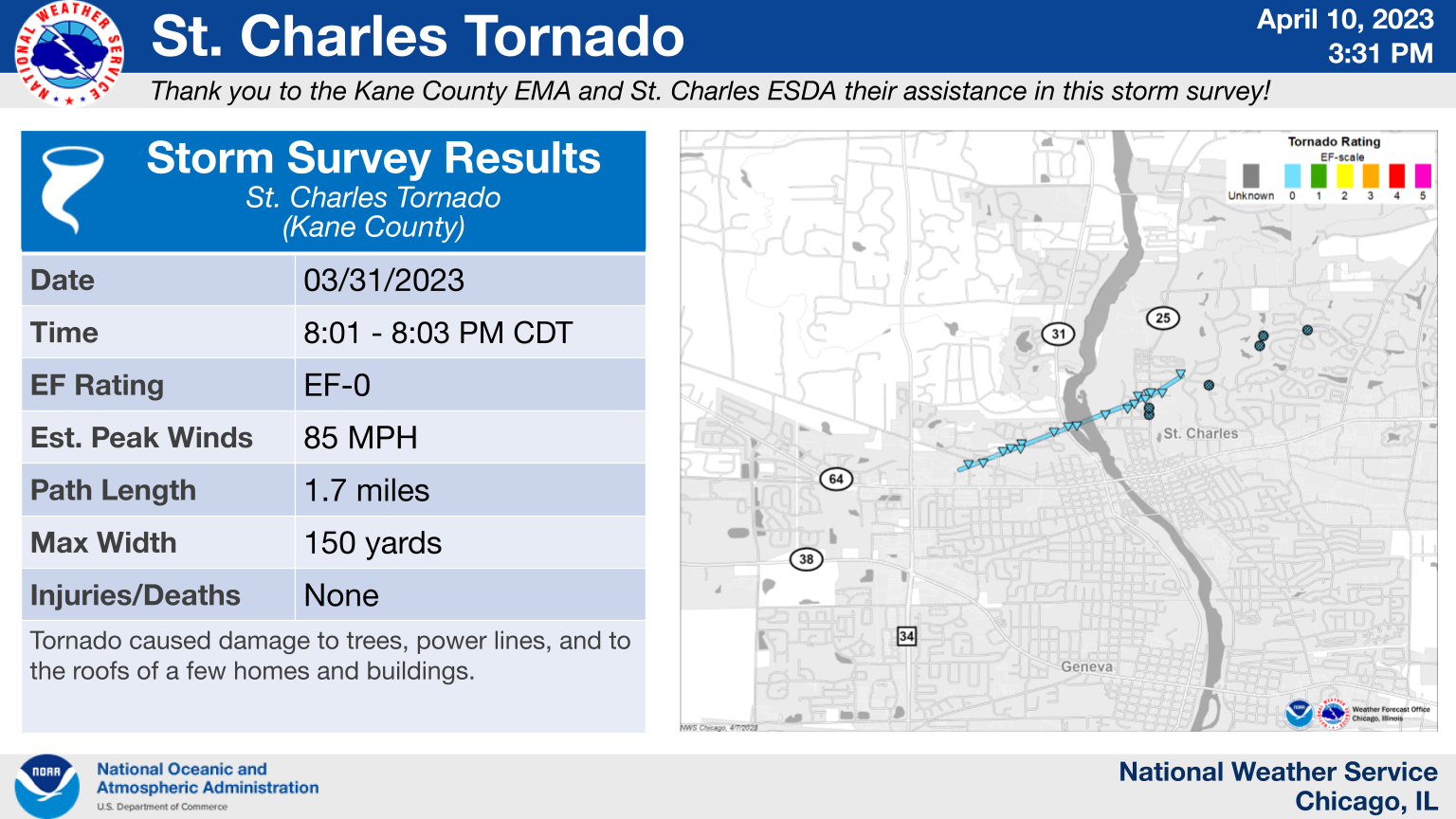
13.) St. Charles, IL: EF-0
|
(click on image to enlarge) |
|
This tornado began south of Dean St. near 15th St. and tracked northeast, passing over Boy Scout Island and the Fox River before lifting shortly after it crossed Illinois Route 25. Damage along the tornado`s path consisted of several uprooted and damaged trees, downed power lines, roof shingles peeled off of houses, and a damaged HVAC unit on the roof of a construction facility. |
14.) Joliet, IL: EF-0
|
(click on image to enlarge) |
|
This tornado began near the intersection of Arbeiter and Black roads in eastern Kendall County and damaged several homes in neighborhoods, causing shingle damage and the collapse of a chimney. A trampoline was also thrown into a tree. The tornado then crossed into Will County, causing additional damage to shingles and trees near Troy Middle School. The tornado lifted shortly before reaching Illinois Route 59, but straight-line wind damage continued farther to the east past Interstate 55. |
15.) Plainfield, IL: EF-0
|
(click on image to enlarge) |
|
The tornado began near W 135th Street just west of Meadow Lane and tracked east northeast before weakening near Illinois Route 59. The damage was confined to primarily trees, but some shingles and siding were removed from homes along the path, consistent with the 80 mph EF-0 rating. |
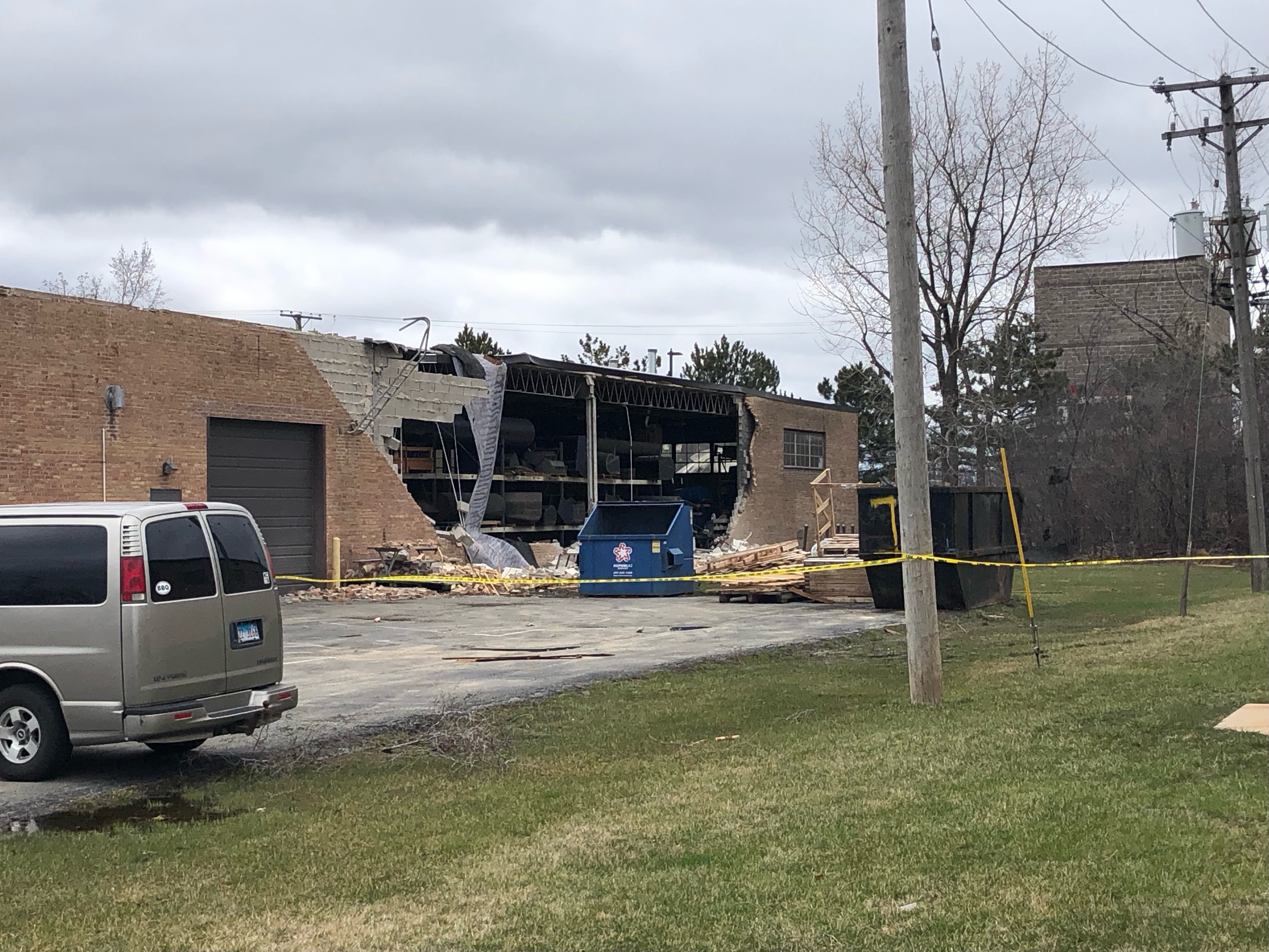
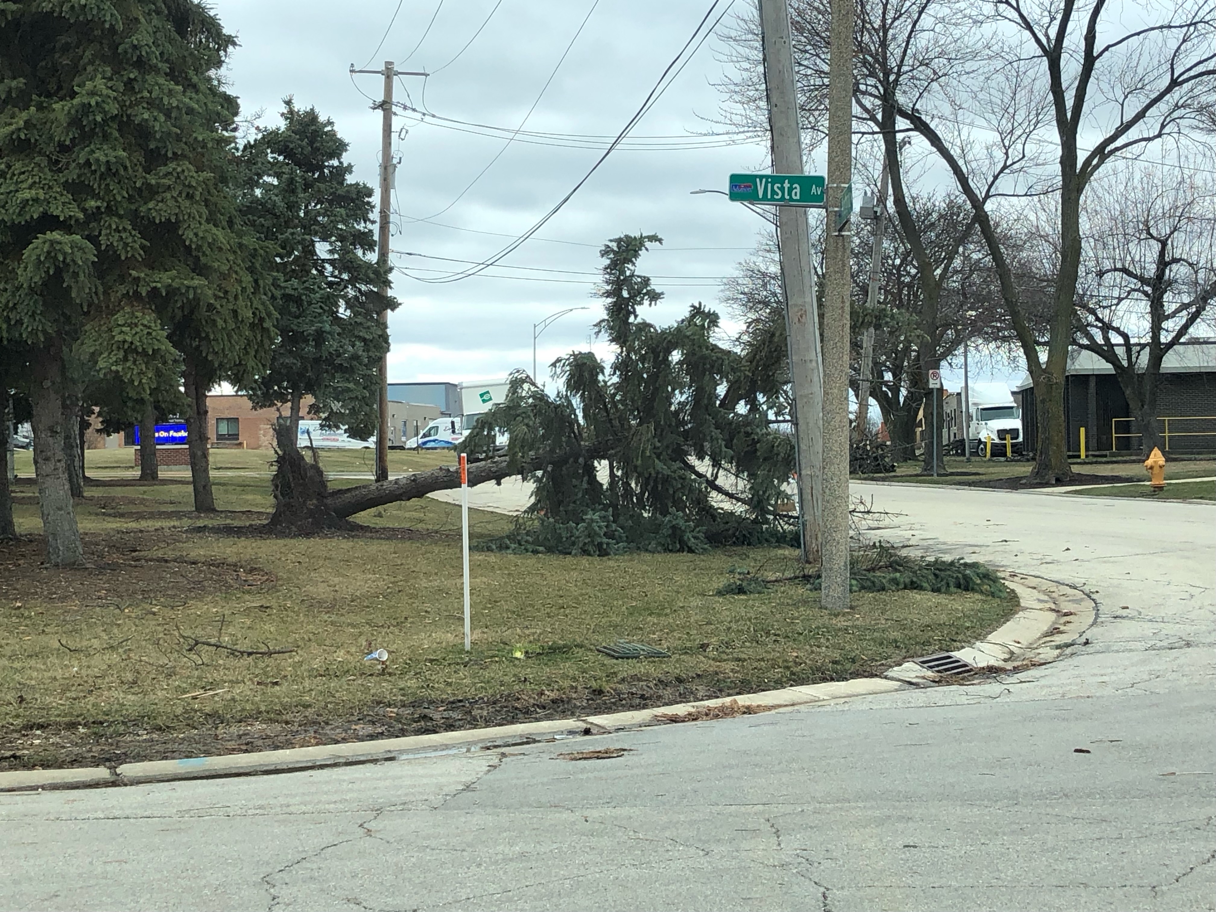
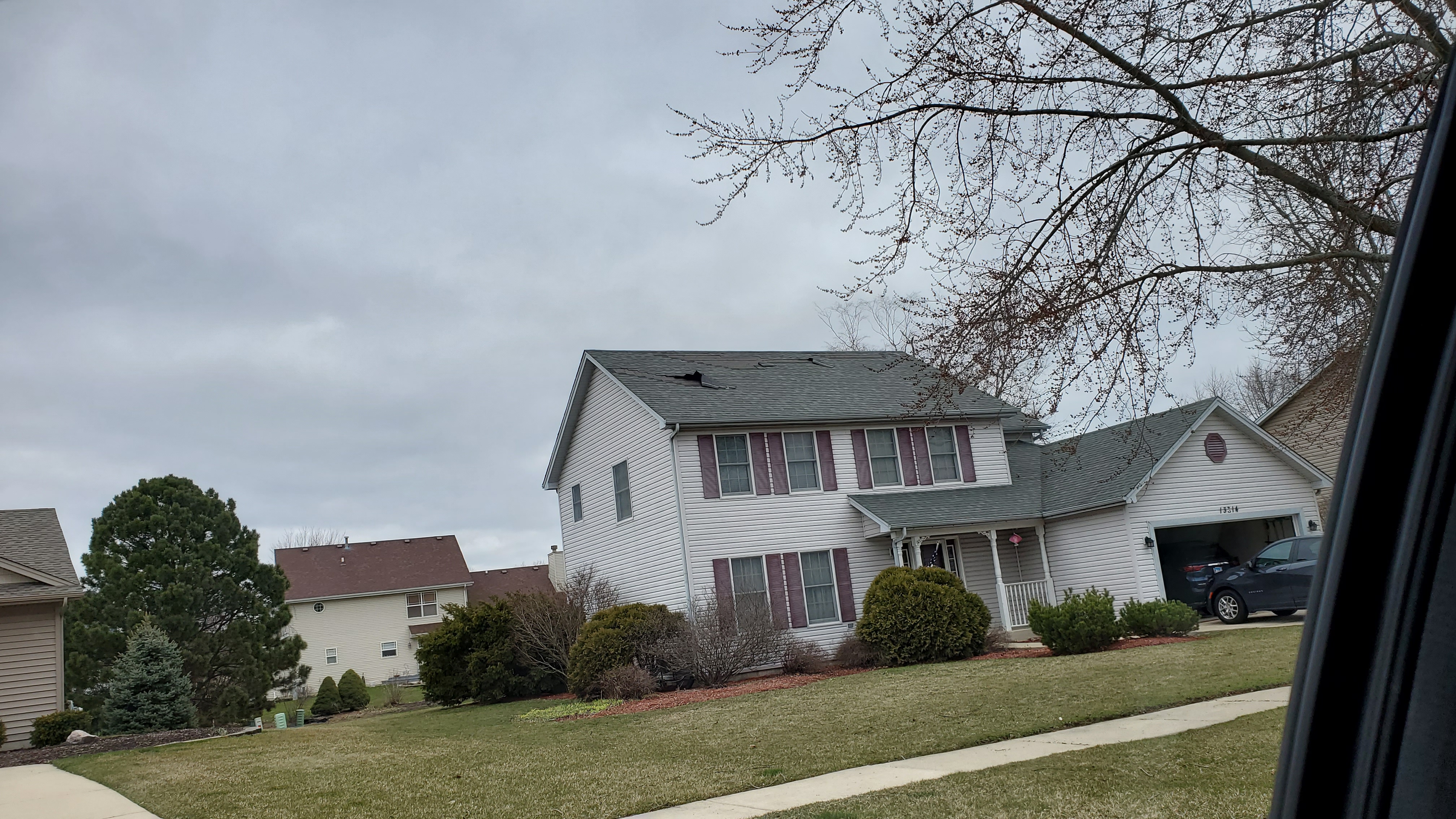
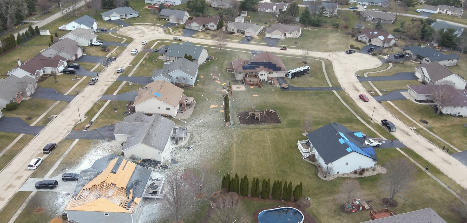
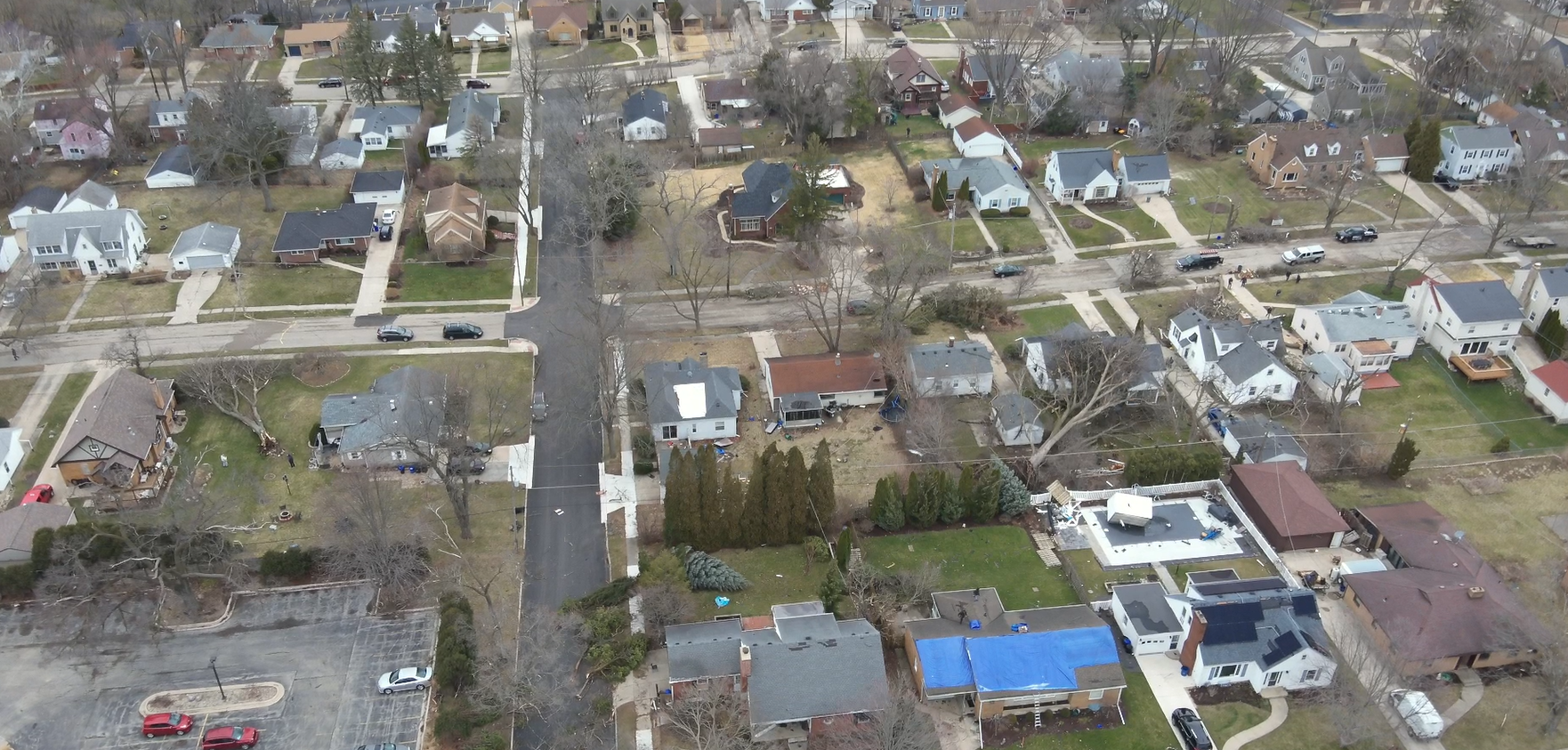
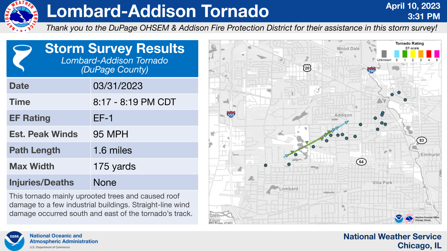
16.) Lombard - Addison, IL: EF-1
|
(click on image to enlarge) |
|
This tornado began in an industrial park on the far north side of Lombard where it caused roof damage to a couple of buildings. It then tracked into Addison, where security camera footage from a fire station captured it causing roof damage to nearby office buildings. The tornado then caused primarily tree damage as it tracked across a residential area of Addison south of Fullerton Ave. before lifting as it crossed Fullerton Ave. at Hale St. To the south and east of the tornado`s track, a wider swath of damage caused by straight-line winds of up to approximately 85 mph was noted. This damage included additional instances of roof damage to office buildings, a large portion of a roof peeled off an apartment complex, a semi truck blown over on I-290, and damage to a billboard and brick sound barriers along I-290. |
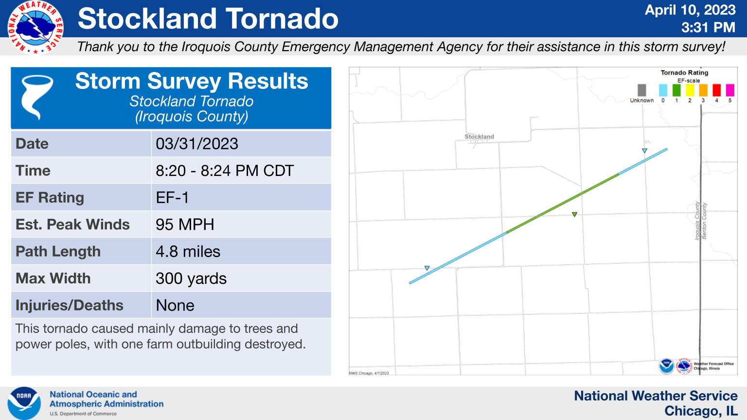
17.) Stockland, IL Area: EF-1
|
(click on image to enlarge) |
|
A brief EF-1 tornado occurred south of Stockland causing damage to trees, power poles, and leading to the destruction of at least one small farm outbuilding. |
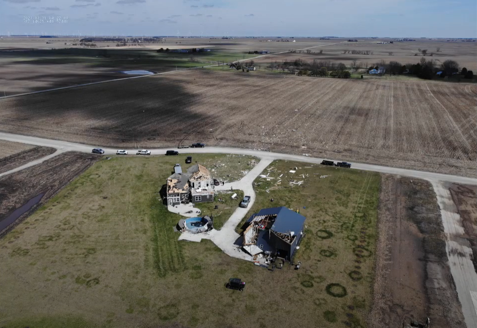
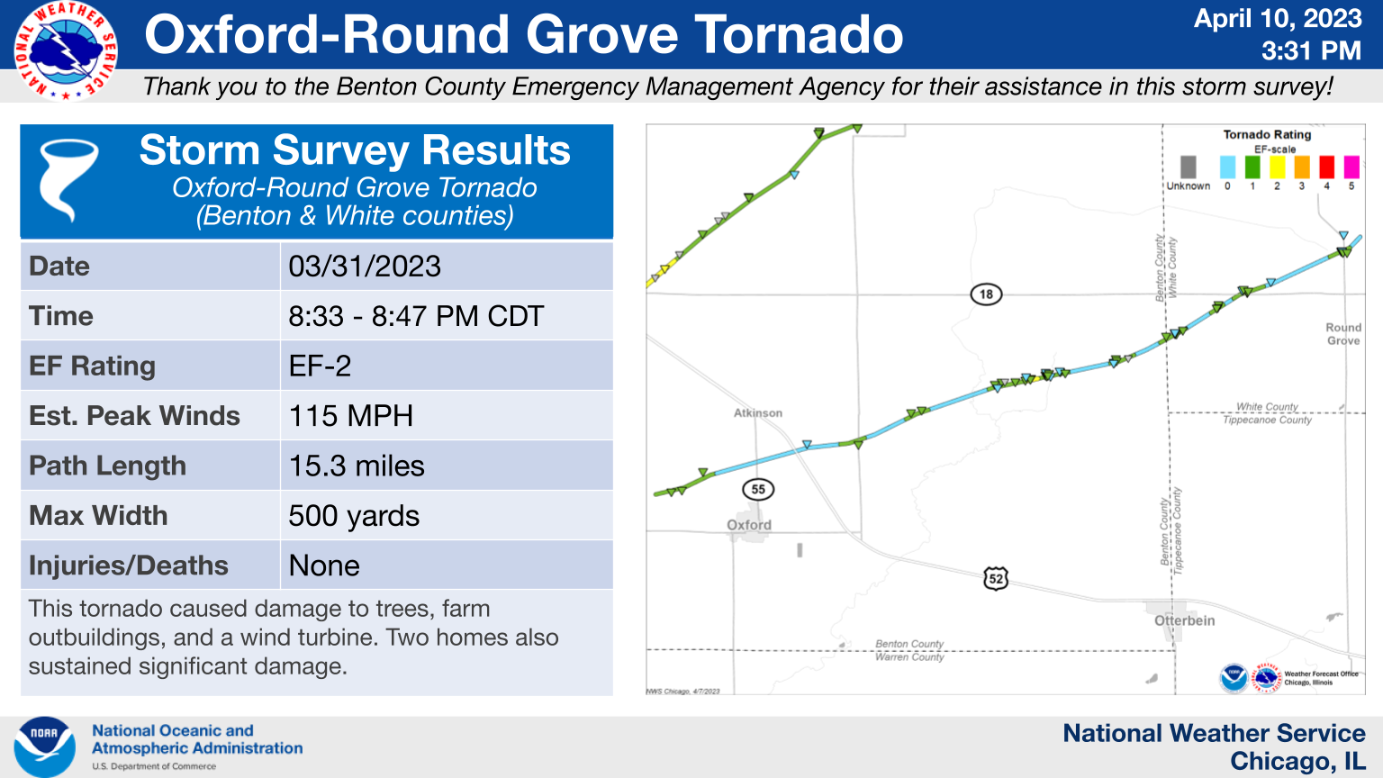
18.) Oxford - Round Grove, IN: EF-2
|
(click on image to enlarge) |
|
This EF-2 tornado primarily downed trees and power poles and damaged farm outbuildings. However, the tornado also caused damage to a few homes, two of which were significantly damaged. |
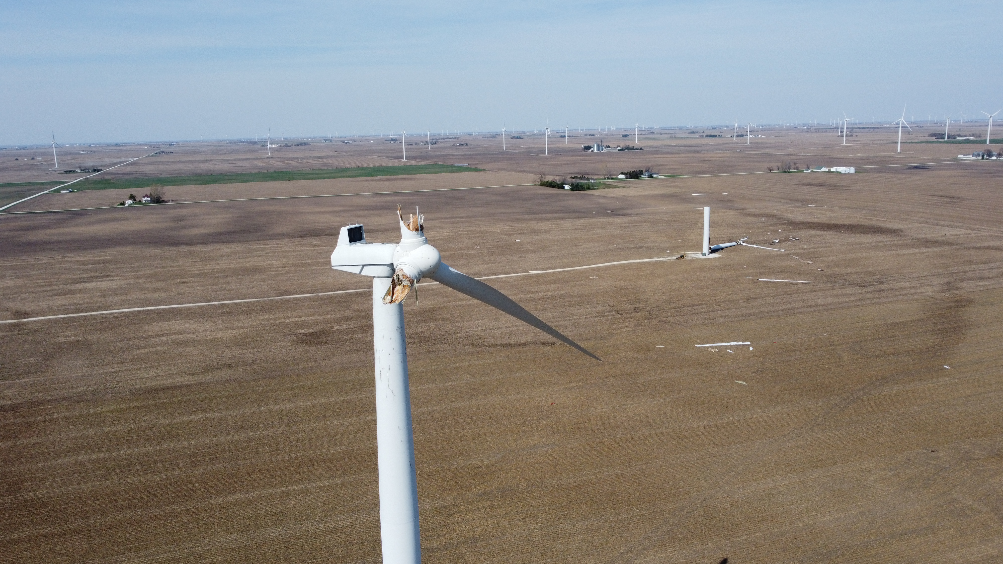
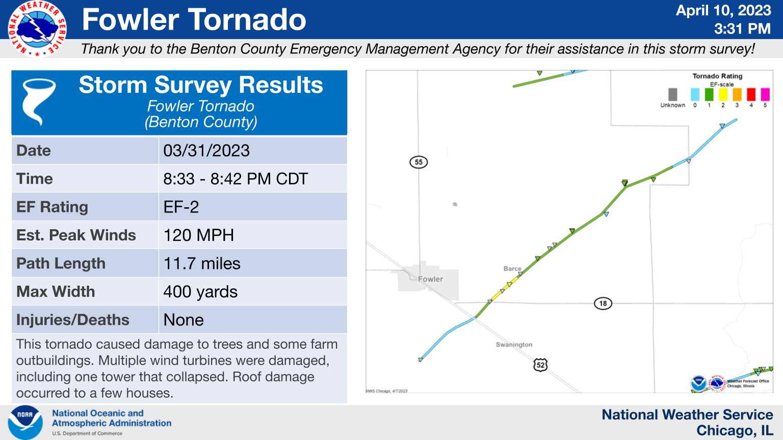
19.) Fowler, IN Area: EF-2
|
(click on image to enlarge) |
|
This EF-2 tornado damaged a few homes and multiple wind turbines, including one wind turbine that was snapped about halfway up. This tornado also downed trees and power poles along its 11.7 mile path. |
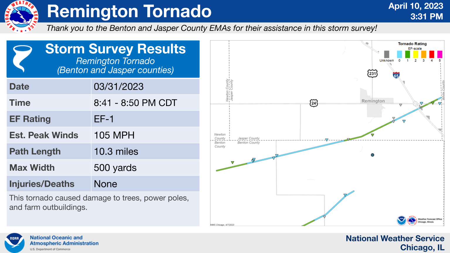
20.) Remington, IN Area: EF-1
|
(click on image to enlarge) |
|
Most of the damage caused by this EF-1 tornado consisted of snapped power poles, downed trees, and damage to small farm outbuildings. |
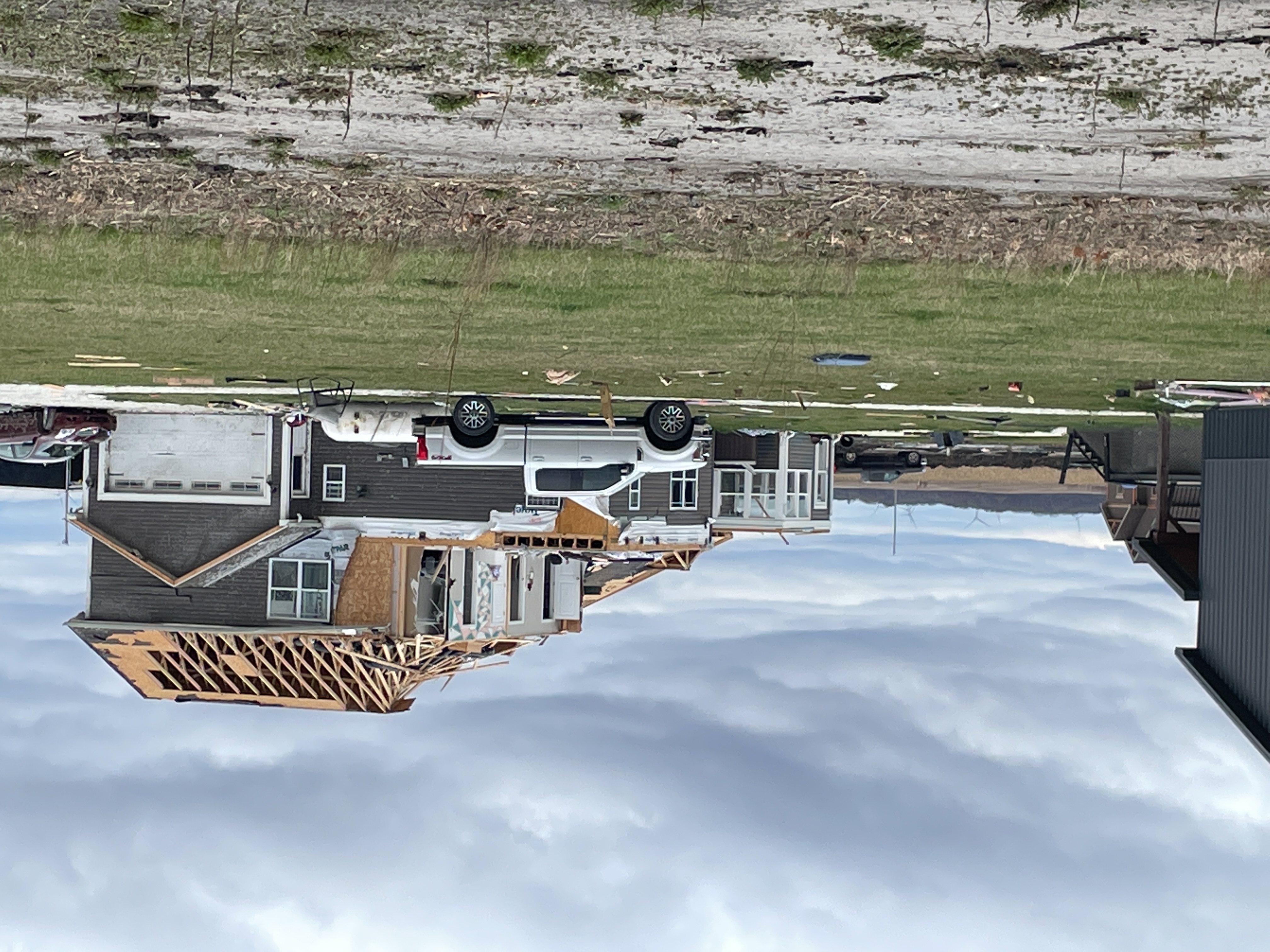
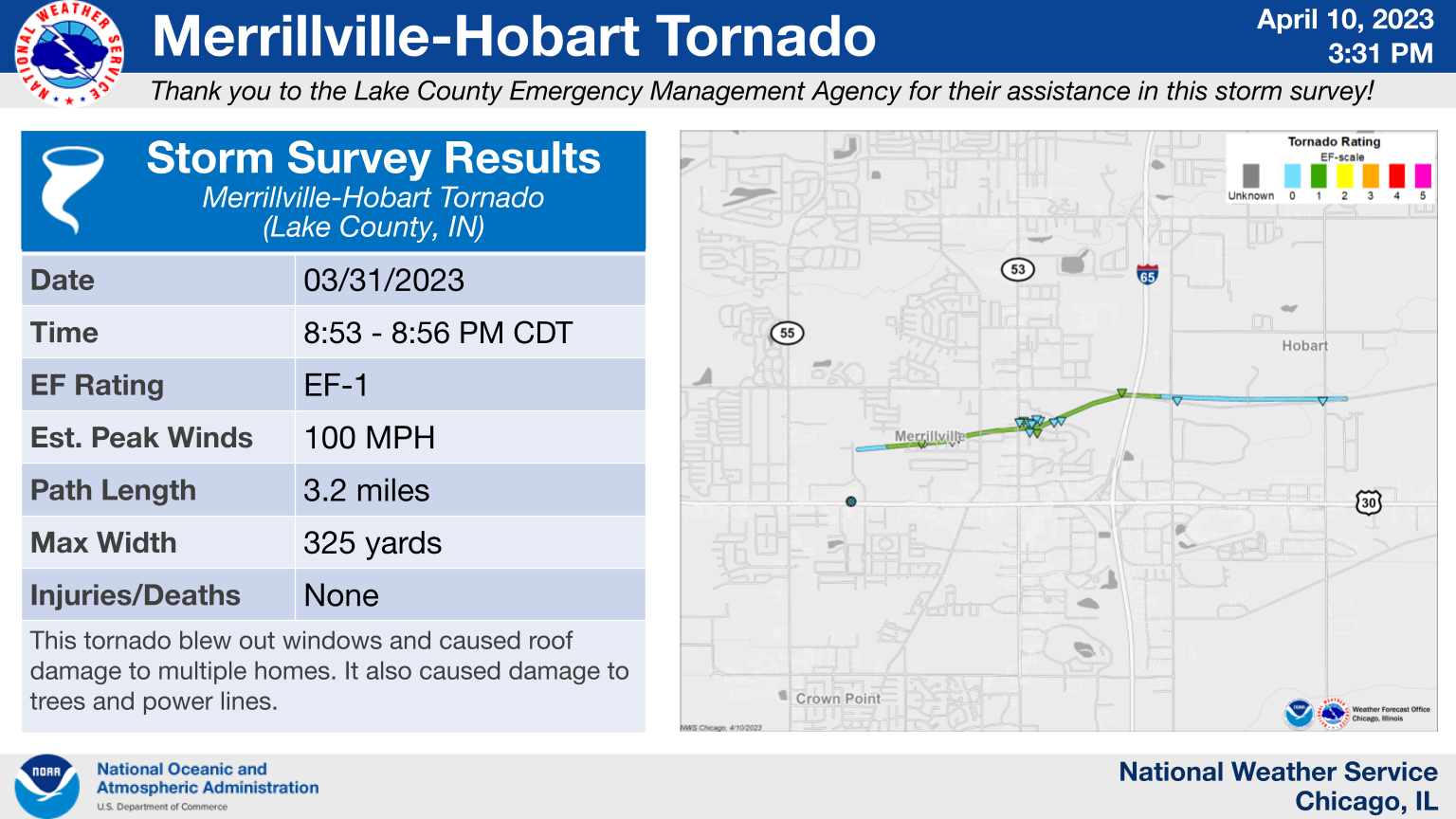
21.) Merrillville - Hobart, IN: EF-1
|
(click on image to enlarge) |
|
This tornado touched down north of U.S. Route 30 near Grant St. in Merrillville and then tracked eastward for roughly 3.3 miles before lifting over the far south side of Hobart. The tornado blew out windows and tore sections of roofs off of multiple homes where its winds were able to compromise the residences` garage doors. The tornado also caused damage to power lines and several trees along its path. |
22.) Shorewood Forest, IN Area: EF-0
|
(click on image to enlarge) |
|
This brief EF-0 tornado damaged trees, outbuildings, and farm equipment over its short 0.6 mile long track. |
The Enhanced Fujita (EF) Scale classifies tornadoes into the following categories:
| EF0 Weak 65-85 mph |
EF1 Moderate 86-110 mph |
EF2 Significant 111-135 mph |
EF3 Severe 136-165 mph |
EF4 Extreme 166-200 mph |
EF5 Catastrophic 200+ mph |
 |
|||||
When a tornado is known to have occurred but does not cause damage to any qualified damage indicators, or if the only damage is located in an area that is inaccessible to NWS storm survey personnel, then a tornado may be assigned the EF-Unknown (EF-U) rating.
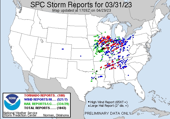
Storm Reports
|
Map of preliminary storm reports for March 31, 2023 |
|
Preliminary National Storm Reports for March 31, 2023 Interactive Map of Preliminary Storm Reports for March 31, 2023 |
In the NWS Chicago forecast area, over 100 reports of damaging winds, hail, and flooding were received. A total of 22 tornadoes were also confirmed. Click on the links below to see a listing of quality-controlled storm reports:
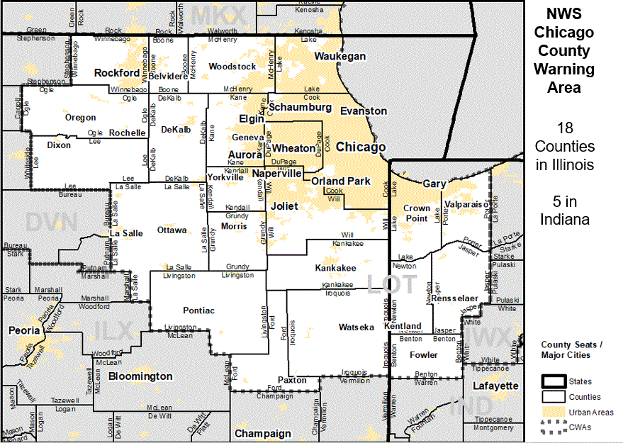
(Winnebago, Boone, McHenry, Lake, Ogle, Lee, DeKalb, Kane, DuPage, Cook, La Salle, Grundy, Kendall, Will, Kankakee, Livingston, Ford, and Iroquois)
(Lake, Porter, Newton, Jasper, and Benton)
Photos
 |
 |
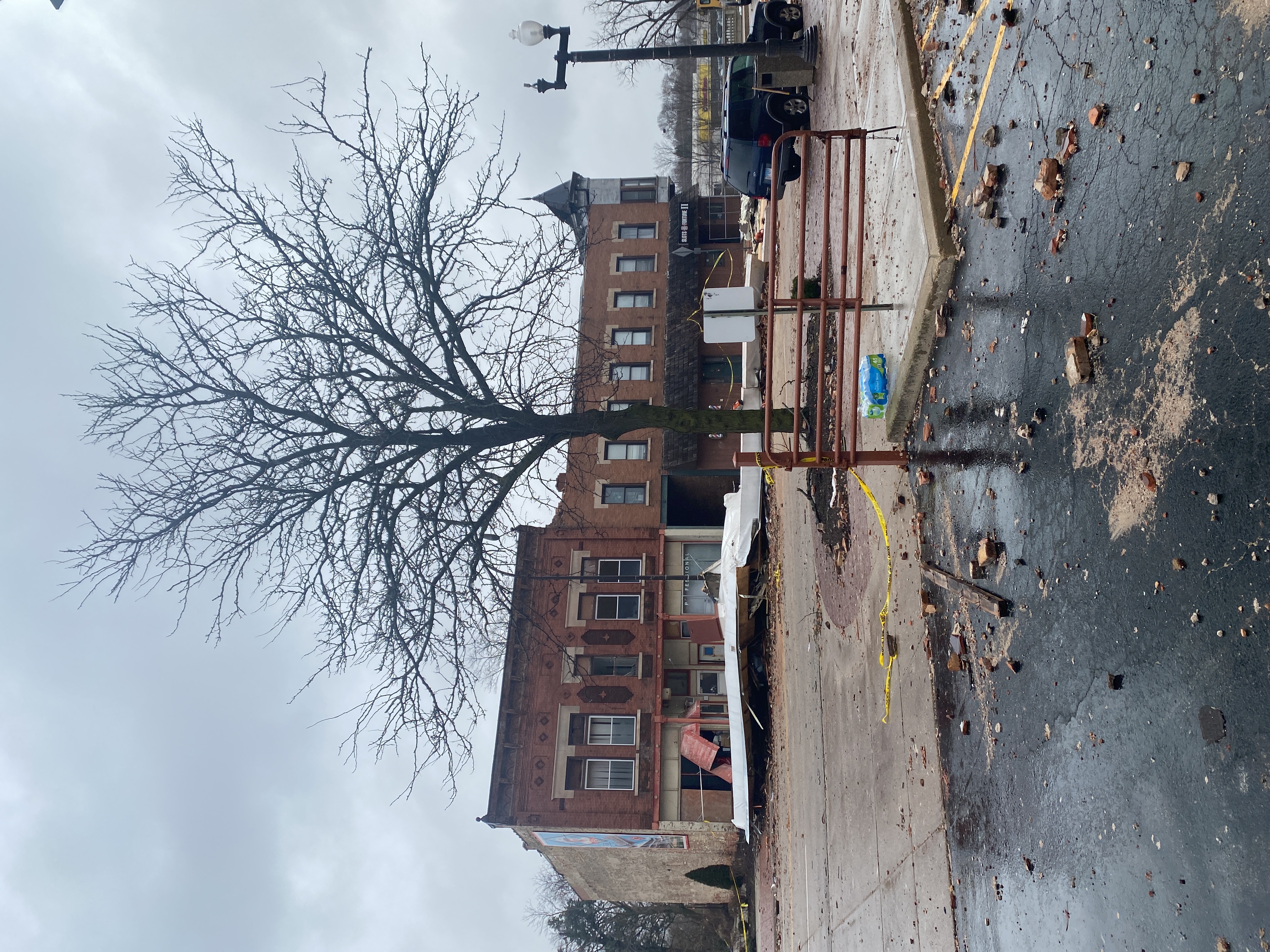 |
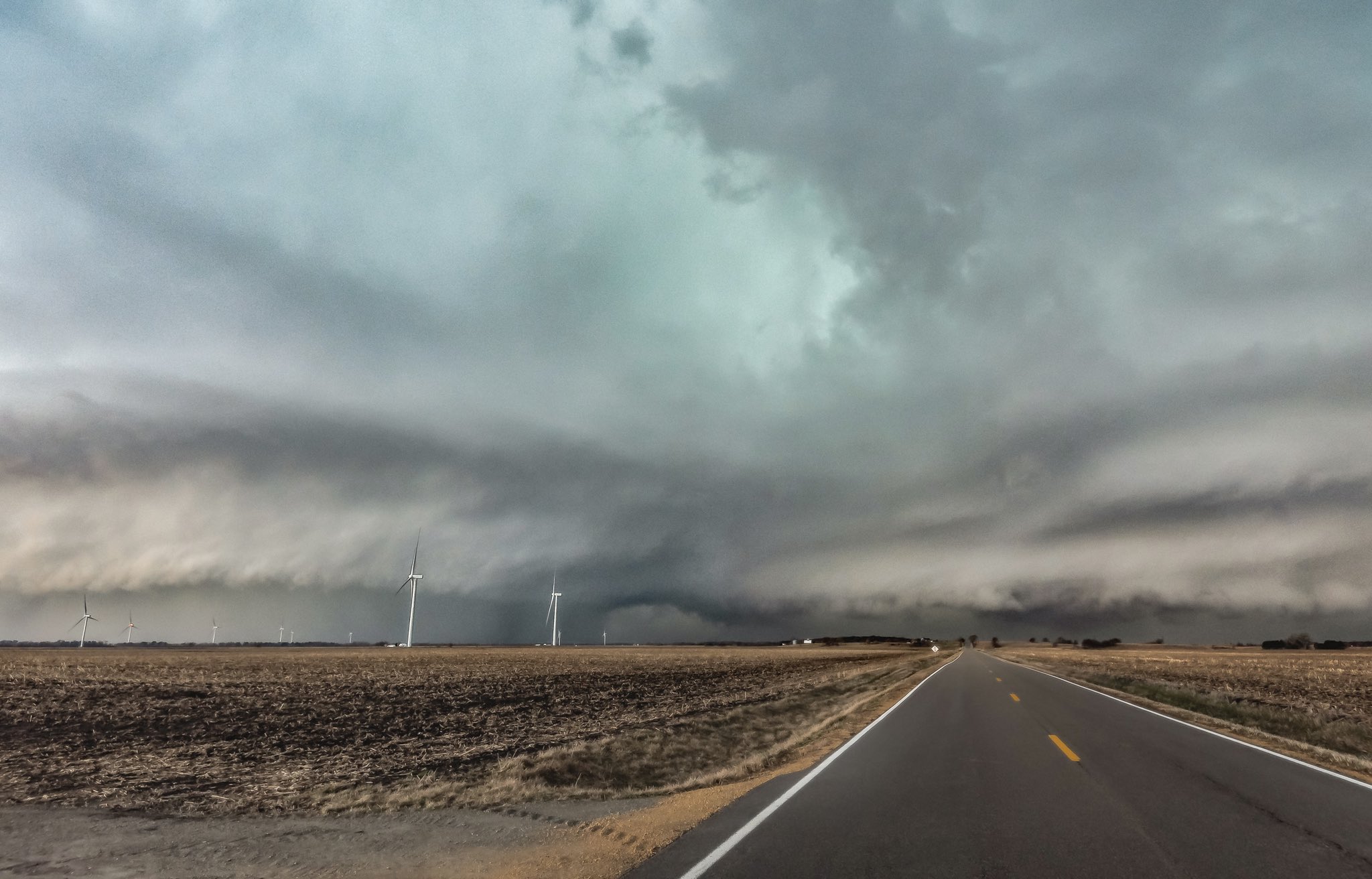
| Shelf cloud in northwest Illinois. Photo courtesy of Nina Brady. | Tornado damage in Belvidere, IL. Photo from NWS storm survey. | Tornado damage in Belvidere, IL. Photo from NWS storm survey. |
 |
 |
 |
| Tornado damage in St. Charles, IL. Photo courtesy of Sara Parker. | Tornado damage in Addison, IL. Photo from NWS storm survey. | Tornado damage in Addison, IL. Photo from NWS storm survey. |
 |
 |
 |
| Tornado damage in Plainfield, IL. Photo from NWS storm survey. | Tornado damage in Machesney Park, IL. Drone footage courtesy of the Winnebago County EMA. | Tornado damage in Rockford, IL. Drone footage courtesy of the Winnebago County EMA. |
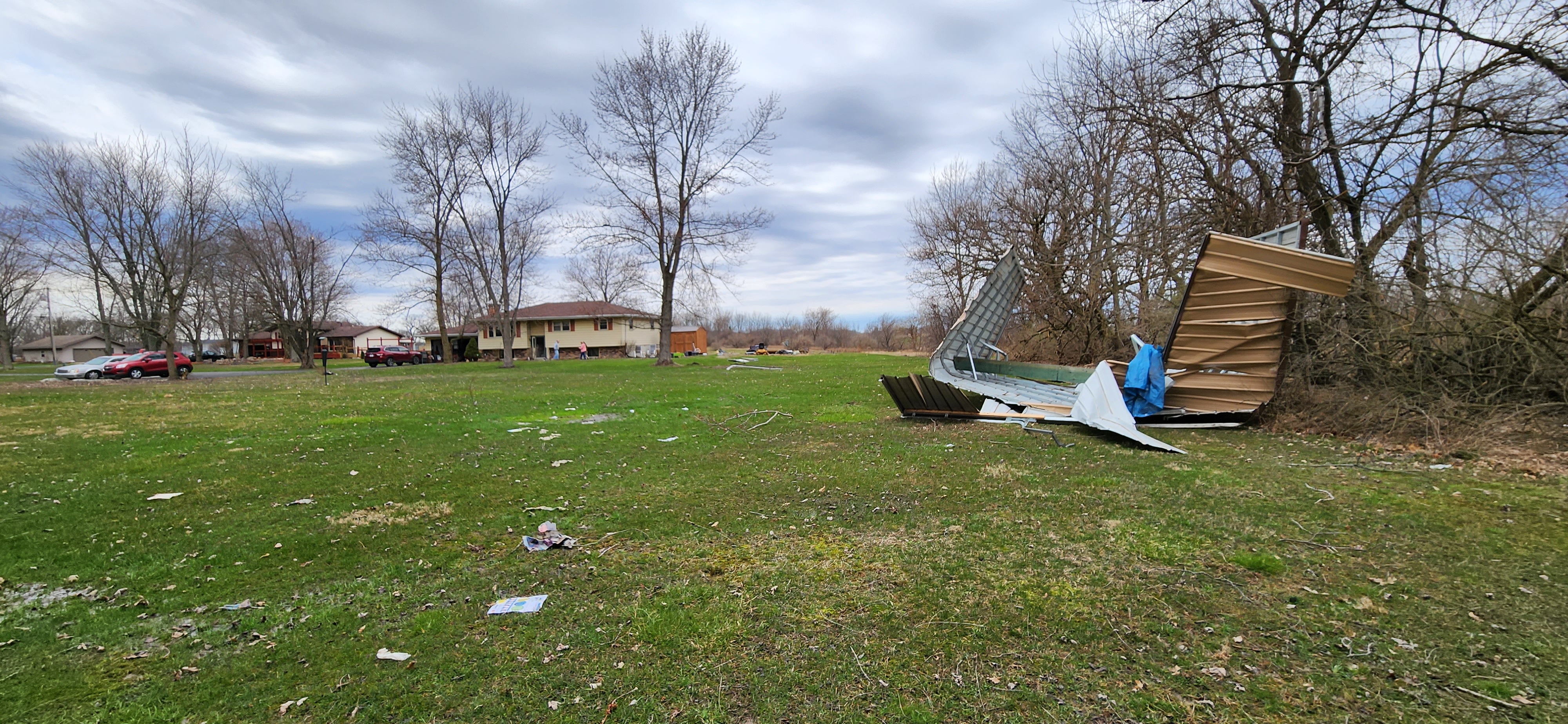
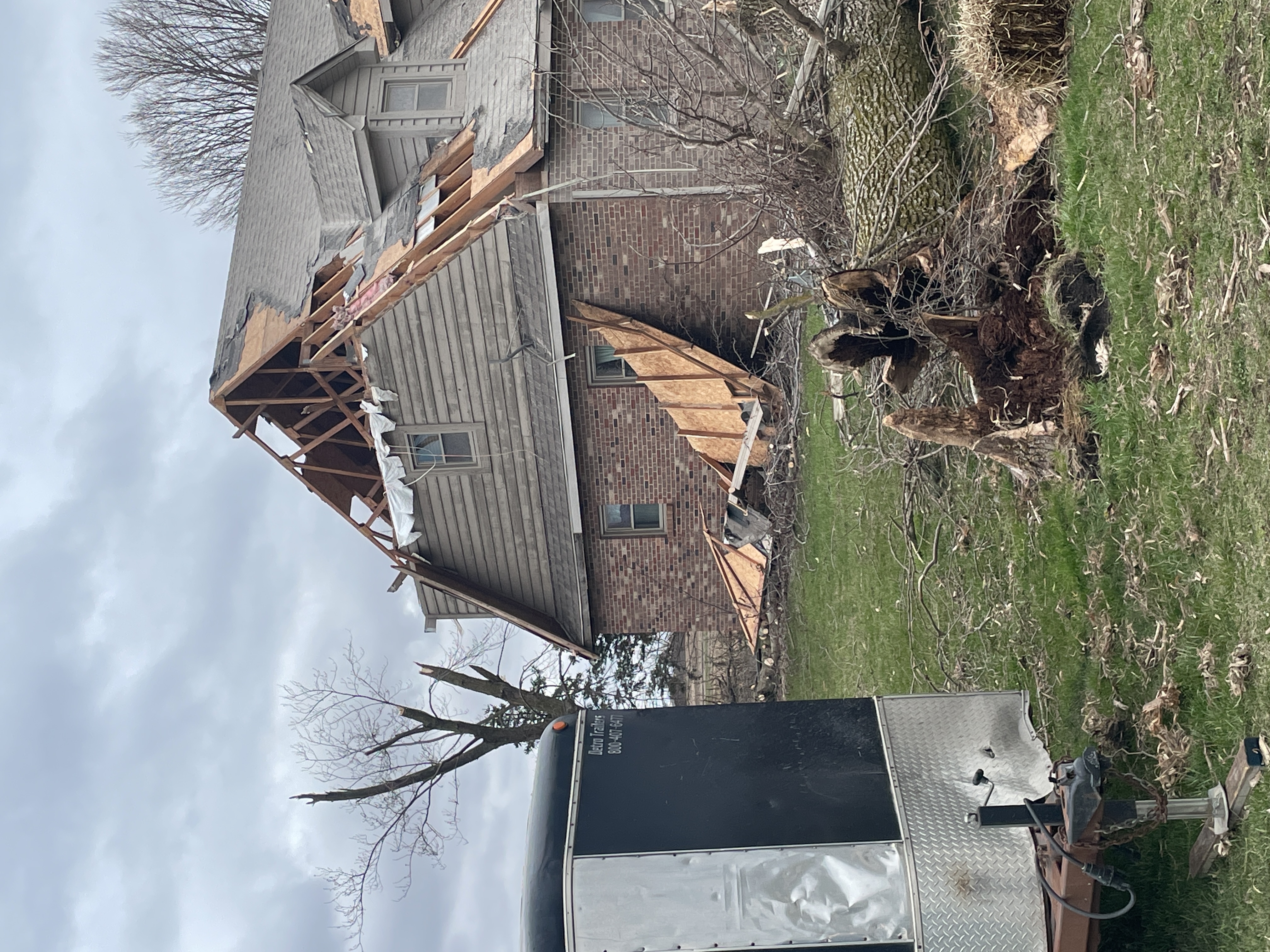
 |
|
|
| Tornado damage in Merrillville, IN. Drone footage courtesy of Paul Goddard. | Tornado damage near Shorewood Forest, IN. Photo courtesy of the Porter County EMA. | Tornado damage northeast of Fowler, IN. Photo from NWS storm survey. |
 |
 |
 |
| Tornado damage northeast of Oxford, IN. Photo from NWS storm survey. | Tornado damage northeast of Oxford, IN. Drone footage courtesy of the Benton County EMA. | Tornado damage east of Fowler, IN. Drone footage courtesy of Twitter user @shinjix2. |
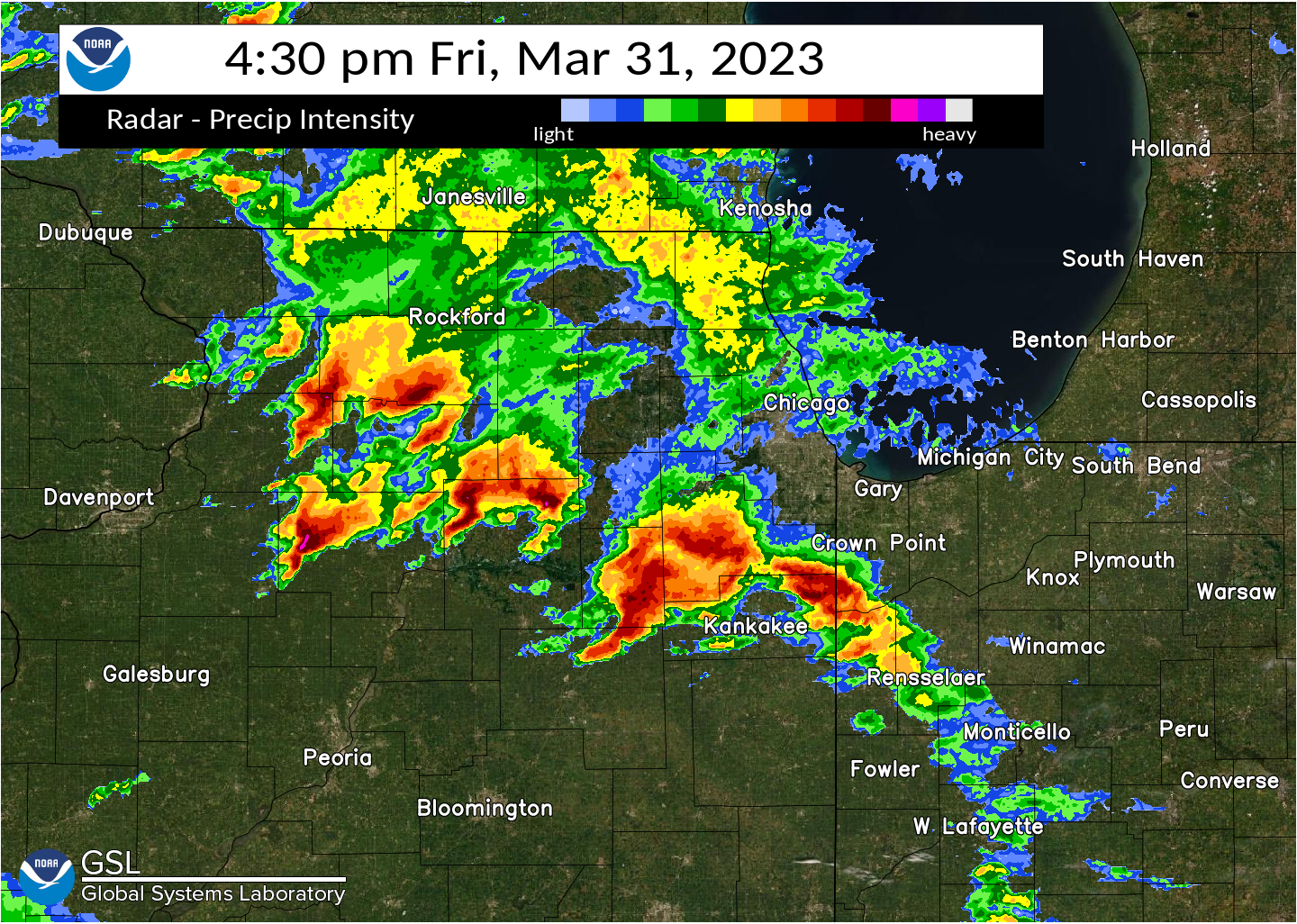
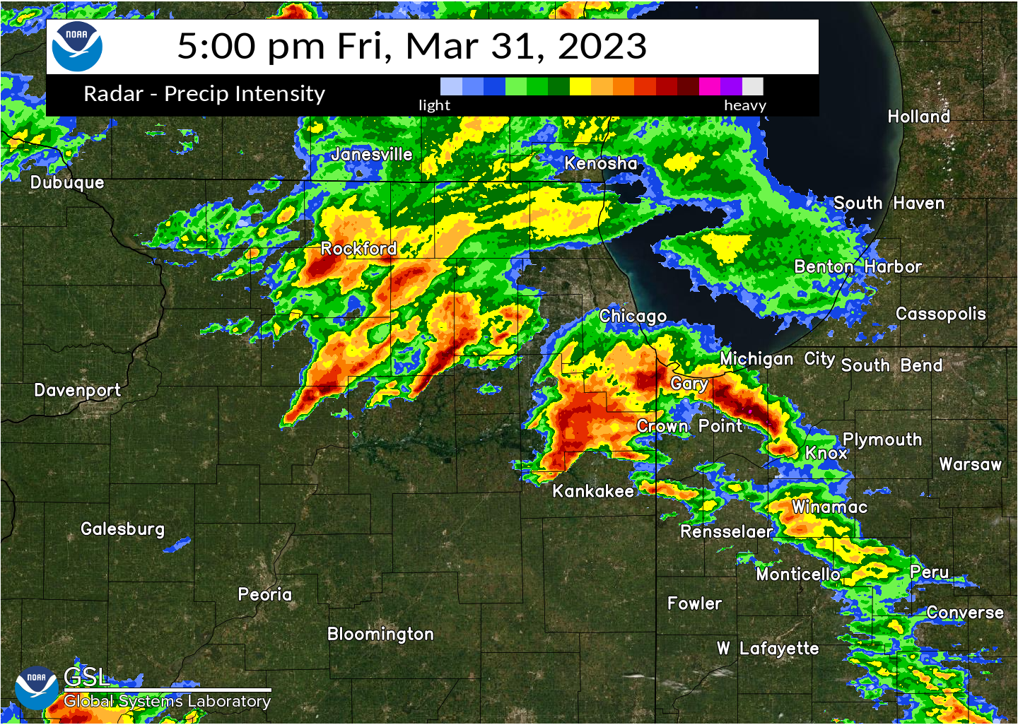
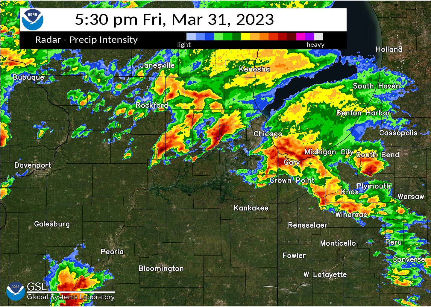
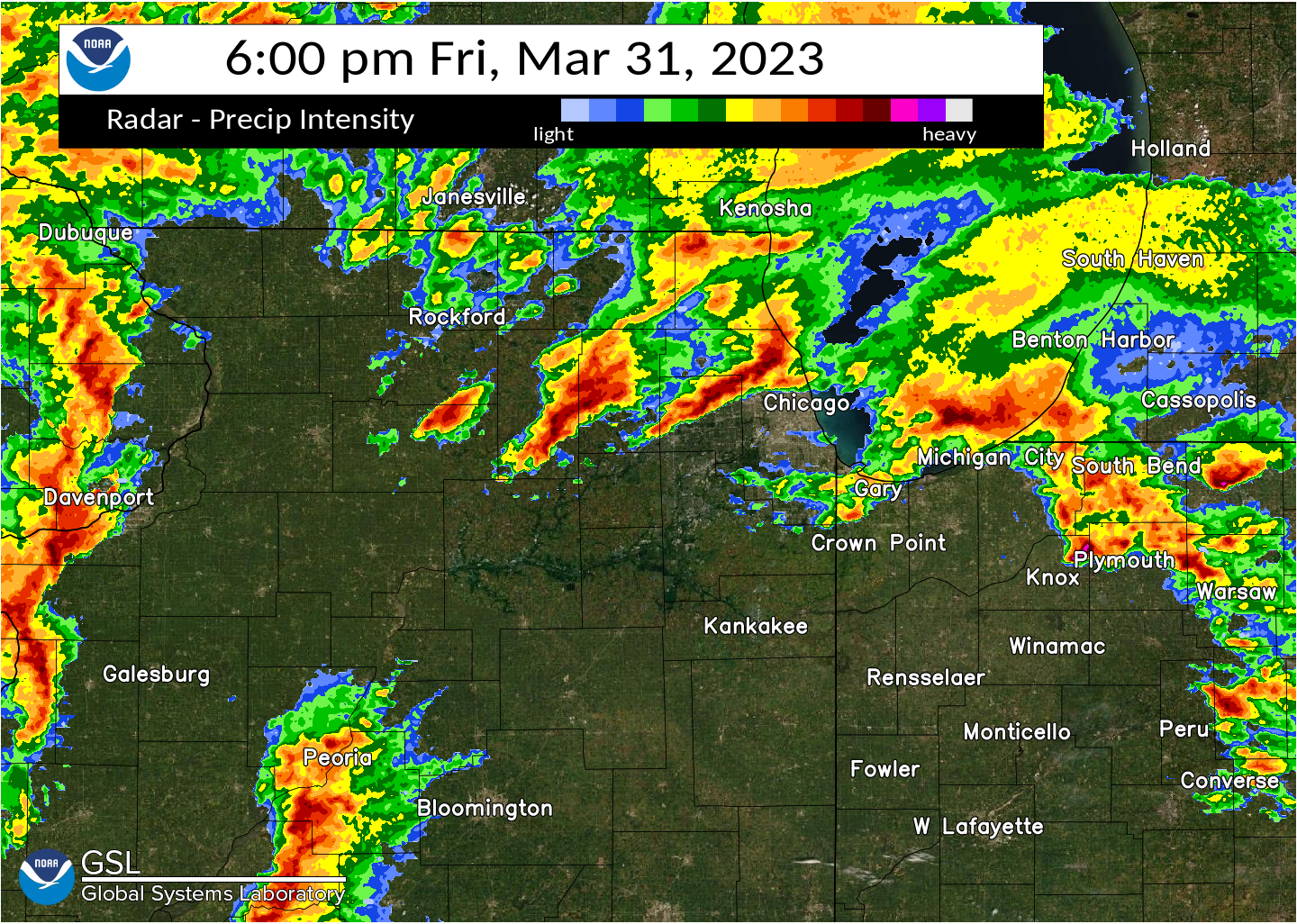
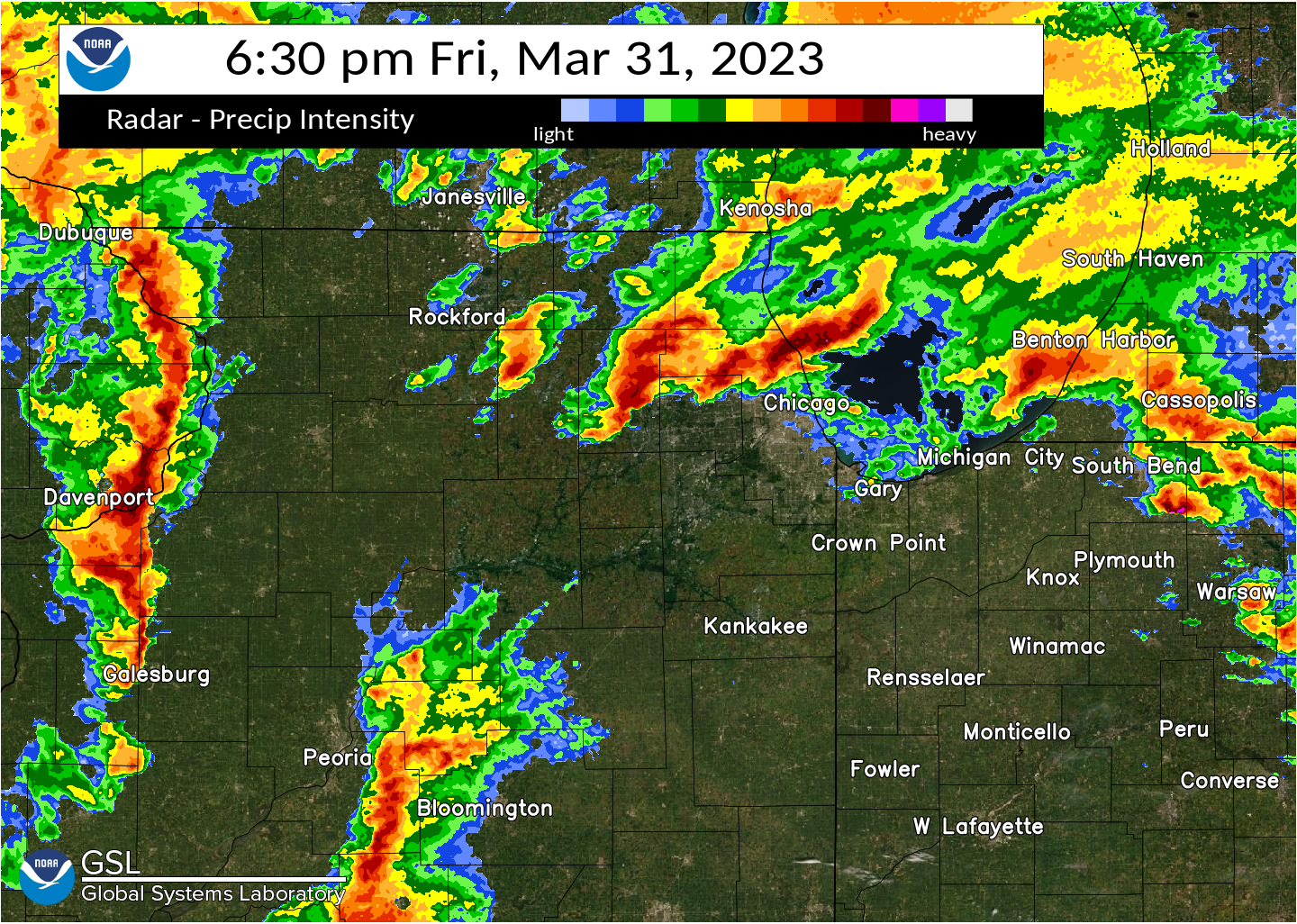
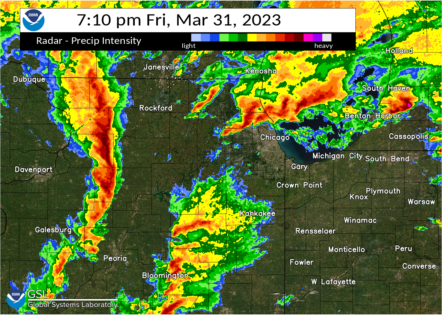
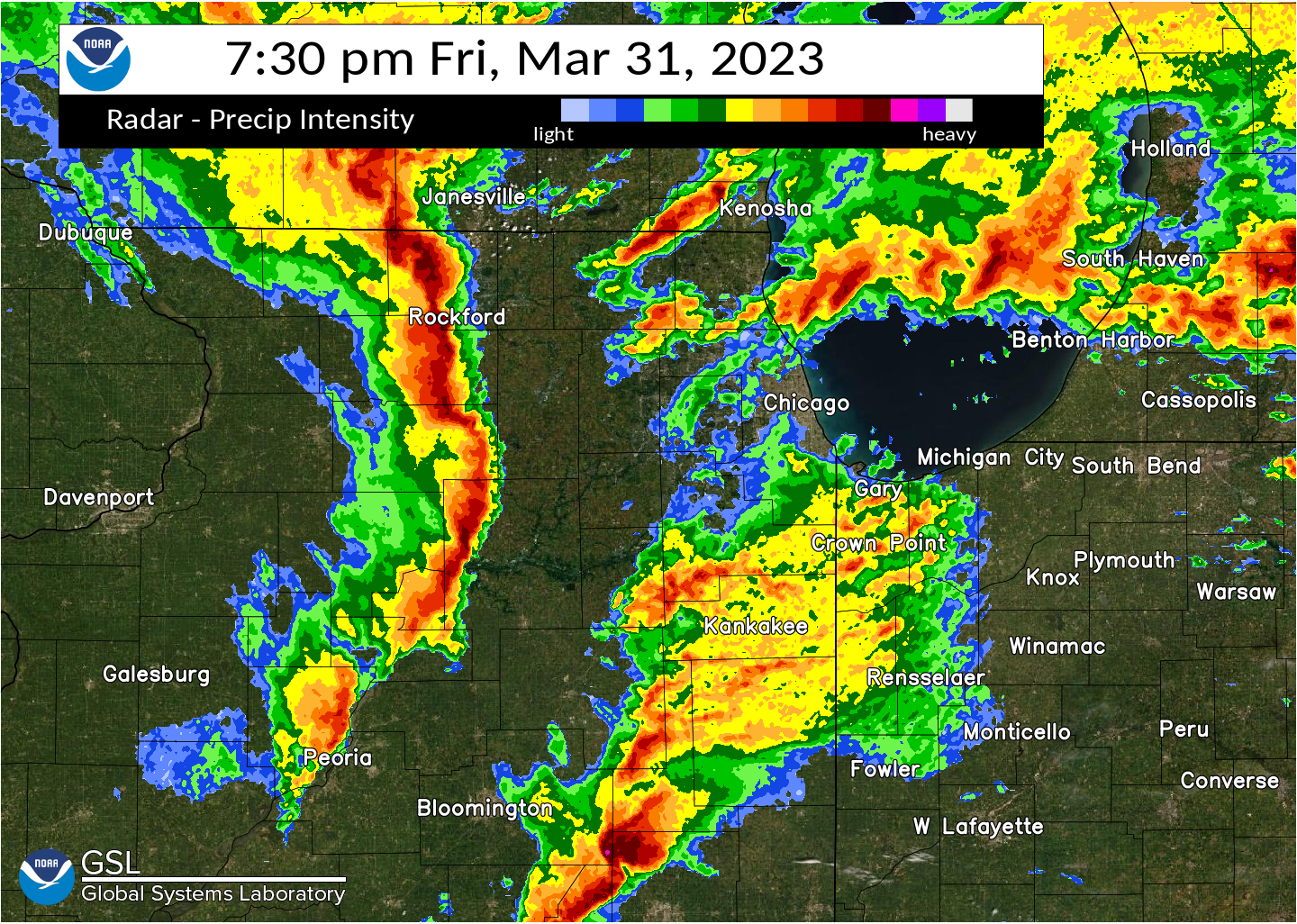
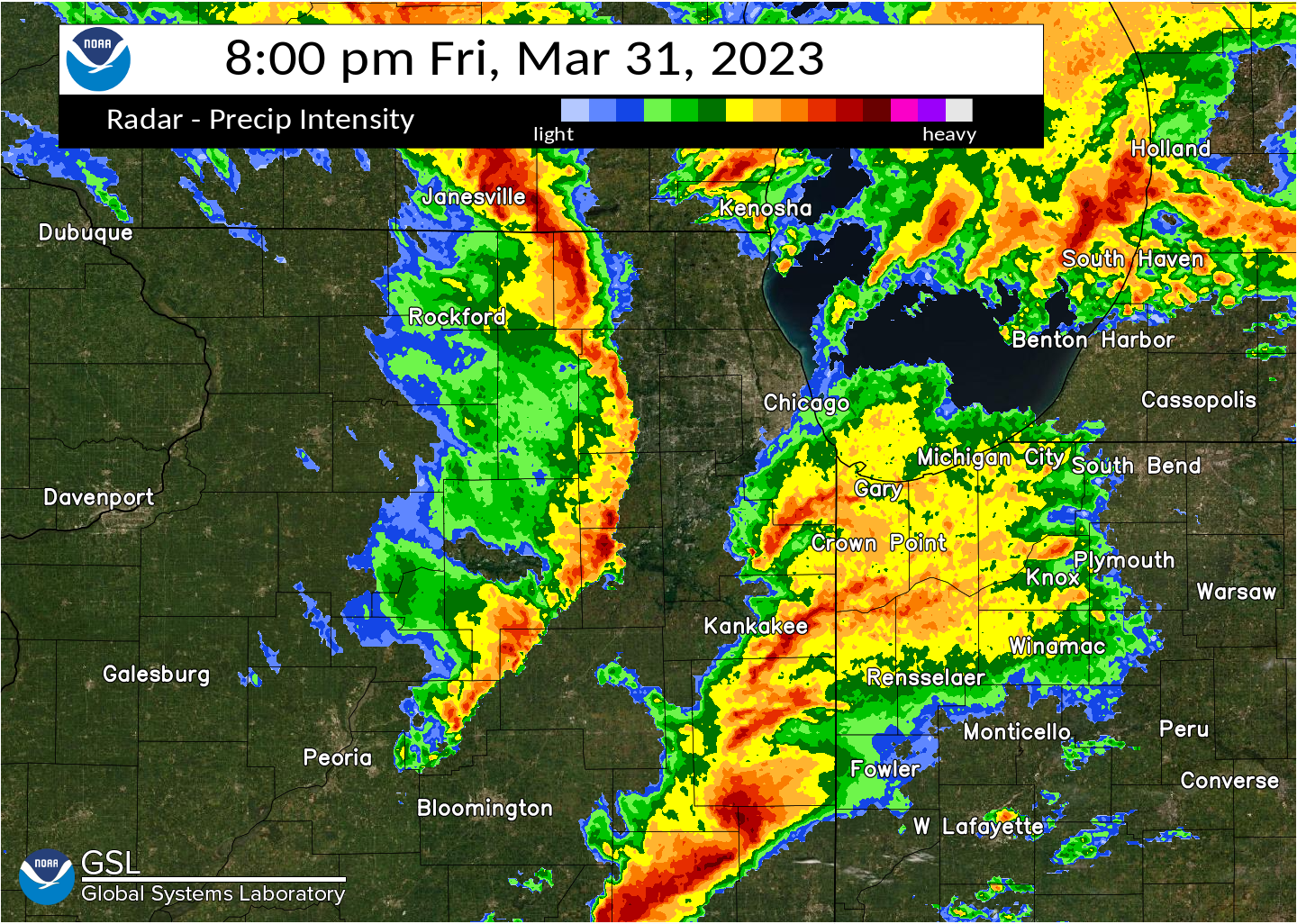
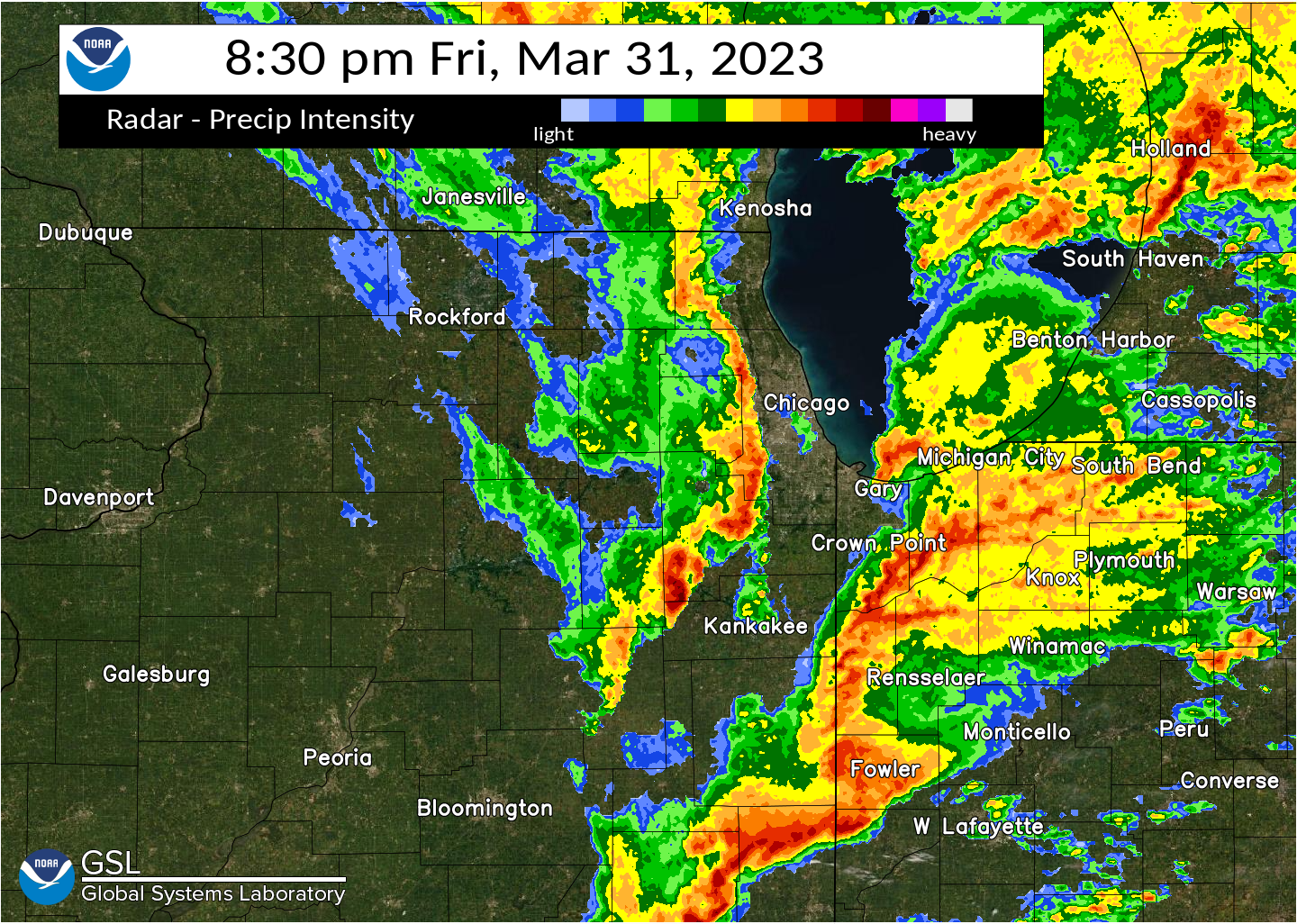
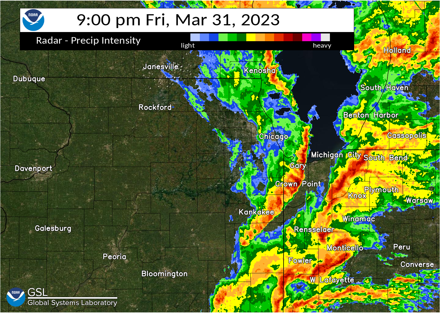
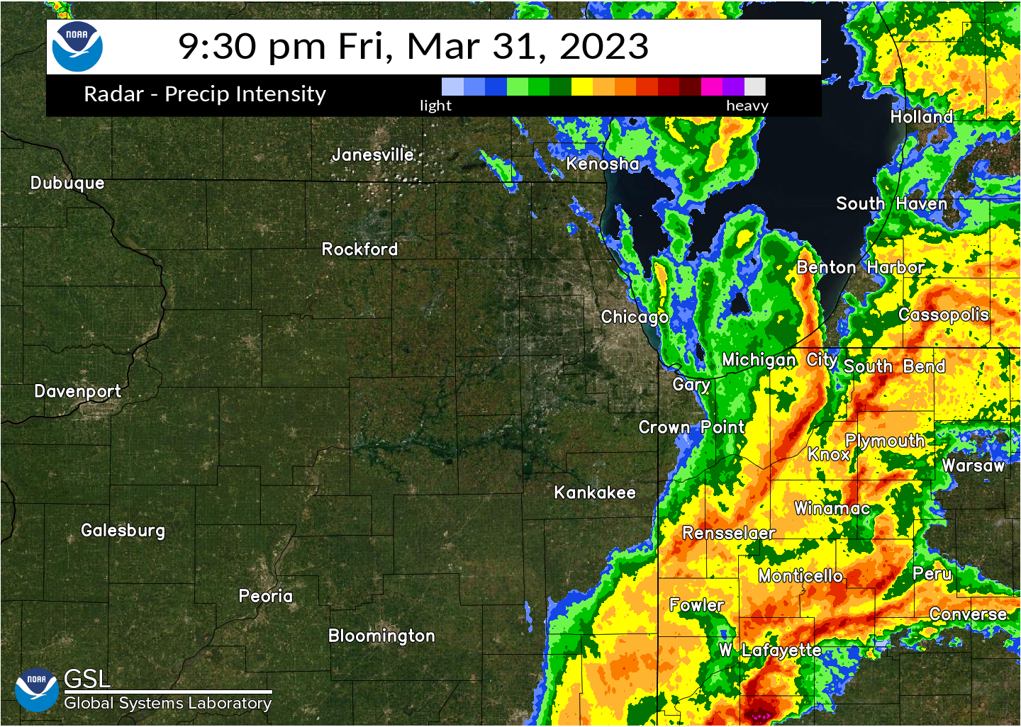
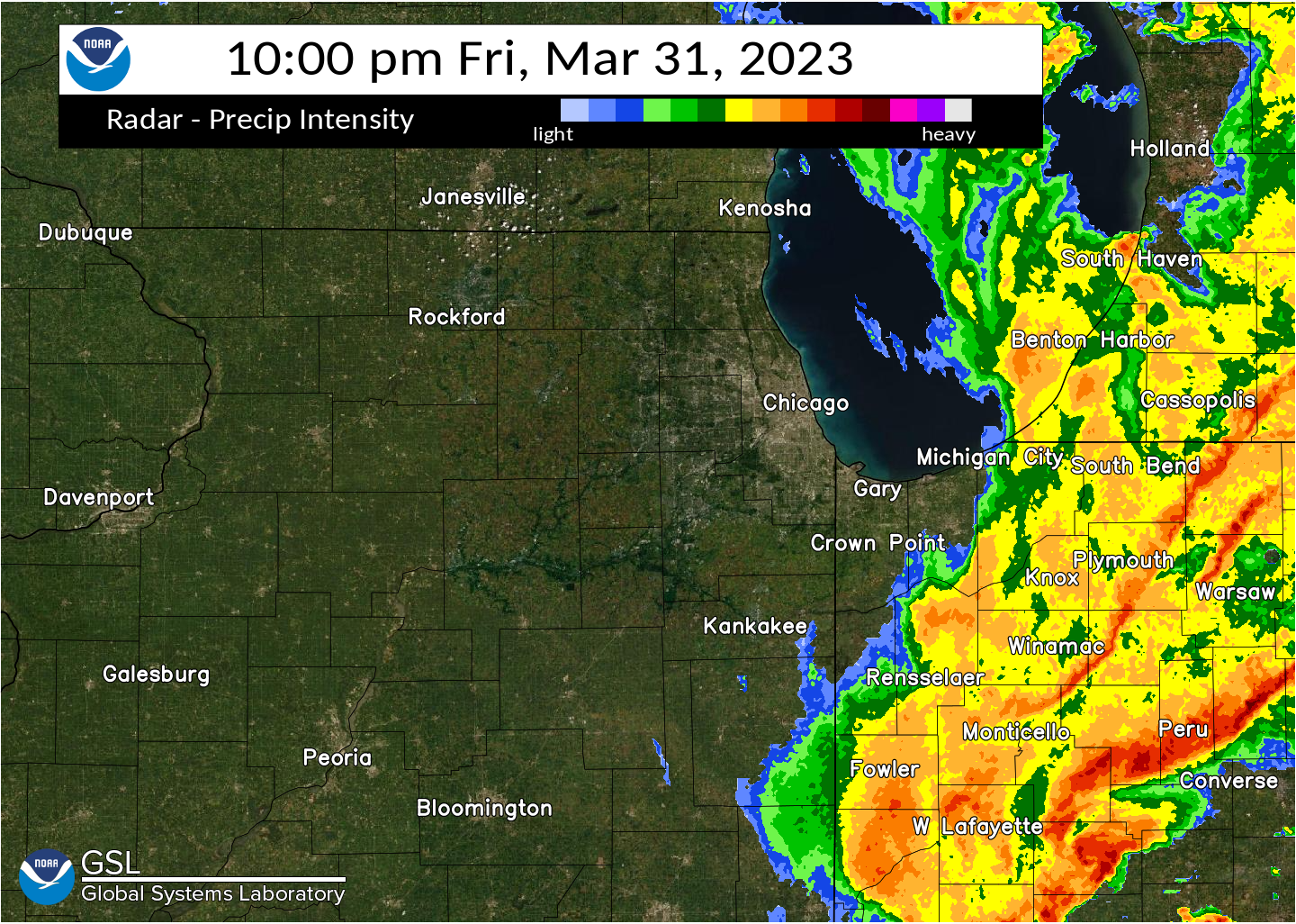
Radar
MRMS Reflectivity at Lowest Level (RALA) between 3:00 PM and 10:00 PM CDT 3/31/2023.
.
Meteorology and Environment
A brief recap of the meteorology behind this severe weather outbreak is discussed in this section.
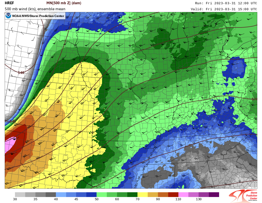
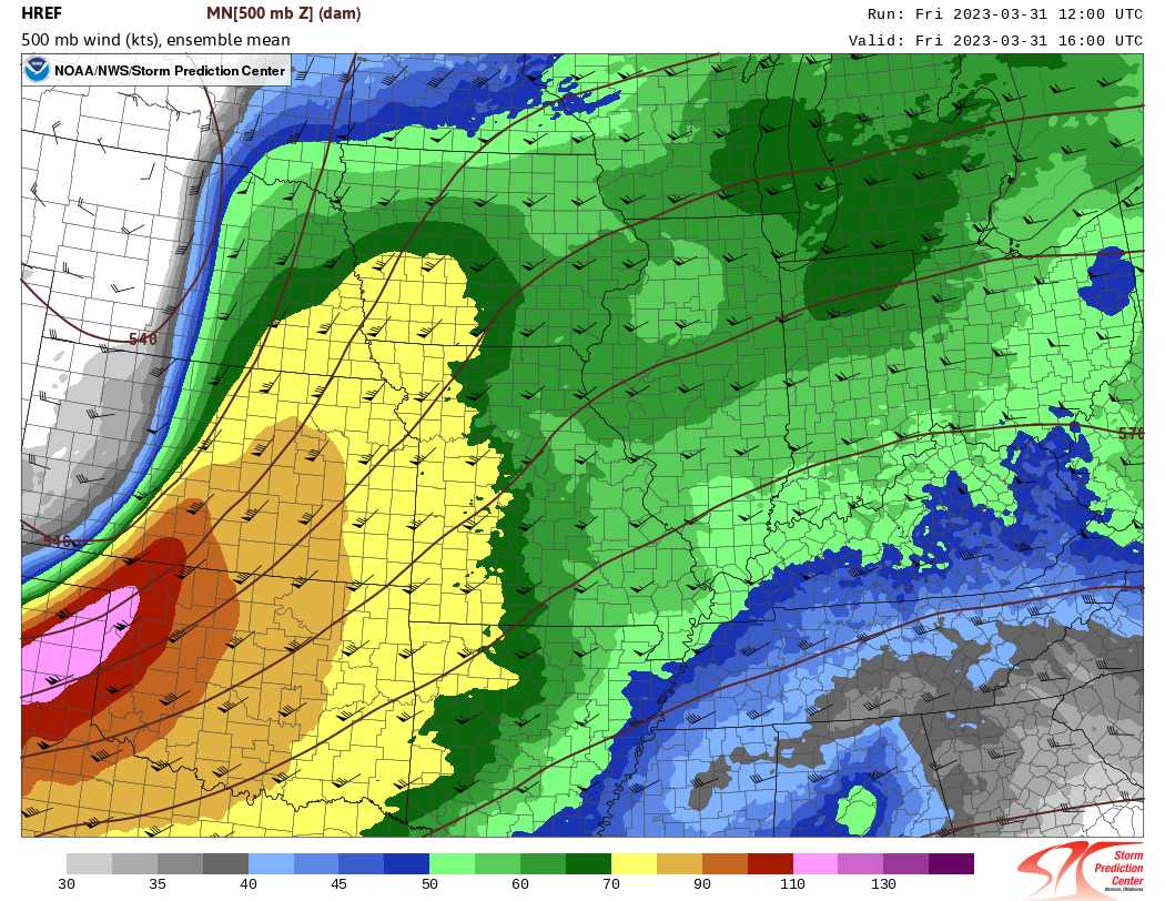
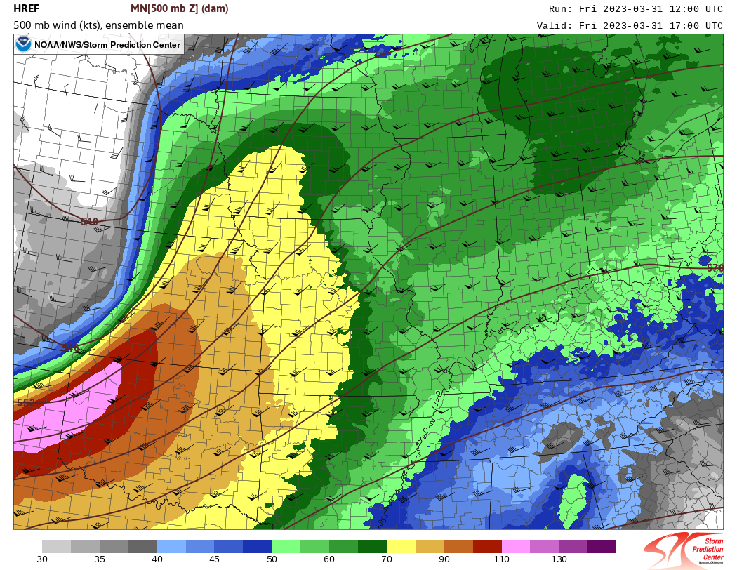
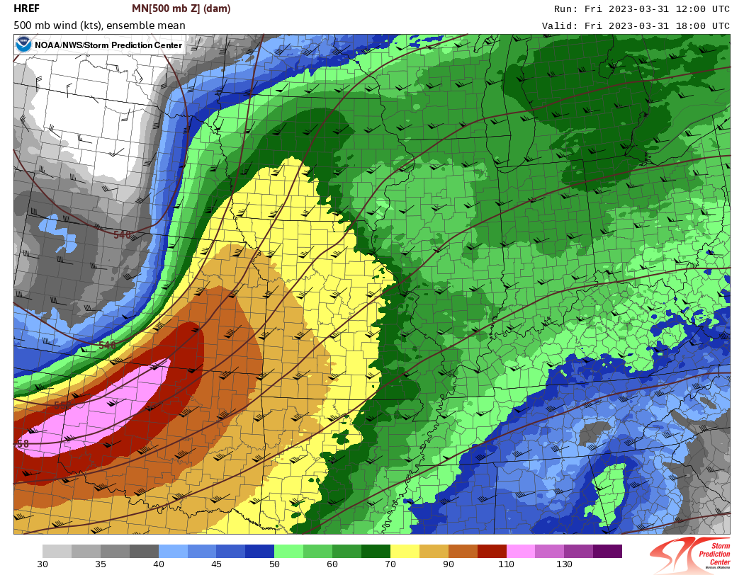
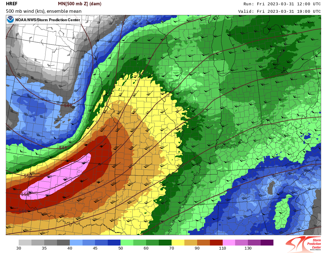
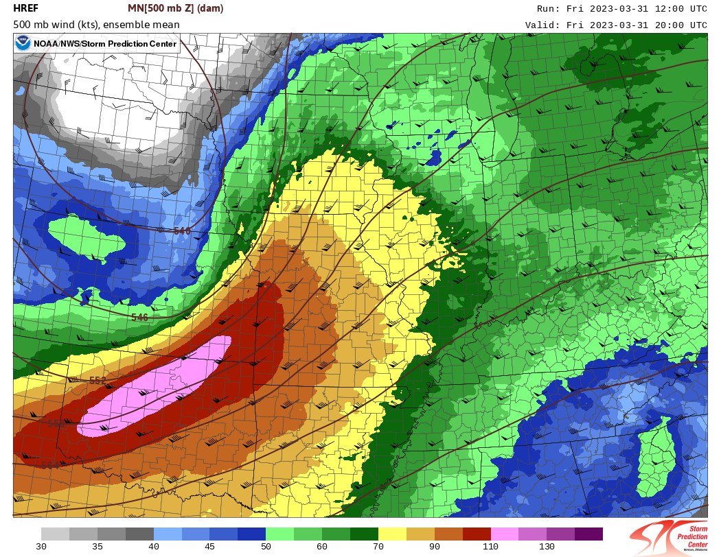
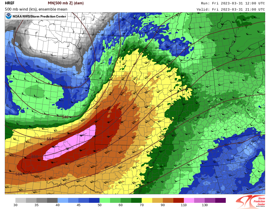
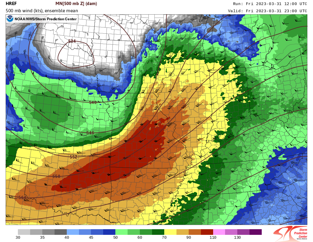
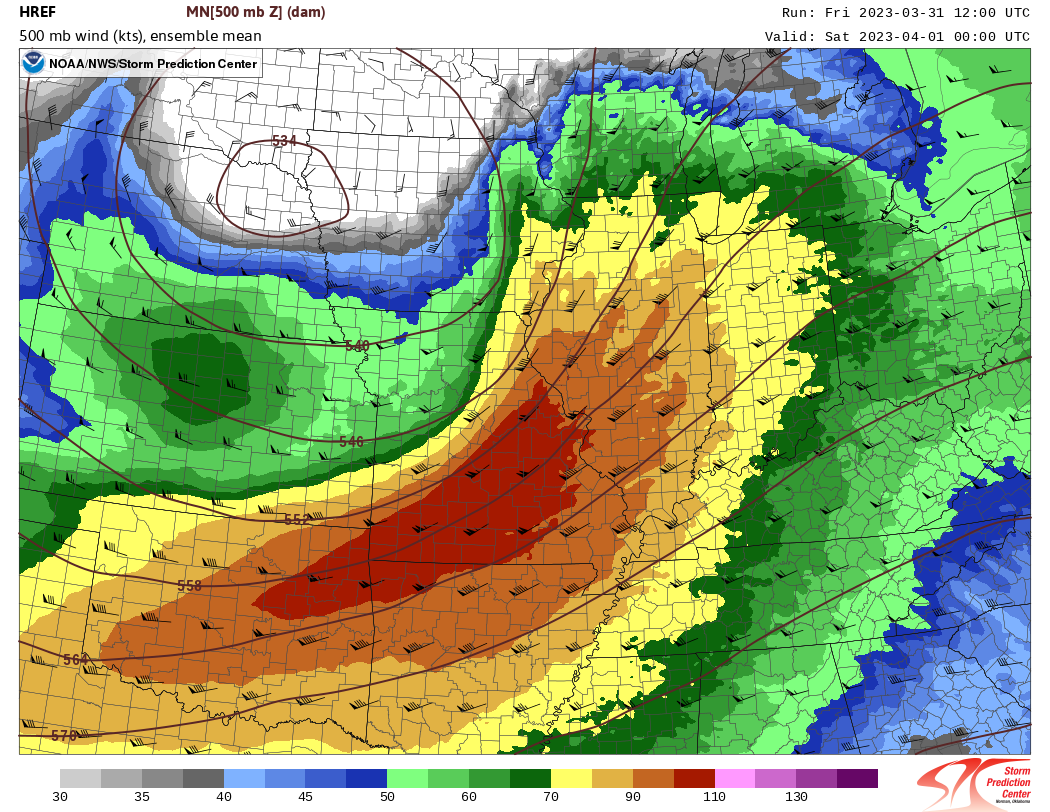
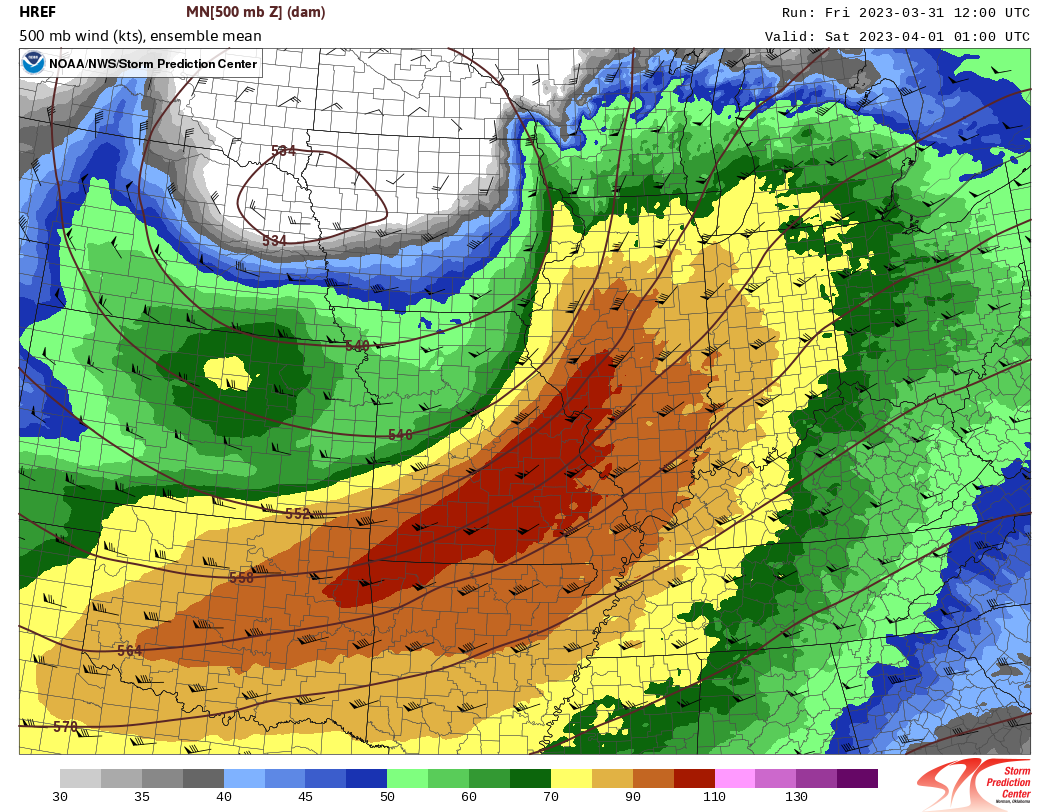
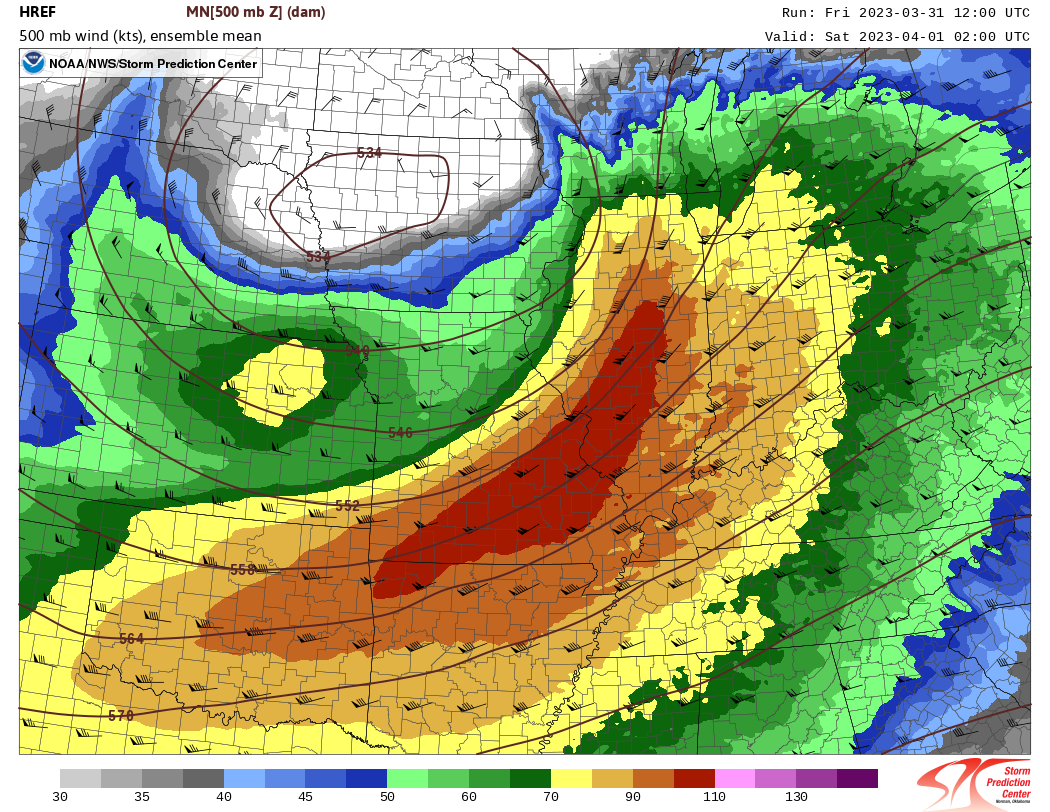
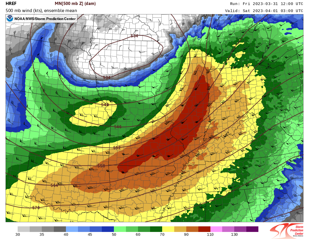
1. Upper Level Setup
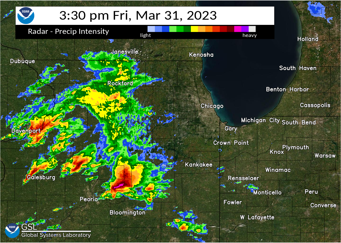
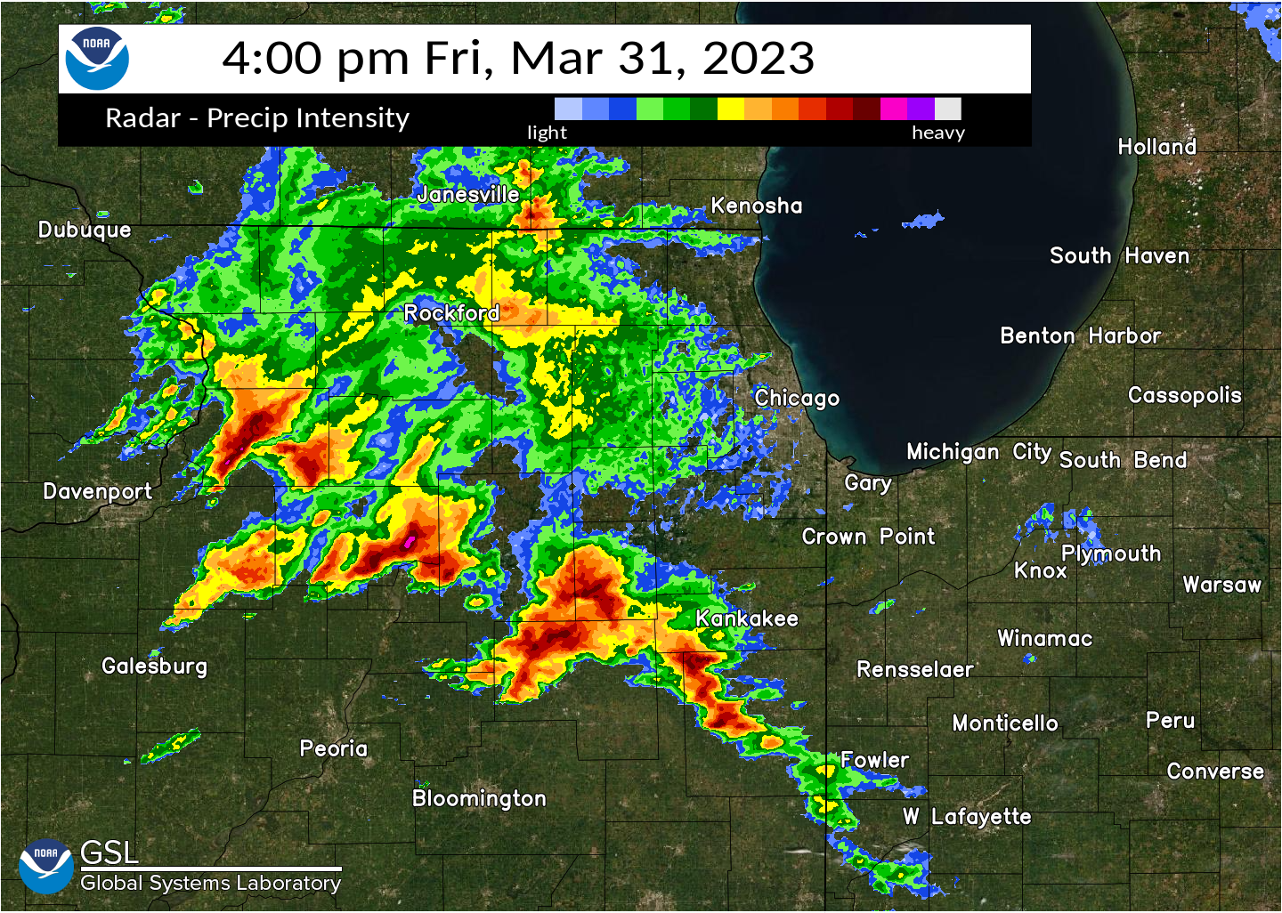
This loop shows a short term model forecast of 500 mb (approximately 20,000 feet up) conditions between 10 AM and 10 PM CDT. The color fill depicts 500 mb wind speeds. Note the significant 100+ knot "jet" core which spreads rapidly across Missouri and central and northern Illinois through the afternoon and evening along the southern flanks of a neutral to negatively tilted trough and associated closed low. This is a classic look to the upper-level pattern ahead of big severe weather episodes in our area.


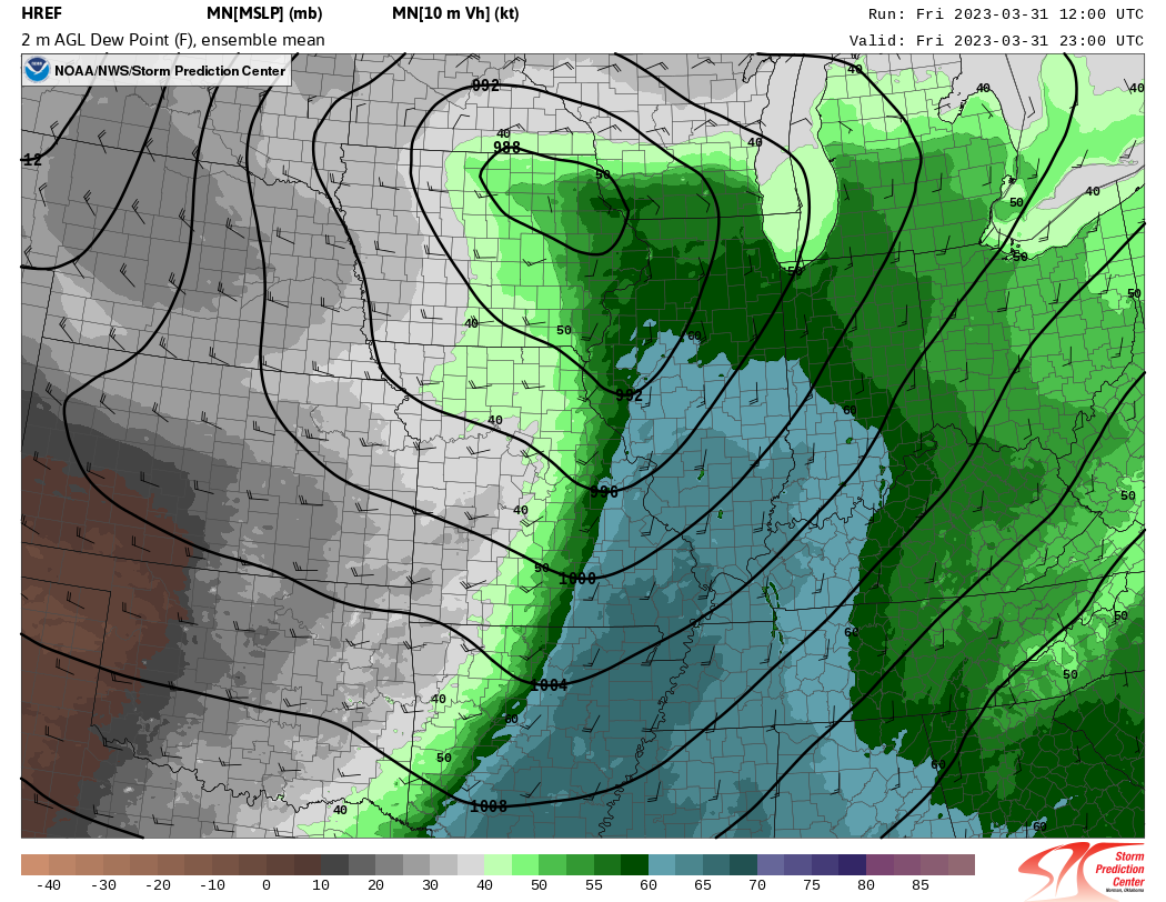
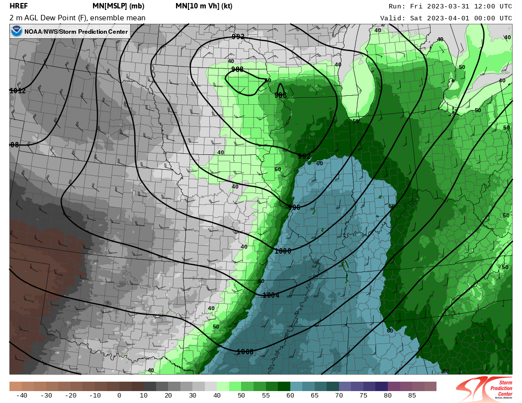
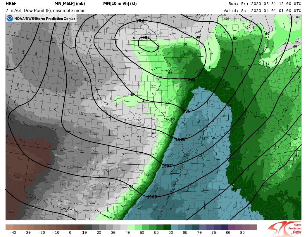
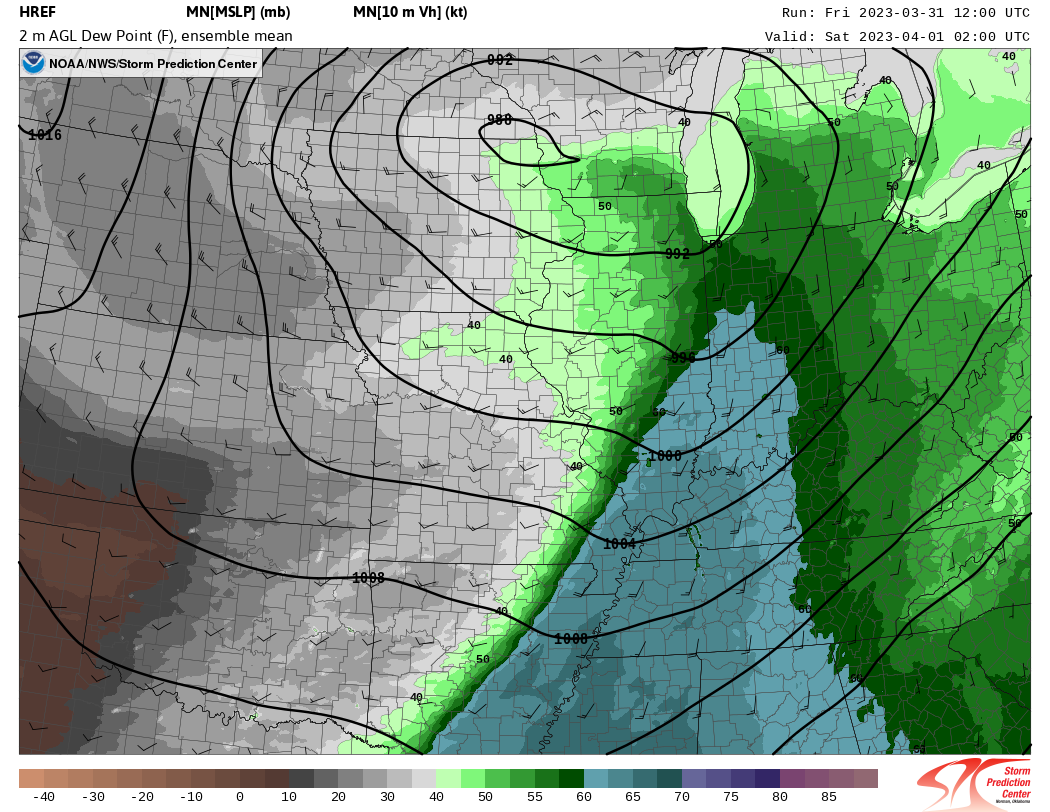
2. Surface Conditions
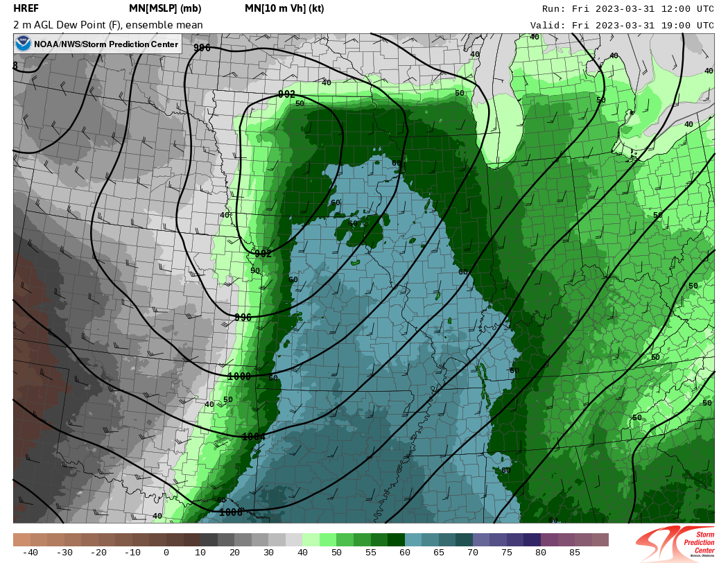
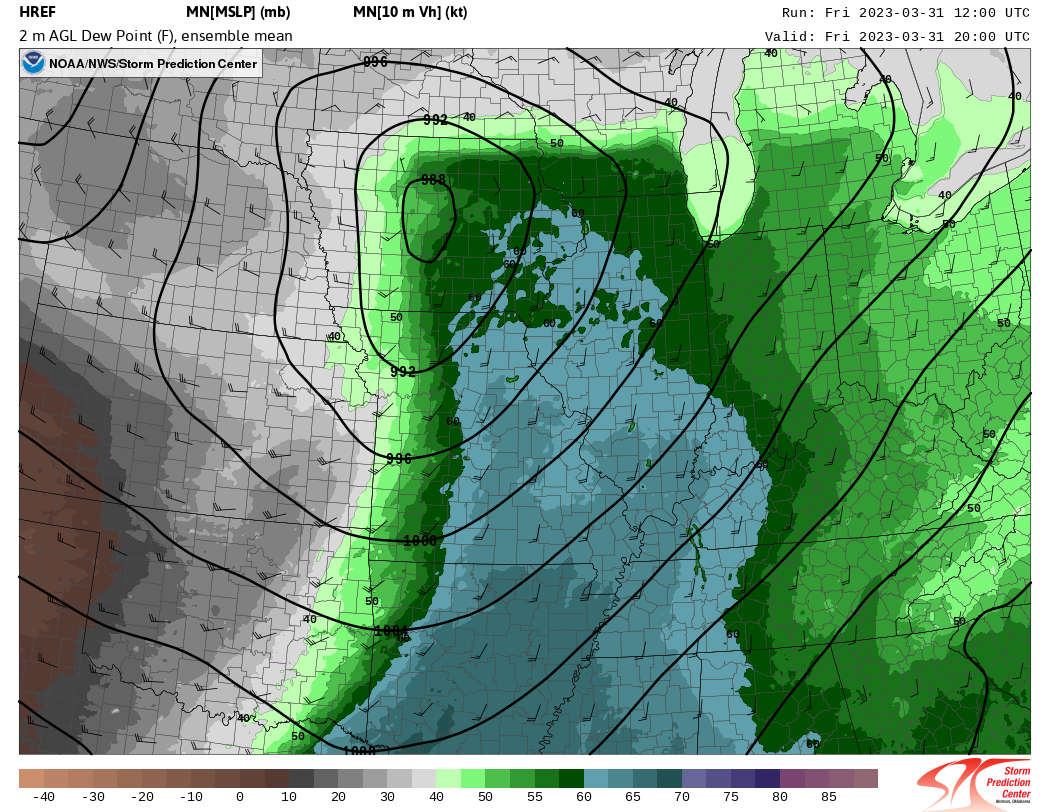
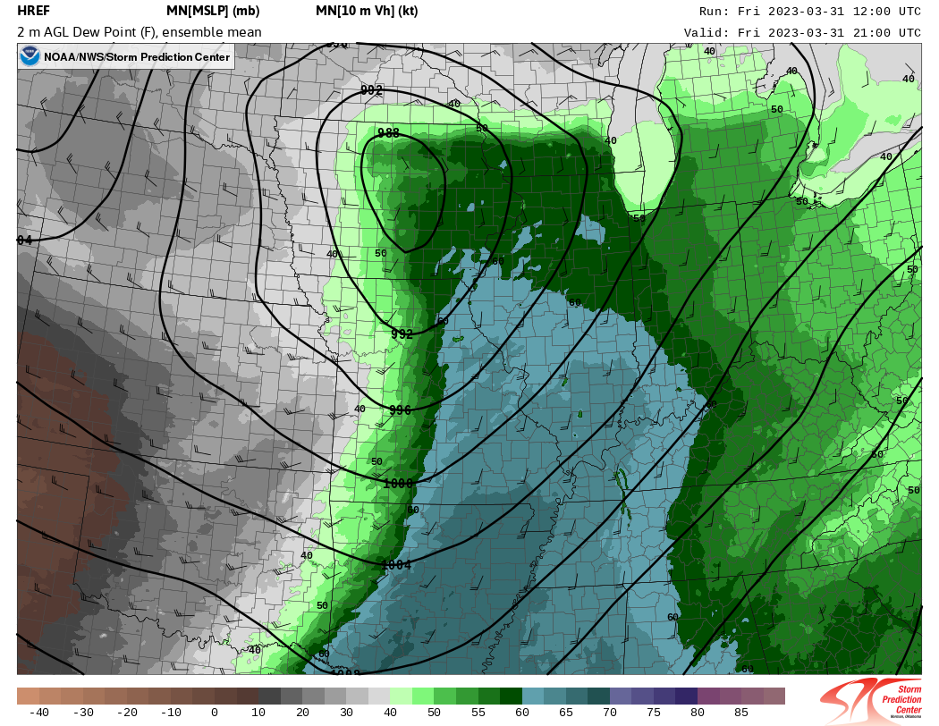
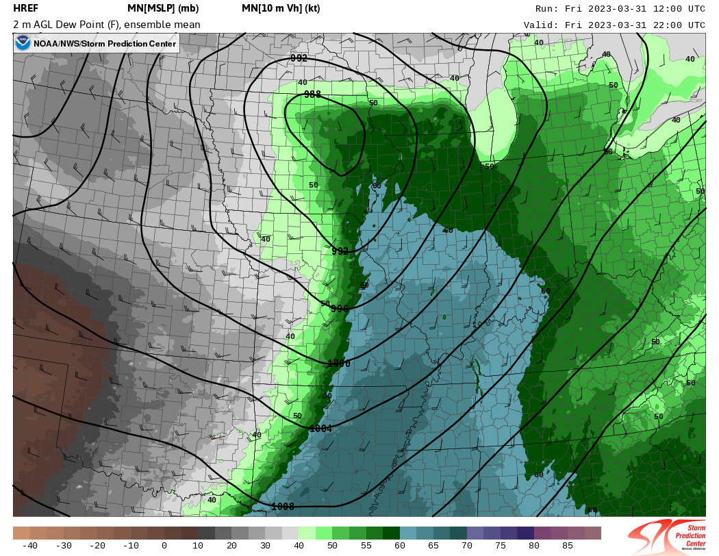
The loop here shows surface dewpoint temperatures (color fill) and mean sea level pressure (contours). Notice both the deepening surface low which tracks northeast across Iowa and the rapid northward advance of 60+ degree dewpoints (blue-ish color fill) during the afternoon hours.
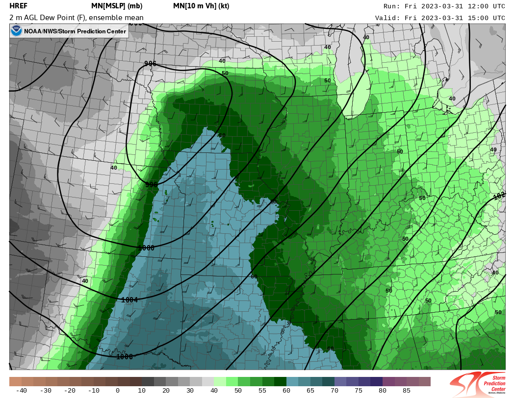
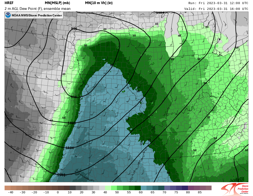
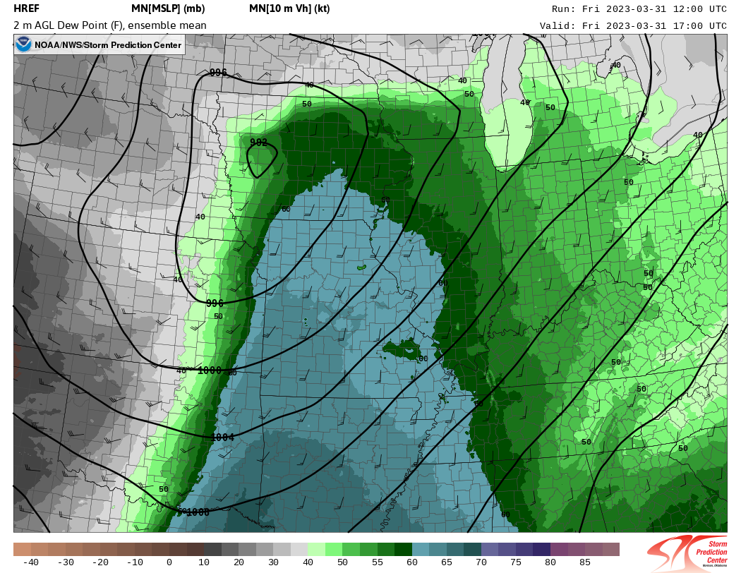
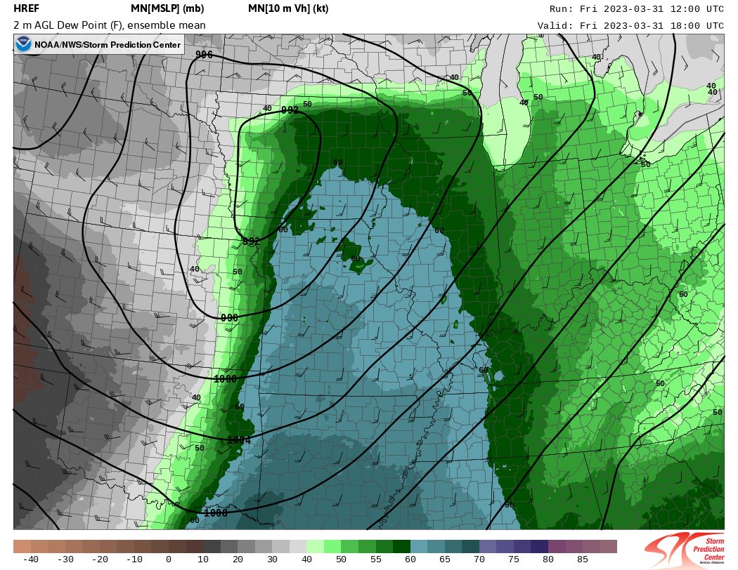


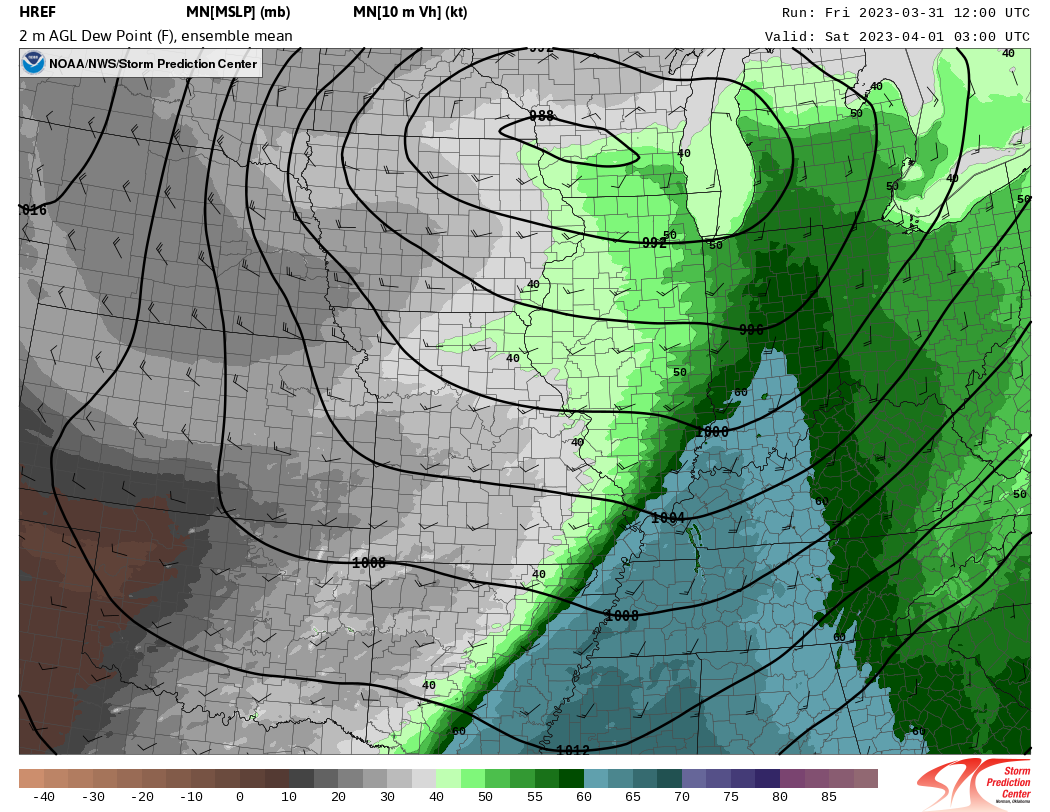
An NWS Chicago forecaster was staffed as the dedicated "mesoanalyst" during this event. The mesoanalyst is responsible for maintaining situational awareness of mesoscale boundaries, placement of surface lows, fronts, and other features that have the potential to modulate the severe weather potential, along with ensuring this information is relayed to the radar operators (the individuals issuing warnings). Below are examples of hand-drawn surface maps the mesoanalyst created to better identify the placement (and rapid northward advancement) of the surface warm front:
|
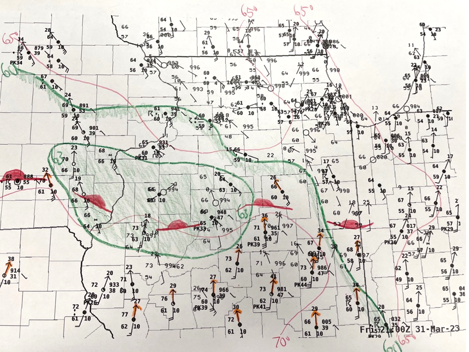
(Click to enlarge image) Hand-analyzed surface map at 21Z (4 PM CDT) on Friday, March 31, 2023. Isodrosotherms (lines of equal dewpoint temperature) at 60 and 63 degrees F are shown (in green), and surface stations gusting over 25 kts are highlighted with orange arrows. |
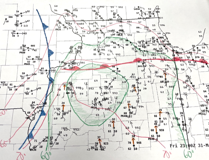
(Click to enlarge image) Hand-analyzed surface map at 23Z (6 PM CDT) on Friday, March 31, 2023. Notice how the warm front has "surged" northward right up to about the I-80 corridor in the past two hours. This set the stage for the second round of widespread severe storms. |
3. Severe Weather Parameters
|
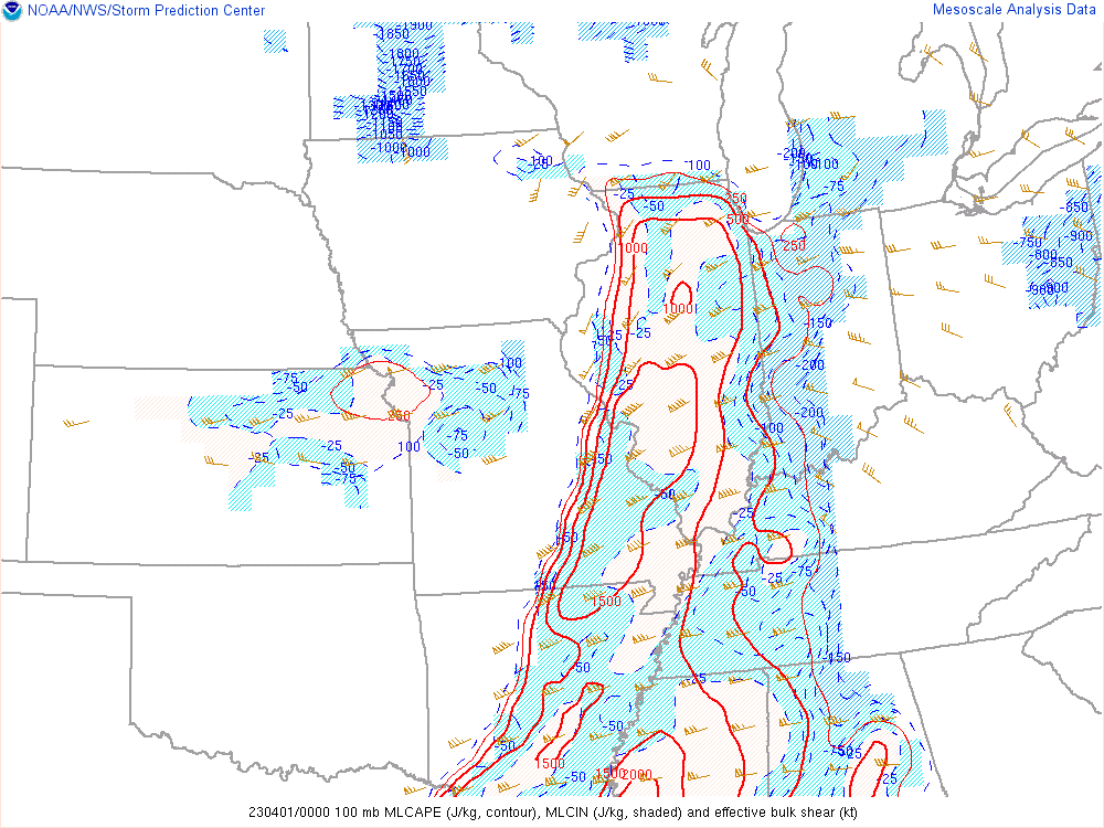
(Click to enlarge image) SPC mesoanalysis image (valid at 7 PM CDT) of MLCAPE (a measure of atmospheric instability), MLCIN (stability), and deep layer shear (vectors). Deep layer shear values were very high during this event, at times in excess of 60-70 knots which is very supportive for rotating thunderstorms (supercells). |
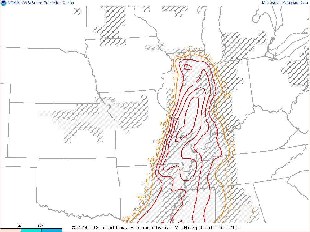
(Click to enlarge image) SPC mesoanalysis image (also valid at 7 PM CDT) of the effective Significant Tornado Parameter (eSTP). This is a composite parameter which combines instability, deep layer shear, stability, and low-level shear together in one value. Values increasing over 1 tend to suggest an increased potential for tornadoes. |
Additional Information
Links:
 |
Media use of NWS Web News Stories is encouraged! Please acknowledge the NWS as the source of any news information accessed from this site. Additional recaps can be found on the NWS Chicago Past Events Page |
|


.png)
.png)
.png)
.png)
.png)
.png)