Hazardous heat will continue across the Southern Plains, Gulf Coast and Desert Southwest through the weekend. Additional heat will build into the Great Basin and Northern Plains this weekend. A stalled front is expected to bring periods of heavy to excessive rainfall and flooding from the Tennessee Valley to the Southeast U.S on Friday. Read More >
|
|
|
Fast Facts
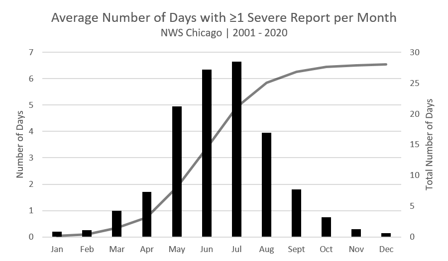
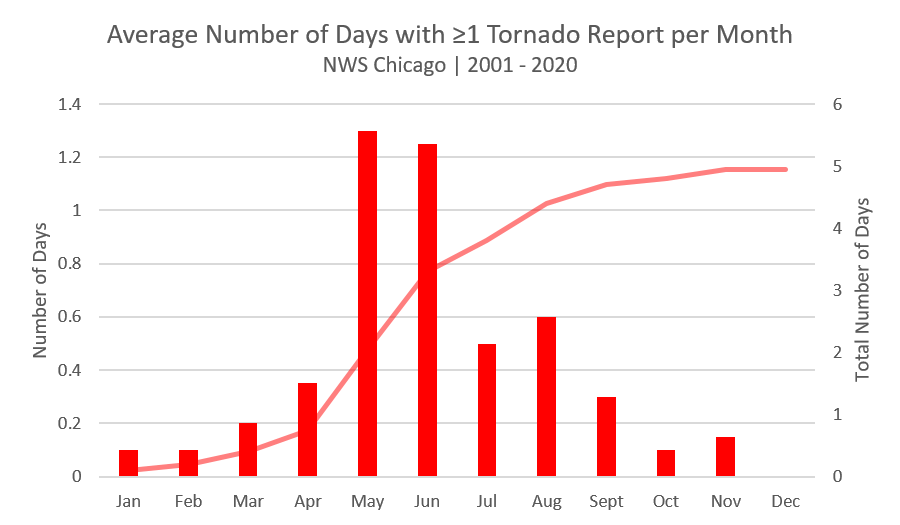
Climatology
NWS Chicago Forecast Area (map)
|
|
 |
|
| (click on image to enlarge) | (click on image to enlarge) |
Illinois
Tornado
|
(click on image to enlarge) |
This is a view of a tornado southeast of Gibson City from around 6pm tonight. Damage reported on county road 200 E just east of highway 47 and southeast of town. Picture from Brystal Deer. pic.twitter.com/5Z419NIwIX
— Kevin Lighty - WCIA 3 Chief Meteorologist (@KevinLighty) January 4, 2023
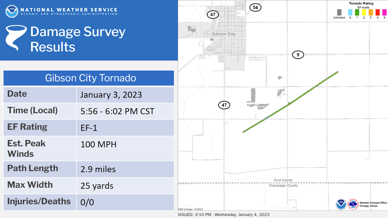
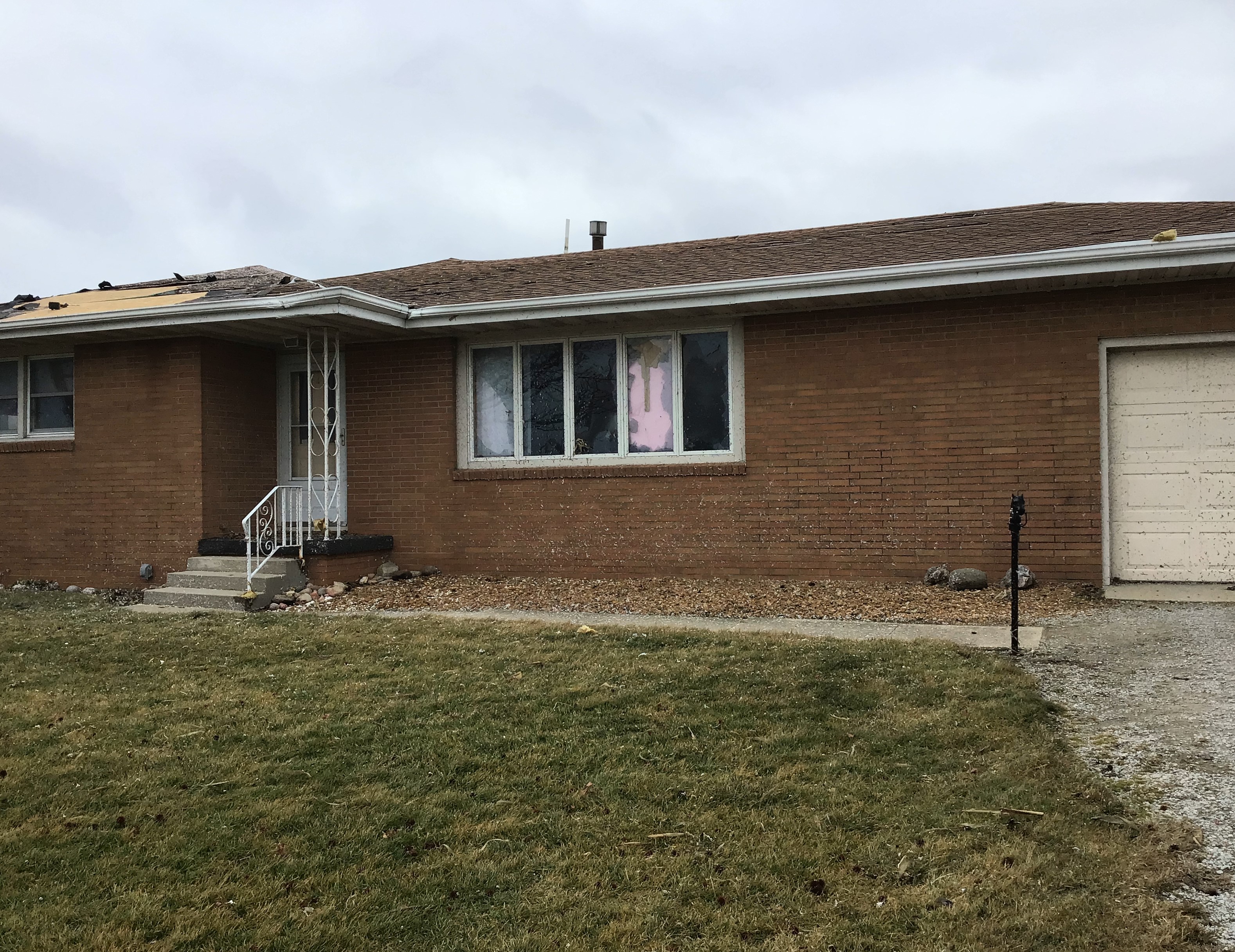
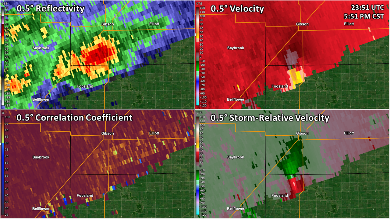
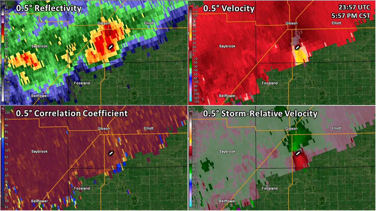
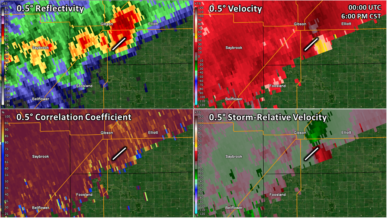
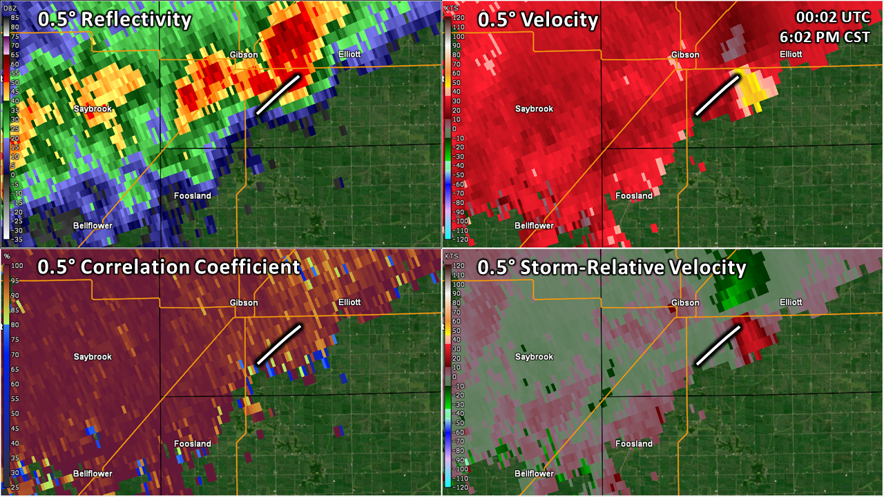
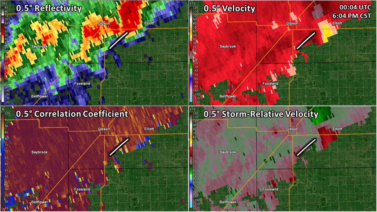
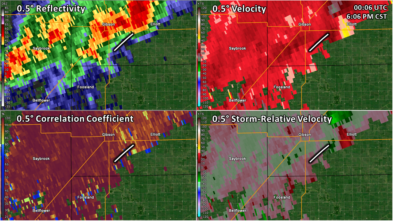
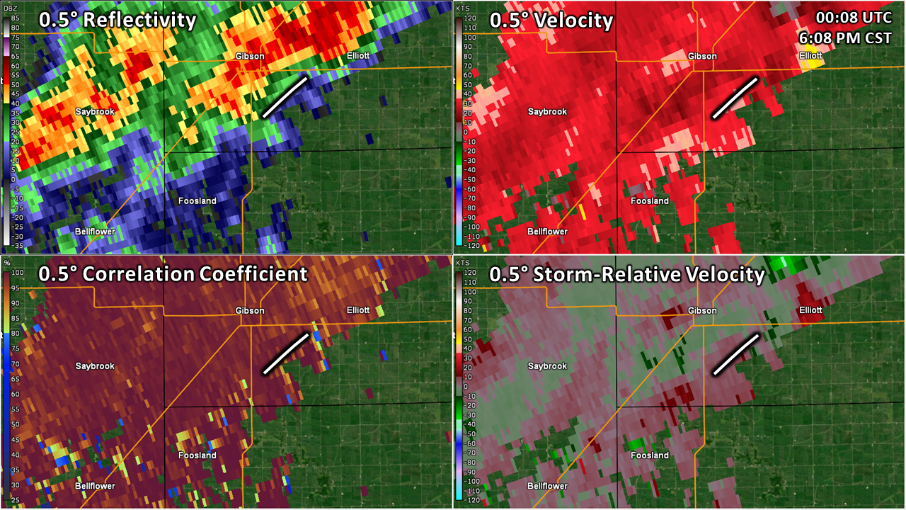
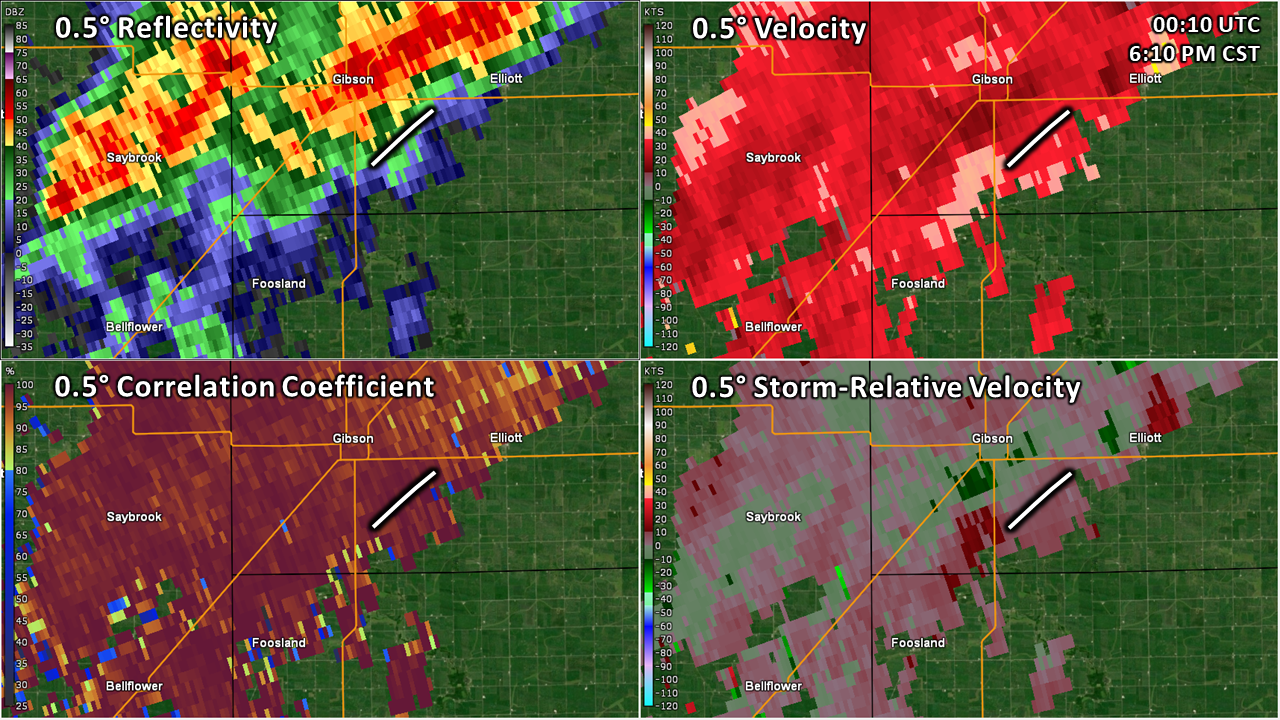
Public Information Statement National Weather Service Chicago IL 247 PM CST Wed Jan 4 2023 /347 PM EST Wed Jan 4 2023/ ...NWS Damage Survey for 01/03/23 Gibson City Tornado... .Gibson City Tornado... Rating: EF-1 Estimated Peak Wind: 100 mph Path Length /statute/: 2.9 miles Path Width /maximum/: 25 yards Fatalities: 0 Injuries: 0 Start Date: 01/03/23 Start Time: 05:56 PM CST End Location: 3 S Gibson City / Ford County / IL Start Lat/Lon: 40.4219 / -88.2669 Start Date: 01/03/23 End Time: 06:02 PM CST End Location: 2 ESE Gibson City / Ford County / IL End Lat/Lon: 40.4490 / -88.3243 Survey Summary: A National Weather Service damage survey found that an EF-1 tornado occurred near Gibson City, IL on the evening of January 3, 2023. The tornado touched down in an open field east of State Route 47 where it proceeded to track northeast for 2.9 miles causing damage to two homesteads before dissipating in a field east of 700 East Road. Both homesteads sustained roof damage to the residences in addition to damage to outbuildings. The northern most property sustained total destruction of their pole barn with debris thrown northeastward into a nearby field, which is consistent with 100 mph wind rating. && EF Scale: The Enhanced Fujita Scale classifies tornadoes into the following categories: EF0...Weak......65 to 85 mph EF1...Weak......86 to 110 mph EF2...Strong....111 to 135 mph EF3...Strong....136 to 165 mph EF4...Violent...166 to 200 mph EF5...Violent...>200 mph NOTE: The information in this statement is preliminary and subject to change pending final review of the event and publication in NWS Storm Data. $$ |
Storm Reports and Photos
 |
 |
 |
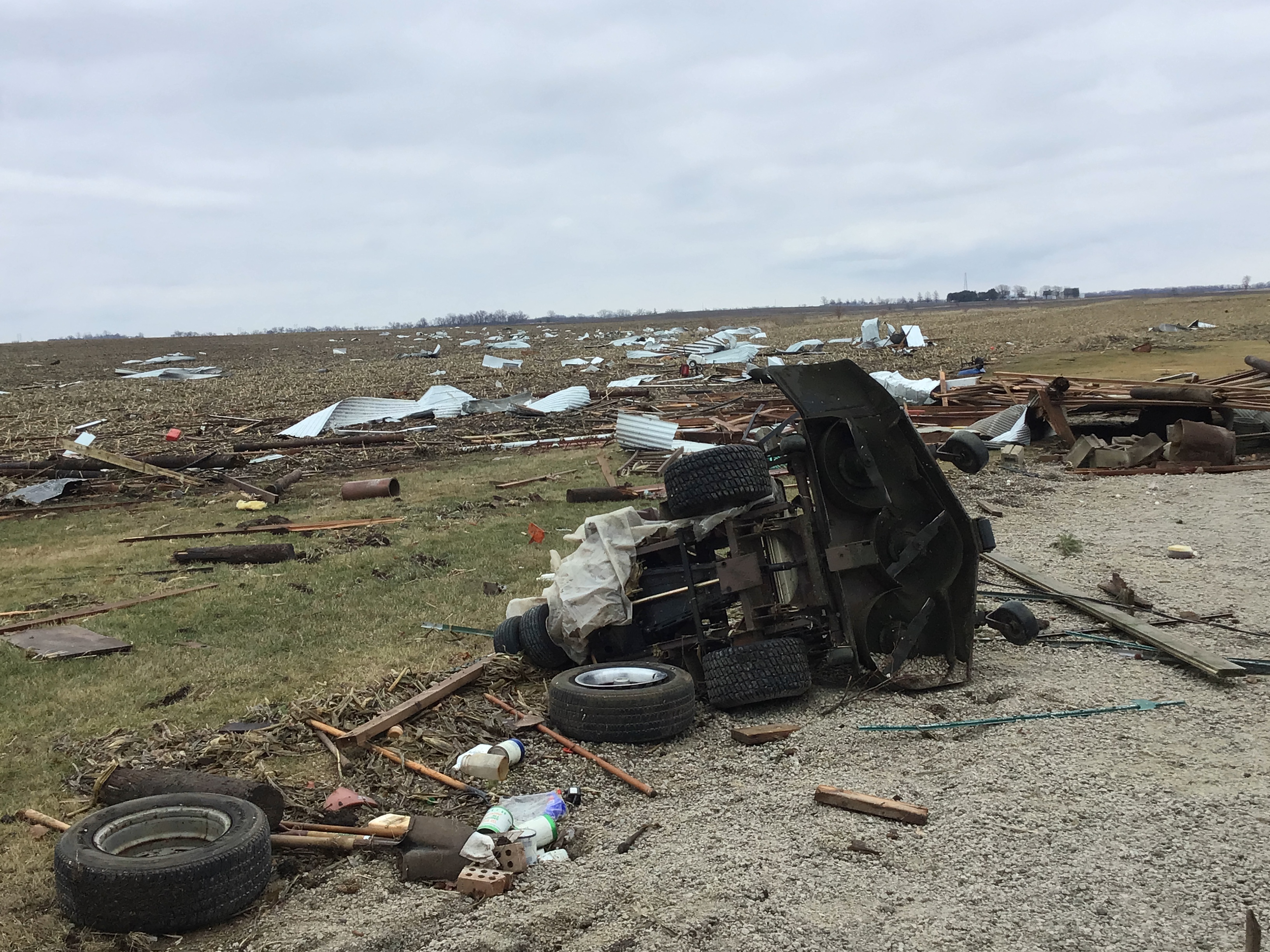 |
| Hail in Elgin, IL. Courtesy of Antonio Rios. | Tornado damage southeast of Gibson City. From NWS storm survey. | Tornado damage southeast of Gibson City. From NWS storm survey. |
..TIME... ...EVENT... ...CITY LOCATION... ...LAT.LON...
..DATE... ....MAG.... ..COUNTY LOCATION..ST.. ...SOURCE....
..REMARKS..
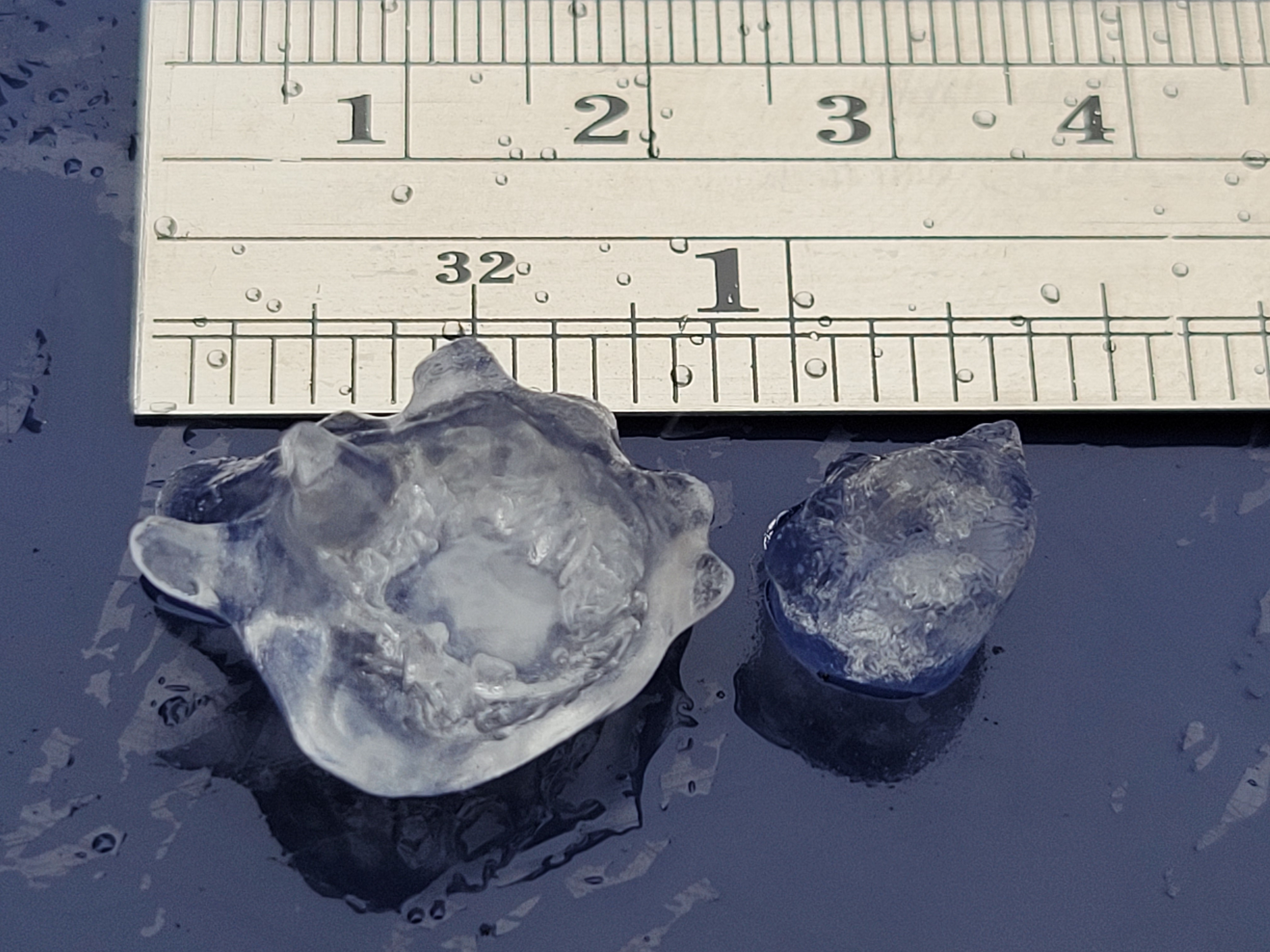
0214 PM HAIL 1 NE ELGIN 42.05N 88.27W
01/03/2023 M1.00 INCH KANE IL TRAINED SPOTTER
MOST HAILSTONES WERE HALF AN INCH OR LESS IN
DIAMETER, BUT PHOTOS SHOW THAT THE LARGEST
HAILSTONES WERE ROUGHLY ONE INCH IN
DIAMETER.
0215 PM HAIL 1 N ELGIN 42.06N 88.28W
01/03/2023 U0.50 INCH KANE IL PUBLIC
REPORT FROM MPING: HALF-INCH (0.50 IN.).
0219 PM HAIL 6 WNW HOFFMAN ESTATES 42.07N 88.22W
01/03/2023 U0.50 INCH COOK IL PUBLIC
REPORT FROM MPING: HALF-INCH (0.50 IN.).
0230 PM HAIL 1 N BARRINGTON 42.17N 88.13W
01/03/2023 U0.50 INCH LAKE IL PUBLIC
REPORT FROM MPING: HALF-INCH (0.50 IN.).
0235 PM HAIL PALATINE 42.14N 88.02W
01/03/2023 E0.70 INCH COOK IL TRAINED SPOTTER
HAIL COATING THE GROUND WITH THE LARGEST
HAILSTONES APPROXIMATELY DIME SIZED.
0250 PM HAIL 1 NW NORTH CHICAGO 42.33N 87.86W
01/03/2023 E0.75 INCH LAKE IL PUBLIC
HAIL COATING THE GROUND WITH THE LARGEST
HAILSTONES APPROXIMATELY PENNY SIZED.
0253 PM HAIL 1 SSE WAUKEGAN 42.35N 87.84W
01/03/2023 E1.00 INCH LAKE IL PUBLIC
PHOTOS SHARED SHOWING HAILSTONES
APPROXIMATELY ONE INCH IN DIAMETER IN
WAUKEGAN. TIME AND LOCATION ESTIMATED FROM
RADAR.
0556 PM TORNADO 3 SSE GIBSON CITY 40.42N 88.37W
01/03/2023 FORD IL NWS STORM SURVEY
NWS STORM SURVEY FOUND DAMAGE CONSISTENT
WITH AN EF1 TORNADO WITH ESTIMATED PEAK
WINDS OF 100 MPH. DAMAGE INCLUDED LOSS OF
PORTIONS OF A ROOF DECK ON TWO HOMES AND
COLLAPSE OF AN OUT BUILDING.
0721 PM HAIL 1 SE LYNWOOD 41.52N 87.53W
01/03/2023 U0.75 INCH COOK IL TRAINED SPOTTER
TIME ESTIMATED FROM RADAR.
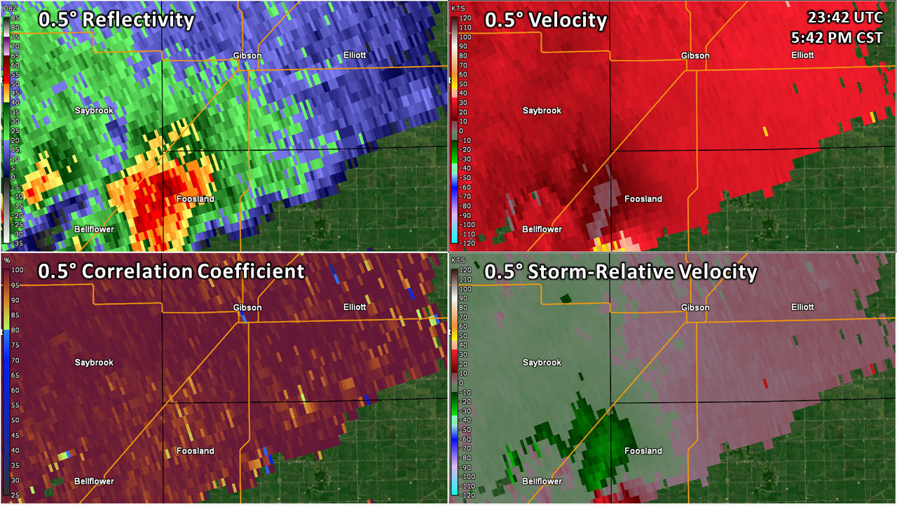
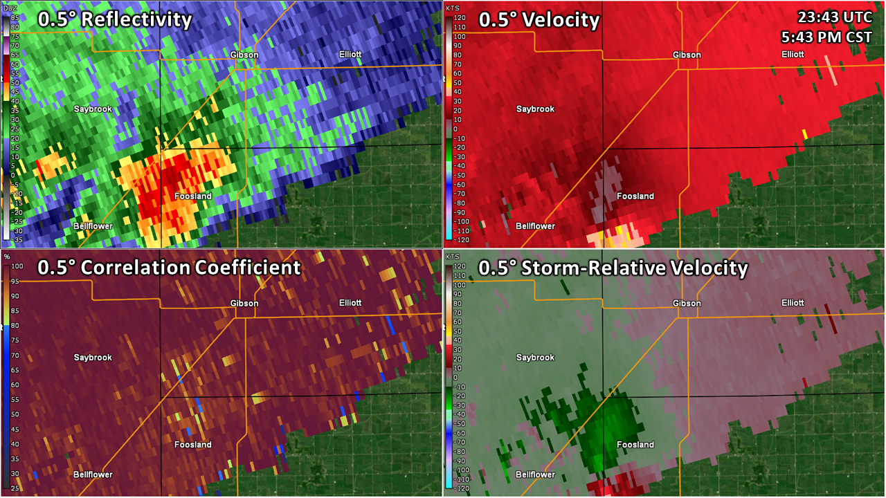
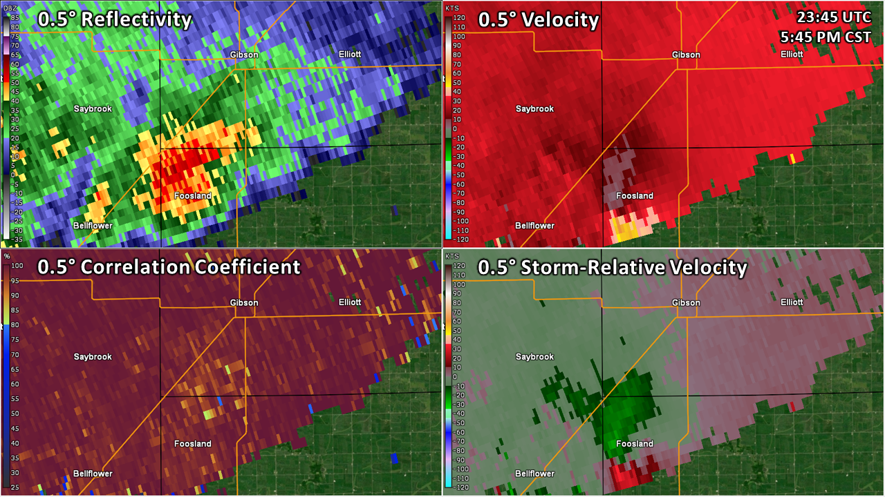
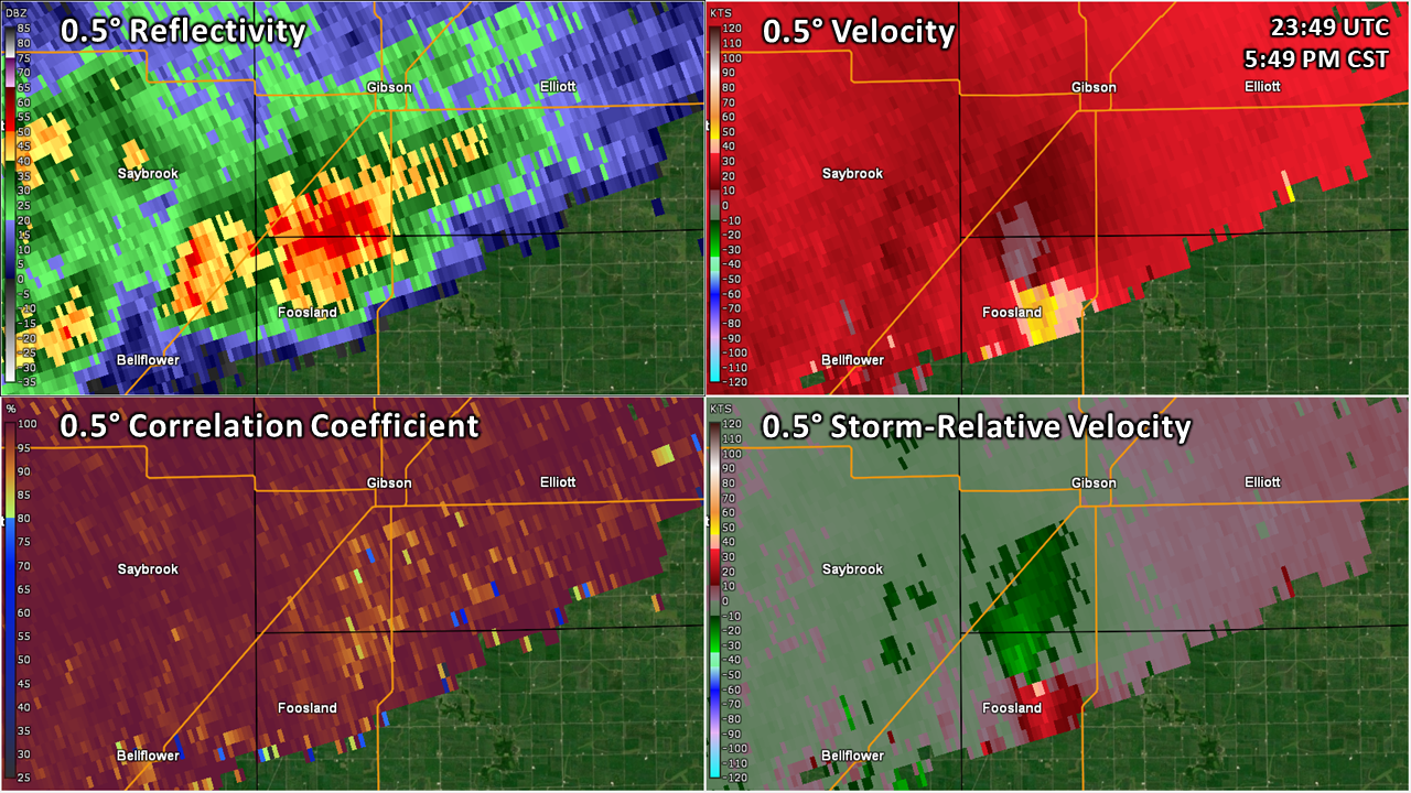
Radar
Below is a four-panel loop from the Lincoln, Illinois radar (which was quite a bit closer to this supercell than our radar in Romeoville) which runs from 5:42 PM CST through 6:10 PM CST. Note that there are two velocity products shown: base velocity (top right image) and "storm-relative" velocity (bottom right). Storm-relative velocity removes the storm motion from the base velocity product, which makes it a bit easier to see areas of rotation.


 |
Media use of NWS Web News Stories is encouraged! Please acknowledge the NWS as the source of any news information accessed from this site. Additional recaps can be found on the NWS Chicago Past Events Page |
|