A significant heat wave is underway for the Intermountain West, Northern Plains, and Upper Great Lakes, peaking in intensity through midweek and lingering across parts of the Northern Plains and Midwest until this weekend. In southwest Texas, excessive rainfall may bring a risk for potentially life-threatening flash and arroyo flooding through Thursday. Read More >
|
|
Overview
Tornado
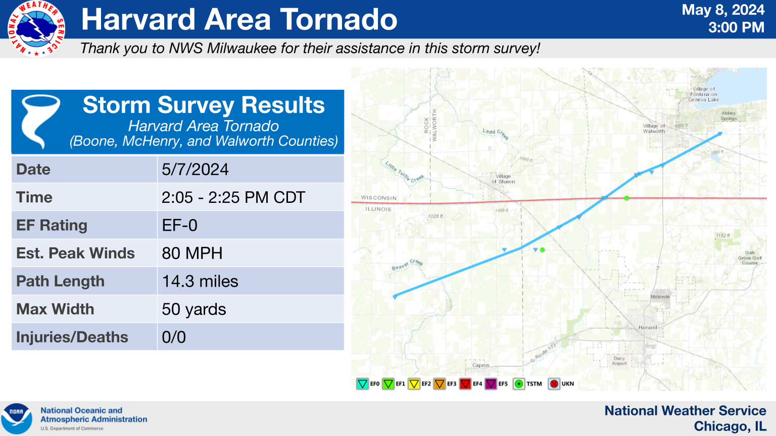
Harvard, IL Area Tornado
|
(click on image to enlarge)
|
|
Summary: A tornado developed in far northern Illinois and tracked northwest of Harvard, IL into Wisconsin south of Walworth before ending east of Walworth. The main structural damage was to a barn on the Illinois side near Weidner Rd., where it collapsed and landed on a number of sheep that were sheltering there. Another shed was lofted and destroyed along Six Corners Rd. near Highway 67. |
The Enhanced Fujita (EF) Scale classifies tornadoes into the following categories:
| EF0 Weak 65-85 mph |
EF1 Moderate 86-110 mph |
EF2 Significant 111-135 mph |
EF3 Severe 136-165 mph |
EF4 Extreme 166-200 mph |
EF5 Catastrophic 200+ mph |
 |
|||||
When a tornado is known to have occurred but does not cause damage to any qualified damage indicators, or if the only damage is located in an area that is inaccessible to NWS storm survey personnel, then a tornado may be assigned the EF-Unknown (EF-U) rating.
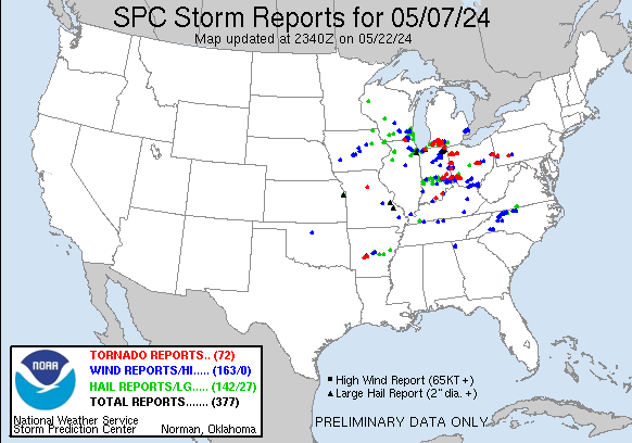
Storm Reports
|
Preliminary Storm Report Map |
Preliminary Local Storm Report...Summary
National Weather Service Chicago IL
323 PM CDT Wed May 8 2024

..TIME...   ...EVENT...      ...CITY LOCATION...     ...LAT.LON...
..DATE...   ....MAG....      ..COUNTY LOCATION..ST.. ...SOURCE....
            ..REMARKS..

1233 PM     Hail             3 NW Adeline            42.17N 89.54W
05/07/2024  M0.75 Inch       Ogle               IL   Public


0143 PM     Hail             Channahon               41.41N 88.25W
05/07/2024  E1.00 Inch       Grundy             IL   Public

            Photos shared on social media showing
            quarter size hail in Channahon. Time
            estimated from radar.

0145 PM     Hail             1 NE Channahon          41.44N 88.22W
05/07/2024  E0.88 Inch       Will               IL   Emergency Mngr

            mostly pea sized to dime, with larger mixed
            in.

0150 PM     Hail             1 NW Joliet             41.53N 88.09W
05/07/2024  E0.75 Inch       Will               IL   Public

            Report from mPING: Dime (0.75 in.).

0152 PM     Hail             Merrionette Park        41.68N 87.70W
05/07/2024  M1.00 Inch       Cook               IL   Public


0153 PM     Hail             Beverly - Chicago       41.71N 87.67W
05/07/2024  M1.00 Inch       Cook               IL   Public


0156 PM     Hail             1 SW Evergreen Park     41.71N 87.72W
05/07/2024  E1.00 Inch       Cook               IL   Public

            Report from mPING: Quarter (1.00 in.).

0157 PM     Hail             1 N Rockdale            41.52N 88.12W
05/07/2024  E0.75 Inch       Will               IL   Public

            Report from mPING: Dime (0.75 in.).

0205 PM     Tornado          5 NNW Harvard           42.48N 88.66W
05/07/2024                   McHenry            IL   NWS Storm Survey

            An EF-0 tornado began northwest of Capron in
            northern Boone County, crossed into
            northwest McHenry County where a barn was
            destroyed, then continued across the state
            line into southern Wisconsin.

0207 PM     Hail             3 NE New Lenox          41.54N 87.94W
05/07/2024  E1.00 Inch       Will               IL   Public

            Report from mPING: Quarter (1.00 in.).

0210 PM     Flood            2 E Ingalls Park        41.52N 88.00W
05/07/2024                   Will               IL   Public

            Video shared to social media shows several
            inches of standing water on Gougar Road near
            US30 east of Joliet. Time estimated by
            radar.

0210 PM     Flood            2 ENE Ingalls Park      41.53N 88.00W
05/07/2024                   Will               IL   Public

            Gougar Road near Francis Road flooded. Time
            estimated by radar.

0212 PM     Hail             2 NW Mokena             41.55N 87.91W
05/07/2024  M1.50 Inch       Will               IL   Public

            Photo shared on social media showing hail
            that fell in Mokena. The largest hailstone
            was approximately 1.5 inches in diameter
            with most other hailstones being under 1
            inch in diameter.

0217 PM     Hail             1 E Orland Hills        41.59N 87.83W
05/07/2024  U1.00 Inch       Cook               IL   Public

            Report from mPING: Quarter (1.00 in.).

0217 PM     Hail             1 WNW Tinley Park       41.58N 87.82W
05/07/2024  M0.88 Inch       Cook               IL   Public


0218 PM     Hail             1 N Tinley Park         41.59N 87.80W
05/07/2024  M1.75 Inch       Cook               IL   Public


0219 PM     Tstm Wnd Dmg     1 NW Oak Forest         41.61N 87.76W
05/07/2024                   Cook               IL   Public

            Large tree downed on fence, photo relayed
            via service account email. Time estimated by
            radar.

0220 PM     Tstm Wnd Dmg     Alsip                   41.67N 87.74W
05/07/2024                   Cook               IL   Public

            reports of minor gutter damage to homes.

0220 PM     Flood            1 NE Orland Park        41.63N 87.83W
05/07/2024                   Cook               IL   Public

            Public report of street flooding in Orland
            Park. Time estimated by radar.

0220 PM     Hail             Tinley Park             41.57N 87.80W
05/07/2024  M1.00 Inch       Cook               IL   Trained Spotter


0220 PM     Hail             1 W Palos Park          41.67N 87.85W
05/07/2024  E1.00 Inch       Cook               IL   Trained Spotter


0220 PM     Hail             Orland Park             41.62N 87.85W
05/07/2024  M1.25 Inch       Cook               IL   Public


0222 PM     Hail             Homer Glen              41.60N 87.94W
05/07/2024  M1.00 Inch       Will               IL   Public


0222 PM     Hail             Palos Heights           41.67N 87.80W
05/07/2024  M1.50 Inch       Cook               IL   Trained Spotter


0223 PM     Hail             Worth                   41.69N 87.80W
05/07/2024  U1.00 Inch       Cook               IL   Public

            Report from mPING: Quarter (1.00 in.).

0223 PM     Hail             Crestwood               41.65N 87.75W
05/07/2024  M1.25 Inch       Cook               IL   Trained Spotter

            Corrects time on previous hail report from
            Crestwood.

0223 PM     Hail             1 W Alsip               41.67N 87.76W
05/07/2024  M1.50 Inch       Cook               IL   Public

            Time estimated by radar. Relayed via mping.

0225 PM     Flood            Worth                   41.70N 87.80W
05/07/2024                   Cook               IL   Public

            Multiple public reports received of street
            flooding in the Palos Heights, Chicago
            Ridge, and Oak Lawn areas. Relayed via
            mping. Time estimated by radar.

0225 PM     Hail             Alsip                   41.67N 87.74W
05/07/2024  M1.25 Inch       Cook               IL   Public

            Corrects time on previous hail report from
            Alsip.

0225 PM     Hail             1 NW Oak Forest         41.61N 87.75W
05/07/2024  E1.25 Inch       Cook               IL   Public

            Report from mPING: Half Dollar (1.25 in.).

0226 PM     Flood            1 S Machesney Park      42.33N 89.04W
05/07/2024                   Winnebago          IL   Broadcast Media

            Saturn Street Flooded.

0226 PM     Hail             1 W Oak Lawn            41.72N 87.77W
05/07/2024  U1.00 Inch       Cook               IL   Public

            Report from mPING: Quarter (1.00 in.).

0227 PM     Hail             Hometown                41.73N 87.73W
05/07/2024  M1.00 Inch       Cook               IL   Public

            Relayed via mping. Time estimated via radar.

0227 PM     Hail             3.0 SW Midway Airport   41.74N 87.78W
05/07/2024  E0.88 Inch       Cook               IL   CO-OP Observer


0229 PM     Tstm Wnd Dmg     1 NNE Roseland - Chicag 41.72N 87.62W
05/07/2024                   Cook               IL   911 Call Center

            Multiple reports of tree damage across the
            south side of Chicago. The damage appeared
            to be most concentrated in the Washington
            Heights, Roseland, Chatham, Avalon Park,
            South Shore, and South Chicago community
            areas of the city.

0230 PM     Hail             2 N Tinley Park         41.60N 87.79W
05/07/2024  E2.00 Inch       Cook               IL   Emergency Mngr


0238 PM     Hail             1 SW Auburn-Gresham     41.74N 87.67W
05/07/2024  E1.00 Inch       Cook               IL   Trained Spotter


0240 PM     Flash Flood      1 E Washington Hts - Ch 41.71N 87.63W
05/07/2024                   Cook               IL   Dept of Highways

            Traffic cameras show all lanes of I-57
            northbound flooded between Halsted Street
            and Wentworth Avenue. Time estimated by
            radar and traffic travel time data.

0243 PM     Flood            Machesney Park          42.35N 89.04W
05/07/2024                   Winnebago          IL   Broadcast Media

            Front yards flooded with several inches of
            water.

0245 PM     Tstm Wnd Dmg     2 S Hebron              42.44N 88.44W
05/07/2024                   McHenry            IL   Emergency Mngr

            Large branches down, road impassable by cars
            on Rt 47 and Vander Karr.

0249 PM     Hail             2 SE Hobart             41.51N 87.23W
05/07/2024  M1.50 Inch       Lake               IN   Cocorahs


0252 PM     Hail             1 S Hobart              41.52N 87.26W
05/07/2024  M1.00 Inch       Lake               IN   Public

            Time estimated by radar. Relayed via mping.

0253 PM     Flood            Harvard                 42.42N 88.61W
05/07/2024                   McHenry            IL   Broadcast Media

            North Jefferson Street flooded.

0257 PM     Hail             Portage                 41.56N 87.18W
05/07/2024  E1.00 Inch       Porter             IN   Trained Spotter

            Photo shared on social media showing quarter
            size hail in Portage. Time estimated from
            radar.

0305 PM     Hail             2 NNE Porter            41.64N 87.06W
05/07/2024  E1.25 Inch       Porter             IN   Public


0305 PM     Tstm Wnd Dmg     2 NNE Porter            41.64N 87.06W
05/07/2024                   Porter             IN   Public

            Numerous trees reported down in area.

0306 PM     Tstm Wnd Dmg     1 NNE Porter            41.63N 87.07W
05/07/2024                   Porter             IN   Fire Dept/Rescue

            Trees down.

0307 PM     Tstm Wnd Dmg     1 SW Porter             41.61N 87.08W
05/07/2024                   Porter             IN   Public

            Large trees snapped near base.

0311 PM     Tstm Wnd Dmg     2 NNE Porter            41.64N 87.06W
05/07/2024                   Porter             IN   Fire Dept/Rescue

            CR50 and US 20 Tree down on road.

0316 PM     Hail             Town of Pines           41.68N 86.96W
05/07/2024  M1.25 Inch       Porter             IN   Trained Spotter


0316 PM     Tstm Wnd Dmg     Town of Pines           41.68N 86.95W
05/07/2024                   Porter             IN   NWS Storm Survey

            An NWS storm survey found that tree and
            vehicle damage in and near the Town of Pines
            area was caused by a microburst and
            wind-driven large hail.

0412 PM     Hail             Waukegan                42.36N 87.84W
05/07/2024  M0.75 Inch       Lake               IL   Public


0726 PM     Tstm Wnd Gst     Compton                 41.69N 89.08W
05/07/2024  M56 MPH          Lee                IL   Mesonet

            Peak gust from a Davis personal weather
            station.

0730 PM     Hail             Steward                 41.85N 89.02W
05/07/2024  M0.75 Inch       Lee                IL   Trained Spotter


0814 PM     Tstm Wnd Gst     1 NE Lily Lake          41.96N 88.47W
05/07/2024  E59 MPH          Kane               IL   Public

            Several 3-5 inch diameter branches blown
            down.

0823 PM     Tstm Wnd Gst     3 SE Batavia            41.82N 88.27W
05/07/2024  M64 MPH          Kane               IL   Mesonet

            Mesonet station KILAUROR58, 64.4 mph wind
            gust, matched time and location with TORD,
            TMDW, and KLOT wind max.

0830 PM     Tstm Wnd Gst     1 SW Warrenville        41.81N 88.18W
05/07/2024  M50 MPH          DuPage             IL   Mesonet

            Mesonet station KILWARRE34. 50.3 mph wind
            gust, matched time and location with TORD,
            TMDW, and KLOT wind max.

0833 PM     Tstm Wnd Dmg     Naperville              41.77N 88.15W
05/07/2024                   DuPage             IL   Public

            Picture relayed via social media of a large
            tree branch down. Time estimated via radar.
|
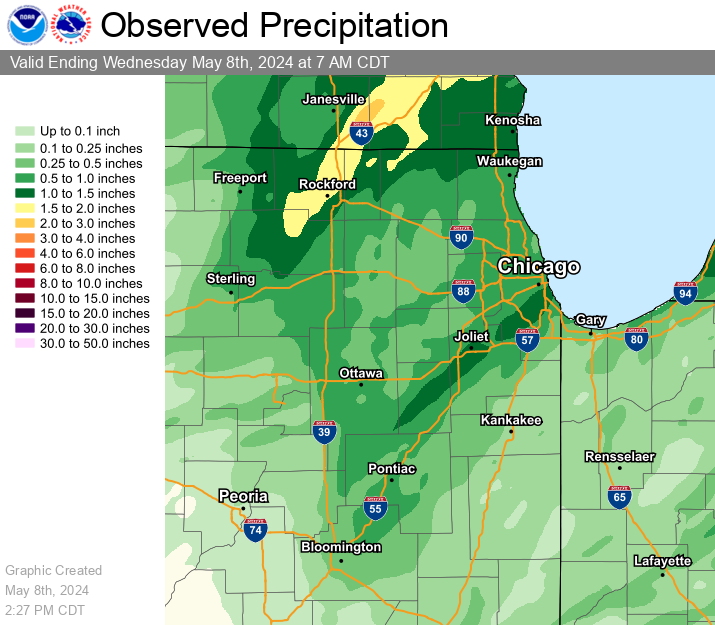
Rainfall
|
Map of Approximate 24-hour Rainfall Totals from the Morning of 5/7 through the Morning of 5/8 |
CoCoRaHS Precipitation Summary National Weather Service Chicago IL 158 PM CDT Wed May 8 2024 24-hour CoCoRaHS precipitation reports ending between 6 AM and 9 AM local time. These reports are considered supplemental and unofficial. .B LOT 0508 C DH07/PP/SF/SD/SW : : :Illinois CoCoRaHS Precipitation Reports : : Snow Snow Water : Pcpn Fall Depth Equiv : IL-MCH-103 : Harvard 4.4 NNE : 2.10 / MM / MM / MM IL-WN-48 : Rockford 3.8 NNW : 2.09 / MM / MM / MM IL-WN-40 : Rockford 4.5 WSW : 1.97 / MM / MM / MM IL-WN-45 : Machesney Park 0.9 W : 1.95 / MM / MM / MM IL-MCH-108 : Spring Grove 1.2 ESE : 1.83 / MM / MM / MM IL-WN-41 : South Beloit 1.5 ESE : 1.77 / MM / MM / MM IL-WL-174 : Joliet 0.8 E : 1.65 / MM / MM / MM IL-WL-131 : Homer Glen 0.7 NNE : 1.59 / 0.0 / 0.0 / MM IL-CK-149 : Oak Lawn 0.5 SSW : 1.56 / MM / MM / MM IL-CK-211 : Oak Lawn 1.6 WNW : 1.56 / MM / MM / MM IL-WL-175 : Joliet 0.7 WNW : 1.54 / MM / MM / MM IL-CK-148 : Oak Lawn 1.9 SE : 1.51 / MM / MM / MM IL-WN-44 : Winnebago 5.4 SE : 1.47 / MM / MM / MM IL-LK-83 : Antioch 3.4 WSW : 1.46 / MM / MM / MM IL-GY-16 : Morris 6.4 ESE : 1.42 / MM / MM / MM IL-GY-10 : Minooka 0.3 NE : 1.39 / MM / MM / MM IL-MCH-115 : McHenry 3.8 ENE : 1.35 / MM / MM / MM IL-WL-67 : Channahon 2.5 SSE : 1.35 / MM / MM / MM IL-LK-81 : Lake Villa 2.3 WSW : 1.32 / MM / MM / MM IL-CK-364 : Evergreen Park 0.4 WNW : 1.26 / MM / MM / MM IL-GY-20 : Morris 2.5 SSE : 1.26 / MM / MM / MM IL-BN-19 : Belvidere 5.0 NNW : 1.24 / MM / MM / MM IL-MCH-66 : Harvard 2.8 SSE : 1.24 / MM / MM / MM IL-CK-390 : Alsip 0.9 E : 1.23 / MM / MM / MM IL-BN-14 : Capron 0.1 N : 1.21 / MM / MM / MM IL-WL-63 : New Lenox 1.8 SE : 1.21 / MM / MM / MM IL-WL-147 : New Lenox 2.0 ESE : 1.20 / MM / MM / MM IL-LK-26 : Zion 0.5 WNW : 1.18 / MM / MM / MM IL-LK-23 : Winthrop Harbor 0.2 SSE : 1.16 / MM / MM / MM IL-WL-180 : Mokena 4.4 WNW : 1.14 / MM / MM / MM IL-GY-01 : Carbon Hill 3.1 N : 1.12 / 0.0 / 0.0 / MM IL-LE-25 : Dixon 0.8 NE : 1.11 / MM / MM / MM IL-MCH-35 : Lakemoor 1.9 NW : 1.08 / MM / MM / MM IL-LK-09 : Lake Villa 1.1 SSW : 1.06 / MM / MM / MM IL-WL-72 : New Lenox 2.9 ENE : 1.04 / MM / MM / MM IL-WL-100 : Joliet 2.9 WNW : 1.04 / MM / MM / MM IL-CK-152 : Chicago Ridge 0.2 WSW : 1.03 / MM / MM / MM IL-WL-97 : New Lenox 3.3 E : 1.01 / 0.0 / 0.0 / 0.00 IL-MCH-34 : Pistakee Highlands 0.4 SW : 1.00 / MM / MM / MM IL-LK-112 : Lindenhurst 1.0 ENE : 0.98 / MM / MM / MM IL-CK-253 : Midlothian 0.1 SSE : 0.95 / MM / MM / MM IL-GY-28 : Morris 1.5 SW : 0.94 / MM / MM / MM IL-WL-42 : Mokena 1.3 W : 0.93 / MM / MM / MM IL-LE-05 : Sterling 4.3 NE : 0.87 / MM / MM / MM IL-WL-182 : Plainfield 3.9 SSW : 0.87 / MM / MM / MM IL-CK-306 : Oak Forest 0.6 N : 0.85 / 0.0 / 0.0 / MM IL-GY-21 : Coal City 2.8 N : 0.85 / MM / MM / MM IL-CK-285 : Harwood Heights 0.4 NNE : 0.84 / MM / MM / MM IL-CK-163 : Arlington Heights 1.2 SW : 0.82 / MM / MM / MM IL-LK-18 : Grayslake 0.7 WSW : 0.82 / MM / MM / MM IL-LE-22 : Amboy 0.5 SSW : 0.81 / MM / MM / MM IL-LV-30 : Pontiac 1.1 NNW : 0.81 / MM / MM / MM IL-MCH-33 : Woodstock 3.8 SW : 0.81 / MM / MM / MM IL-DP-189 : Downers Grove 1.8 SSE : 0.80 / MM / MM / MM IL-GY-38 : Dwight 2.2 NNW : 0.80 / MM / MM / MM IL-WL-96 : Wilmington 6.3 NW : 0.80 / MM / MM / MM IL-MCH-13 : Bull Valley 2.5 WNW : 0.79 / 0.0 / 0.0 / MM IL-MCH-107 : Crystal Lake 3.9 WNW : 0.79 / MM / MM / MM IL-WL-165 : Frankfort 1.3 ESE : 0.79 / MM / MM / MM IL-CK-12 : Bridgeview 1.3 NNW : 0.77 / MM / MM / MM IL-CK-326 : Morton Grove 1.2 WNW : 0.77 / MM / MM / MM IL-DP-177 : Winfield 0.8 ENE : 0.77 / MM / MM / MM IL-KN-33 : North Aurora 1.5 NE : 0.77 / MM / MM / MM IL-CK-367 : Mount Prospect 0.2 NNE : 0.76 / MM / MM / MM IL-DP-42 : Carol Stream 0.3 SSE : 0.76 / MM / MM / MM IL-CK-294 : Palatine 1.4 NNE : 0.75 / MM / MM / MM IL-DP-176 : Winfield 0.6 SSW : 0.75 / MM / MM / MM IL-DP-191 : Winfield 0.7 NE : 0.75 / MM / MM / MM IL-CK-98 : La Grange Park 0.7 SSW : 0.74 / MM / MM / MM IL-DP-79 : Burr Ridge 1.9 SW : 0.72 / 0.0 / 0.0 / MM IL-LE-27 : Amboy 0.5 SSE : 0.72 / 0.0 / 0.0 / 0.00 IL-CK-131 : Schaumburg 2.0 E : 0.72 / MM / MM / MM IL-CK-322 : Arlington Heights 0.8 NNW : 0.72 / MM / MM / MM IL-CK-405 : Palatine 2.6 WNW : 0.72 / MM / MM / MM IL-DP-187 : Lombard 0.2 N : 0.72 / MM / MM / MM IL-KD-124 : Plattville 0.5 W : 0.72 / MM / MM / MM IL-WL-178 : Mokena 2.1 SW : 0.72 / MM / MM / MM IL-KD-34 : Plainfield 4.8 SW : 0.71 / 0.0 / 0.0 / MM IL-CK-406 : Palatine 1.5 NE : 0.71 / MM / MM / MM IL-LK-13 : Lake Bluff 1.3 W : 0.71 / MM / MM / MM IL-DP-102 : Bolingbrook 2.7 NE : 0.70 / MM / MM / MM IL-DP-180 : Bolingbrook 2.7 NE : 0.70 / MM / MM / MM IL-GY-11 : Morris 4.8 NNW : 0.70 / MM / MM / MM IL-MCH-94 : McHenry 2.4 E : 0.70 / MM / MM / MM IL-DP-174 : Bolingbrook 2.6 NE : 0.69 / MM / MM / MM IL-MCH-49 : Cary 0.3 NE : 0.68 / MM / MM / MM IL-LE-08 : Ashton 0.4 SSW : 0.67 / 0.0 / 0.0 / MM IL-MCH-43 : Algonquin 0.7 N : 0.67 / 0.0 / 0.0 / 0.00 IL-DP-40 : Lombard 1.0 NNW : 0.67 / MM / MM / MM IL-KN-119 : Maple Park 3.1 SE : 0.67 / MM / MM / MM IL-LK-120 : Wadsworth 1.4 S : 0.67 / MM / MM / MM IL-LK-129 : Gurnee 2.1 ESE : 0.67 / MM / MM / MM IL-WL-179 : New Lenox 2.8 SE : 0.67 / MM / MM / MM IL-DP-164 : West Chicago 3.5 SE : 0.66 / MM / MM / MM IL-LS-17 : Ottawa 1.6 N : 0.65 / 0.0 / MM / MM IL-CK-32 : Chicago 6.4 NNE : 0.65 / MM / MM / MM IL-CK-278 : Hoffman Estates 1.6 SE : 0.65 / MM / MM / MM IL-KD-125 : Plano 1.6 NW : 0.65 / MM / MM / MM IL-MCH-95 : Cary 0.5 SSW : 0.65 / MM / MM / MM IL-LS-01 : Ottawa 1.3 NW : 0.64 / MM / MM / MM IL-DP-173 : Lombard 1.2 N : 0.63 / MM / MM / MM IL-KD-136 : Oswego 0.3 E : 0.63 / MM / MM / MM IL-DK-36 : De Kalb 3.5 WSW : 0.62 / MM / MM / MM IL-KN-128 : Batavia 3.4 WSW : 0.62 / MM / MM / MM IL-DP-16 : Aurora 3.6 SE : 0.61 / 0.0 / 0.0 / 0.00 IL-CK-421 : Berwyn 1.0 SSE : 0.61 / MM / MM / MM IL-LK-11 : Lincolnshire 0.9 N : 0.61 / MM / MM / MM IL-CK-53 : Glencoe 0.1 NW : 0.60 / MM / MM / MM IL-DP-157 : West Chicago 3.5 NNE : 0.60 / MM / MM / MM IL-KN-127 : Geneva 0.6 SSE : 0.60 / MM / MM / MM IL-KN-145 : Hampshire 0.5 SE : 0.60 / MM / MM / MM IL-LE-10 : Dixon 3.0 NNW : 0.60 / MM / MM / MM IL-DP-101 : Aurora 3.8 SE : 0.59 / 0.0 / 0.0 / 0.00 IL-CK-382 : Niles 0.7 NE : 0.59 / MM / MM / MM IL-CK-412 : Oak Park 1.1 N : 0.59 / MM / MM / MM IL-KD-143 : Yorkville 3.1 N : 0.59 / MM / MM / MM IL-KD-144 : Yorkville 5.2 S : 0.59 / MM / MM / MM IL-LK-100 : Long Lake 0.4 S : 0.59 / MM / MM / MM IL-WL-92 : Naperville 4.0 SSW : 0.58 / 0.0 / MM / MM IL-CK-414 : Hoffman Estates 2.5 NNE : 0.58 / MM / MM / MM IL-DP-192 : Lombard 1.7 NW : 0.58 / MM / MM / MM IL-DP-196 : Wheaton 1.6 NNE : 0.58 / MM / MM / MM IL-KN-135 : Batavia 0.8 W : 0.58 / MM / MM / MM IL-LK-54 : Mundelein 0.5 NNE : 0.58 / MM / MM / MM IL-LK-78 : Libertyville 1.8 ESE : 0.58 / MM / MM / MM IL-CK-74 : Oak Park 1.3 NNE : 0.57 / 0.0 / MM / MM IL-KN-22 : Geneva 1.0 SSW : 0.57 / 0.0 / 0.0 / MM IL-WL-20 : Manhattan 4.7 ENE : 0.57 / 0.0 / 0.0 / MM IL-CK-323 : Chicago 6.8 NW : 0.57 / MM / MM / MM IL-DP-150 : Bloomingdale 1.2 ESE : 0.57 / MM / MM / MM IL-KN-115 : Aurora 3.5 ESE : 0.57 / MM / MM / MM IL-DP-132 : Wheaton 2.0 NNE : 0.56 / 0.0 / 0.0 / MM IL-DP-38 : Elmhurst 0.4 SW : 0.56 / MM / MM / MM IL-WL-166 : Naperville 3.6 SE : 0.56 / MM / MM / MM IL-WL-171 : Plainfield 1.7 WNW : 0.56 / MM / MM / MM IL-KN-78 : Geneva 1.3 SSW : 0.55 / 0.0 / 0.0 / 0.00 IL-CK-106 : Hoffman Estates 4.6 W : 0.55 / MM / MM / MM IL-DK-29 : Earlville 4.8 NNE : 0.55 / MM / MM / MM IL-DP-186 : Medinah 0.8 S : 0.55 / MM / MM / MM IL-KN-133 : Geneva 0.9 E : 0.55 / MM / MM / MM IL-LK-39 : Riverwoods 0.4 ENE : 0.55 / MM / MM / MM IL-LK-125 : Volo 0.3 SSE : 0.55 / MM / MM / MM IL-CK-320 : Park Forest 0.7 WNW : 0.54 / 0.0 / 0.0 / 0.00 IL-CK-214 : Rogers Park 1.5 SW : 0.54 / MM / MM / MM IL-DK-38 : Cortland 0.3 E : 0.54 / MM / MM / MM IL-DP-49 : Naperville 2.5 ESE : 0.54 / MM / MM / MM IL-KD-109 : Yorkville 1.0 N : 0.54 / MM / MM / MM IL-KN-67 : St. Charles 6.0 NW : 0.53 / 0.0 / 0.0 / MM IL-KN-123 : Aurora 2.8 WSW : 0.53 / 0.0 / MM / MM IL-KN-23 : Batavia 1.5 WNW : 0.53 / MM / MM / MM IL-KN-138 : Aurora 3.2 WNW : 0.53 / MM / MM / MM IL-KN-149 : Elgin 1.1 NNE : 0.53 / MM / MM / MM IL-LS-60 : Peru 0.7 ENE : 0.53 / MM / MM / MM IL-DK-28 : De Kalb 0.7 SW : 0.52 / 0.0 / 0.0 / MM IL-KN-09 : Elgin 1.0 S : 0.52 / 0.0 / 0.0 / MM IL-DP-163 : Lombard 1.2 E : 0.52 / MM / MM / MM IL-LK-87 : Lake Zurich 1.3 N : 0.52 / MM / MM / MM IL-CK-94 : Lincolnwood 1.8 E : 0.51 / MM / MM / MM IL-LK-74 : Mundelein 1.6 WNW : 0.51 / MM / MM / MM IL-KD-102 : Oswego 2.4 SSW : 0.50 / 0.0 / 0.0 / MM IL-KN-95 : Elgin 2.5 W : 0.50 / 0.0 / MM / MM IL-DP-190 : Roselle 1.0 SE : 0.50 / MM / MM / MM IL-WL-73 : Wilmington 2.6 SE : 0.50 / MM / MM / MM IL-CK-75 : Elk Grove Village 2.2 WSW : 0.49 / MM / MM / MM IL-CK-345 : Franklin Park 0.5 SSE : 0.49 / MM / MM / MM IL-WL-26 : Manhattan 0.8 ESE : 0.49 / MM / MM / MM IL-CK-69 : Park Forest 0.8 NNE : 0.48 / MM / MM / MM IL-MCH-87 : Marengo 0.7 NNE : 0.48 / MM / MM / MM IL-WL-99 : Manhattan 1.9 SE : 0.48 / MM / MM / MM IL-KN-121 : Geneva 1.3 NW : 0.47 / 0.0 / 0.0 / 0.00 IL-KN-134 : Maple Park 3.9 S : 0.47 / MM / MM / MM IL-LK-16 : Buffalo Grove 1.5 N : 0.47 / MM / MM / MM IL-LK-103 : Buffalo Grove 1.3 ESE : 0.47 / MM / MM / MM IL-LK-128 : Lake Forest 2.0 WSW : 0.47 / MM / MM / MM IL-LV-28 : Dwight 2.3 SSE : 0.47 / MM / MM / MM IL-MCH-110 : Algonquin 1.4 WSW : 0.46 / MM / MM / MM IL-KN-02 : Elgin 2.3 WNW : 0.45 / MM / MM / MM IL-LK-121 : Libertyville 0.4 ESE : 0.45 / MM / MM / MM IL-CK-336 : Evanston 0.8 ESE : 0.44 / 0.0 / 0.0 / 0.00 IL-KN-64 : St. Charles 0.1 E : 0.44 / 0.0 / 0.0 / MM IL-KN-144 : North Aurora 0.8 N : 0.44 / 0.0 / 0.0 / 0.00 IL-CK-371 : Evanston 1.2 S : 0.44 / MM / MM / MM IL-KD-110 : Yorkville 0.9 SSW : 0.44 / MM / MM / MM IL-KD-126 : Oswego 1.1 ESE : 0.44 / MM / MM / MM IL-KK-39 : Herscher 3.3 E : 0.43 / 0.0 / 0.0 / MM IL-DK-27 : Kingston 2.3 WNW : 0.42 / MM / MM / MM IL-KN-86 : Elgin 7.5 WSW : 0.42 / MM / MM / MM IL-KN-118 : Sleepy Hollow 0.7 W : 0.42 / MM / MM / MM IL-MCH-83 : Crystal Lake 1.0 WSW : 0.42 / MM / MM / MM IL-MCH-109 : Crystal Lake 2.9 ENE : 0.42 / MM / MM / MM IL-KK-47 : Herscher 2.5 ESE : 0.40 / MM / MM / MM IL-CK-260 : Midlothian 1.2 SE : 0.39 / MM / MM / MM IL-KD-127 : Oswego 1.7 WSW : 0.39 / MM / MM / MM IL-KN-98 : Gilberts 0.5 N : 0.39 / MM / MM / MM IL-LV-23 : Fairbury 4.7 SSE : 0.39 / MM / MM / MM IL-CK-64 : Homewood 0.1 ESE : 0.38 / 0.0 / 0.0 / MM IL-DP-85 : Villa Park 1.0 NW : 0.38 / MM / MM / MM IL-KN-04 : Sugar Grove 0.7 NE : 0.38 / MM / MM / MM IL-CK-407 : Matteson 0.9 E : 0.37 / MM / MM / MM IL-DK-09 : De Kalb 3.2 WNW : 0.37 / MM / MM / MM IL-DK-42 : Sycamore 1.4 SE : 0.37 / MM / MM / MM IL-KD-05 : Montgomery 0.8 SSE : 0.35 / MM / MM / MM IL-DK-05 : Cortland 0.3 SSW : 0.34 / MM / MM / MM IL-CK-63 : Elk Grove Village 0.6 ESE : 0.33 / MM / MM / MM IL-LE-26 : West Brooklyn 4.3 WNW : 0.33 / MM / MM / MM IL-CK-424 : Tinley Park 1.1 ESE : 0.31 / MM / MM / MM IL-CK-229 : Flossmoor 1.2 ESE : 0.30 / MM / MM / MM IL-IR-22 : Chebanse 1.6 SW : 0.30 / MM / MM / MM IL-KK-28 : Chebanse 0.4 NNE : 0.30 / MM / MM / MM IL-LS-34 : La Salle 0.1 W : 0.30 / MM / MM / MM IL-GY-34 : Morris 4.5 NW : 0.28 / MM / MM / MM IL-LV-07 : Chatsworth 0.4 ESE : 0.20 / MM / MM / MM IL-WL-46 : Peotone 0.4 ENE : 0.19 / 0.0 / 0.0 / MM IL-GY-04 : Coal City 0.4 N : 0.19 / MM / MM / MM IL-WL-58 : Plainfield 3.0 ESE : 0.19 / MM / MM / MM IL-OG-16 : Rochelle 5.1 WNW : 0.17 / MM / MM / MM IL-WL-149 : Bult Field-Monee 4.9 SE : 0.16 / 0.0 / 0.0 / MM IL-KK-46 : Aroma Park 0.6 S : 0.16 / MM / MM / MM IL-IR-16 : Cissna Park 0.6 S : 0.14 / 0.0 / 0.0 / 0.00 IL-WL-138 : Crete 2.7 W : 0.13 / MM / MM / MM IL-KK-45 : Kankakee 1.4 WSW : 0.12 / MM / MM / MM IL-WL-25 : Crete 2.6 E : 0.12 / MM / MM / MM IL-IR-24 : Clifton 3.9 ESE : 0.11 / MM / MM / MM IL-IR-27 : Martinton 4.0 WNW : 0.11 / MM / MM / MM IL-IR-21 : Clifton 0.5 WNW : 0.10 / MM / MM / MM IL-MCH-113 : Crystal Lake 3.5 NE : 0.10 / MM / MM / MM IL-FD-09 : Gibson City 3.0 WNW : 0.09 / MM / MM / MM IL-IR-14 : Watseka 6.9 WNW : 0.09 / MM / MM / MM IL-WL-23 : Beecher 3.4 SSE : 0.09 / MM / MM / MM IL-FD-10 : Gibson City 6.5 NE : 0.08 / MM / MM / MM IL-LS-49 : North Utica 6.3 N : 0.08 / MM / MM / MM IL-LV-27 : Flanagan 0.4 NNE : 0.08 / MM / MM / MM IL-WL-136 : Crete 3.3 ENE Franktuary : 0.07 / 0.0 / 0.0 / MM IL-IR-26 : Buckley 4.0 ENE : 0.07 / MM / MM / MM IL-WL-65 : Crete 2.6 SSW : 0.07 / MM / MM / MM IL-LS-12 : Peru 0.6 SW : 0.06 / MM / MM / MM IL-LV-20 : Cropsey 1.0 NE : 0.05 / MM / MM / MM IL-IR-02 : Ashkum 5.6 E : 0.04 / MM / MM / MM IL-IR-25 : Milford 3.5 ENE : 0.04 / MM / MM / MM : : :Indiana CoCoRaHS Precipitation Reports : : Snow Snow Water : Pcpn Fall Depth Equiv : IN-PT-69 : Porter 0.6 S : 1.32 / MM / MM / MM IN-PT-80 : Portage 2.8 E : 1.01 / MM / MM / MM IN-PT-181 : Porter 2.1 SW : 0.77 / MM / MM / MM IN-LK-119 : Hobart 2.4 SE : 0.57 / 0.0 / 0.0 / 0.00 IN-PT-70 : Valparaiso 5.8 NE : 0.48 / MM / MM / MM IN-LK-111 : Hobart 1.1 S : 0.40 / MM / MM / MM IN-JS-31 : De Motte 5.9 S : 0.35 / MM / MM / MM IN-JS-37 : De Motte 0.8 NNW : 0.32 / MM / MM / MM IN-LK-26 : Crown Point 1.1 N : 0.32 / MM / MM / MM IN-PT-110 : Chesterton 1.4 ENE : 0.27 / MM / MM / MM IN-PT-180 : Valparaiso 2.7 ENE : 0.27 / MM / MM / MM IN-NW-01 : Mount Ayr 1.6 NNE : 0.26 / 0.0 / 0.0 / 0.00 IN-JS-45 : De Motte 1.2 SSW : 0.26 / MM / MM / MM IN-JS-49 : De Motte 4.1 SW : 0.25 / MM / MM / MM IN-PT-157 : Portage 2.4 NNW : 0.25 / MM / MM / MM IN-JS-46 : Wheatfield 4.6 W : 0.24 / MM / MM / MM IN-LK-89 : Hammond 0.6 SSW : 0.24 / MM / MM / MM IN-LK-117 : Gary 6.2 ENE : 0.24 / MM / MM / MM IN-LK-70 : Schererville 2.1 ESE : 0.23 / MM / MM / MM IN-PT-79 : Lakes Of The Four Seasons : 0.23 / MM / MM / MM IN-PT-128 : Valparaiso 1.0 NE : 0.20 / MM / MM / MM IN-PT-179 : Valparaiso 3.0 NNE : 0.20 / MM / MM / MM IN-PT-117 : Valparaiso 5.5 SSW : 0.19 / MM / MM / MM IN-JS-01 : Wheatfield 2.8 S : 0.18 / MM / MM / MM IN-JS-14 : Rensselaer 5.2 NW : 0.18 / MM / MM / MM IN-LK-63 : Gary 4.8 ENE : 0.18 / MM / MM / MM IN-PT-12 : Valparaiso 4.3 SW : 0.18 / MM / MM / MM IN-PT-18 : Hebron 3.7 NE : 0.18 / MM / MM / MM IN-JS-07 : Rensselaer 1.9 SSW : 0.17 / MM / MM / MM IN-PT-163 : Valparaiso 2.2 NW : 0.17 / MM / MM / MM IN-PT-98 : Valparaiso 0.9 NNW : 0.16 / 0.0 / 0.0 / MM IN-LK-99 : St. John 2.8 SE : 0.16 / MM / MM / MM IN-LK-78 : Schererville 1.4 E : 0.15 / MM / MM / MM IN-LK-94 : Griffith 1.2 N : 0.14 / MM / MM / MM IN-PT-03 : Valparaiso 2.0 WSW : 0.14 / MM / MM / MM IN-PT-134 : Valparaiso 1.7 N : 0.14 / MM / MM / MM IN-JS-86 : Rensselaer 10.6 NNE : 0.13 / MM / MM / MM IN-PT-165 : Valparaiso 2.6 WNW : 0.13 / MM / MM / MM IN-LK-67 : Schererville 1.1 E : 0.12 / MM / MM / MM IN-LK-122 : Crown Point 4.0 SSE : 0.12 / MM / MM / MM IN-JS-85 : Wheatfield 1.0 SSE : 0.10 / MM / MM / MM IN-NW-06 : Kentland 1.7 SSE : 0.10 / MM / MM / MM IN-LK-46 : St. John 0.2 WSW : 0.09 / 0.0 / 0.0 / MM IN-LK-15 : Dyer 1.0 WNW : 0.09 / MM / MM / MM IN-JS-32 : Rensselaer 6.2 SE : 0.06 / 0.0 / 0.0 / MM IN-LK-107 : Lowell 3.1 NNW : 0.05 / MM / MM / MM IN-JS-47 : Remington 0.3 N : 0.04 / MM / MM / MM .END $$ |
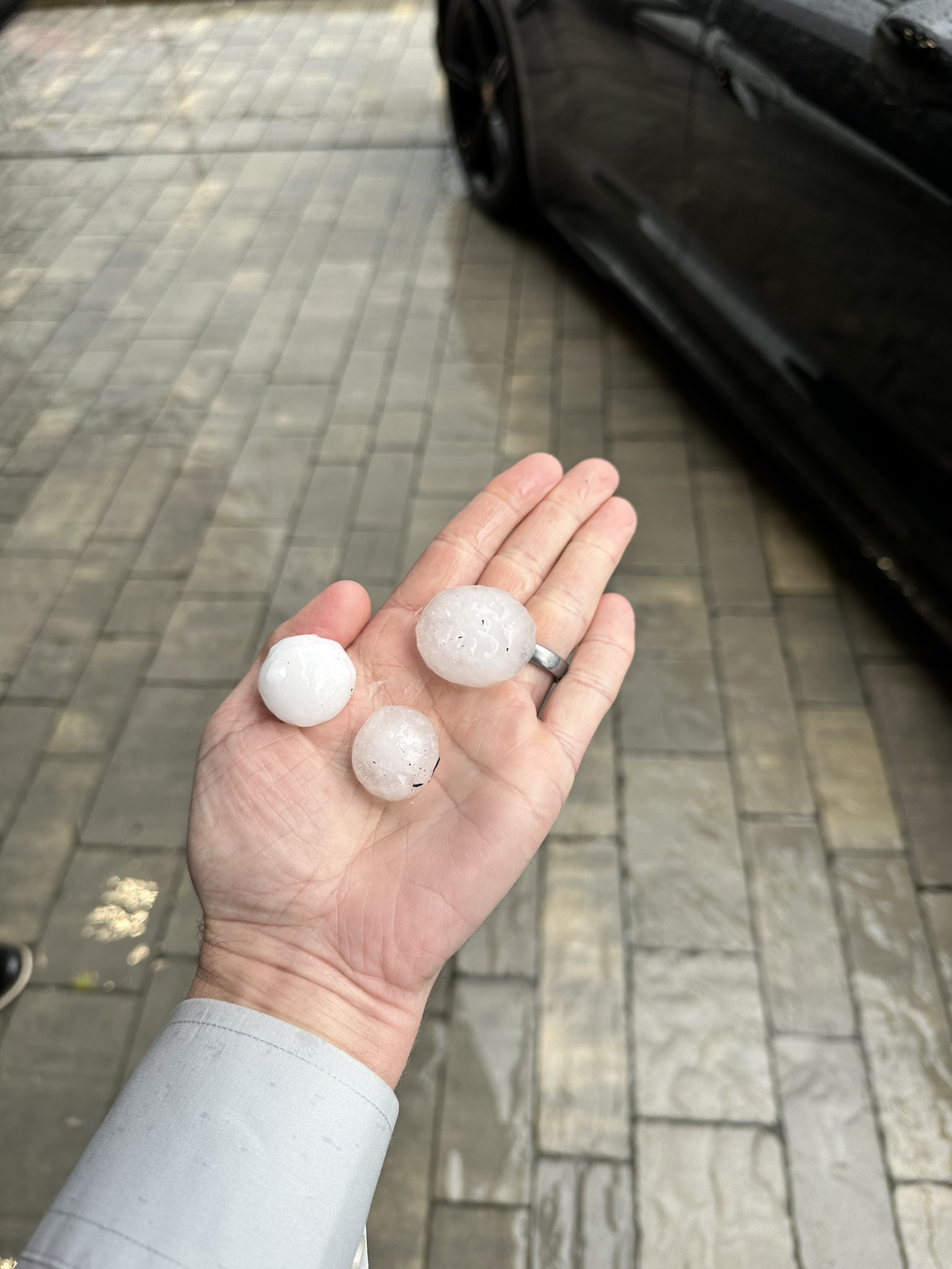
Photos and Additional Information
 |
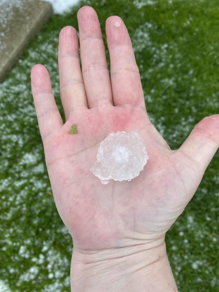 |
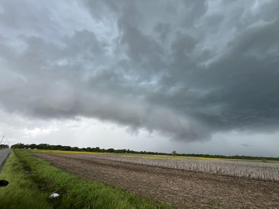 |
| Hail in Orland Park, IL. Photo courtesy of Chris Chojnowski. | Hail in Orland Park, IL. Photo courtesy of Diane Laist. | Severe thunderstorm near South Haven, IN. Photo courtesy of Danny Ferguson. |
Links:
 |
Media use of NWS Web News Stories is encouraged! Please acknowledge the NWS as the source of any news information accessed from this site. Additional recaps can be found on the NWS Chicago Past Events Page |
|


.png)