
Severe thunderstorms will continue today across portions of the Southeast as this system tracks offshore. Meanwhile, dry and breezy conditions will increase fire weather concerns for areas of central Florida today; The threat shifts into portions of the northern Plains on Friday. Record warmth will spread for the southern Plains, Southwest, central Great Basin and interior California next week. Read More >
Last Map Update: Thu, May 7, 2026 at 12:22:13 pm PDT
|
Text Product Selector (Selected product opens in current window)
|
|


 Forecast Discussion
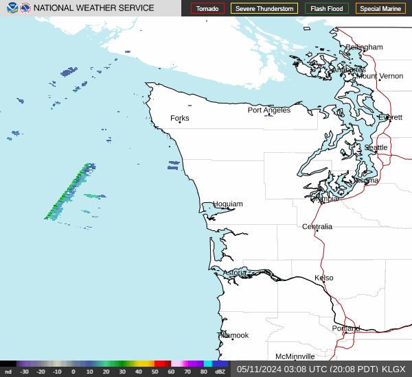 Langley Hill Radar
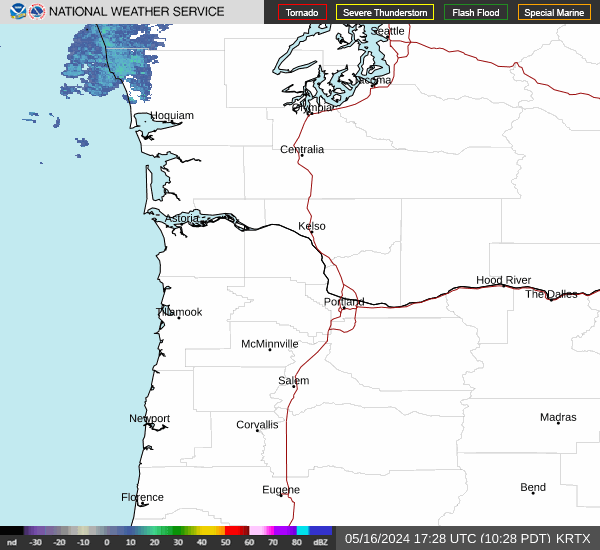 Portland Radar
  Satellite
 Rivers & Lakes
 Current Weather
 Graphical Forecasts
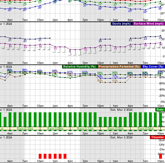 Forecast, Hourly
 Submit Storm Report
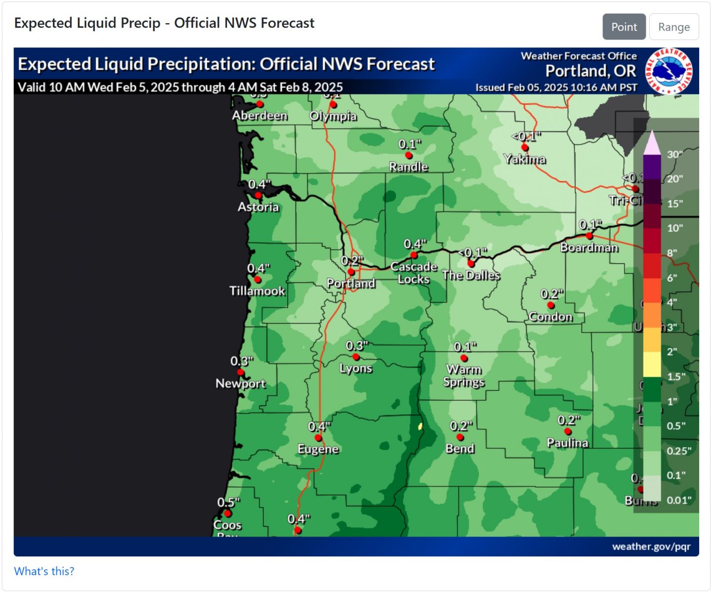 Experimental QPF Probability
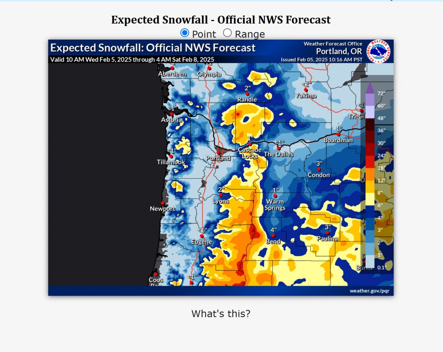 Experimental Winter Probability
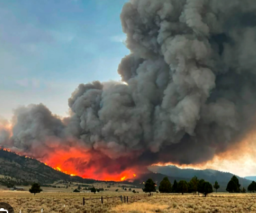 Fire Weather
 Aviation Weather
 Marine Weather
 Bar Obs & Cams
 Drought Info
 Road Conditions
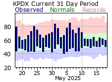 Climate Charts