A long-lived cluster of severe thunderstorms moved across South Carolina during the afternoon of May 30, 2025. Numerous reports of wind damage and strong winds over 58 mph occurred along a 200-mile long path from Augusta, GA to the coastal waters near Sunset Beach, NC. This falls just shy of the official NWS definition of a derecho that requires a 240+ mile path length.
|
Storm reports from May 30, 2025. Yellow squares are wind damage reports; orange squares are measured winds of 58+ mph. |
Across eastern South Carolina, numerous reports of wind damage occurred near Hemingway in Williamsburg County and also in the Myrtle Beach area.
|
Radar loop from the severe thunderstorms of May 30, 2025. Reflectivity is on the left. Radial velocity is on the right. Shades of light green and blue in velocity indicate strong winds pushing east toward the radar located at the right edge of the image. |
Hemingway, SC Damage
An NWS storm survey crew visited Hemingway, SC. Williamsburg County Emergency Management directed the crew to various locations where substantial damage occurred in and near town. Numerous trees and large tree limbs were blown down, in some cases falling across power lines. Damage was also observed to roofs, barns, carports, and at least one masonry church sign. Evidence for wind speeds around 90 mph was observed in a few spots. In all cases fallen trees were pointing toward the east, implying damage was from straight-line thunderstorm wind and not a tornado. Based on radar, damage in Hemingway likely occurred within a few minutes of 6:05 p.m.
|
Large tree blown down near Hemingway, SC |
|
Myrtle Beach, SC Damage
Numerous reports of high winds and thunderstorm wind damage were also received from the Grand Strand area as storms swept through between 6:30 and 7:00 pm. North Myrtle Beach airport (CRE) and Myrtle Beach International Airport (MYR) recorded wind gusts of 58 and 59 mph, respectively. A NOAA anemometer on Springmaid Pier in Myrtle Beach measured 57 mph at 6:36 pm. Social media reports showed a large number of trees fell across roads.
Why Did These Storms Occur?
A confluence of meteorological factors led to severe thunderstorms on May 30. As is typical for late May, sunshine during the day boosted temperatures into the 80s away from the beaches. This warm air contrasted strongly with colder temperatures in the mid and upper levels of the troposphere. This thermal difference, plus plenty of Gulf moisture coming in on southwest winds, helped generate moderate instability with MLCAPE increasing to over 1000 J/kg across much of South Carolina.
|
Mixed-layer CAPE over 1000 J/kg shows a moderately unstable atmosphere across South Carolina just prior to the arrival of the storms. |
500 mb analysis loop from SPC shows increasing winds and falling temperatures aloft over South Carolina associated with the approaching shortwave. |
Thunderstorms developed during the afternoon ahead of a cold front moving through Georgia and western South Carolina. Stronger winds aloft associated with a shortwave trough crossing the southern Appalachians helped organize thunderstorms into a bowing line that accelerated eastward late in the day. Mid level winds increased to over 50 knots at 700 mb. Thunderstorm downdrafts may have tapped this higher momentum air aloft and transported it down to the surface causing the large amount of wind damage.
|
700 mb analysis loop from SPC shows increasing westerly winds across South Carolina that likely assisted in the development of strong thunderstorm winds. |
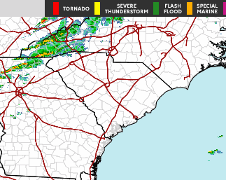
Regional radar loop for the afternoon of May 30, 2025 |
The Storm Prediction Center noted these factors early on and upgraded the day's severe weather risk to "enhanced" during the morning, highlighting the growing potential for damaging winds. A Severe Thunderstorm Watch followed early in the afternoon several hours prior to the occurrence of severe weather across eastern South Carolina.
Page Author: Tim Armstrong
Last Updated: June 3, 2025


 Coastal Flood