Overview
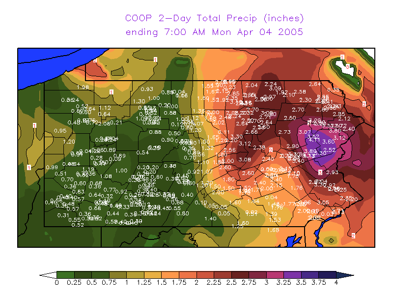
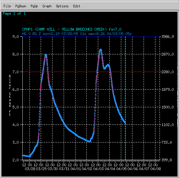
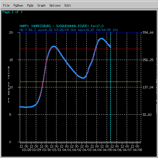
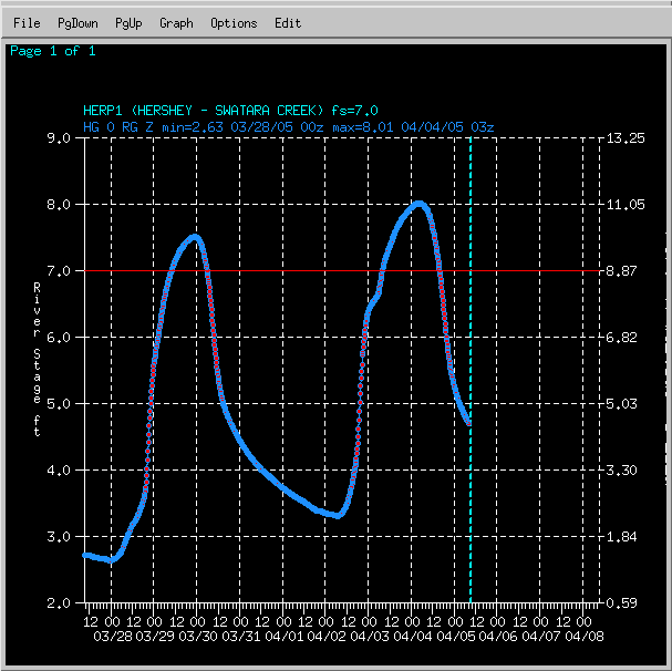
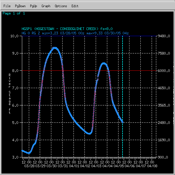
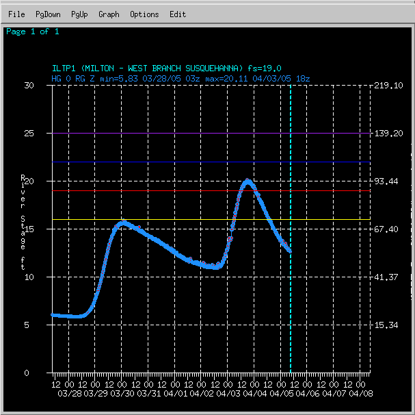
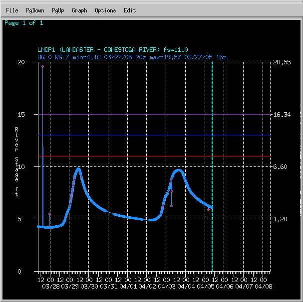
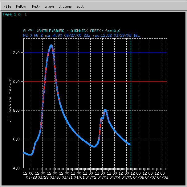
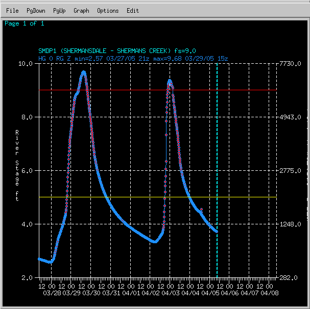
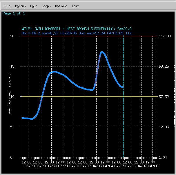
On April 2nd and 3rd, 2005, an unusually strong spring storm brought heavy snow to the high terrain of West-Central PA, and flooding rains to the east and south-central counties. The rainfall came on the heels of another significant rainfall just a few days prior (on the 28th and 29th of March) , which produced minor flooding on it's own. The already swollen rivers had little time to receed, and were easily pushed back up to flood levels by the rainfall on the 2nd and 3rd.
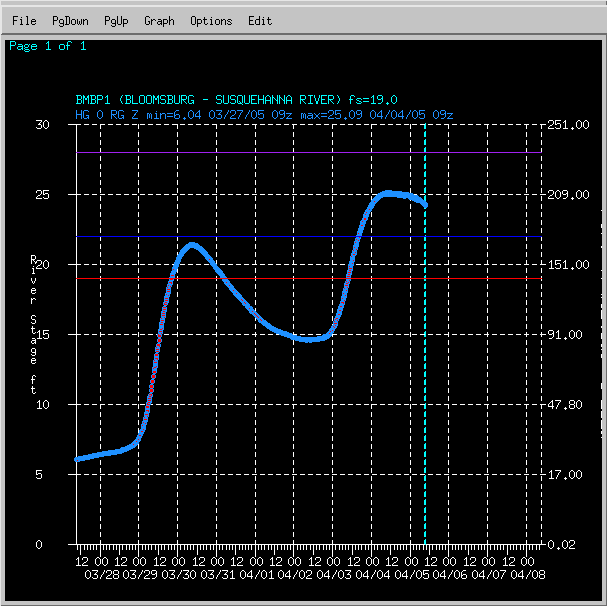
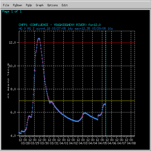
Although the heavy, wet snowfall in the west was fantastic, the flooding that the rains produced rivaled the flooding that occurred in Hurricane Ivan (Sep 2004), which were some of the all-time highest stages ever recorded!
The resultant river stages at a few locations can be seen below (in hydrograph format):
 |
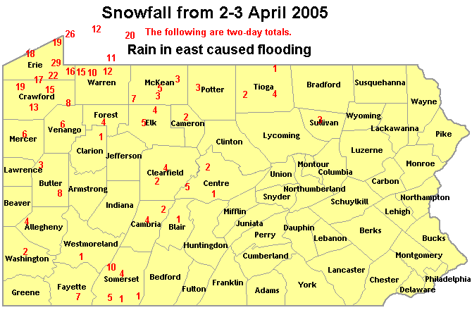 |
| 2 day precipitation (liquid) totals (7am 4/2 thru 7am 4/4/2005): | 2 day snowfall totals (from NWS Co-Op Observing Sites and spotter/public reports - 7am 4/2 thru 7am 4/4/2005): |
Hydrographs
 |
 |
 |
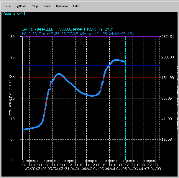 |
| BMBP1 | CNFP1 | CPHP1 | DANP1 |
 |
 |
 |
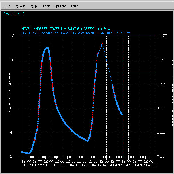 |
| HARP1 | HERP1 | HGSP1 | HTVP1 |
 |
 |
 |
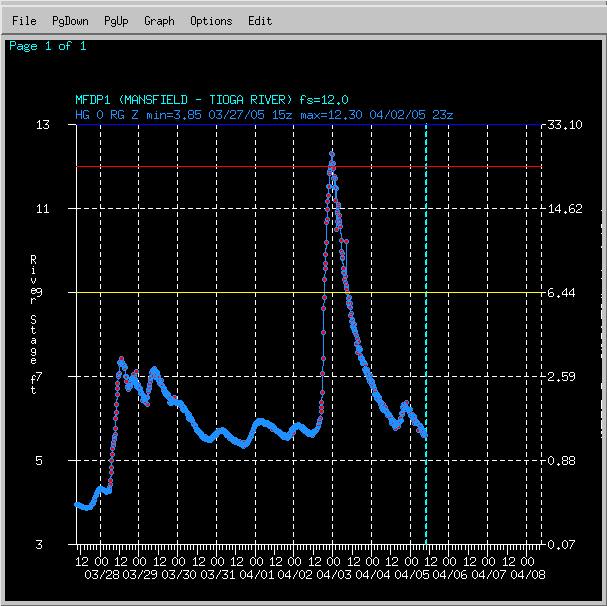 |
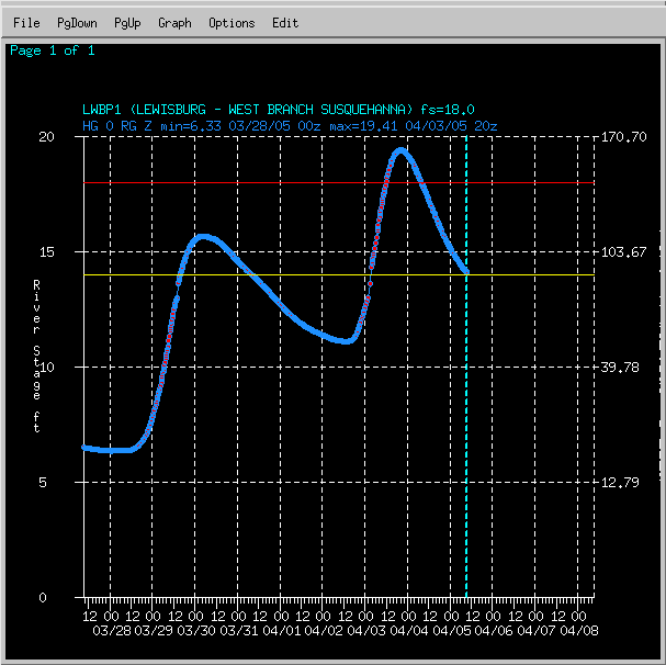
| ILTP1 | LNCP1 | LWBP1 | MFDP1 |
 |
 |
 |
 |
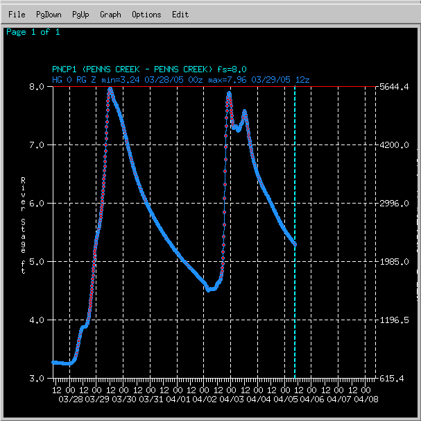
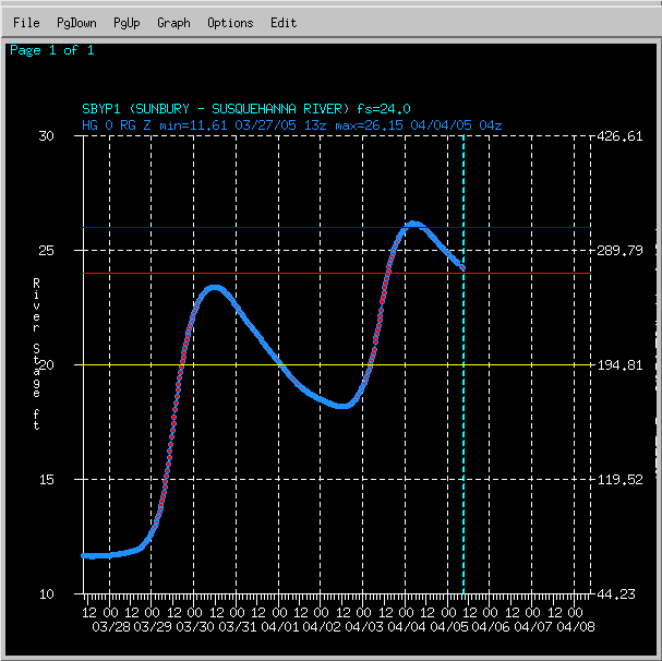
| MRTP1 | PNCP1 | SBYP1 | SLYP1 |
 |
|||
| SDMP1 |
 |
Media use of NWS Web News Stories is encouraged! Please acknowledge the NWS as the source of any news information accessed from this site. |
|


 Send Us a Report