Overview
|
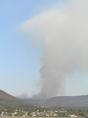
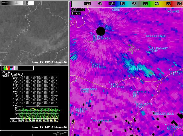
A wildfire on Tussey Mountain in the Rothrock State Forest Lands (South-Central Centre County, PA) near Treaster Kettle Road on May 1st was highly visible from the town of State College, and from our window at the office. The KCCX 88D Radar, which was running in clear-air mode at the time, also had a good shot at the smoke plume and debris that it carried along. Check out the images below, and see what the KCCX 88D could sense of the fire (the smoke plume, really), and see the visible Satellite shots from GOES East during the same time. Note the smoke drifts right along with the winds (Southeasterly, or TO the Northwest) indicated on the VAD Wind Profile from the 88D. |
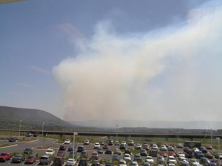 Picture of the fire from 330 Innovation Blvd. |
 |
 |
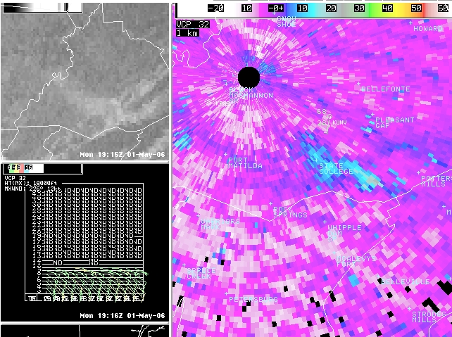 |
| Picture of the smoke plume with start of Pyro-Cumulus cloud (cumulus started because of the rising hot gases from the fire) at the top of the plume. | Reflectivity, Visible Satellite, and VAD Wind Profile of the Smoke Plume | Same panels as above only brightness-enhanced |
 |
Media use of NWS Web News Stories is encouraged! Please acknowledge the NWS as the source of any news information accessed from this site. |
|


 Send Us a Report