Overview
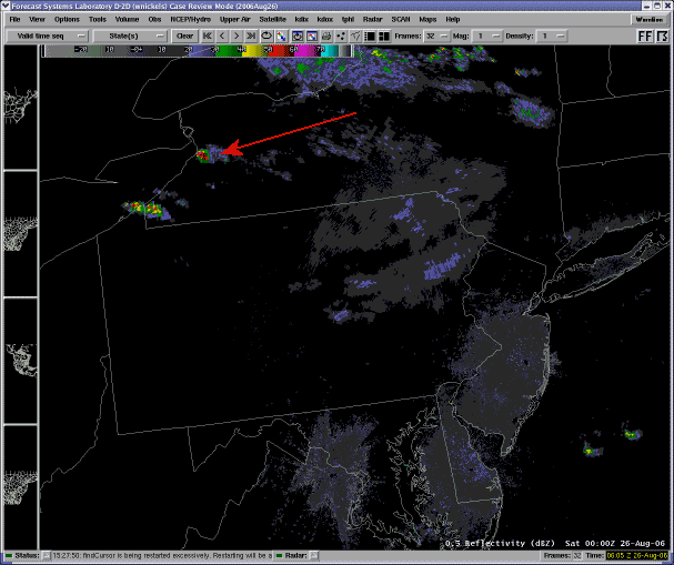
A few Supercell thunderstorms developed well to the north of a warm front draped over Southwestern PA, and dropped into Central Pennsylvania from the north during the evening of the 25th. The storms formed in a high shear environment (as indicated by the 00z 26th sounding from KBUF - right at the genesis of these cells).
Many of these storms exhibited very strong and deep rotation, and were very long-lived. See the image loop below and follow the track of a monster storm that began near Buffalo, NY and did not dissipate until it hit the Atlantic coast of NJ !! That storm produced severe weather all along it's path despite being well back in the cooler, more stable air.
 |
 |
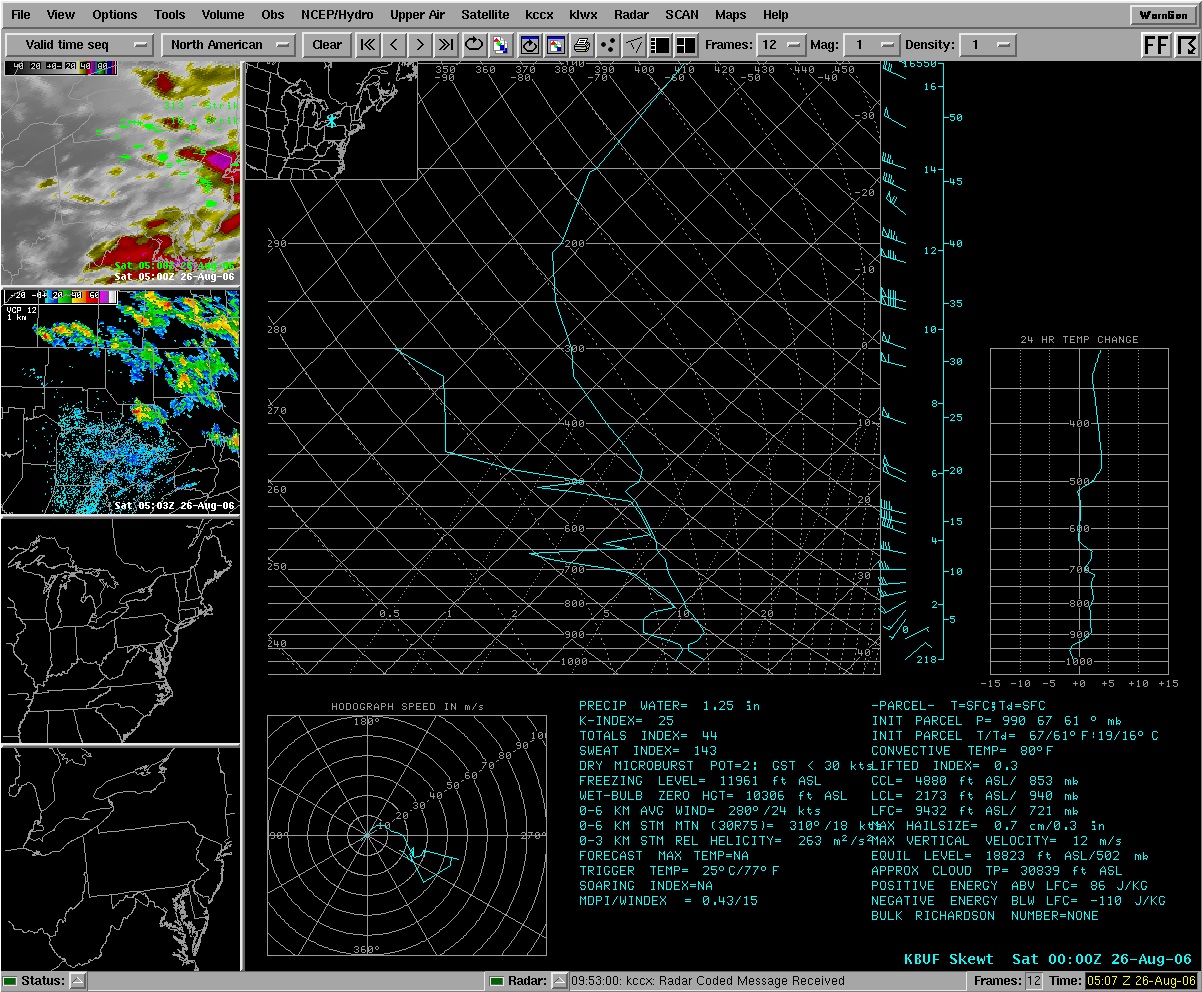 |
| Loop of long-lived Supercell Storms (courtesy of Al Cope, SOO, NWS Mount Holly, NJ) | Severe Weather Warnings (boxes), and severe weather reports from the evening of the 25th and early morning of the 26th of August, 2006. (courtesy NWS RLX) | KBUF Balloon Sounding from 00UTC 26 Aug 2006 |
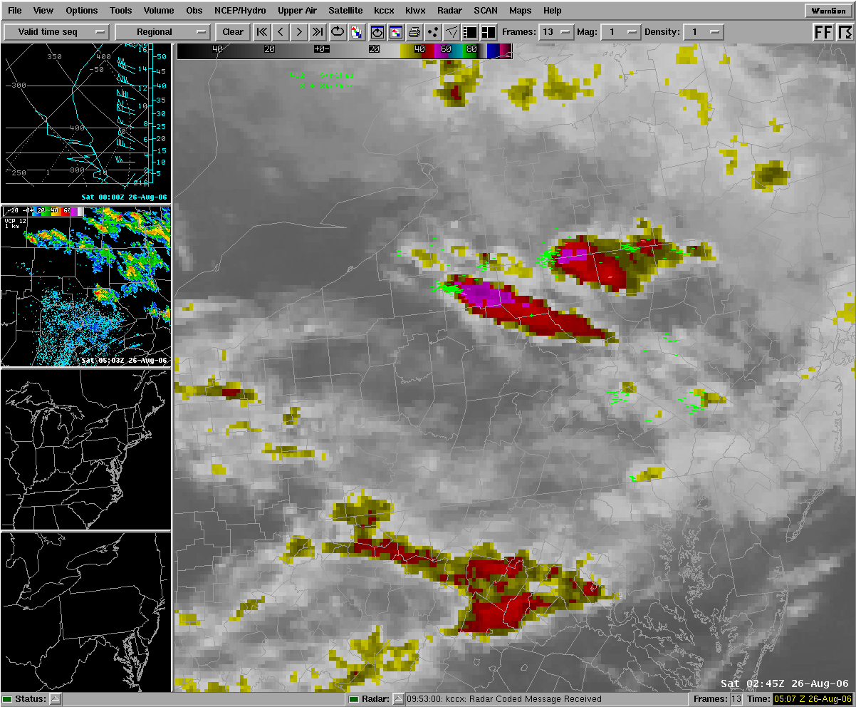
Satellite Imagery
 |
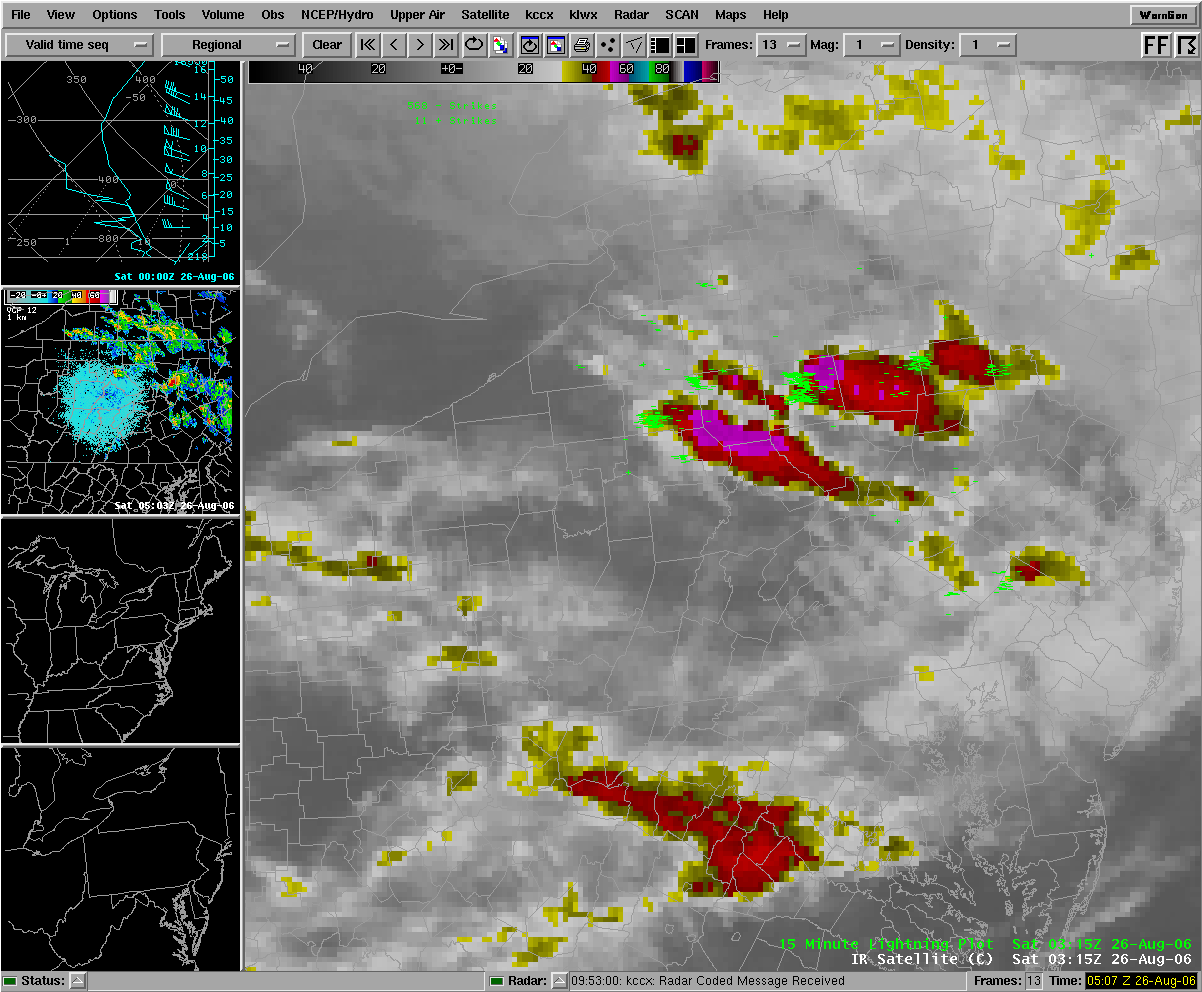 |
| Infrared Sat Pic with past 15 minute lightning strikes 02:45Z | Infrared Sat Pic with past 15 minute lightning strikes 03:15Z |
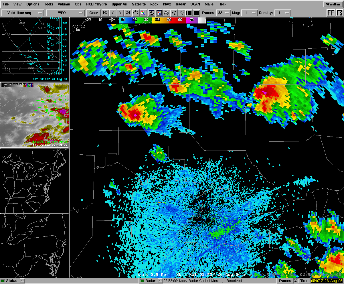
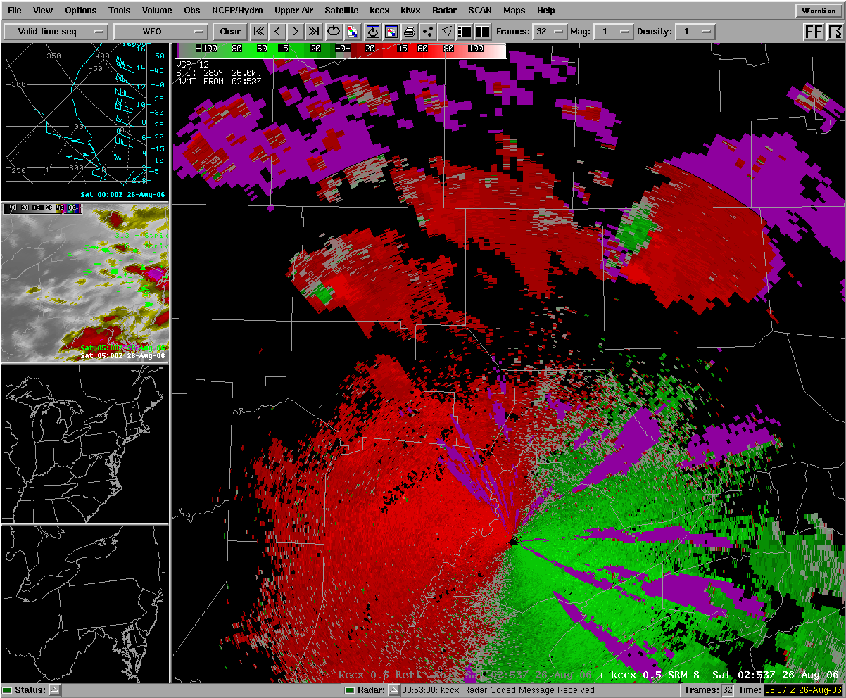
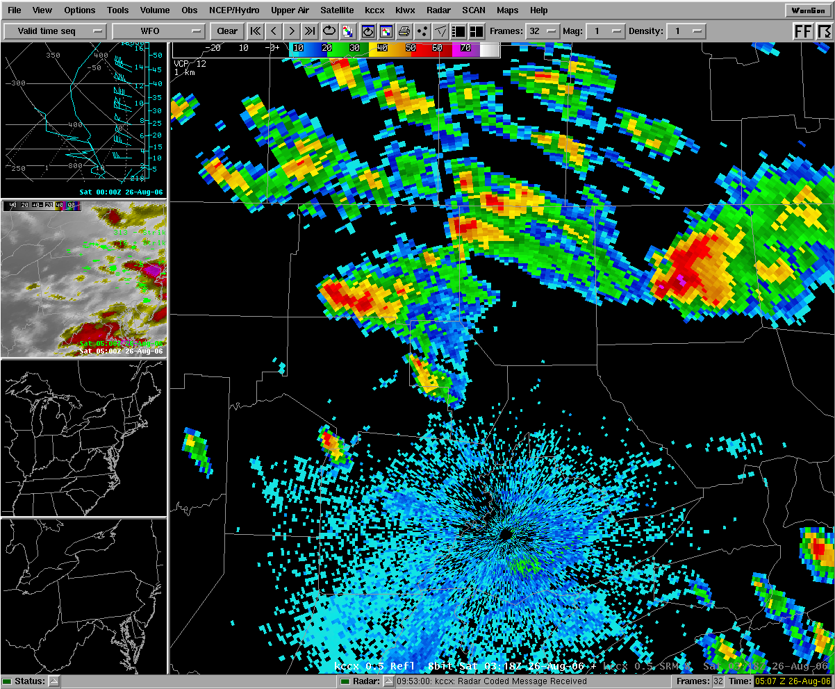
Radar
 |
 |
 |
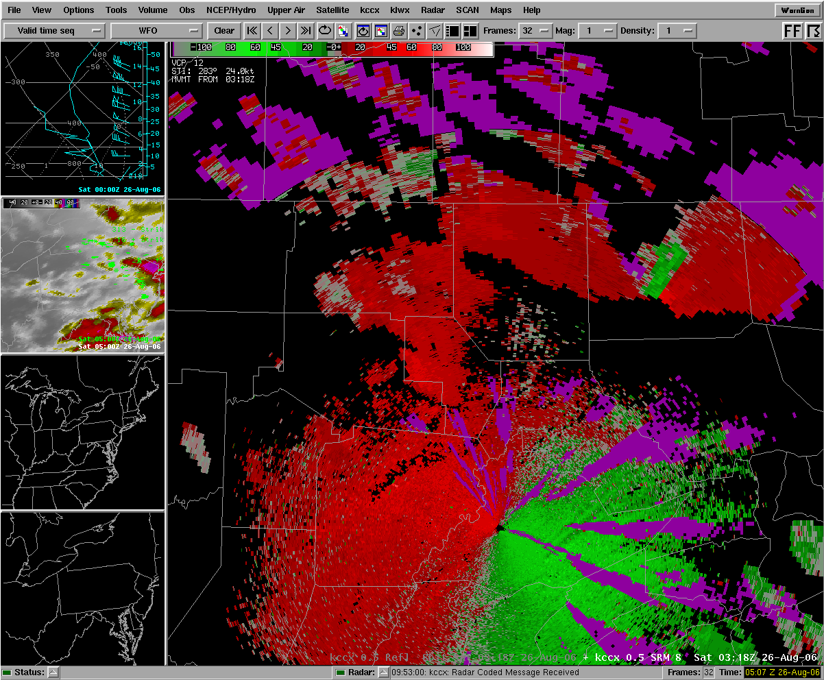 |
| KCCX Reflectivity of two big supercell thunderstorms in McKean and Tioga Counties. | KCCX Storm Relative Motion pictures of two big supercell thunderstorms in McKean and Tioga Counties. | KCCX Reflectivity of two big supercell thunderstorms in McKean and Tioga Counties. | KCCX Storm Relative Motion pictures of two big supercell thunderstorms in McKean and Tioga Counties. |
 |
Media use of NWS Web News Stories is encouraged! Please acknowledge the NWS as the source of any news information accessed from this site. |
|


 Send Us a Report