Overview
Strong wind shear, abnormally warm temperatures, and high humidity for late September combined to produce severe thunderstorms - and one confirmed tornado near Tidioute, PA - over Northwest PA during the evening of Wednesday, 26 September 2007. Numerous reports of funnel clouds were received that evening in real time as the event was on-going. See the maps/pictures below for a quick summary of the storms Wed Evening.
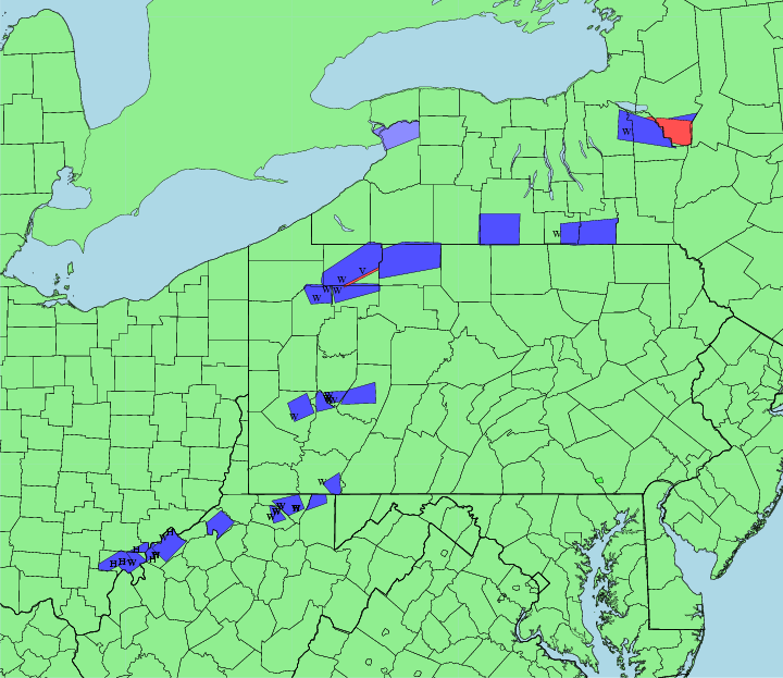 |
| Map of Warnings and preliminary reports - Summary for 26 Sept 2007. |
Tornadoes:
|
Tornado - Southern Warren County
|
||||||||||||||||
The Enhanced Fujita (EF) Scale classifies tornadoes into the following categories:
| EF0 Weak 65-85 mph |
EF1 Moderate 86-110 mph |
EF2 Significant 111-135 mph |
EF3 Severe 136-165 mph |
EF4 Extreme 166-200 mph |
EF5 Catastrophic 200+ mph |
 |
|||||
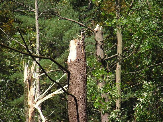
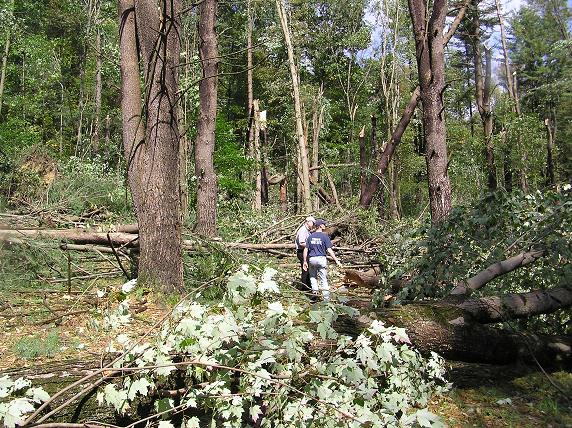
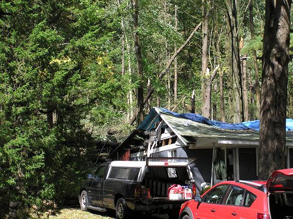
Photos & Video
 |
 |
 |
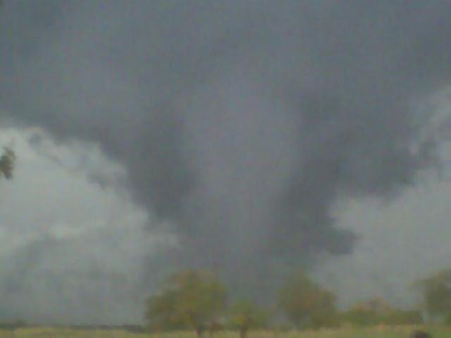 |
| (Healthy) Trees snapped off | In the middle of the tornado path | Trees snapped and damage to structure/camp | Photo of funnel cloud |
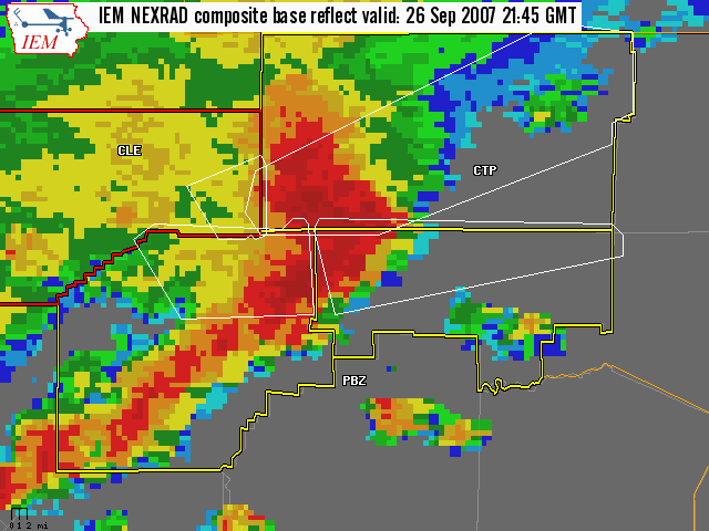
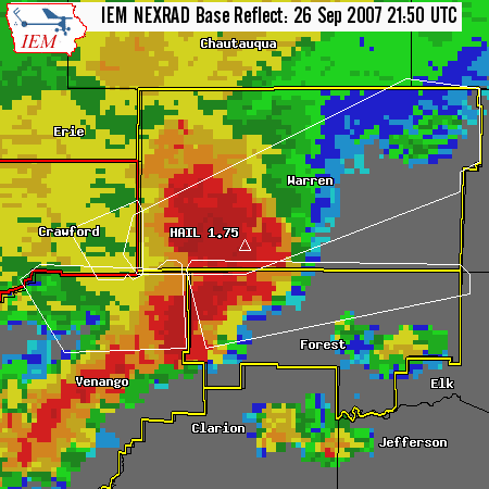
Radar
 |
 |
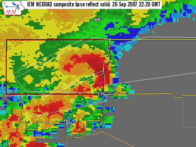 |
| Storm complex moving into western Warren County, note the bookend vortex already forming. | Storm as it produced golf-ball size hail in Tidioute. | Storm as it is entering Western McKean County. |
Storm Reports
NWUS51 KCTP 262320
LSRCTP

PRELIMINARY LOCAL STORM REPORT...SUMMARY
NATIONAL WEATHER SERVICE STATE COLLEGE PA
720 PM EDT WED SEP 26 2007

..TIME...   ...EVENT...      ...CITY LOCATION...     ...LAT.LON...
..DATE...   ....MAG....      ..COUNTY LOCATION..ST.. ...SOURCE....
            ..REMARKS..

0548 PM     TSTM WND DMG     TIDIOUTE                41.68N 79.40W
09/26/2007                   WARREN             PA   EMERGENCY MNGR

            PHONE LINES DOWN. HAIL ALSO REPORTED.

0550 PM     HAIL             TIDIOUTE                41.68N 79.40W
09/26/2007  E1.75 INCH       WARREN             PA   EMERGENCY MNGR

            HAIL AND FUNNEL CLOUD SPOTTED.

0608 PM     FUNNEL CLOUD     3 WSW CLARENDON         41.76N 79.15W
09/26/2007                   WARREN             PA   EMERGENCY MNGR

            FUNNEL CLOUD SPOTTED AT CHAPMAN STATE PARK.

0610 PM     HAIL             CLARENDON               41.78N 79.10W
09/26/2007  E0.75 INCH       WARREN             PA   PUBLIC

            PENNY-SIZE HAIL REPORTED IN CLARENDON.

0620 PM     FUNNEL CLOUD     WARREN                  41.84N 79.14W
09/26/2007                   WARREN             PA   FIRE DEPT/RESCUE

            THREE FUNNEL CLOUDS SPOTTED OVER WARREN.


&&

$$
 |
Media use of NWS Web News Stories is encouraged! Please acknowledge the NWS as the source of any news information accessed from this site. |
|


 Send Us a Report