State College, PA
Weather Forecast Office
Overview
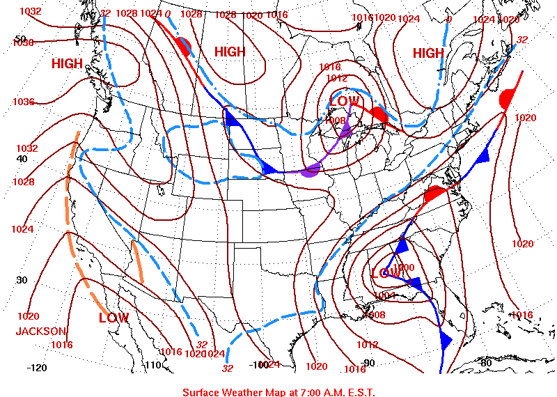
A Storm System moved northeast from the Gulf Coast States on Thursday the 11th of December, and brought with it a mix of rain, freezing rain and snow to Central PA. The precipitation lasted into the early morning of the 12th.
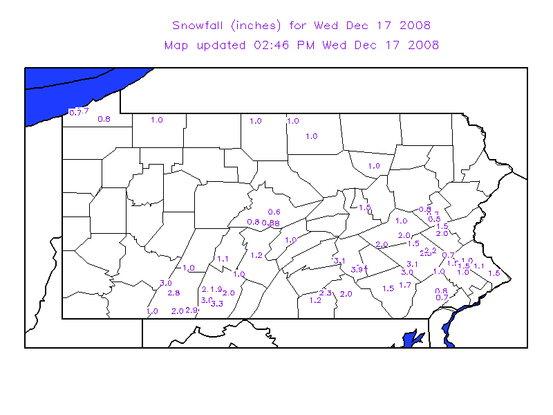
While the lower elevations in the Southern and Central sections of the state remained plain rain through the entire event, the ridges in the Central Mountains received heavy ice accretions from freezing rain. Most of the precipitation across the Northern Mountains fell as snow, but some icing was also seen there.
Heavy rain fell in the Lower Susquehanna Valley, and even set a record daily rainfall for the 11th at Harrisburg, where 2.29 inches of rain fell. This heavy rain created minor flooding along the Swatara Creek.
 |
 |
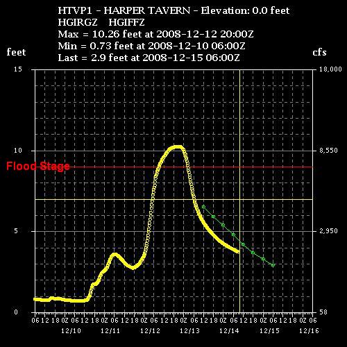 |
| Surface map from the morning of Thursday 12-11-2008 | Map of Snow and Ice Totals | Hydrograph (River Stage Time-Plot) for the Swatara Creek at Harper Tavern, PA |
 |
Media use of NWS Web News Stories is encouraged! Please acknowledge the NWS as the source of any news information accessed from this site. |
|
US Dept of Commerce
National Oceanic and Atmospheric Administration
National Weather Service
State College, PA
328 Innovation Blvd, Suite 330
State College, PA 16803
(814)954-6440
Comments? Questions? Please Contact Us.


 Send Us a Report