State College, PA
Weather Forecast Office
Overview
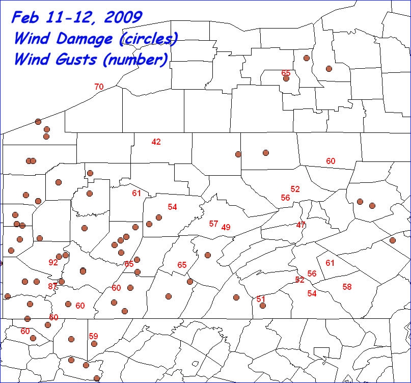
A strong cold front blasted through Central PA during the evening of the 11th, and early in the morning of the 12th of February, 2009. A squall line produced very high wind gusts as it moved through Western PA, but weakened as it moved into the Central Mountains. Then, the winds behind the front picked up and created a long duration of high sustained winds and gusts almost as strong as the squall line. These strong west winds lasted for 12 to 24 hours after the front moved past, peaking during the hours around sunrise on the 12th. Many locations had damage with trees and power lines going down.
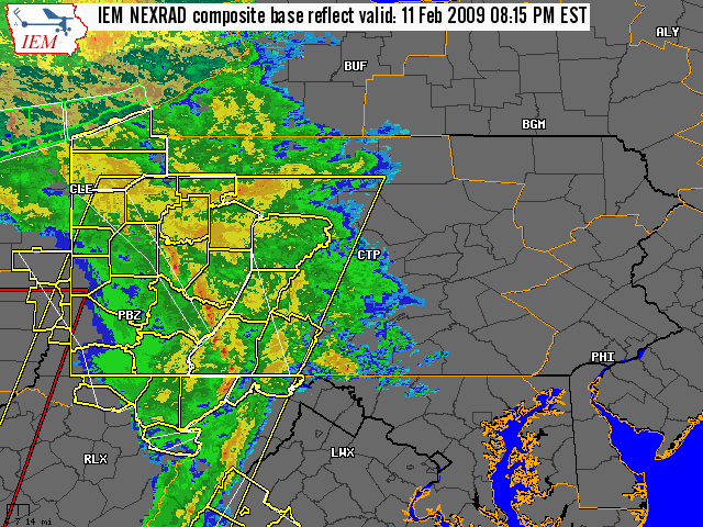
Composite Radar Animation from the evening of 11 Feb 2009
 |
Media use of NWS Web News Stories is encouraged! Please acknowledge the NWS as the source of any news information accessed from this site. |
|
US Dept of Commerce
National Oceanic and Atmospheric Administration
National Weather Service
State College, PA
328 Innovation Blvd, Suite 330
State College, PA 16803
(814)954-6440
Comments? Questions? Please Contact Us.


 Send Us a Report