Overview
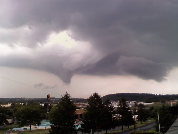
Funnel clouds were sighted over Dauphin County during the afternoon of August 20, 2009. Around 3:30 pm a local viewer passed images of a funnel cloud to a TV meteorologist which then relayed the report to the National Weather Service office in State College. Those images as well as radar loops and storm reports for the event are shown below.
 |
 |
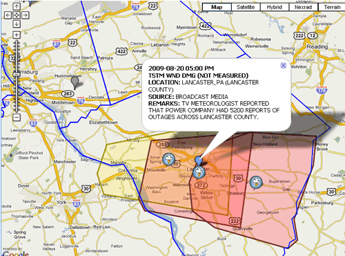 |
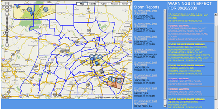
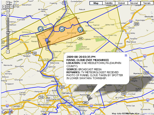
| Warnings and Storm Reports for Aug 20th, 2009 | Storm Report over Dauphin county 3:35 pm | Storm Report over Lancaster County 5:00 pm |
Photos & Video
 |
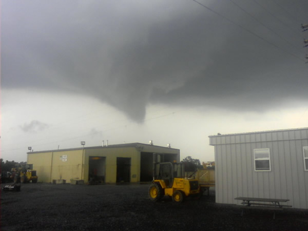 |
| Funnel Cloud over Dauphin County around 3:30 pm. Image courtesy of TV Meteorologist ABC27. |
Funnel Cloud over Dauphin County around 3:30 pm. Image courtesy of TV Meteorologist ABC27. |
Radar
 |
 |
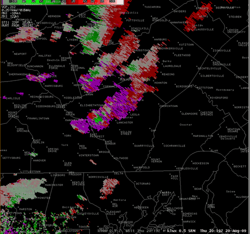 |
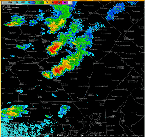
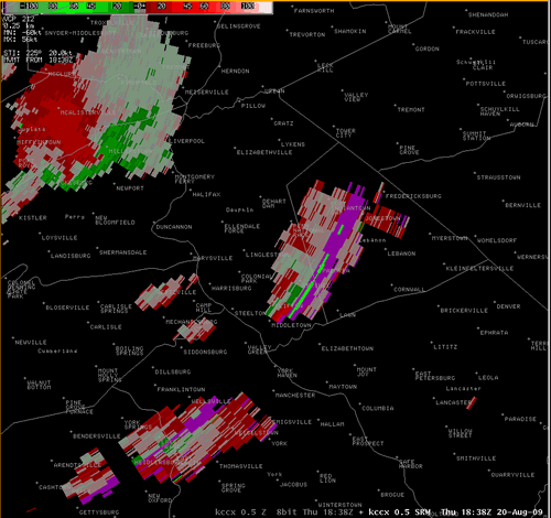
| KCCX Radar Reflectivity Loop 2:38 to 3:51 pm (click for larger image) | KCCX Radar Reflectivity Loop 2:38 to 3:51 pm (click for larger image) | KLWX Storm Relative Velocity Loop 4:19 to 5:23 pm (click for larger image) |
Storm Reports
000
NWUS51 KCTP 210136
LSRCTP

PRELIMINARY LOCAL STORM REPORT...SUMMARY
NATIONAL WEATHER SERVICE STATE COLLEGE PA
936 PM EDT THU AUG 20 2009

..TIME...   ...EVENT...      ...CITY LOCATION...     ...LAT.LON...
..DATE...   ....MAG....      ..COUNTY LOCATION..ST.. ...SOURCE....
            ..REMARKS..

0300 PM     TSTM WND DMG     2 S LIVERPOOL           40.54N 76.99W
08/20/2009                   PERRY              PA   COUNTY OFFICIAL

            911 CENTER REPORTED TREES DOWN ALONG HUNTERS VALLEY ROAD
            IN BUFFALO TOWNSHIP.

0330 PM     TSTM WND DMG     5 ESE HALIFAX           40.44N 76.85W
08/20/2009                   DAUPHIN            PA   COUNTY OFFICIAL

            911 CENTER REPORTED TREES ON WIRES IN MIDDLE PAXTON
            TOWNSHIP.

0335 PM     FUNNEL CLOUD     3 NE MIDDLETOWN         40.23N 76.69W
08/20/2009                   DAUPHIN            PA   BROADCAST MEDIA

            TV METEOROLOGIST RECIEVED PHOTO OF FUNNEL CLOUD TAKEN BY
            SPOTTER IN LOWER SWATARA TOWNSHIP.

0435 PM     TSTM WND DMG     LANCASTER               40.04N 76.30W
08/20/2009                   LANCASTER          PA   EMERGENCY MNGR

            TREES DOWN IN THE CITY OF LANCASTER.

0500 PM     TSTM WND DMG     LANCASTER               40.04N 76.30W
08/20/2009                   LANCASTER          PA   BROADCAST MEDIA

            TV METEOROLOGIST REPORTED THAT POWER COMPANY HAD 5200
            REPORTS OF OUTAGES ACROSS LANCASTER COUNTY.

0830 PM     TSTM WND DMG     SHEFFIELD               41.70N 79.03W
08/20/2009                   WARREN             PA   COUNTY OFFICIAL

            911 CENTER REPORTED TREES DOWN.

0900 PM     TSTM WND DMG     SPRING CREEK            41.88N 79.51W
08/20/2009                   WARREN             PA   COUNTY OFFICIAL

            911 CENTER REPORTED WIRES DOWN.
 |
Media use of NWS Web News Stories is encouraged! Please acknowledge the NWS as the source of any news information accessed from this site. |
|


 Send Us a Report