Overview
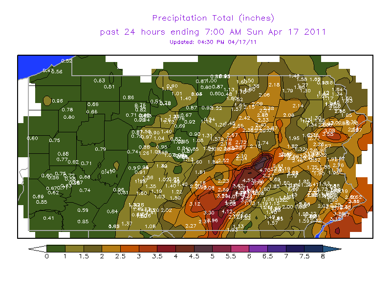
The rain quickly amounted to more than an inch over much of Central PA, and a stripe of 3 to 5 inches of rainfall occurred from Gettysburg up through Harrisburg and Shamokin. The water was too much for the streams and creeks. Flash Flooding created a extremely dangerous situation where up to a dozen water-rescues were made by local rescue personnel. Many businesses and homes were flooded across Southeastern PA. The one tornado occurred just to the west of the City of York, near the West Manchester Mall.
 |
 |
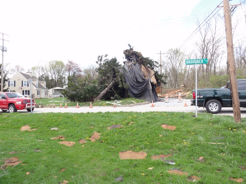 |
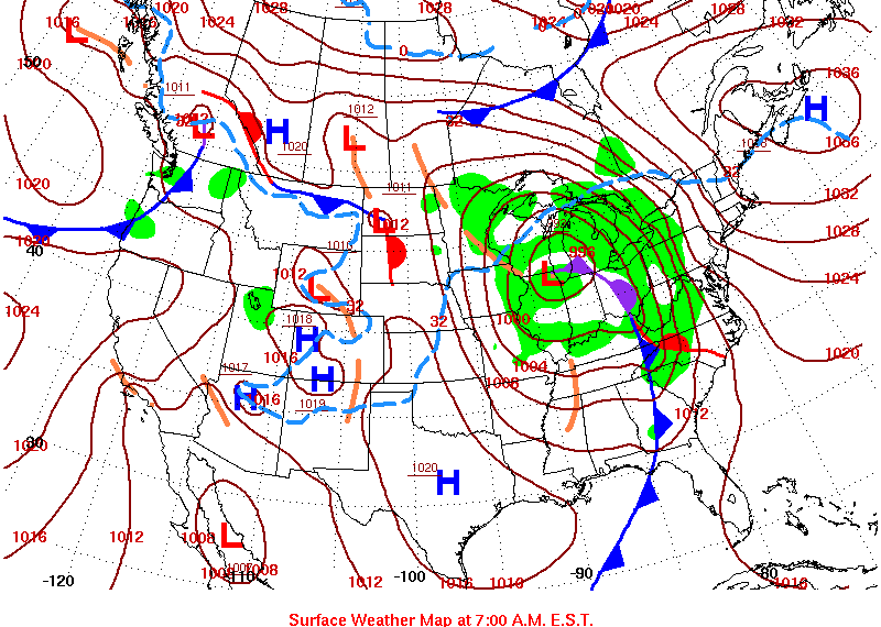
| Surface Map on the morning of Saturday April 16, 2011 | Precipitation Totals 8 AM EDT 16 April 2011 - 8 AM EDT 17 April 2011 | Damaging near West Manchester Mall, York, PA - rubber roofing wrapped around a tree |
Tornadoes:
|
Tornado - York
Track Map 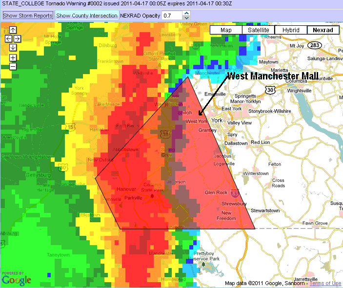 
Downloadable KMZ File |
||||||||||||||||
The Enhanced Fujita (EF) Scale classifies tornadoes into the following categories:
| EF0 Weak 65-85 mph |
EF1 Moderate 86-110 mph |
EF2 Significant 111-135 mph |
EF3 Severe 136-165 mph |
EF4 Extreme 166-200 mph |
EF5 Catastrophic 200+ mph |
 |
|||||
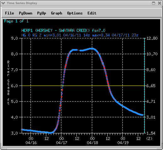
River Stage Levels
 |
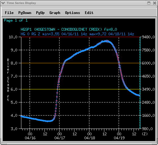 |
| River Stage of the Swatara Creek at Hershey, PA | River Stage of the Conodoguinet Creek at ogestown, PA |
 |
Media use of NWS Web News Stories is encouraged! Please acknowledge the NWS as the source of any news information accessed from this site. |
|


 Send Us a Report