State College, PA
Weather Forecast Office
Overview
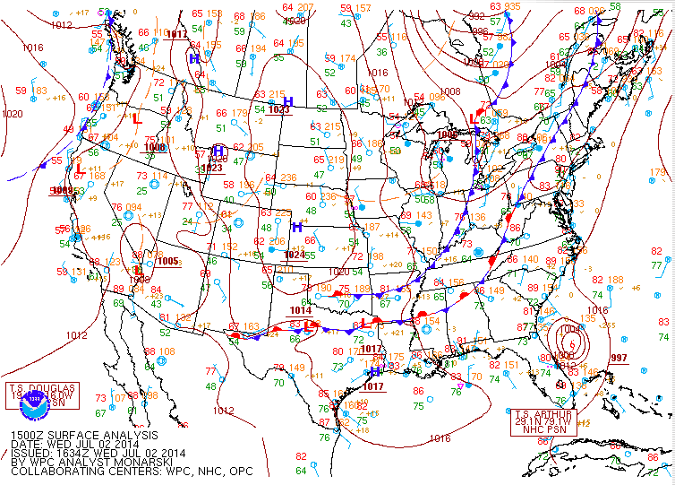
On July 2, 2014, a relatively weak cold front passed over an area of instability near the Central Ridge Valley and Susquehanna Valley areas, causing severe thunderstorms, flash flooding, and a tornado in Lycoming County.
 |
 |
 |
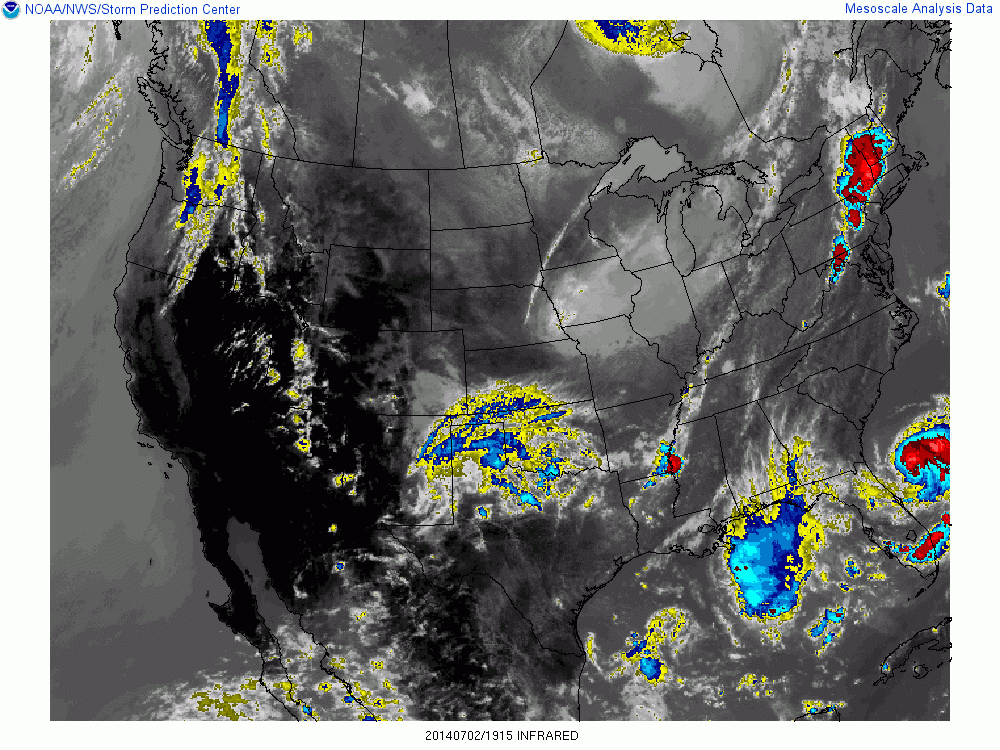 |
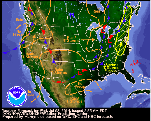
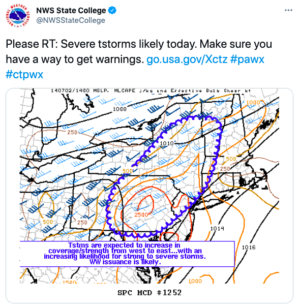
| WPC Surface Analysis 07-02-2014 15 UTC | WPC National Forecast | SPC MCD #1252 | IR Satellite 19:15 UTC |
Warnings
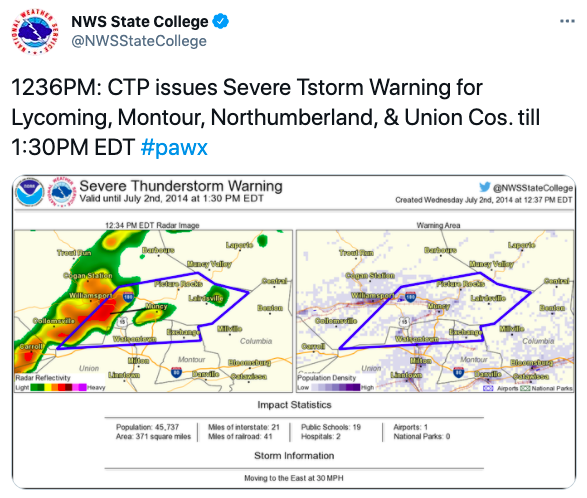
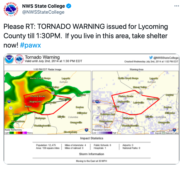
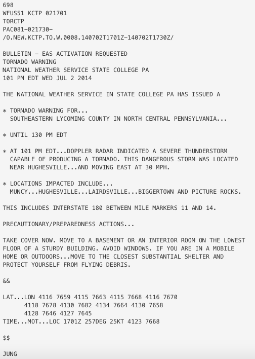
Issued Severe T-Storm, Tornado and Flash Flood Warnings
 |
 |
 |
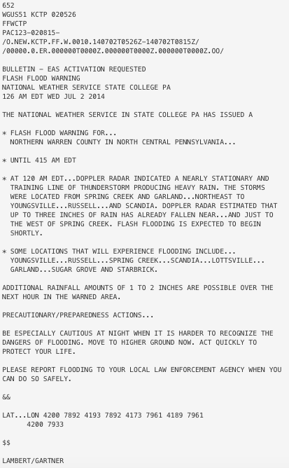 |
| 12:36 PM Severe T-Storm Warning | 1:30 PM Tornado Warning | Tornado Waning Text | Flash Flood Warning Text |
 |
Media use of NWS Web News Stories is encouraged! Please acknowledge the NWS as the source of any news information accessed from this site. |
|
US Dept of Commerce
National Oceanic and Atmospheric Administration
National Weather Service
State College, PA
328 Innovation Blvd, Suite 330
State College, PA 16803
(814)954-6440
Comments? Questions? Please Contact Us.


 Send Us a Report