State College, PA
Weather Forecast Office
Overview
|
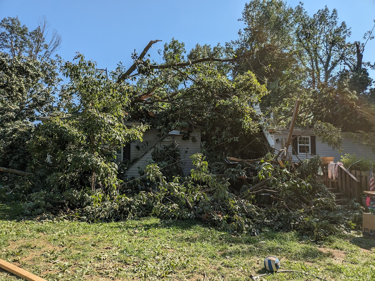
High instability and wind shear contributed to a significant severe weather episode across south-central Pennsylvania during the afternoon and evening of August 7, 2023. Of note, a significant bow echo produced widespread wind damage and a trio of weak (EF0-EF1) tornadoes across southern York and Lancaster Counties. |
 Tornado damage off of Truce Rd, Lancaster County, PA |
Upper Air/Surface
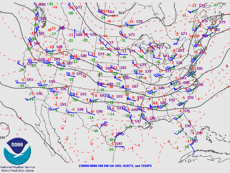
A seasonably deep upper level trough worked into PA on August 7th 2023.
 |
 |
 |
|
500mb pattern 00Z 08/08/23
|
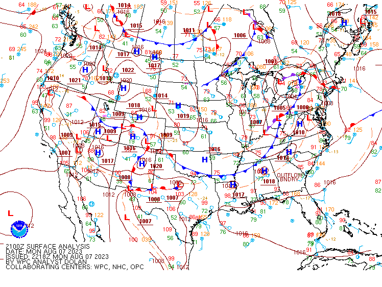
Surface pattern 21Z 08/07/23
|
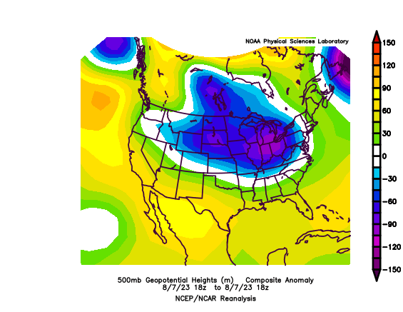
500mb Anomalies
|
Photos
Header
 |
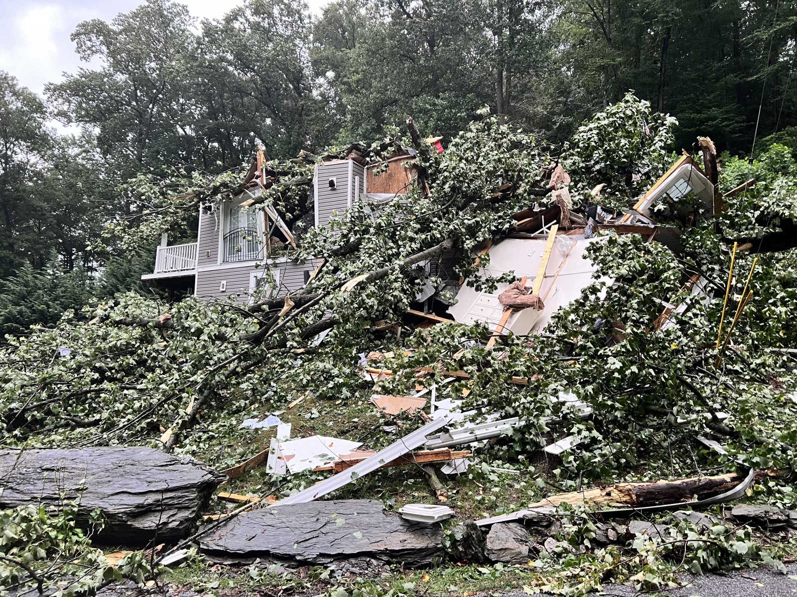 |
| Schoolhouse Rd, Whiterock, Lancaster Co |
Lancaster Co damage
|
Radar
 |
 |
|
Radar Loop
|
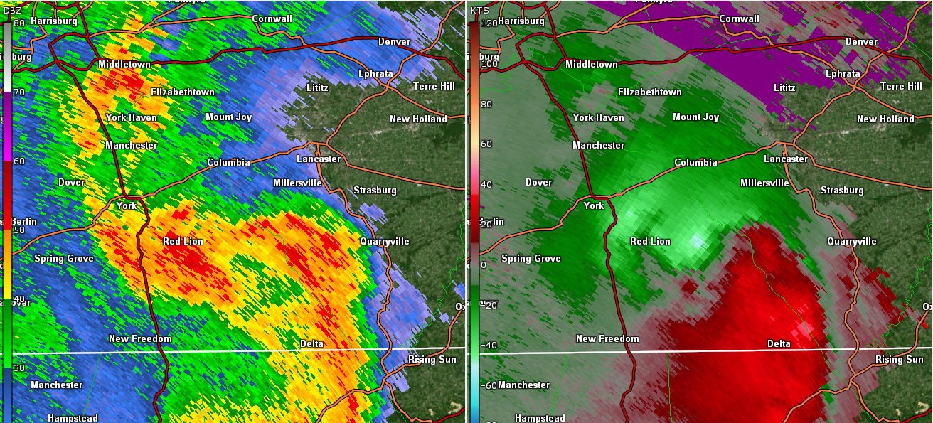
REF/SRM at time of tornado 4SSW Smithville, Lancaster Co
|
Storm Reports
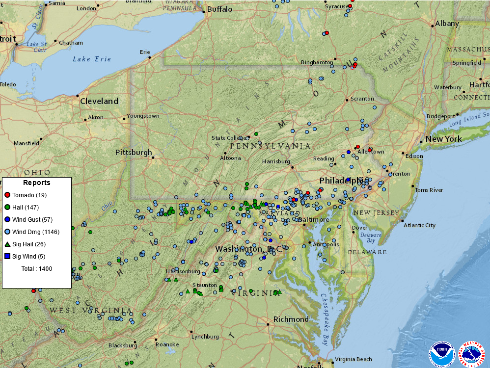
Storm report map for August 7 2023
 |
Media use of NWS Web News Stories is encouraged! Please acknowledge the NWS as the source of any news information accessed from this site. |
|
US Dept of Commerce
National Oceanic and Atmospheric Administration
National Weather Service
State College, PA
328 Innovation Blvd, Suite 330
State College, PA 16803
(814)954-6440
Comments? Questions? Please Contact Us.


 Send Us a Report