State College, PA
Weather Forecast Office
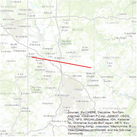
A tornado started one mile southeast of Darlington and moved through Beaver Falls, Zelienople, Evans City and Saxonburg, to one mile south of Sarver. There were nine deaths: two in Evans City, one in New Sewickley, two at a shopping center in Beaver Boro, and four in Saxonburg. Over 300 structures were damaged or destroyed. All fourteen shops at the shopping center were damaged extensively. More than 100 cars in the parking lot were damaged or destroyed. Golf ball size hail was reported at Midland and Monaca (both Beaver County).
Source: NCDC Storm Data: May 1985; Volume 27, Number 5
US Dept of Commerce
National Oceanic and Atmospheric Administration
National Weather Service
State College, PA
328 Innovation Blvd, Suite 330
State College, PA 16803
(814)954-6440
Comments? Questions? Please Contact Us.


 Send Us a Report