Overview
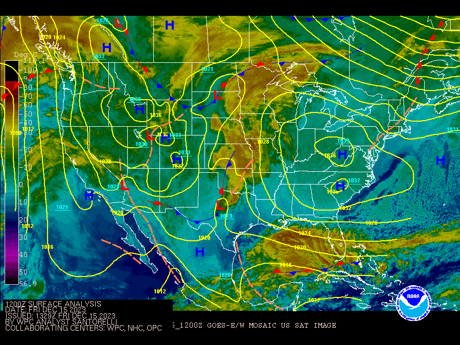
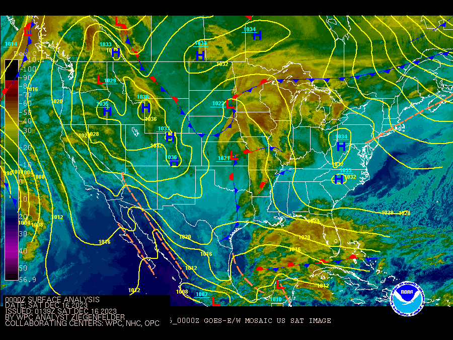
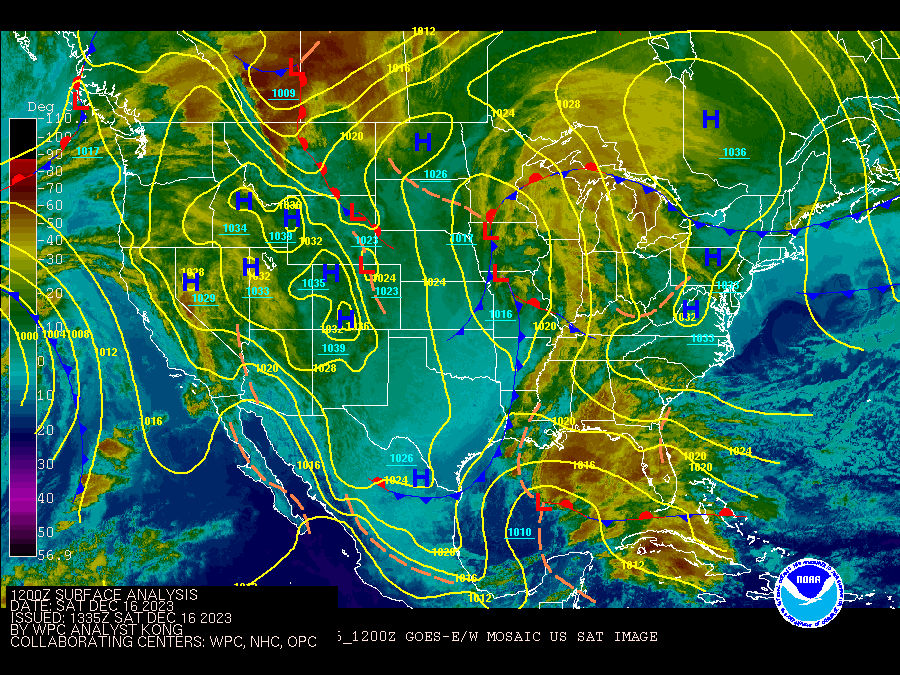
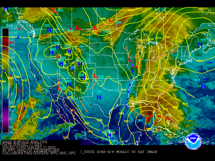
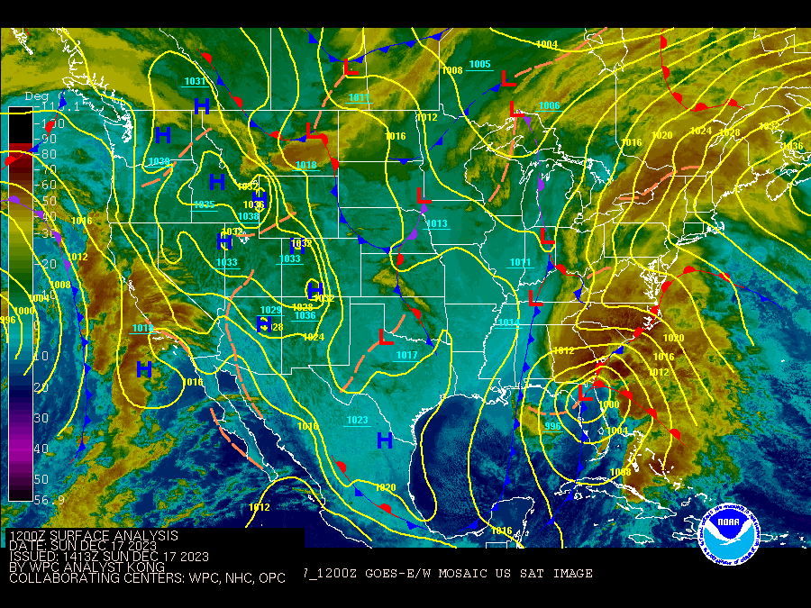
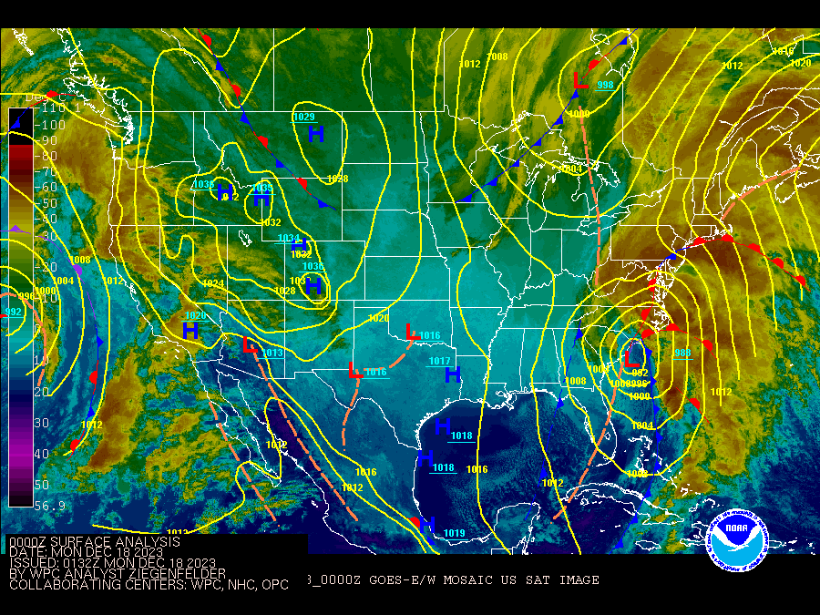
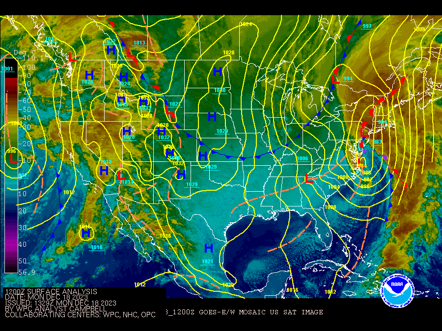
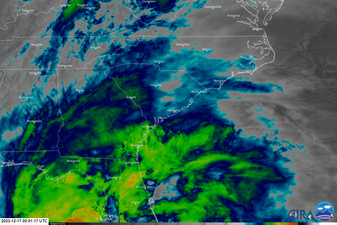
A strengthening low pressure system in the eastern Gulf of America on December 16, 2023 moved northeast across Florida and along the Southeast U.S. coast December 17 and 18. Near hurricane-force wind gusts, significant rainfall and tidal flooding, and an EF-1 tornado occurred across portions of southeast NC, northeast SC and the adjacent Atlantic Ocean. |
|
|
|
|
|
The storm was a "nor'easter" -- a non-tropical low pressure system that produces strong northeast winds along the coastline. While nor'easters are not uncommon during the fall, winter, and early spring, this was a particularly strong one with record low sea level pressure readings for December (see below). Unlike tropical systems (e.g., tropical storms and hurricanes), nor'easters feed off the temperature differences between cold and warm air masses, which is why they are most common during cooler months when the land can cool down a lot more than the Atlantic Ocean. Record Low Sea Level Pressures Set for December: * Wilmington, NC (ILM) - 985.4 mb (29.10 in Hg) * N Myrtle Beach, SC (CRE) - 988.1 mb (29.18 in Hg) * Myrtle Beach, SC (MYR) - 989.2 mb (29.21 in Hg) |
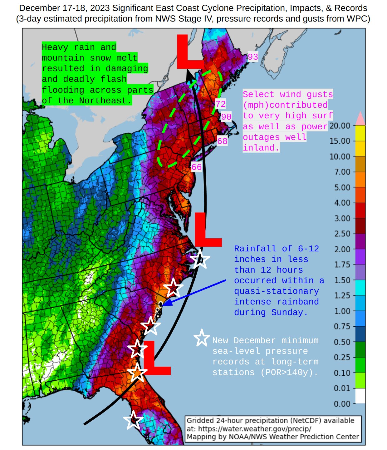 |
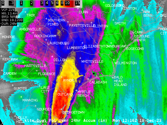
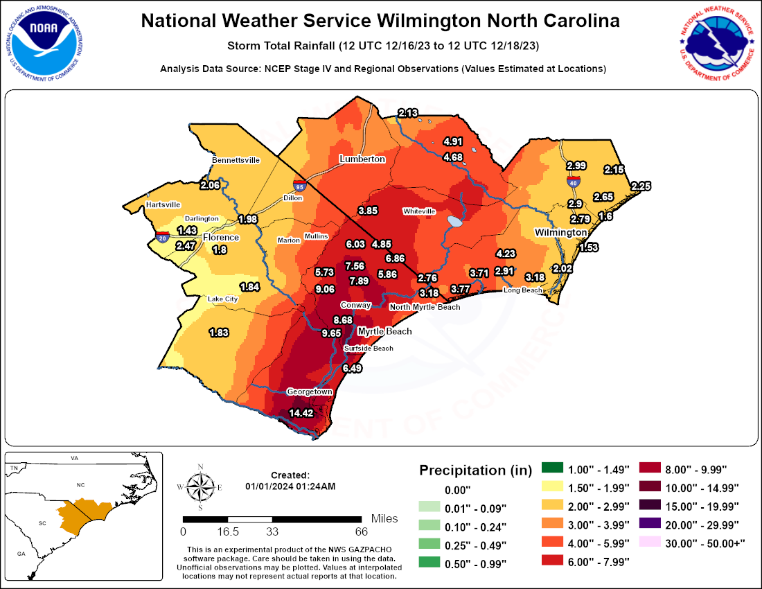
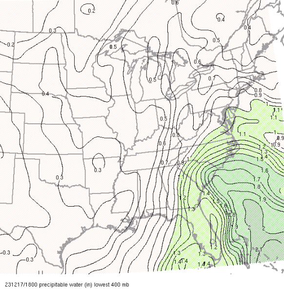
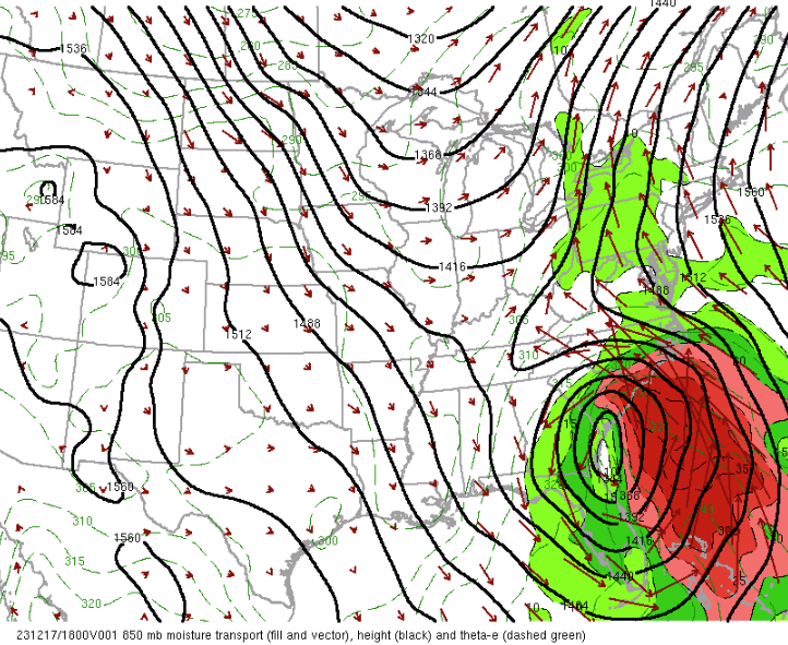
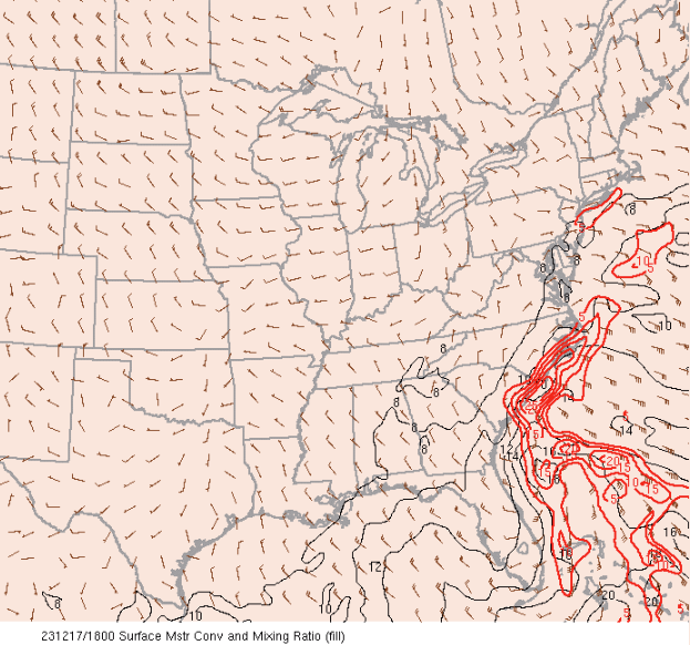
A surface trough along the coast along with deep moisture and strong mid-level moisture transport led to abundant moisture convergence and very heavy rainfall across much of the area. The heaviest rainfall was focused along the SC coast and led to significant flash flooding, especially in Georgetown and Horry Counties where widespread totals of 6+" were observed with locally higher amounts of 10-15". Daily rainfall records were even set for December 17 at all 4 of our official climate sites: N. Myrtle Beach, SC (CRE) - 3.59", Florence, SC (FLO) - 2.39", Wilmington, NC (ILM) - 3.23" and Lumberton, NC (LBT) - 4.08".
|
Wilmington, NC doppler radar (KLTX) dual pol 24-hr precipitation accumulation ending 1216 UTC (716 AM EST) on December 18, 2023. |
|
48-hr precipitation analysis from 12 UTC (7 AM EST) December 16 to 12 UTC (7 AM EST) December 18, 2023 across southeast NC and northeast SC. |
The tidal forecast was definitely one of the most challenging aspects of this event. As is typical in such nor'easters, we anticipated a significant risk from coastal flooding but trying to pinpoint the exact water levels everywhere along the coast is always difficult, especially given the uncertainty regarding the storm's track/timing/strength. This is especially the case at our 3 Total Water Level (TWL) forecast sites - Springmaid Pier in Myrtle Beach, SC, Johnnie Mercer's Pier in Wrightsville Beach, NC and along the Cape Fear River at Wilmington, NC.
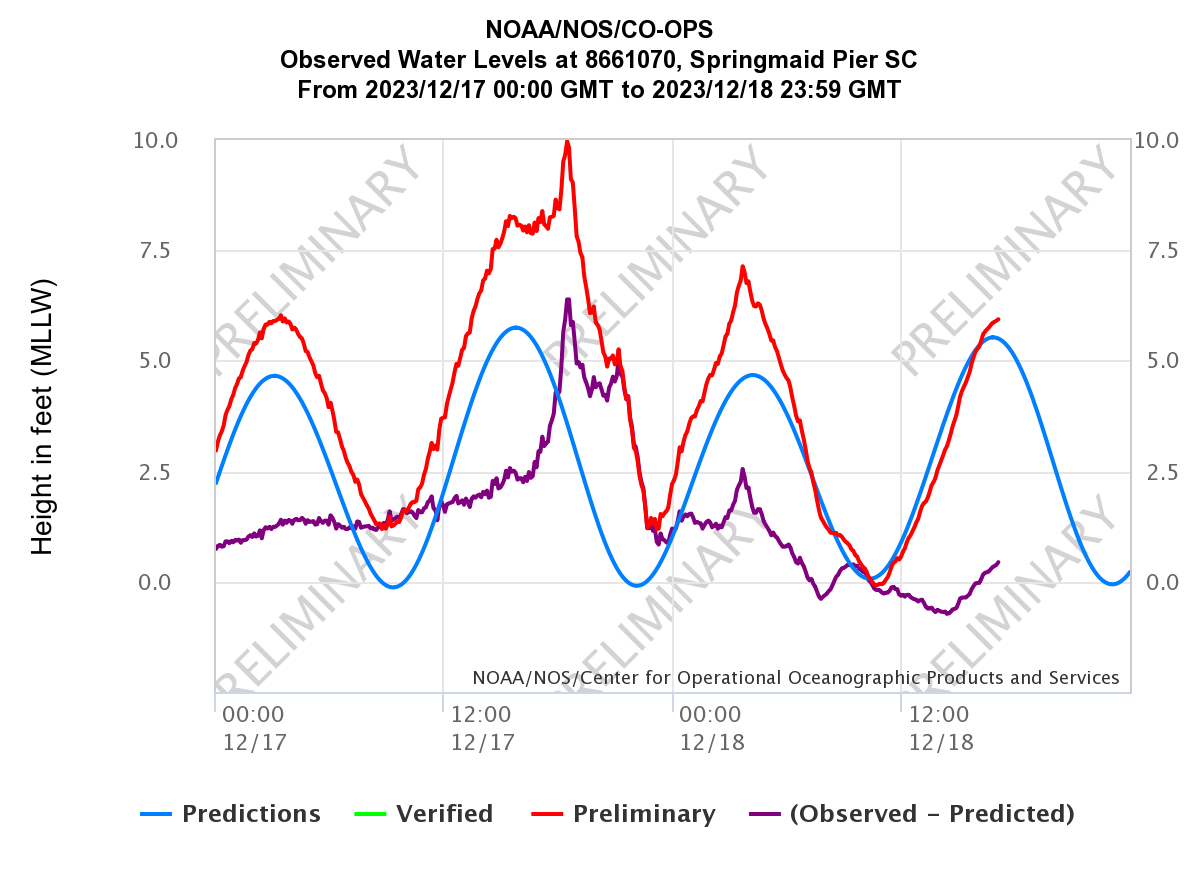
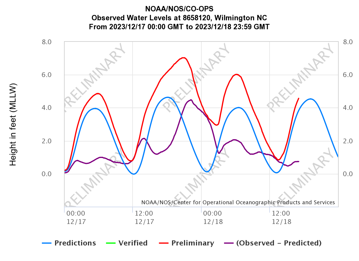
Persistent, strong north to northeast winds helped raise water levels along the coast prior to the storm's arrival from the south. Water levels then peaked during the afternoon on Sunday, December 17 around the time of the strongest onshore winds, although this was several hours after the highest astronomical tides. Thus, water levels could have been higher if the peak storm surge occurred closer to high astronomical tide! The highest water level recorded at Springmaid Pier was 9.97 ft above Mean Lower Low Water (MLLW) / 4.37 ft above Mean Higher High Water (MHHW), which was one of the highest tides on record at the time (and highest tide not related to a tropical cyclone!). At Wilmington, the tide peaked at 7.03 ft MLLW / 2.35 ft MHHW. However, the greatest surge occurred closer to low tide at Wrightsville Beach and thus, only minor coastal flooding levels were reached there. Ultimately, minor to moderate coastal flooding occurred across the area, with the greatest water levels south of Cape Fear, including Pawleys Island, SC, Myrtle Beach, SC, N. Myrtle Beach, SC, Cherry Grove, SC, Ocean Isle Beach, NC and Southport, NC.
 |
 |
 |
| Water level observations (ft above MLLW) at the NOAA/NOS tide gage at Myrtle Beach, SC | Water level observations (ft above MLLW) at the NOAA/NOS tide gage at Wilmington, NC | Water level observations (ft above MLLW) at the NOAA/NOS tide gage at Wrightsville Beach, NC |
 |
| Wind (top), temperature (middle) and pressure (bottom) observations at the NOAA/NOS tide gauge at Springmaid Pier, SC. Note how the winds peaked when the pressure fell most quickly around 18 UTC (1 PM EST) on December 17, which also coincided with the time of the highest water levels. |
Wind gusts reached tropical storm force (>=39 mph) across much of the region, a combination of pressure gradient winds and convective winds, as well as from a gravity wave (around Florence, SC). The strong winds and heavy rainfall loosened up the soils and resulted in some downed trees/power lines and property damage.
|
Peak wind gust analysis across southeast NC and northeast SC for December 17-18, 2023. Gusts just offshore were near hurricane-force (~70 mph)! |
Tornado
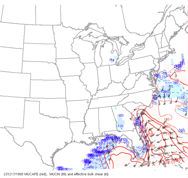
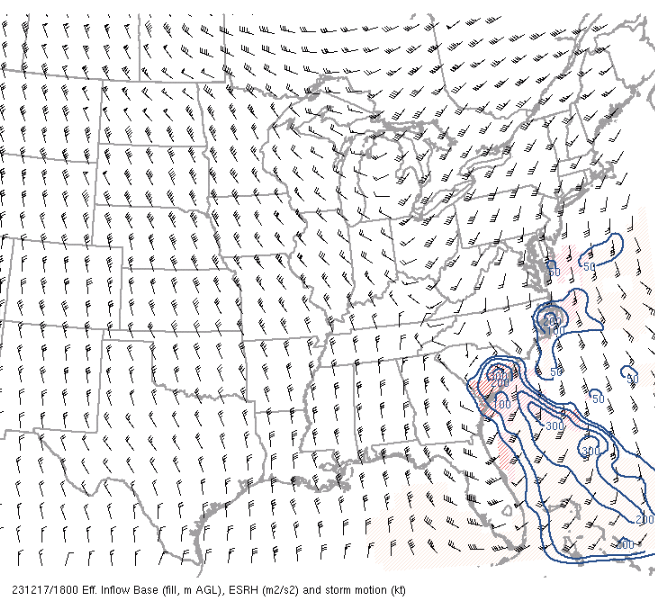
A coastal trough extending northward ahead of the storm shifted inland during the early afternoon of December 17 bringing warmer and moister air with it which led to sufficient instability for severe thunderstorm development. Although most of the damaging winds were of the straight-line downburst variety, the strong low-level helicity in place also led to a brief tornado in Horry County, SC.
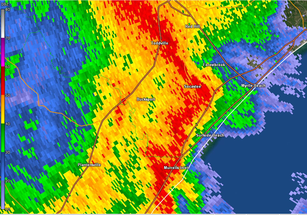 |
| Wilmington, NC doppler radar (KLTX) image of reflectivity on December 17, 2023 at 1818 UTC (118 PM EST). |
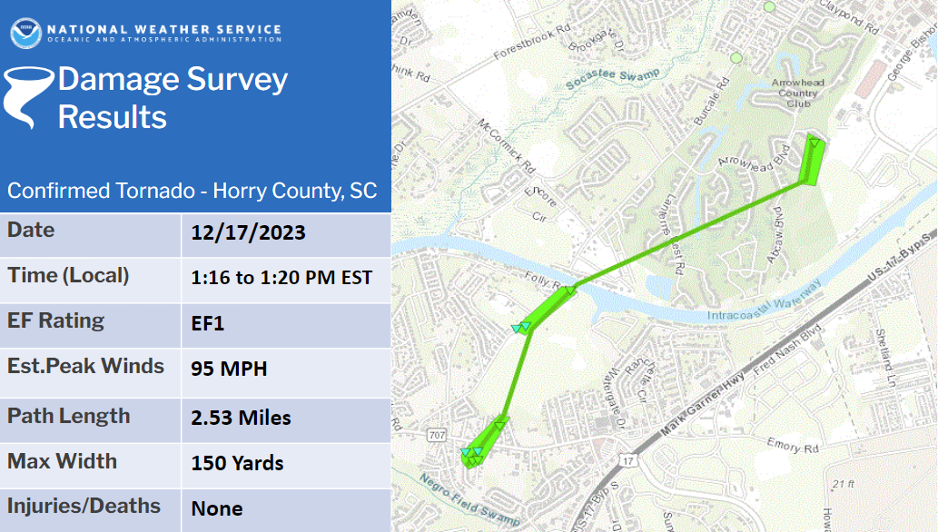 |
PUBLIC INFORMATION STATEMENT National Weather Service Wilmington NC 649 PM EST Mon Dec 18 2023 ...NWS Damage Survey for 12/17/2023 Tornado Event... .Overview...A tornadic storm developed north of a strong coastal low which moved northeast across eastern South Carolina. .Socastee-Forestbrook... Rating: EF1 Estimated Peak Wind: 95 mph Path Length /statute/: 2.53 miles Path Width /maximum/: 150 yards Fatalities: 0 Injuries: 0 Start Date: 12/17/2023 Start Time: 01:16 PM EST Start Location: 2 E Socastee / Horry County / SC Start Lat/Lon: 33.6837 / -78.9737 End Date: 12/17/2023 End Time: 01:20 PM EST End Location: 2 ESE Forestbrook / Horry County / SC End Lat/Lon: 33.7081 / -78.9451 Survey Summary: The tornado touched down south of Socastee Blvd between Everette St and Tyner St, snapping several large trees and blowing off portions of roofs from a few mobile homes. It moved north, skipped across Socastee Blvd, and snapped several large pines along Village Dr. Eight homes suffered moderate to major damage as a result of falling trees. The storm cell continued north across inaccessible property, and emerged near Folly Rd and Wayland Circle. Significant damage was observed to several homes and trees. Several trees were snapped or uprooted, and minor to moderate damage was noted to roofs and siding. One mobile home was pushed off its block foundation. The tornado appeared to lift as it crossed the Intracoastal Waterway and touched down again on the Arrowhead Country Club property. Numerous large hard and softwood trees were snapped just south of the Flintlake Apartments. Tree debris was blown into several apartments, breaking windows and causing moderate roof and siding damage. Damage upstream of the initial touchdown, along and south of Palmetto Pointe Blvd, was straightline in nature and not the result of a tornado. Additional wind damage occurred to the old Waccamaw Mall at Fantasy Harbour. Portions of the facade were blown off, in addition to several pieces of siding. A few bay doors were blown in, and a large section of storefront wall was buckled outward a few inches. A few nearby UPS and FedEx trucks were blown over, in addition to a tractor trailer. This damage appeared to be the result of straightline winds that occurred after the tornado dissipated and the storm cell bowed northeastward. Spotty tree damage was also observed on the northeast side of Highway 501 in the River Oaks area. && EF Scale: The Enhanced Fujita Scale classifies tornadoes into the following categories: EF0.....65 to 85 mph EF1.....86 to 110 mph EF2.....111 to 135 mph EF3.....136 to 165 mph EF4.....166 to 200 mph EF5.....>200 mph NOTE: The information in this statement is preliminary and subject to change pending final review of the event and publication in NWS Storm Data. $$ VAO/CRM |
| Public Information Statement (PNS) summarizing the storm survey results which confirmed an EF-1 tornado occurred in Horry County, SC during the afternoon of December 17, 2023. |
Additional Info
More information about the storm can be found in our annual weather summary.
Page Author: Bob Bright
Page Created: January 11, 2024
Page Updated: May 28, 2024


 Coastal Flood
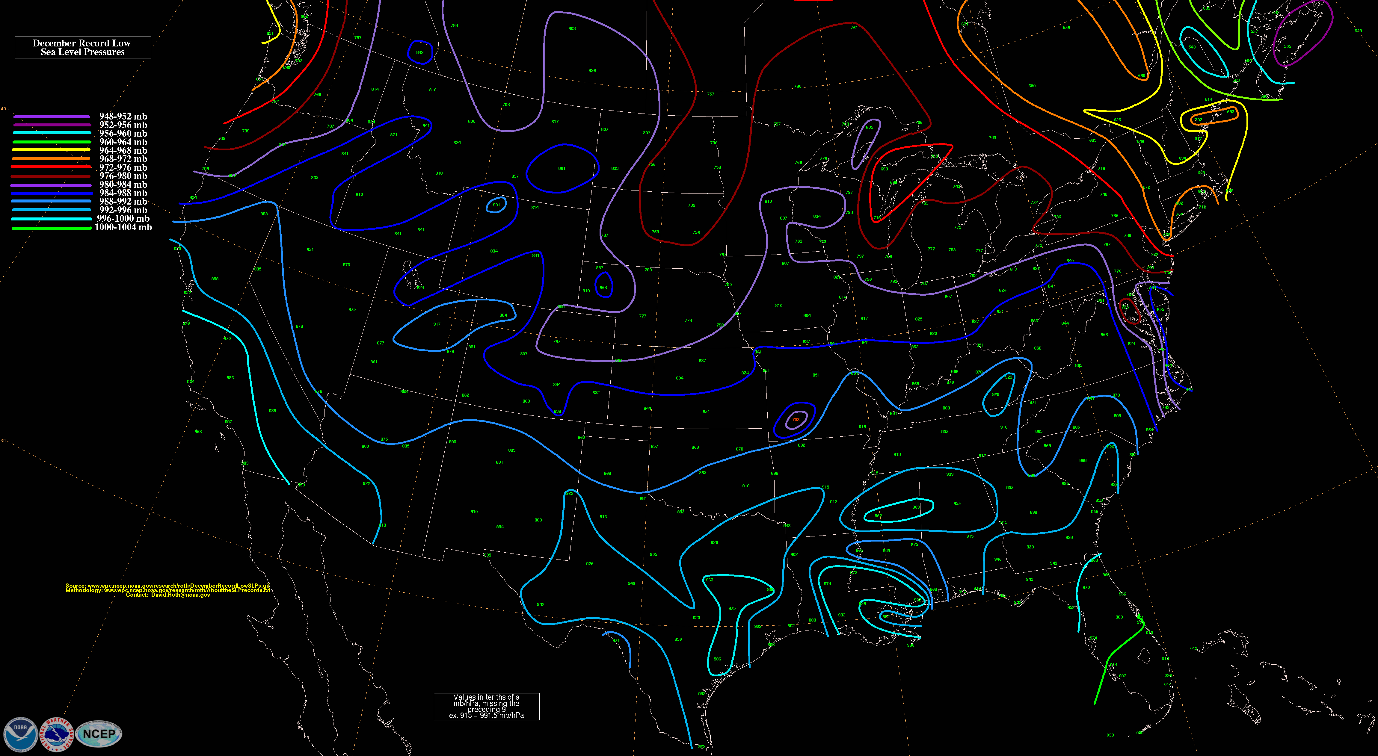