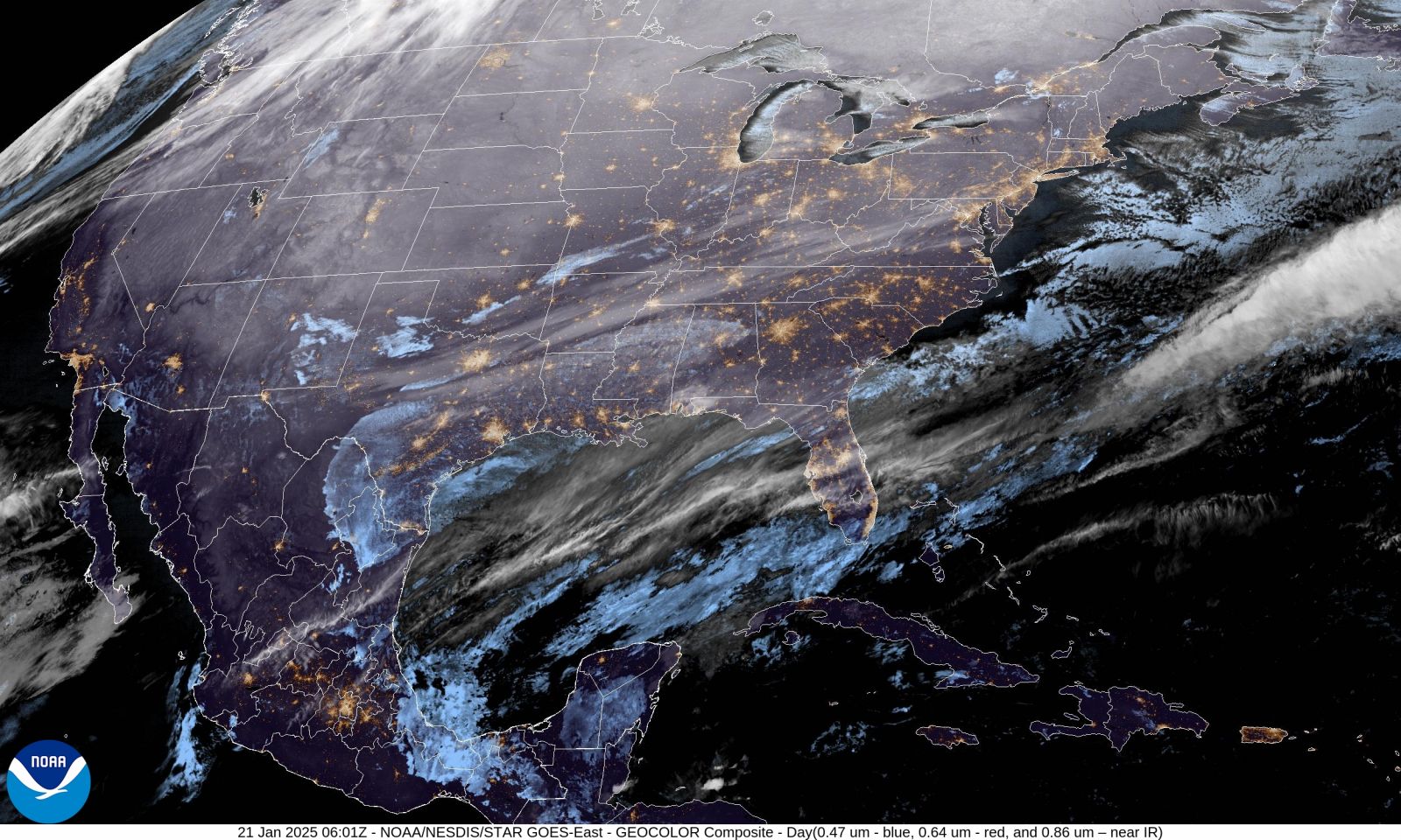
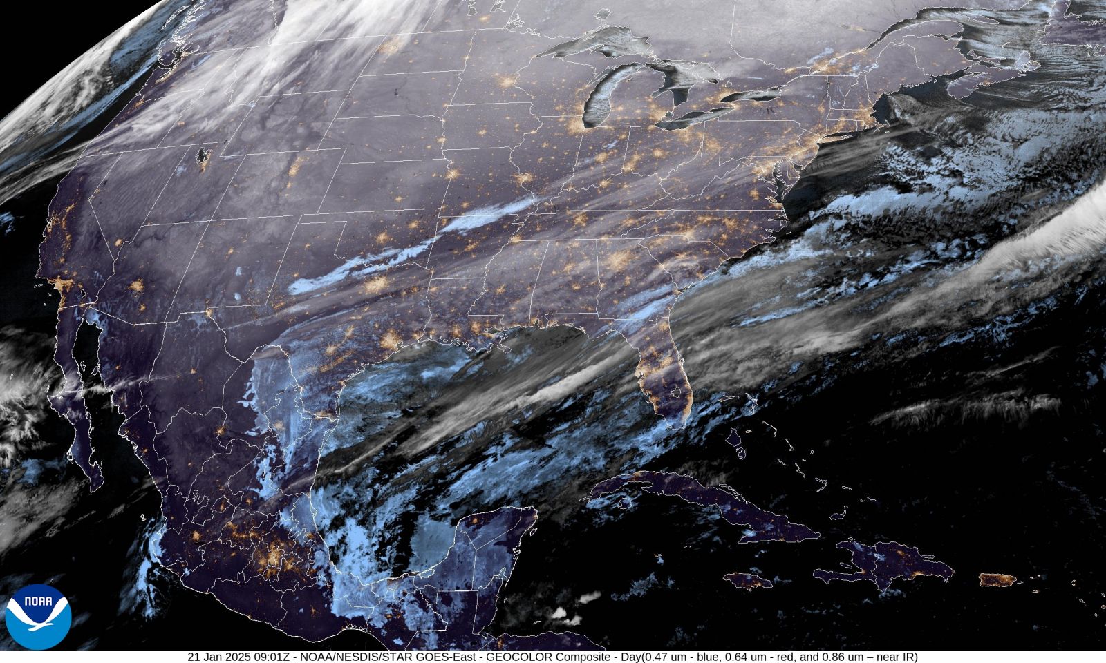
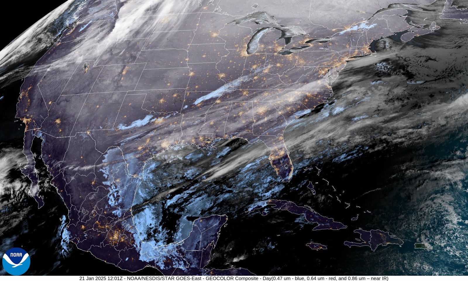
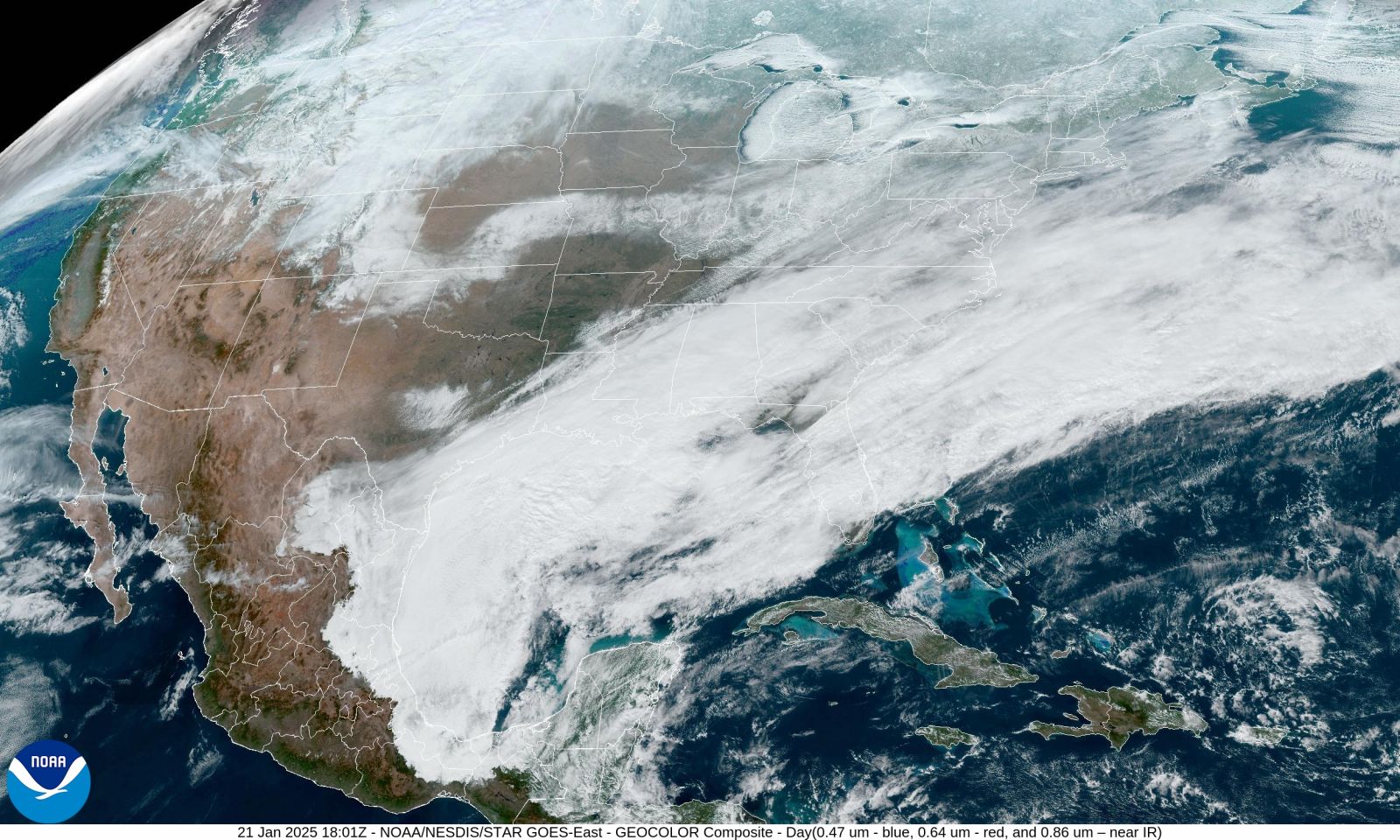
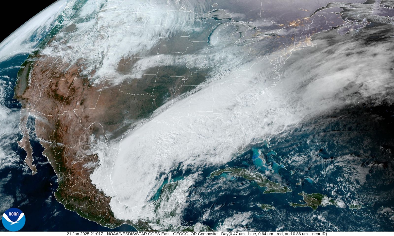
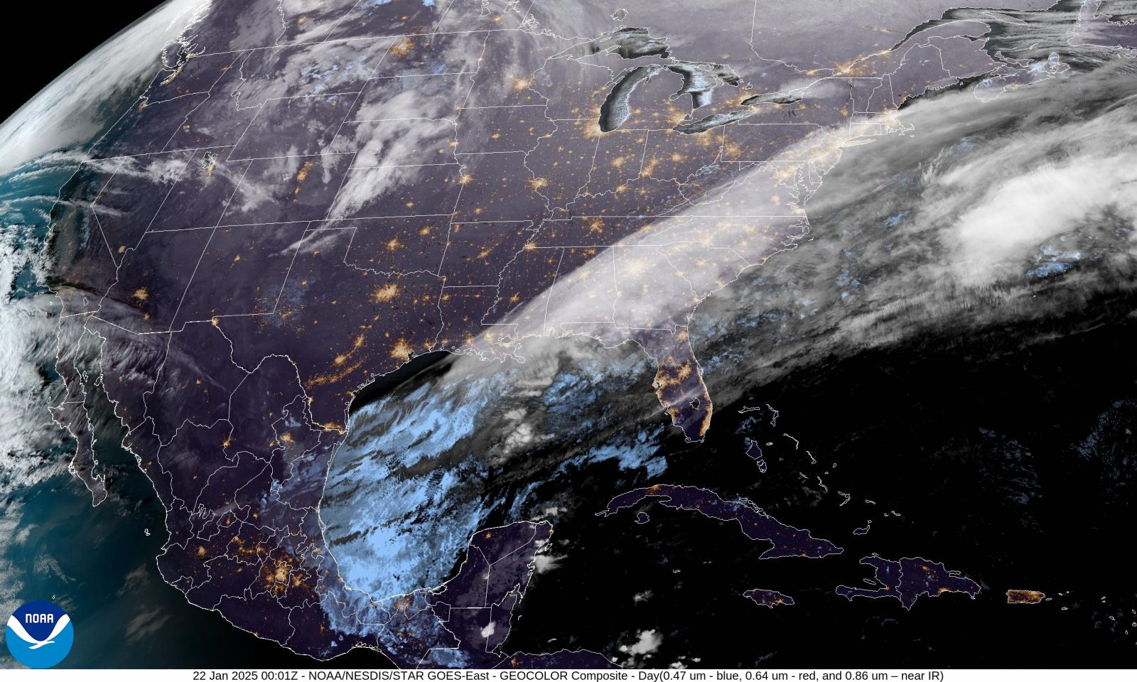
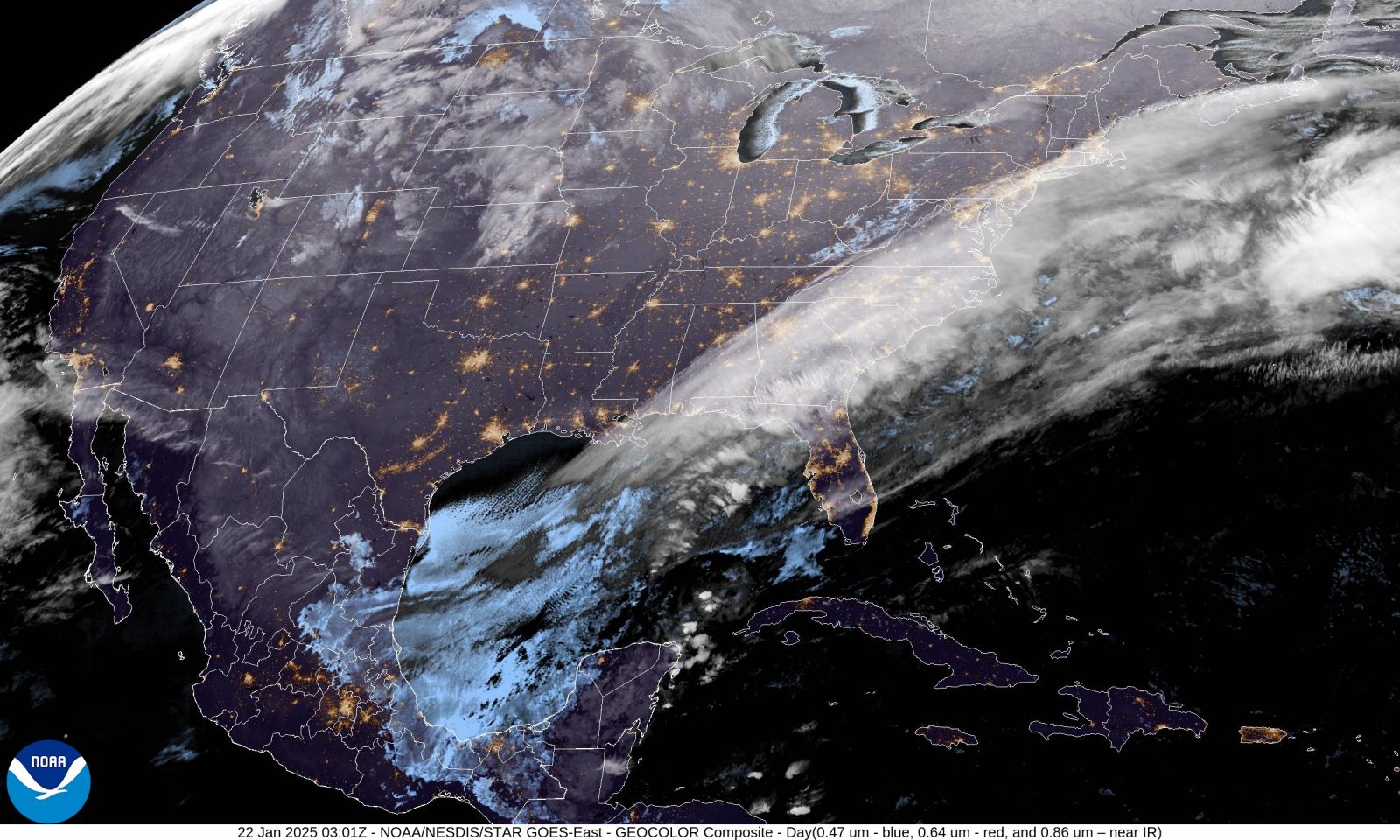
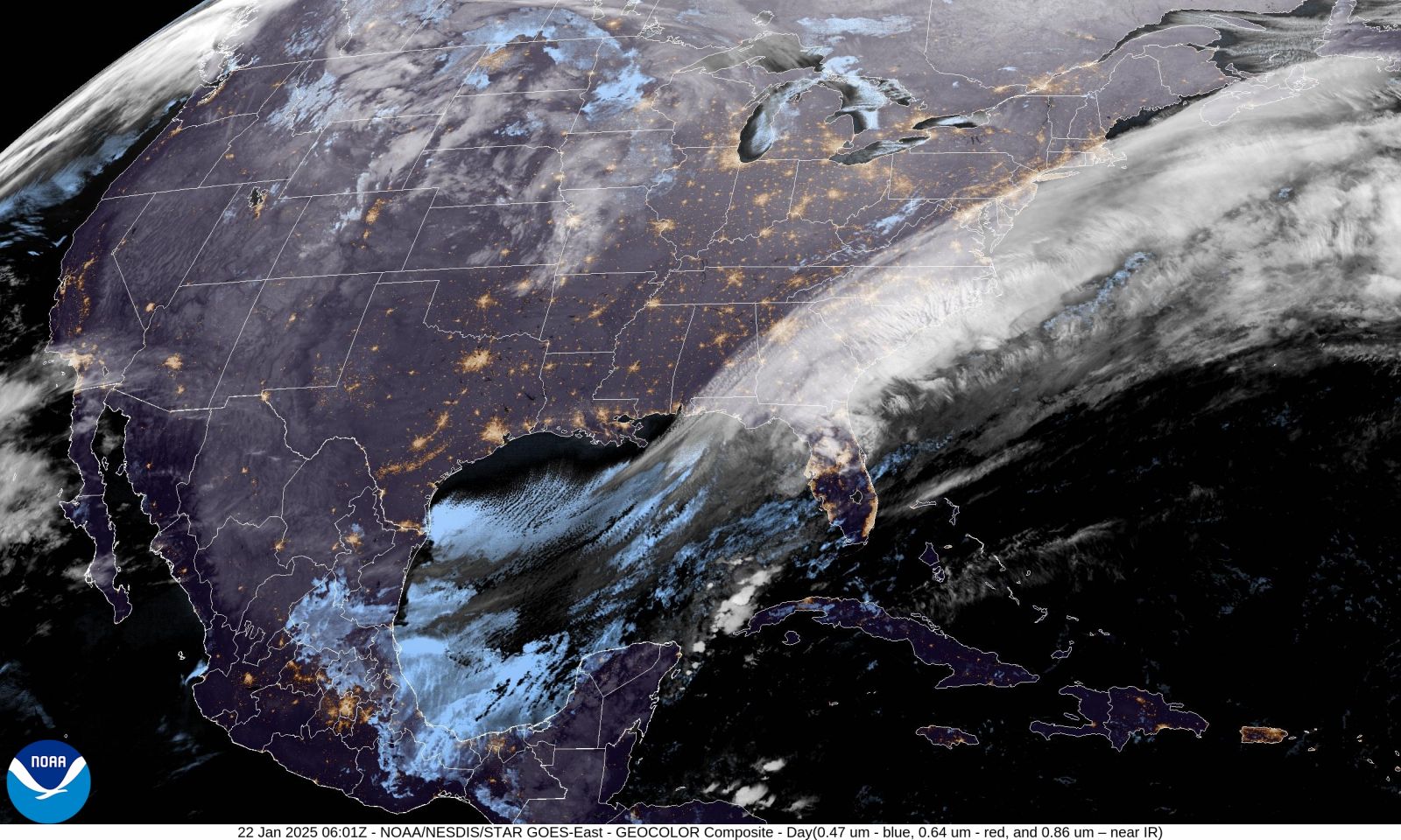
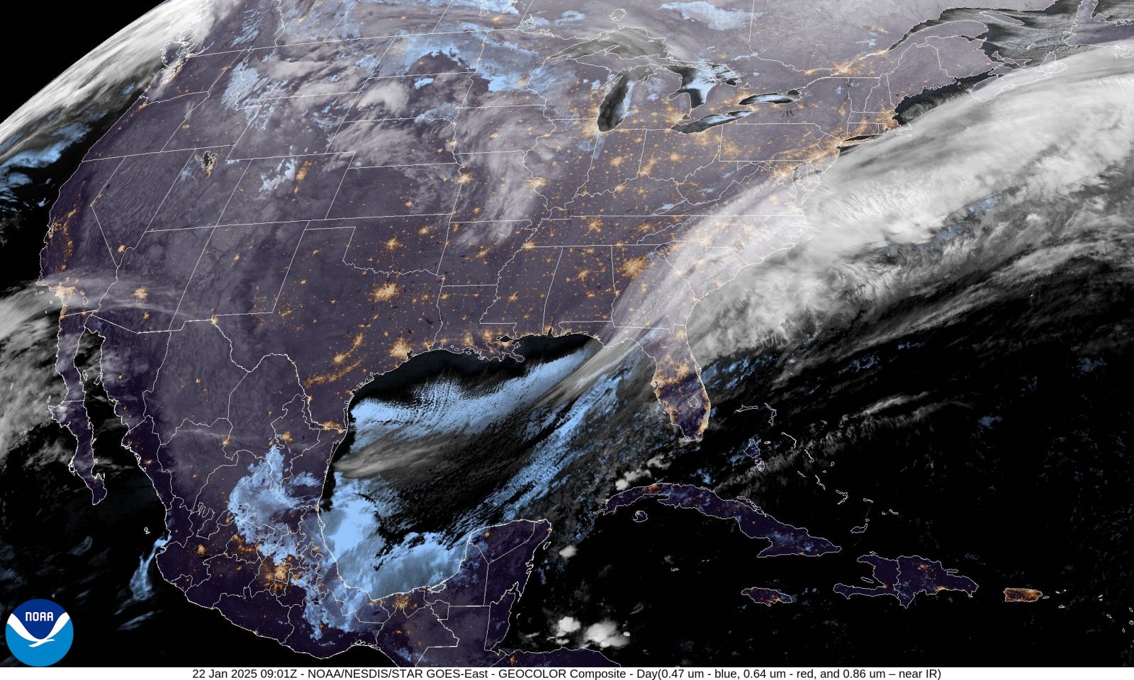
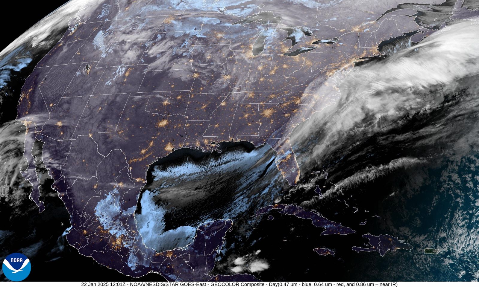
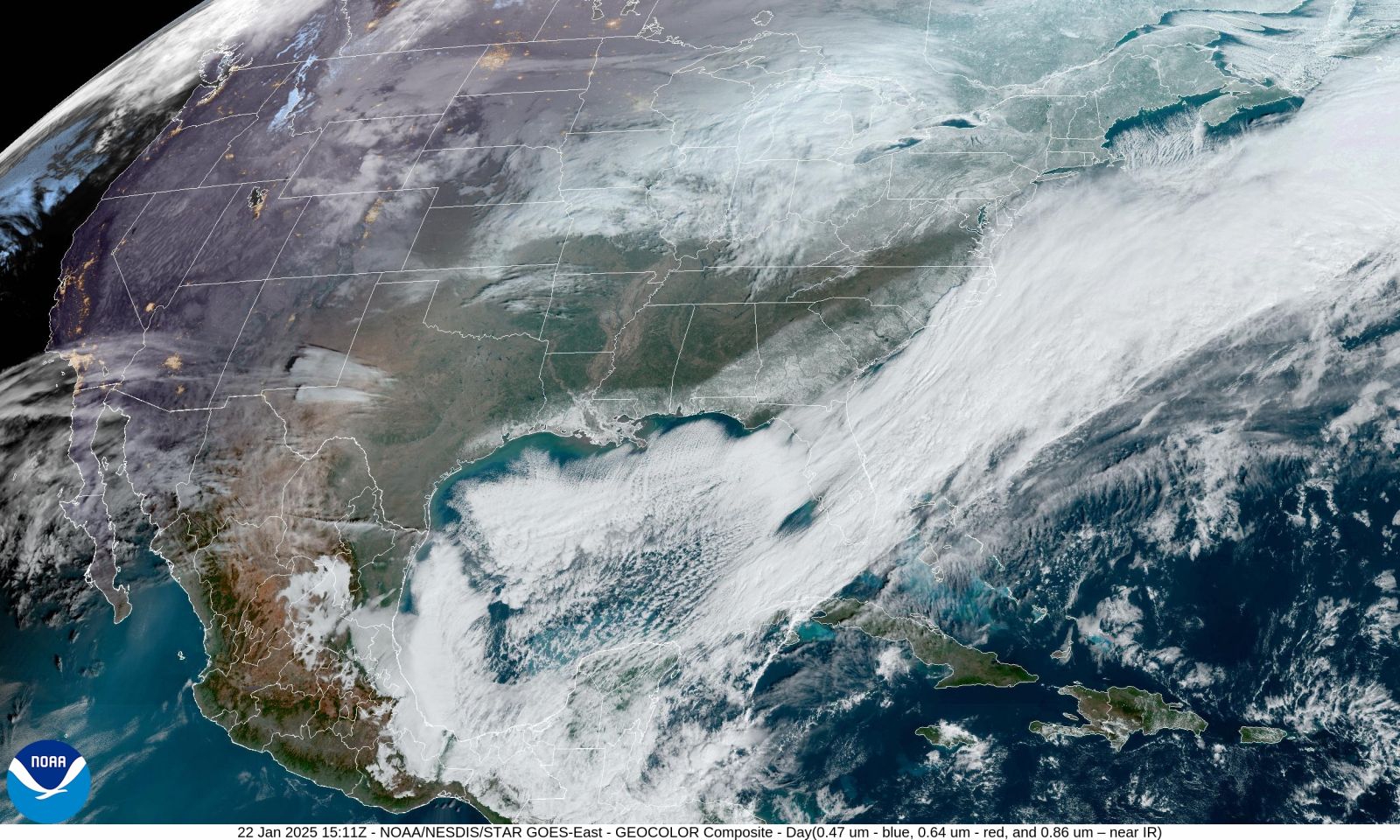
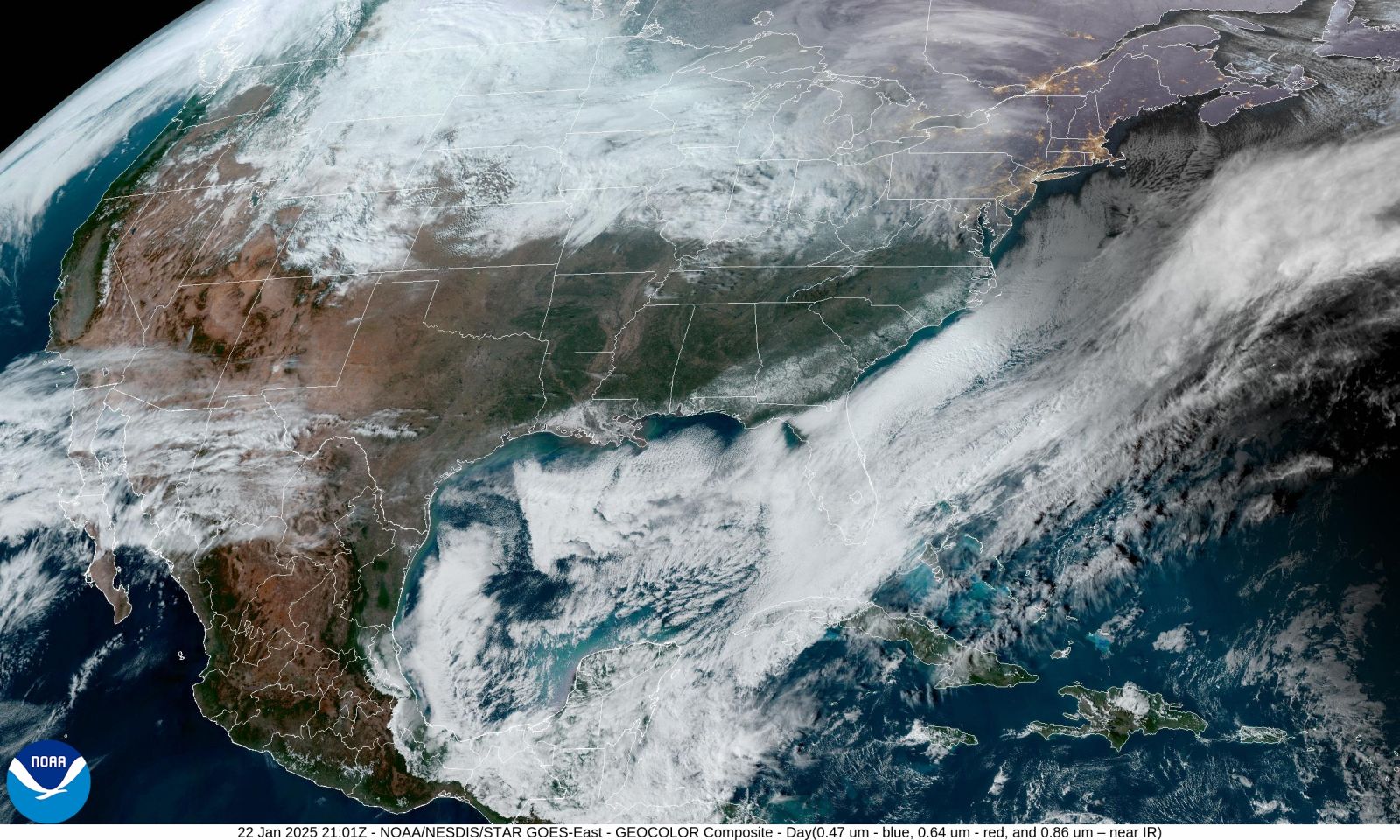
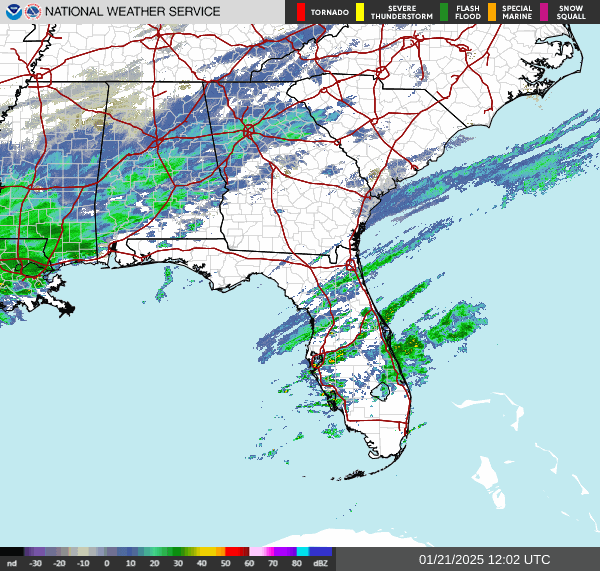
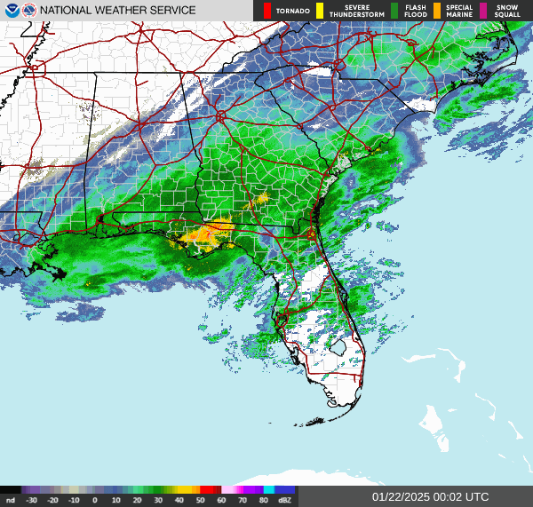
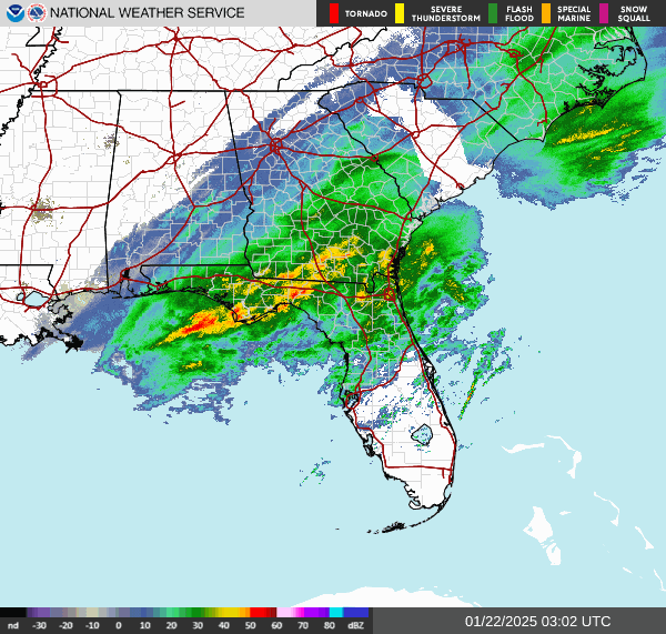
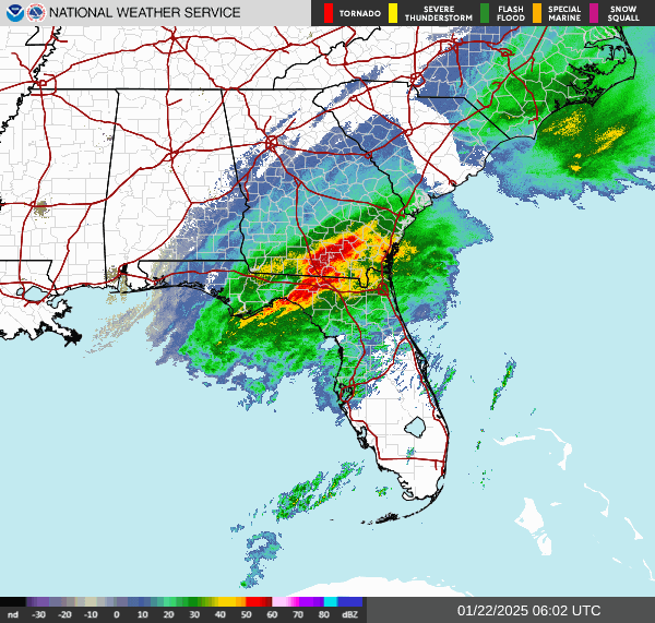
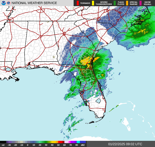
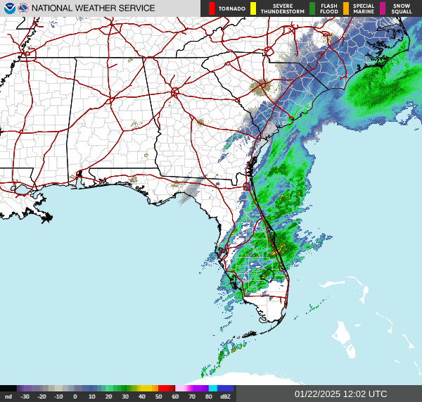
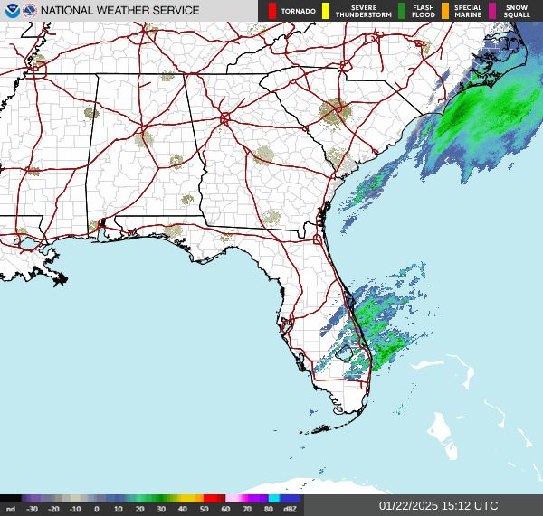
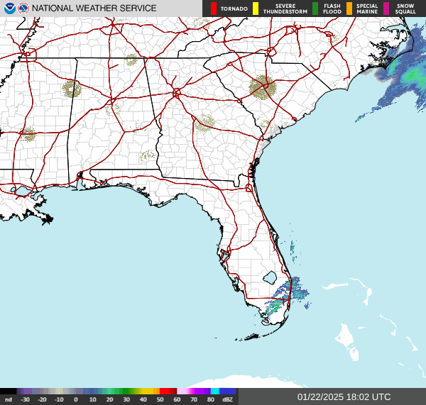
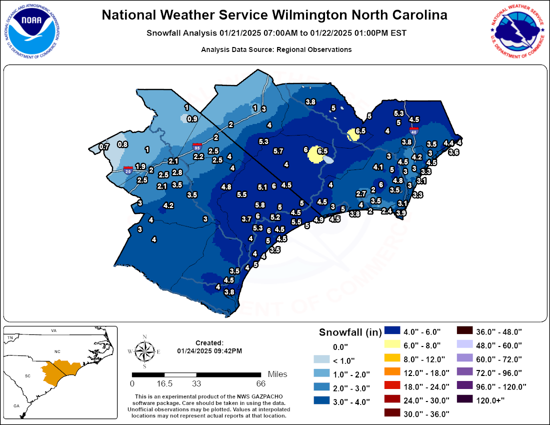
OverviewMoisture moving northward from the Gulf of America ahead of an upper-level trough combined with arctic temperatures to cause record snowfall and even blizzard conditions along parts of the Gulf Coast January 20-22, 2025. Wintry precipitation then spread northeast across the Southeast U.S. and into the southern Mid-Atlantic, with up to ~7" of snow falling across portions of southeast NC and northeast SC, the first significant snowfall for the area since January 2018. Myrtle Beach, SC unofficially recorded 5", which was the most snowfall there since December 1989 and is unofficially tied for the 5th snowiest storm on record since 1940. Daily record snowfall was also recorded at Wilmington (ILM) on January 21 and 22. See the last few images of the satellite loop below to see the swath of snow stretching along the Gulf and Southeast U.S. coasts from Texas through the Carolinas. Fortunately, no significant impacts besides hazardous travel conditions were reported. |
|


|
|
|
|
|
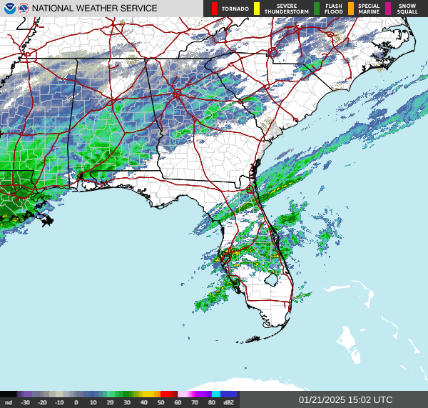
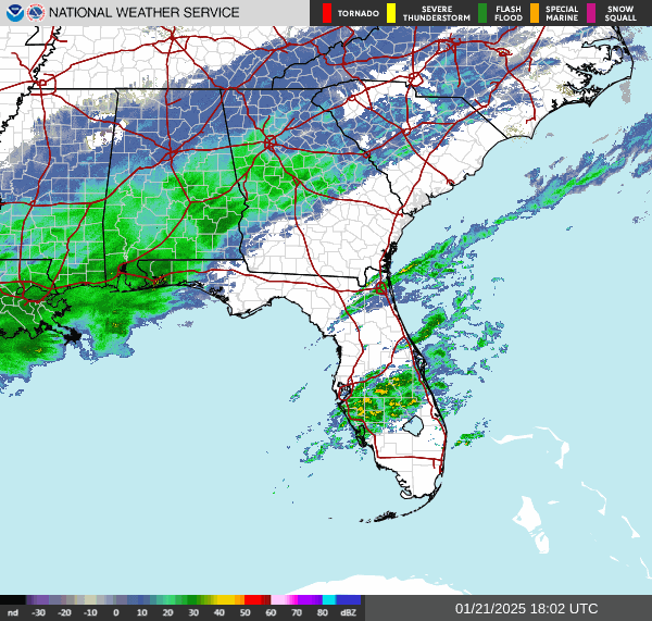
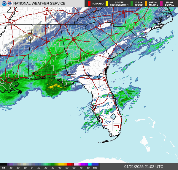
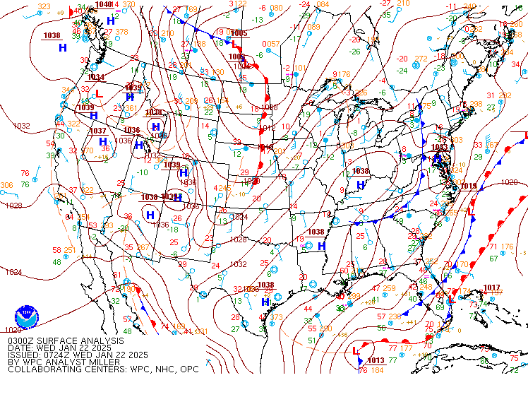
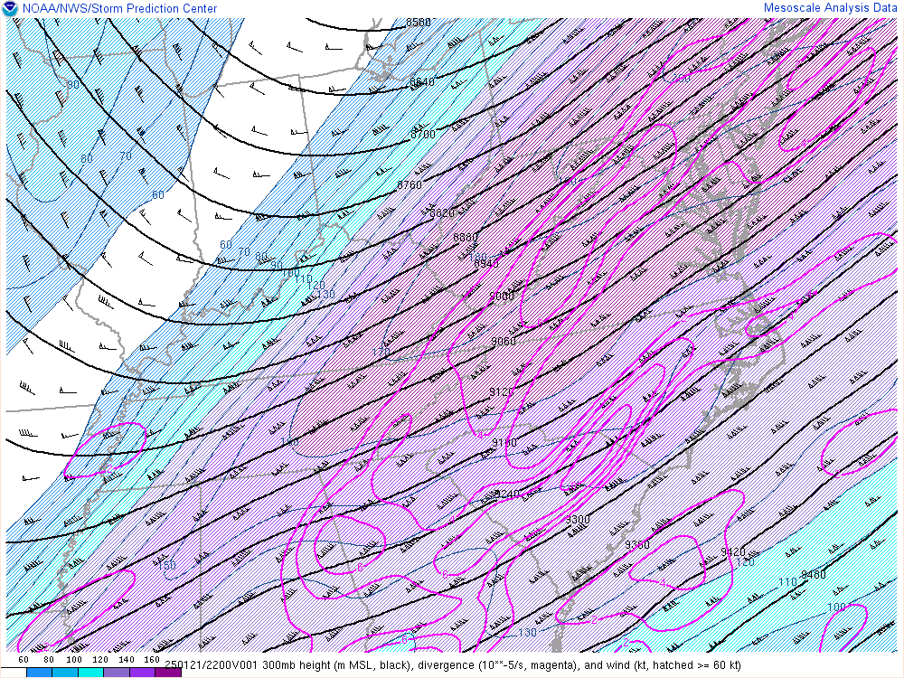
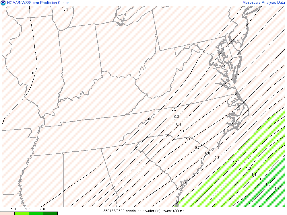
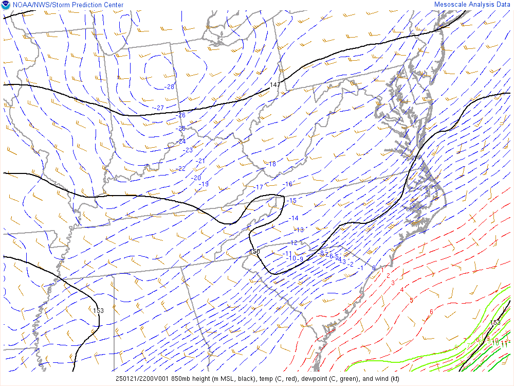
Although the surface low pressure systems stayed well south and east of the area, forcing for ascent from the mid-level trough and strong upper jet allowed unseasonably high levels of moisture from the Gulf of America to move northward atop the very cold air mass near the surface. The precipitation began falling across southeast NC and northeast SC during the afternoon of January 21 into a very dry low-level air mass which helped to cool the low-level air mass through evaporative cooling. Most of the precipitation fell as snow, although there was some mixed precipitation initially in the form of snow, sleet, freezing rain and rain near the coast due to slightly above freezing air several thousand feet above the surface that moved in temporarily closer to the coast. However, the precipitation transitioned to all snow later in the day as the air mass saturated completely and cooled below freezing. |
|
Snow amounts generally ranged from 1-2" well inland near/west of I-95 to 3-5" farther east with locally higher amounts up to ~7". The only official snowfall amount was 2.6" recorded at Wilmington Airport (ILM).
|
|
Public Information Statement
Spotter Reports
National Weather Service Wilmington NC
946 PM EST Fri Jan 24 2025


********STORM TOTAL SNOWFALL: JANUARY 21-22, 2025********************

LOCATION                TOTAL      TIME/DATE  COMMENTS
                     SNOWFALL       MEASURED
                     (inches)

NORTH CAROLINA

...Bladen County...
  Kelly                   6.5  1000 AM  1/22  Public
  White Lake              5.0   320 PM  1/22  Public
  6 NW Elizabethtown      3.8   700 AM  1/22  NC-BD-2

...Brunswick County...
  Bolivia                 6.0   830 AM  1/22  Public
  Ocean Isle Beach        5.0   900 AM  1/22  Public
  4 S Leland              5.0   700 AM  1/22  NC-BR-78
  3 NNW Calabash          4.5  1052 AM  1/22  Public
  2 WNW Calabash          4.5   700 AM  1/22  NC-BR-106
  Sunset Beach            4.5  1023 AM  1/22  Trained Spotter
  Leland                  4.5   930 AM  1/22  County Official
  6 WSW Leland            4.1   720 AM  1/22  NC-BR-2
  Ash                     4.0  1045 AM  1/22  Trained Spotter
  Varnamtown              4.0  1045 AM  1/22  Public
  Southport               3.9   806 AM  1/22  Trained Spotter
  1 WNW Holden Beach      3.8   700 AM  1/22  NC-BR-119
  Boiling Spring Lake     3.5   945 AM  1/22  Public
  3 NW Oak Island         3.5   930 AM  1/22  Trained Spotter
  5 SW Leland             3.4   600 AM  1/22  NWS Employee
  2 WNW Sunset Beach      3.4   700 AM  1/22  NC-BR-6
  1 NE Southport          3.1   700 AM  1/23  NC-BR-14
  8 SW Bolivia            3.0   700 AM  1/22  NC-BR-73
  1 WNW Leland            3.0   700 AM  1/22  NC-BR-98
  6 WNW Leland            3.0   700 AM  1/22  NC-BR-101
  3 NE Sunset Beach       3.0   800 AM  1/22  NC-BR-90
  8 SW Bolivia            2.7   700 AM  1/22  NC-BR-71
  1 NW Southport          2.4   800 AM  1/22  NC-BR-121
  8 SW Bolivia            2.1   700 AM  1/22  NC-BR-45
  Oak Island              2.0   215 AM  1/22  Public
  4 SW Bolivia            2.0   820 AM  1/22  Amateur Radio
  7 W Southport           1.9   800 AM  1/22  NC-BR-102

...Columbus County...
  5 W Lake Waccamaw       6.5  1215 PM  1/22  Public
  Whiteville              6.0   740 AM  1/22  Trained Spotter
  Cerro Gordo             5.7  1123 AM  1/22  Public
  Clarendon               4.0   500 AM  1/22  Public

...New Hanover County...
  5 SSE Wilmington        4.8   800 AM  1/22  NWS Employee
  Ogden                   4.5   130 AM  1/22  Public
  7 NE Wilmington         4.2   700 AM  1/22  NC-NH-68
  1 NNW Myrtle Grove      4.0   340 PM  1/22  Public
  7 NE Wilmington         3.8   700 AM  1/22  NC-NH-81
  7 NE Wilmington         3.5   700 AM  1/22  NC-NH-106
  1 N Carolina Beach      3.3   700 AM  1/23  NC-NH-62
  Seagate                 3.3   545 AM  1/22  Public
  6 SSE Wilmington        3.1   800 AM  1/22  NC-NH-123
  Wilmington              3.0   230 AM  1/22  NWS Employee
  3 ESE Wilmington        3.0   800 AM  1/22  NC-NH-99
  1 NE Bayshore           3.0   700 AM  1/22  NC-NH-116
  5 NE Wilmington         3.0   900 AM  1/22  NWS Employee
  Myrtle Grove            3.0   900 AM  1/22  NWS Employee
  1 NW Silver Lake        3.0   700 AM  1/22  NC-NH-90
  4 SE Wilmington         2.8   820 AM  1/22  NC-NH-102
  8 ENE Wilmington        2.8   700 AM  1/22  NC-NH-10
  4 N Wilmington          2.6   700 AM  1/22  Official NWS Obs
  Castle Hayne            2.5   605 AM  1/22  Public
  6 SSE Wilmington        2.5   700 AM  1/22  NC-NH-46
  1 WNW Silver Lake       2.2   230 PM  1/22  Public
  6 S Wilmington          2.1   812 AM  1/22  Trained Spotter
  1 ENE Bayshore          2.0   545 AM  1/22  NWS Employee
  2 S Wilmington          2.0   800 AM  1/22  NC-NH-94

...Pender County...
  4 SSW Watha             5.3   800 AM  1/22  Amateur Radio
  5 WSW Burgaw            5.0   911 AM  1/22  NC-PD-39
  5 NW Atkinson           5.0   630 AM  1/22  Public
  Burgaw                  4.5   700 AM  1/22  NC-PD-22
  2 WNW Topsail Beach     4.4   630 AM  1/22  Public
  Currie                  4.0  1040 AM  1/22  Public
  1 SW Surf City          4.0  1230 PM  1/22  Public
  Rocky Point             3.8  1230 AM  1/22  Public
  4 E Hampstead           3.6   814 AM  1/22  NWS Employee
  Hampstead               3.5   130 AM  1/22  Public

...Robeson County...
  5 SW Orrum              5.3   700 AM  1/22  Public
  9 SSE Lumberton         4.0   700 AM  1/22  NC-RB-17
  Lumberton               3.0   330 AM  1/22  Broadcast Media
  2 SE Rowland            2.0   700 AM  1/22  NC-RB-26
  1 NW Lumberton          1.0   800 AM  1/22  CO-OP Observer

SOUTH CAROLINA

...Darlington County...
  5 NNE Timmonsville      1.9   915 AM  1/22  Amateur Radio
  2 NNE Darlington        1.0   700 AM  1/22  SC-DR-51
  Hartsville              0.8   130 PM  1/22  Amateur Radio
  5 WSW Hartsville        0.7   720 AM  1/22  SC-DR-20

...Dillon County...
  Fork                    4.0   130 PM  1/22  Amateur Radio
  2 SE Latta              2.5  1006 AM  1/22  Public
  Latta                   2.2   700 AM  1/22  SC-DL-9
  Dillon                  2.0   130 PM  1/22  Amateur Radio

...Florence County...
  Scranton                4.2   130 AM  1/22  Public
  Evergreen               3.5   130 PM  1/22  Amateur Radio
  Pamplico                3.5   100 AM  1/22  Public
  Olanta                  3.0  1245 AM  1/22  Public
  Johnsonville            3.0   745 AM  1/22  Public
  4 SE Quinby             2.8   250 PM  1/22  Public
  Timmonsville            2.5   130 PM  1/22  Amateur Radio
  3 S Florence            2.5   700 AM  1/22  SC-FL-7
  Florence                2.5   150 AM  1/22  Public
  2 W Effingham             2.1   500 AM  1/22  SC-FL-9
  6 NE Florence           2.1   800 AM  1/22  SC-FL-42
  4 W Florence            2.0   852 AM  1/22  Amateur Radio

...Georgetown County...
  1 SSW Murrells Inlet    5.0   800 AM  1/22  SC-GT-61
  Georgetown              4.5   330 AM  1/22  Broadcast Media
  4 SSW Georgetown        4.0   700 AM  1/22  CO-OP Observer
  Murrells Inlet          4.0   730 AM  1/22  Public
  1 NE Murrells Inlet     4.0   700 AM  1/22  SC-GT-60
  2 NE Murrells Inlet     4.0   700 AM  1/22  SC-GT-68
  2 NNW Pawleys Island    4.0   700 AM  1/22  SC-GT-67
  6 S Georgetown          3.8   800 AM  1/22  SC-GT-4
  5 NNE Georgetown        3.5   800 AM  1/22  SC-GT-1

...Horry County...
  Loris                   6.0  1210 AM  1/22  Public
  Conway                  6.0   405 AM  1/22  Public
  5 WNW Myrtle Beach      6.0   700 AM  1/22  SC-HR-46
  6 N Conway              5.8   900 AM  1/22  SC-HR-172
  Briarcliffe Acres        5.5   900 AM  1/22  Public
  Aynor                   5.5  1100 AM  1/22  Public
  8 WNW Myrtle Beach      5.3   700 AM  1/22  SC-HR-67
  6 E Conway              5.2   700 AM  1/22  SC-HR-61
  5 W Loris               5.1   700 AM  1/22  SC-HR-158
  10 ENE Conway           5.0   700 AM  1/22  SC-HR-126
  5.8 WSW Myrtle Beach    5.0   900 AM  1/22  Public
  7 NNW Myrtle Beach      5.0   700 AM  1/22  SC-HR-75
  Longs                   5.0   730 AM  1/22  Public
  1 E North Myrtle Bea    5.0   700 AM  1/22  SC-HR-171
  Socastee                5.0   830 AM  1/22  Public
  Little River            4.9   930 AM  1/22  Public
  Galivants Ferry         4.8   715 AM  1/22  Public
  1 ENE Loris             4.5   700 AM  1/22  SC-HR-19
  1 W Myrtle Beach        4.5   830 AM  1/22  Public
  3 ENE Forestbrook       4.5   845 AM  1/22  NWS Employee
  5 WNW Little River      4.5   600 AM  1/22  SC-HR-137
  6 ENE Red Hill          4.0   700 AM  1/22  Public
  Bucksport               4.0  1100 PM  1/21  Public
  Surfside Beach          4.0   600 AM  1/22  Public
  2.6 SW Myrtle Beach     4.0   900 AM  1/22  Public
  2 WSW Myrtle Beach      4.0   800 AM  1/22  SC-HR-151
  2 SSW Conway            3.7   600 AM  1/22  SC-HR-174
  1.8 NW Myrtle Beach     3.5   900 AM  1/22  Broadcast Media
  5 SW Myrtle Beach       3.5   900 AM  1/22  Public

...Marion County...
  1 SSE Mullins           4.0   733 AM  1/22  CO-OP Observer
  5 E Sellers             2.5   130 PM  1/22  Amateur Radio

...Marlboro County...
  Tatum                   1.0   115 AM  1/22  Public
  2 WNW Clio              0.9   700 AM  1/22  SC-MB-11

...Williamsburg County...
  Kingstree               4.0   610 AM  1/22  Public
  2 ESE Hebron            4.0   900 AM  1/22  CO-OP Observer
  8 NW Kingstree          3.0   800 AM  1/22  SC-WL-2

&&
|
| Snowfall reports from various sources for January 21-22, 2025. |
The main impacts were traffic accidents as a result of hazardous travel conditions. However, the Myrtle Beach Airport (MYR) was also shut down for a period.
 |
 |
 |
|
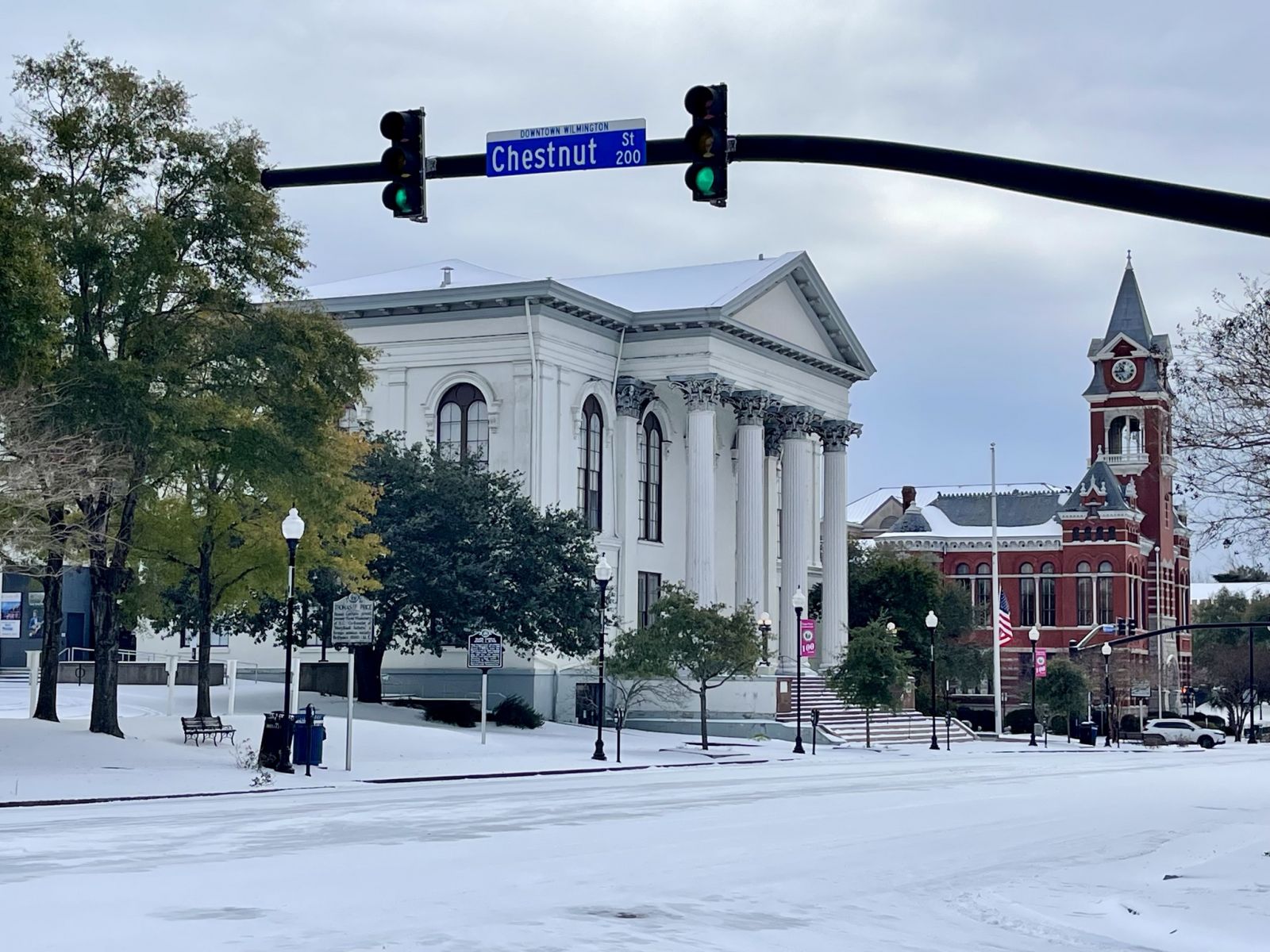
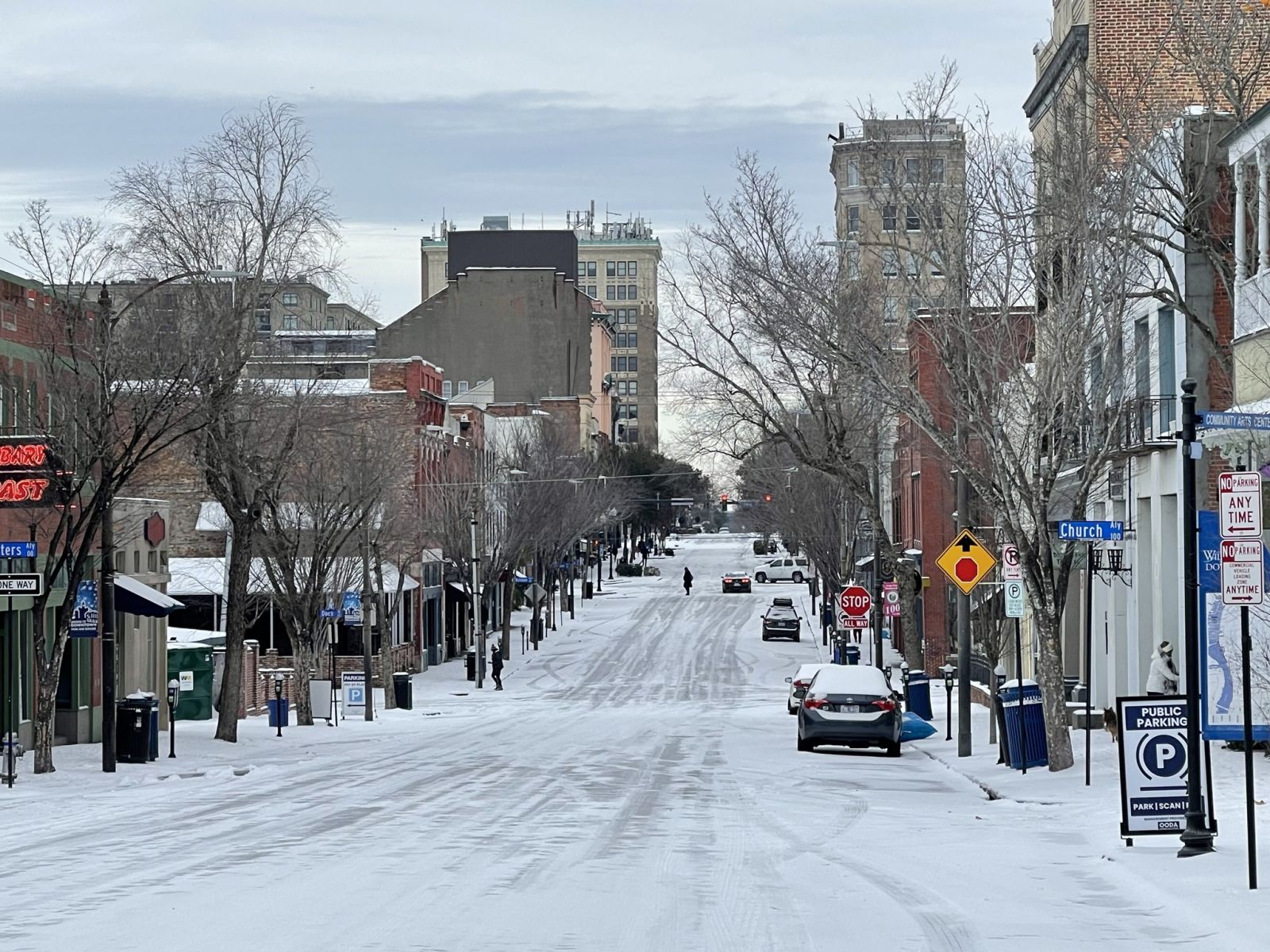
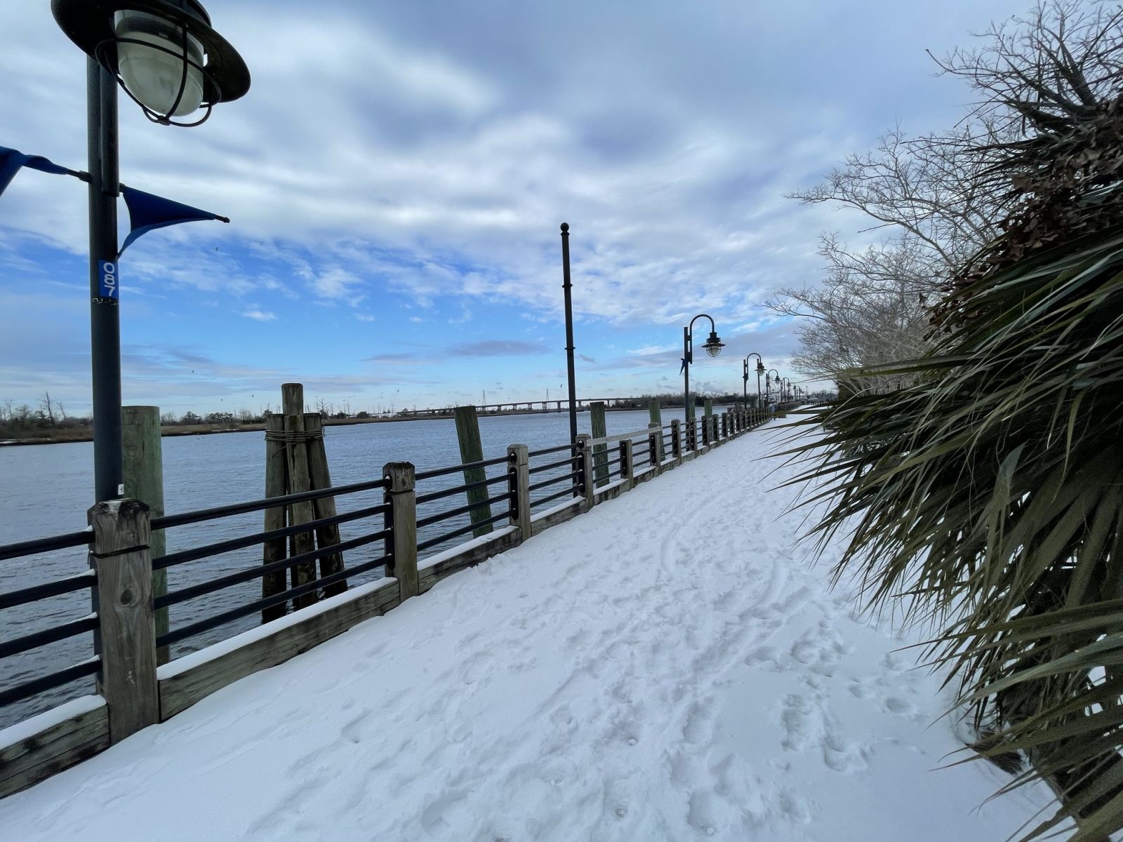
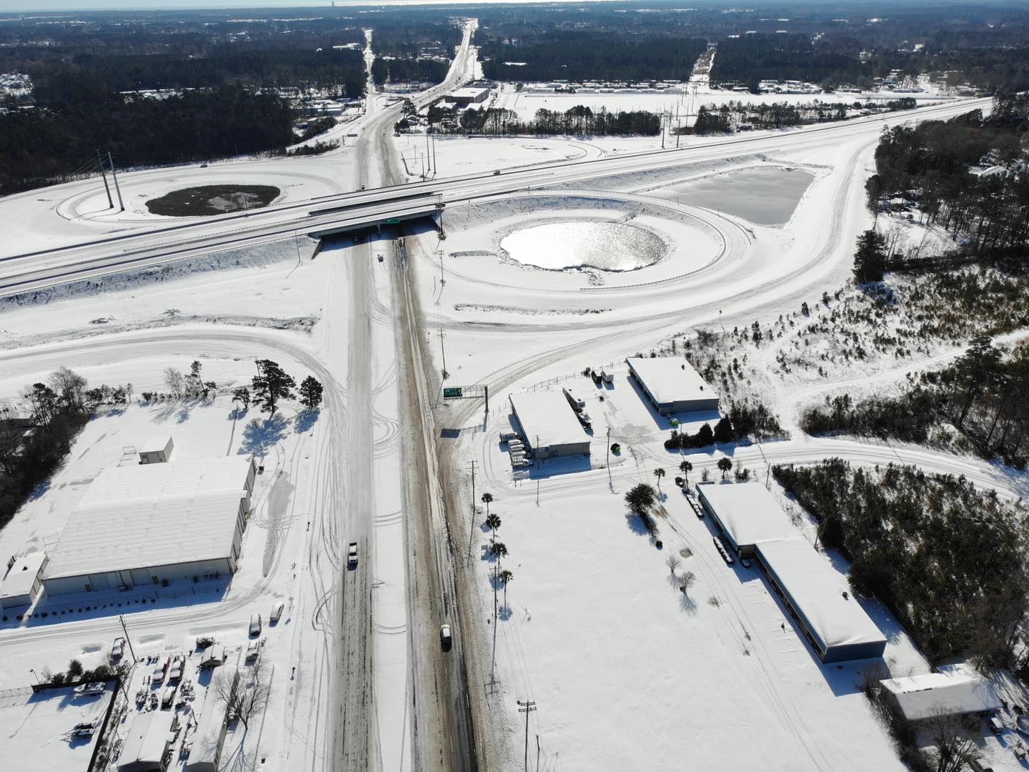
Wilmington, NC [courtesy of City of Wilmington] |
Wilmington, NC [courtesy of City of Wilmington] |
Wilmington, NC [courtesy of City of Wilmington] |
 |
 |
 |
|
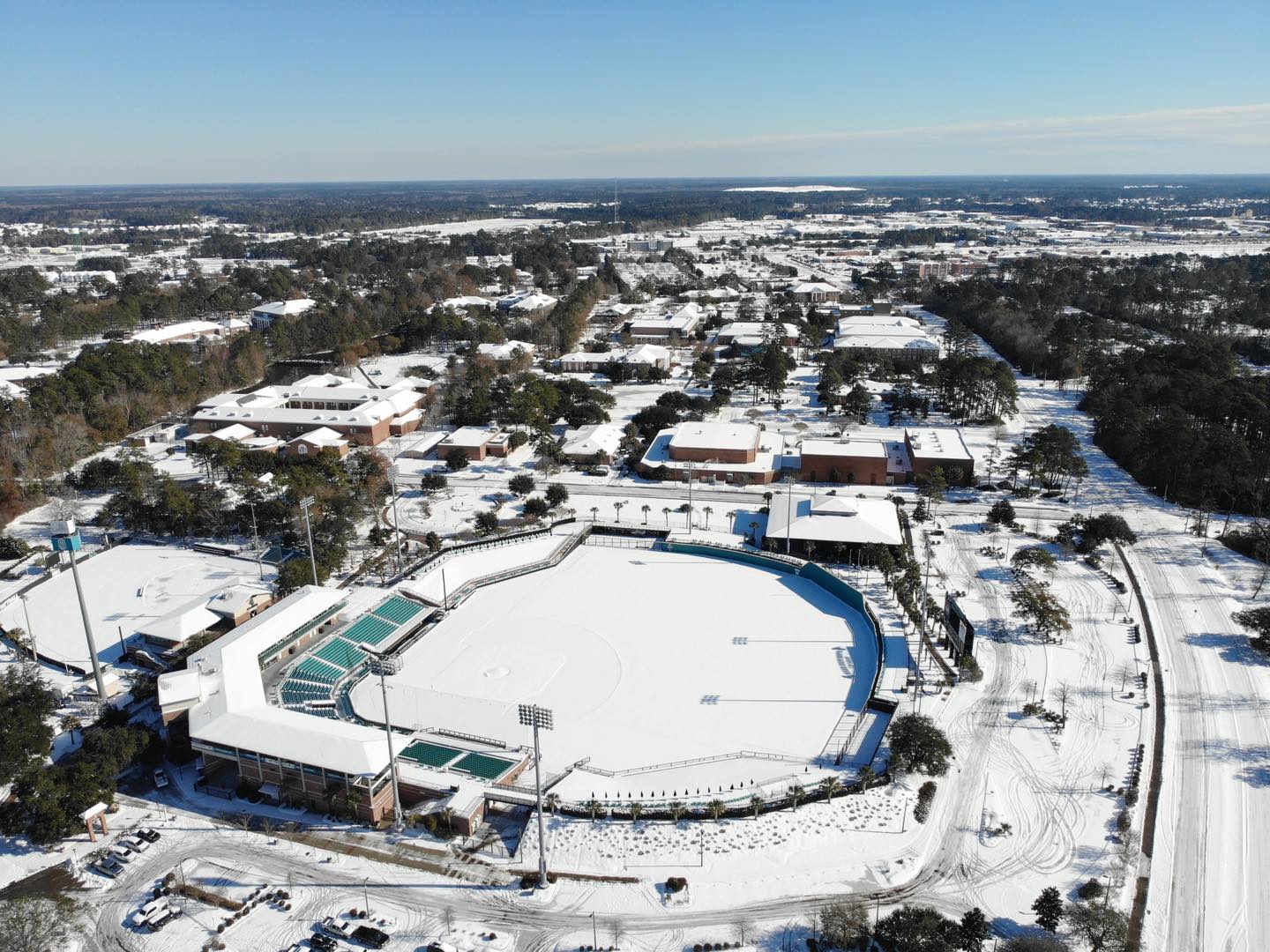
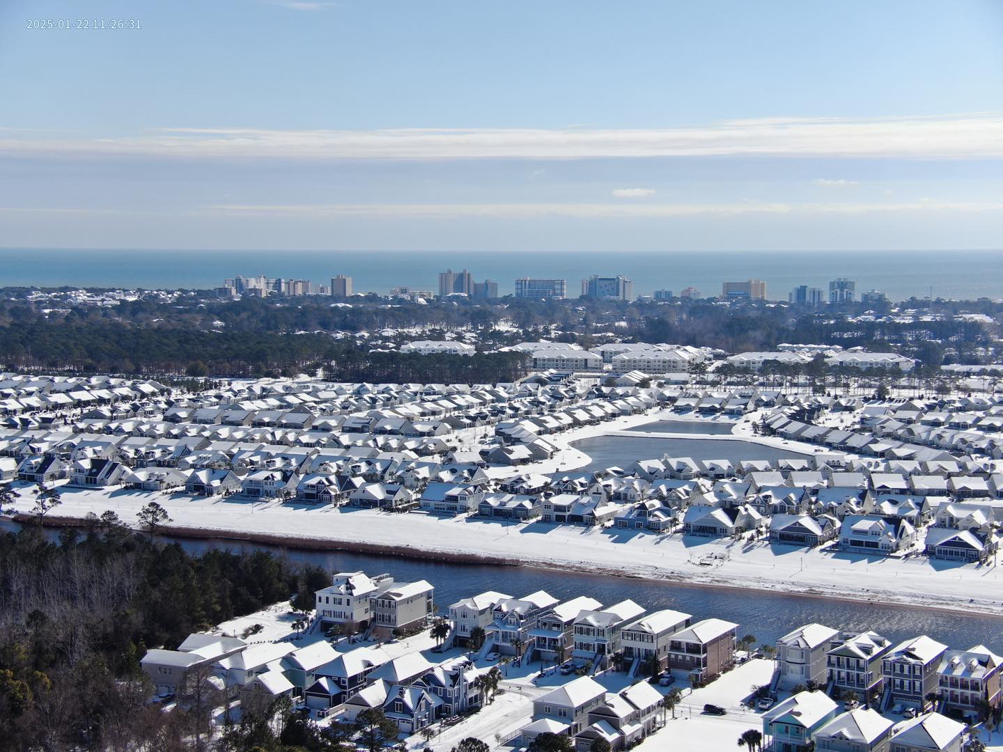
Myrtle Beach, SC [courtesy of Horry County Police] |
Myrtle Beach, SC [courtesy of Horry County Police] |
Myrtle Beach, SC [courtesy of Horry County Police] |
Page Author: Bob Bright
Page Created: January 25, 2025


 Coastal Flood
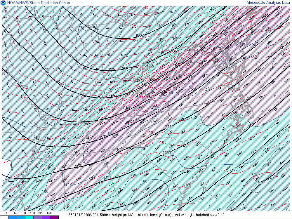